![]() Click here to see the map of the area in full screen.
Click here to see the map of the area in full screen.
| Location | |
.svg/250px-Eritrea_on_the_globe_(Africa_centered).svg.png) | |
| Fast Data | |
| Capital city | Asmara |
| State | One-party state with partial Indirect Democracy |
| Coin | Nakfa (ERN) |
| Area | 117,600 km2 |
| Population | 5,228,000 (2015 estimate) |
| Language | Official None, Tigrinya, Arabic, Tigre |
| Calling Code | 291 |
| Internet TLD | .er |
| Time zone | UTC 3 |
THE Eritrea is her country EasternAfrica.
At a glance
Appropriate visit period
Languages
Areas
Important cities
- Asmara. Capital and largest city of the country. The center of Asmara still holds the style of a provincial city of Italy
- Keren. Second largest city of Eritrea. On April 1, 1941 Keren was the scene of the last battle between the English and the Italians.
- Masawa. Large port on the west coast of the Red Sea
- Aseb the Assab. Second port of the country
Additional tourist destinations
- Dalak Archipelago.
- Debre Bizen. Tawahido Orthodox Church Monastery. It is located at the top of the mountain of the same name at an altitude of 800 m.
- .
How to get there
 By air
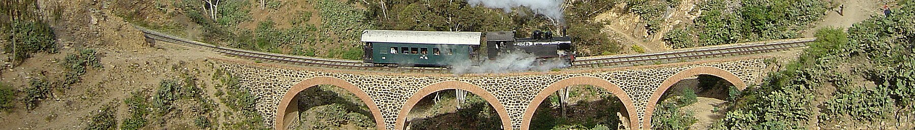
 By train
 By road
 By boat
How to move
What to see
Entertainment
Transactions and purchases
Cost
Local cuisine
Local drinks
Tourist infrastructure
Studies
Job opportunities
Stay safe
Health and precautions
Respect local customs
Communications
![]()