![]() Click here to see the map of the area in full screen.
Click here to see the map of the area in full screen.

THE Smyrna is her city Turkey
At a glance
Smyrna extends from the SW. foothills of Sipylos and NE. of Pagos, where the fertile plain of Mainemeni to the coast, where the wonderful waterfront "Ke" which extends to the NW. from opposite the railway station of Aydin, the so-called Punta (Al Sajak), northern end of the waterfront, to the old headquarters (Konaki), southern end. Until 1922 the city was distinguished in "Pano Mahala" (towards Pagos), the oldest part of the city, where mainly Turks, Jews and a few Greeks lived and in "Kato Mahala" or "Kato Poli", a younger part, where he lived the mainly Christian population, the Armenians (south), and the Greeks (north of the Armenians), up to the opposite NW. coast the so-called Kordelio.
From ancient times Smyrna has suffered many destructions from fires, earthquakes and epidemics (plague). Plague broke out repeatedly in the three consecutive centuries, in the 17th, 18th and 19th centuries with a large number of victims. Also in the great earthquakes of 1688 and 1778 entire neighborhoods were leveled. The most important fire before the catastrophe of 1922 was that of 1842, where the original building of the Evangelical School was burned.
Ideal period of visit
How to get there
 By air
 By train
 By road
 By boat
Orient yourself
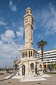
Today's Smyrna, except for a part of the Turkish quarter of the former Pano Mahala and Pounta with its cobbled streets, bears no resemblance to the oriental view of old Smyrna with the horse-drawn waterfront tram, the narrow alleys (= lanes) and the wooden houses. In the vast area of fire of the former six districts, Agia Aikaterini, Agios Dimitrios, Agios Tryfonas, Evangelistria, Agios Nikolaos, and Agios Ioannis and some parts of other old districts, today extends the famous cultural park of Smyrna, 300,000 sq.m. which is a miniature of the Moscow park, which includes small lakes, a zoo, taverns and the facilities of the annual trade fair with permanent exhibitors' stands in ancient Greek style. The Archaeological Museum of Smyrna has been erected on the site of the former church of Agios Dimitrios in the park with a number of exhibits from the ancient Greek, Hellenistic and Roman eras.
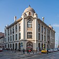
The square of the former Dioikitirio (Konaki) is today the center of traffic of the city in front of which is the dock of small passenger ships ("boats") that serve the transport with the coastal surroundings of Smyrna. The largest commercial and tourist traffic is on an irregular and narrow road from Konaki to the Isar Mosque with a number of modern shops, patisseries, goldsmiths, antique shops, as well as butchers and fruit shops, replacing the pre-1922 shopping streets and Large Taverns. The old vaulted and dark Turkish markets, the so-called "bezestenia", are now covered without canopies.
Main suburbs and villages around Smyrna are from SW. and on the beach in a row Karatasi, Salahanas, Quarantine, Gioz Tepe and Kokargiali, to the east are Daragatsi, Halka-Bunar and from there inland Bournovas which was the predominantly English parish of Smyrna . From Halka-bunar and on the opposite NW. The inland beach of the bay is Agia Triada, Bairakli, and finally at the end Kordelio (Karsiyaka). Other villages of Smyrna are Koukloutzas, Boutzas, Sevdikioi, Prof. Elias and Ag. Anna.
How to move
What to see
Photos


Entertainment
Studies
Job opportunities
What will you buy
Where are you going to eat?
Economic options
Middle class
High benefits
Where to go for coffee - drink
Where will you stay?
Economic options
Middle class
High benefits
Stay safe
Health and precautions
Communications
Small problems
Next destinations
![]() }
}