 | ||
| Amarillo | ||
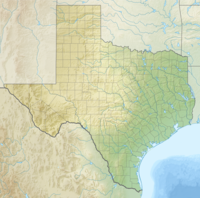
| State | Texas | |
|---|---|---|
| Residents | 190.695 (2010) | |
| height | 1,099 m | |
| no tourist info on Wikidata: | ||
| location | ||
| ||
Amarillo (Texas) is a city in North Texas, she lies in Potter County and is its administrative seat. Part of the city also belongs to the Randall County .
background
In the middle of the 19th century, the area around Amarillo was dominated by cattle breeding. It was predominantly longhorn cattle that adapted well to the conditions of the Great Plains adapt. Originally the place was called Oneida, later it was named Amarillo. This name comes from Spanish and means yellow, perhaps from the yellow flowers of the prairie or the yellow sand of Amarillo Lake. There was also a connection to the railway and Amarillo became an important loading station for cattle. After natural gas and oil were discovered here around 1920, petrochemical companies settled here.
getting there
By plane
- 1 Rick Husband Amarillo International Airport (IATA: AMA).


 in the Wikidata database") The airport is about 10 km east of the city center.
The airport is about 10 km east of the city center.

By train
By bus
In the street
- The interstate
 comes from Santa Rosa and leads to Oklahoma City
 - The interstate
 comes from Lubbock and ends in Amarillo.
By boat
mobility
&groups=Maske,Track,Aktivitaet,Anderes,Anreise,Ausgehen,Aussicht,Besiedelt,Fehler,Gebiet,Kaufen,Kueche,Sehenswert,Unterkunft,aquamarinblau,cosmos,gold,hellgruen,orange,pflaumenblau,rot,silber,violett)
Map of Amarillo (Texas)
Tourist Attractions
- 1 Texas Air & Space Museum
- 3 Cadillac Ranch (Art installation)
- 1 Wonderland Park

