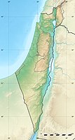
Atlit is a small town on the northern Mediterranean coast of Israel, it's just south of Haifa.
background

On the Mediterranean coast in front of today's Atlit lies the underwater archaeological site of Atlit yam . The coastline ran in the Neolithic around 7,000 - 6,000 BC. probably about 1 km further east than today, 8 - 12 m below the surface of the water, ruins of a Neolithic settlement were excavated. There were a number of rectangular dwellings, in or in their immediate vicinity there were human skeletons buried in a crouched position; the inhabitants had been infected with tuberculosis and otitis media thousands of years ago. A round fountain structure, filled with, among other things, flint fragments and animal bones, and a sanctuary made of semicircular steles with signs of ritual use caused a stir. The settlement sank under sea level 8,500 years ago and was rediscovered in 1984.
The area gained importance in the time of the crusaders. Around 1103 the first crusader castle of "Le Destroit" was built on older ruins. A little later in 1218, the crusaders under the direction of the Order of the Knights Templar built the fortress "Château Pèlerin" on a coastal promontory. It was made with the retreat of the Crusaders to Cyprus after the fall of Akko abandoned as the last fortress on the mainland. In contrast to most other fortresses, it was abandoned without a fight and not destroyed by the Mamluks' troops, but instead used as a quarry centuries later.
An Arab village existed here under Ottoman rule, and in 1903 the settlement of Atlit was built by Jewish settlers right next to it. The relationship between the Arab and Jewish population changed as a result of land sales; around 1944/45 the Jewish population was around 2,000. The area around the fortress "Château Pèlerin" was used by the British Mandate Government from the 1930s as an internment camp for illegal Jewish immigrants. In the camp grounds, which are surrounded by watchtowers and barbed wire, tens of thousands of Jewish immigrants, mostly European Holocaust survivors, were interned until the closure in 1942. In 1945 the Atlit Detainee Camp was reopened and used to intern Jewish immigrants until a Palmach attack in October 1945 enabled prisoners to flee. After the War of Independence, the camp was used to house prisoners of war from the Arab troops, and in 1987 it was converted into a museum as a national memorial.
getting there

By plane
Usually, the journey from the German-speaking area takes place via the airport Tel Aviv - Ben Gurion.
By train
At the 1 Atlit train station the Tel Aviv - Haifa line stops Israel Railways.
By bus
The line 221 the Egged runs between Haifa and atlit.
In the street
From the autobahn 2Tel Aviv - Haifa you can reach Atlit via the ![]() Atlit Interchange, from the main road 4 leads the connecting road 721 west to the Atlit Interchange.
Atlit Interchange, from the main road 4 leads the connecting road 721 west to the Atlit Interchange.
By boat
Atlit does not have a passenger port.
mobility

Locally one moves on foot.
Tourist Attractions


- the archaeological area of Atlit yam off the coast is under protection.
- from the older crusader fortress 1 "Le Destroit" fortress, which was built from 1103/10 and destroyed by the Mamluks in 1264, only a few ruins still exist.
- The environment was called Horbat Qarta Nature Reserve placed under protection around the mouth of the Nahal Hod. From a vantage point there is a good view down to the beach.
- the fortresses of 2 "Château Pèlerin" fortress (Castrum peregrinorum, pilgrim's castle) was built under the Knights Templar in 1218. An outer wall ring of 15 m high and 6 m wide surrounded the inner walls of 30 m high and 12 m wide, protected by two 34 m high towers, in the south was a small fortified harbor. The Atlit settlement around the fortress was also secured by a wall. The fortress was abandoned by the crusaders without a fight in August 1291 and later used as a quarry after earthquake damage. Around 1930/34 excavations were carried out in the fortress area, today access as a military restricted area is forbidden.
- 3 Atlit Detention Camp, Atlit, west of the Atlit Interchange 2. Tel.: 972 (0)4-984-1980, Email: [email protected]. Museum consisting of the reconstructed British internment camp, information about Aliya Beth, the illegal Jewish immigration into the British mandate of Palestine, the ship is also on display, guided tours in English. / Hebrew on registration.Open: Sun-Thu 9 a.m.-5 p.m., Fri 9 a.m.-1 p.m..
- the 4 Salt pans of Salt of the Earth: In Atlit, salt production by seawater evaporation in shallow seawater basins began in 1922, the facilities were expanded in the 1980s and cover a large part of Israel's needs with the salt pans of Eilat.
- the square building of the 5 Sheikh Boreich's grave (Sheikh Bureik) is in the south across the highway.
activities

- Visit to the ruins of the crusader fortresses "Le Destroit" and "Château Pèlerin" (area not accessible); Walk in the nature reserve Horbat Qarta around the fortress ruins of "Le Destroit" and along the beach.
- Visit the Atlit Detainee Camp converted into a museum.
- Bathing on Beach of 1 Neve Yam/ Atlit, south of the village
shop
- there is one in Atlit 1 Supermarket
kitchen
nightlife
accommodation
health
Practical advice
trips
- to Haifa, in the nature reserves of the Carmel Mountains
- A little further south you get to the protected beach section in the nature park Dor HaBonim Nature Reserve
literature
Web links
- http://www.atlit.org.il/mainsite.asp - Official website of Atlit


