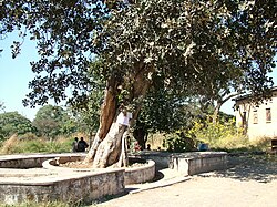
Copperbelt is a region rich in minerals located in the northern part of Zambia.
To know
Background
It was the backbone of the Northern Rhodesia economy during British colonialism. Its economic importance was heavily damaged by the fall in copper prices in 1973 and the nationalization of copper mines by the government of Kenneth Kaunda.
Territories and tourist destinations
Urban centers
- 1 Chililabombwe - Town whose main economic activity consists in the extraction of copper.
- 2 Chingola - Near the Nchanga Open Pit Mine, one of the largest open pit mines in the world.
- 3 Kalulushi - Founded in the 1950s to house the workers of the copper and cobalt mines.
- 4 Kitwe - The third largest city in Zambia. Focused on mining mainly copper and emeralds.
- 5 Luanshya - Industrially and economically very active city.
- Lufwanyama - City at about 1,300 m altitude 105 km southwest of Kitwe, the second largest city in the Zambia.
- Masaiti - Capital of the district of the same name.
- Mpongwe - Capital of the district of the same name.
- Mufulira - Near the border with Democratic Republic of Congo, developed in the 1930s around one of the main copper mines.
- 6 Ndola - Capital of Copperbelt, the largest city in the region and the second largest in Zambia. The city owes its rapid development to the copper mines.
How to get
How to get around
What see
What to do
At the table
Safety
Other projects
 Wikipedia contains an entry concerning Copperbelt
 Commons contains images or other files on Copperbelt


