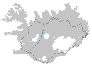
The Kjölur (35) begins in Haukadalur just behind the Gullfoss waterfall and runs between the Langjökull and Hofsjökull glaciers. It ends near Blönduós in the north of the island.
background

The Kjalvegur is probably known since the first settlement and is one of the historical connecting routes. It was used at the time of the conquest as a travel route to Þingvellir zum Alþing, a parliamentary assembly that met once a year. It now runs west of the piste and is still used by hikers and trail riders.
The F., for Fjellvegur, this route has been withdrawn because the rivers have now been bridged, and the route is also used by buses and mobile homes in summer, but a four-wheel drive vehicle is still recommended. There is also a winter closure, but there are plans to pave the entire route.
preparation
Before starting your journey, you should definitely find out about the Weather and road conditions to inform.
getting there
By bus
The Highland bus (Akureyri-Reykjavík) runs daily in summer. You can get off at the desired location after consultation with the driver.
In the street
Of Reykjavík Via the R 1 to the south and on the R 35 to the northeast to Skáhold and Geysir. The Kjölur begins above the waterfall Gullfoss.
Drive
A few kilometers from Gullfoss, the F338 branches off, a cross connection to Kalidalur. This slope runs south of Langjökull.
Gullfoss - Hvítárvatn - Kerlingarfjöll
Starting from Gullfoss, the route first leads through a ground moraine landscape over the Bláfellsháls pass (610 m) and past the Bláfell tabular volcano. From the pass you have a beautiful view over the glacial lake Hvítárvatn in the west, which is approx. 30 km2 in size and 84 m deep. In the past, the glacier tongues from Langjökull reached into the lake and calved. At the edge of the lake, a boggy grassy landscape, you can see whooper swans and short-billed geese. Shortly after crossing the bridge over the Hvítá river, you come to junction F336. This goes as far as Hvítárnes, a hiking hut by the lake.
In the west is the Langjökull glacier (1355 m), in the east the colorful Liparitgebirge Kerlingarfjöll can be seen, the highest peaks of which are Snækollur (1482 m) and Loðmundur (1429 m).
Detour to Kerlingarfjöll (F347)

The Kerlingarfjöll (Altweibergebirge) can be reached via a 10 km long slope that branches off from the 35 to the east. Until a few years ago, some rivers had to be crossed, one directly above a waterfall. In the meantime, all rivers have been bridged and the Kerlingarfjöll detour is also accessible with normal cars. There is a summer ski area and a refuge in Kerlingarfjöll. The piste continues up into the mountains to Hveradalur.
Kerlingarfjöll is one of the most beautiful geothermal areas in Iceland. Many solfataras and fumaroles can be found along the small stream that has eaten deep into the yellowish, heavily weathered rhyolite. The area continues deep below Hofsjökull.
Kerlingarfjöll - Hveravellir
Back on the Kjölur, the path leads to the highest point of the route, the Fjórdungsalda (673 m). On this north / south watershed (by the way, Kjölur means "watershed") there is a memorial stone that commemorates the founder of the Icelandic Trekking Association. Now the landscape changes increasingly and sand gains the upper hand. Over the Þjófadalavegur (F735) it goes to Hveravellir. The slope continues towards Langjökull.
Hveravellir

The geothermal area of Hveravellir, on the northern edge of the Kjalhraun lava field, has an area of 450 km². The multi-colored sinter deposits on the Blahver, the largest spring in the area, are interesting. The most beautiful spring is Fagrivher. Clear, turquoise water invites you to take a relaxing bath.
Hiking trails in Hveravellir lead to the Strýtur volcano with its striking craters or through the green valleys of the Þjófadalir on the edge of the Langjökull.
Hveravellir - Blonduós
North of Hveravellir, the landscape slowly changes into a heather and tundra landscape. You pass the "longest fence in Iceland". This is supposed to prevent the spread of sheep diseases. Once you have crossed the Dúfnefsfell, you come to the Árnarbæli hut, from where you have a beautiful view of Langjökull, Hofsjökull and up to Kerlingarfjöll. You leave the high valley of Kjölur, it is slowly getting greener and numerous sheep can be seen on the humpback meadows. You pass the small Cafe Áfangi, where horse riding trips are occasionally offered. At the southern end of the lake area of Blöndulón is the Áfangafell with a small parking lot and a beautiful view. Due to the reservoir, the piste was re-routed here and the streams and rivers bridged. The Blöndulón, which has been dammed up since the late 1980s, is now the fourth largest lake in the country with over 56 km2. The Blandá power plant generates 150 MW of power at a waterfall height of 288 m. The Kjölur slope ends roughly at the power station.
hike
The Kjalvegur from Hvítárnes to Hveravellir
The path goes from hut to hut, most of the time along the old Kjalvegur, which is still marked with old stone marks. The starting point is the Hvítárnes hut. The highland bus (Akureyri-Reykjavík) stops at a fork nearby on request. Camping is possible at all huts.
- Hvítárnes
From the junction of piste 35 to the hut it is about 8 km (approx. 2 hours walking time). With an all-terrain vehicle you can drive to the parking lot of the hut.
- Hvítárnes - Þverbrekknamúli approx. 5 hours walking time
- Þverbrekknamúli - Þjófadalir approx. 5 hours walking time
- Þjófadalir - Hveravellir approx. 5 hours walking time