 | ||
| Le Prêcheur | ||
| Arrondissement | Saint-Pierre | |
|---|---|---|
| Residents | 1.252 (2018) | |
| Tourist information Tel | 596 (0)596 529-143 (Syndicat d’Initiative) | |
| no tourist info on Wikidata: | ||
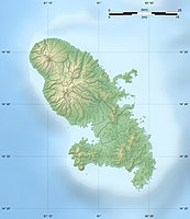
| location | ||
| ||
Le Precheur is a city in Martinique.
background
This is the last village in the north of the west coast. It was founded around 1640 and is 40 km from Fort-de-France. The place has little interesting to offer. Up to the eruption of the Pelée volcano, over 4,600 people lived in the municipality, and the number of inhabitants has been falling since then. On the southern outskirts there is a 12 m high lighthouse. It is worth mentioning the square bell tower of the old church from the late 17th century. It survived the volcanic eruption of 1902. The other road to the northern tip of the island is overgrown and only partially passable. South of the village, halfway to Saint-Pierre, is the Carib grave, Tombeau des Caraibes, also known as the Coffres à Mort, a large rock from which the last Indians are said to have thrown themselves to their death.
beaches
- Anse Belleville. All beaches are north of the village and have black lava sand.
- Anse Céron. Black sand beach with offshore island Rocher de la Perle. There is a snack bar, showers, changing rooms and picnic tables. Not very far from the shore are the diving areas around the islet of La Perle.
- Anse Couleuvre, behind the Anse Céron. There is a restaurant, showers and changing rooms.
getting there
In the street
This place is about 40 km north of the capital Fort-de-France. The better developed coastal road ends in Saint-Pierre. From there it is another 10 km to Le Precheur. There are several quarries in the area, so truck traffic is to be expected. After Le Precheur there is another 4½ km of motorable road to the Habitation Céron. Then the "world is over".
mobility

- Quadra bike: Habitation Céron, tel. 529453, fax 529606
Tourist Attractions
- Eglise Saint-Joseph. The church was declared a cultural monument in 1979.
- Habitation Ceron. Tel.: (0)596 529453. Ruins of a sugar plantation 500 m from the beach.Open: Opening times: 9:30 a.m. - 5:00 p.m. daily.
activities
Diving
hike
- Hiking guide: Jean-Guy Gabriel. Tel.: 596 (0)596 585287, Mobile: 596 (0)596 074898.
kitchen
- La Terrasse du Phare. Tel.: (0)596 529744. Snack.
- Le Mélodie, Abymes district. Tel.: (0)596 529031, Fax: (0)596 529713. Creole restaurant & bar.Price: menu 8-25 euros.
- Matebis, Anse Belleville. Tel.: (0)596 529749, Fax: (0)596 529749. Creole.Open: Opening times: daily 12 p.m. - 5 p.m.
accommodation
- Village Pomme Canelle, Morne slide. Tel.: 596 (0)596 659135, Fax: 596 (0)596 693948. 16 apartments.Price: Rental prices: Weekend 2-6 people 130-300 euros, 1 week 350-720 euros.
health
doctors
- Dr. Habib, Bourg. Tel.: 596 (0)596 529301.
Pharmacies
- Pharmacie Préchotaine, Bourg. Tel.: (0)596 529770, (0)596 529427.
Practical advice
- Mairie de Le Prêcheur, Le Bourg. Tel.: (0)596 529862. Open: Office hours: Mon 7.30 a.m. - 1.00 p.m. 2.30 p.m. - 5.00 p.m., Tue Wed 7.30 a.m. - 2.00 p.m., Thu 7.30 a.m. - 1.00 p.m. 2.30 p.m. - 5.00 p.m., Fri 7.30 a.m. - 1.30 p.m.
- La Poste, Bourg. Tel.: (0)596 529270.
trips
- Chaude et Cascades waterfalls. Length: 4 km, time: 3 to 3½ hours. 500 m after crossing the Rivière Séche, leave the D10 road at the entrance to a private quarry that must be crossed. Through the Coulée Rivière Blanche, which was filled with ash after the volcanic eruption, it goes over the Montagne Perret to the waterfalls of the Rivière Claire. Some springs can reach a water temperature of 50 ° C there.
- Pelée volcano. Length: 3½ km, time: 4 hours. Just before the southern entrance to Precheur, turn towards the television station; Route Communale de la Charmeuse, you can drive another 1½ km by car; Ascent over the Grande Savane. It is a steady rise to a height of 1,100 m above sea level and it is the only hiking trail from the Caribbean coast.
- Anse Couleuvre - Grand-Rivière. Length: 20 km, time: 7 hours. This former connecting route along the north coast is partially paved, old bridges and tunnels are accessible. The path is well signposted and is considered a classic hiking trail. Hikers should not leave the path because of the poisonous lance vipers! The whole area is uninhabited. Up until the beginning of the 20th century, this route between Le Prêcheur and Grand-Rivière was used by ox carts.
literature
Web links
An official website is not known.