The Lincoln Highway covers more than 3,000 miles from New York City to San Francisco.
Understand

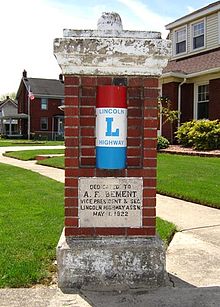
The Lincoln Highway (1913-1930) was the original transcontinental highway in the United States. It was one of various "auto trails", a motley assortment of named routes marked by private organisations and trail associations (such as the Lincoln Highway Association) in the early days of the mass-produced automobile. These routes pre-dated the numbered US Highway system, which was established in the mid-1920s.
The Lincoln Highway ran from New York City to San Francisco along roads which would become part of US 1, US 30, US 40, US 93, US 50, US 99 and US 48. The exact routing changed various times over the life of both the auto trails and the US Highway system which replaced it, as roadbuilders attempted to bypass crowded downtown areas or find a shorter path to a destination. In many communities the Lincoln Highway is "old US 30", not the current US highway routing.
Together with Route 66 it was one of few reliable roads across the Rocky Mountains, before the Interstates were built in the post-war decades. Today, Interstate 80 serves the vehicles traveling between New York and San Francisco.
Prepare
Route
New York
New Jersey
Pennsylvania
Entering Pennsylvania via the Ben Franklin Bridge, 30 travels through Philadelphia's Old City, Center City East and Center City West, the historic and commercial centers of the City. It then joins the Schuykill Expressway (I-76) and travels westward before breaking off south of Fairmont Park. It then heads west and becomes known as the "Mainline," the main corridor of the affluent and upscale "Mainline" suburbs in Montgomery and Delaware Counties. Points of interest along this route include:
- Independence Hall
- Ben Franklin Museum
Once outside of metropolitan Philadelphia, the highway quickly enters Amish Country.
West Virginia
Route 30 briefly transverse West Virginia through Wheeling.
Ohio
2007 - The Lincoln Highway from Mansfield (Ohio) west to Indiana, has been resurfaced in most areas, traffic would be considered light. Driving is pleasurable and the area should be considered safe.
Indiana
Towns and cities on the Lincoln Highway, from the east to west, New Haven, Fort Wayne, Churubusco, Ligonier, Goshen, Elkhart, Osceola, Mishawaka, South Bend, New Carlisle, La Porte, Westville, Valparaiso, Merrillville, Schererville, Dyer.
Illinois
Entering near Sauk Village, the route drives west passing through a number of communities in Chicago's South Suburbs and directly into Joliet's downtown. From there, it moves northwest, passing to the south of Aurora and due west into Kendall County, entering Northern Illinois's closest areas to Chicagoland. It crosses the Rock River at Rock Falls and proceeds on a western course toward the Mississippi River, entering Iowa.
Iowa
Entering Eastern Iowa at Clinton (Iowa), Route 30 proceeds due west, hitting a number of small towns, skirting just south of Grant Wood Country. The most prominent between Clinton and Cedar Rapids are DeWitt (Iowa) and Mount Vernon (Iowa), home to Cornell College. From Cedar Rapids, the route connects Marshalltown to Ames, home to Iowa State. From there, it continues on to Denison and then takes a southwest course to Missouri Valley where it crosses the Missouri River into Nebraska.