 Metula, the Hermon Mountains in the background | ||
| Metula, Metulla, Hebrew מְטֻלָּה | ||
| District | Northern District | |
|---|---|---|
| Residents | 1.614 (2015) | |
| height | 527 m | |
| no tourist info on Wikidata: | ||
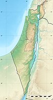
| location | ||
| ||
Metula is a israeli Small town at the extreme north end of Upper Galilee, bordering on Lebanon.
background
Graves indicate that the area of today's settlement was already inhabited in ancient times. In the 19th century travel reports mention a village with a Druze population near a spring. When the Druze joined a rebellion in 1895, the Lebanese Christian landowner Jabur Bey chose 12,800 Dunam Land to agents of Baron Rothschild, who bought land to settle Jewish pioneers. After conflicts after the return of the Druze small farmers, an agreement was reached with an additional payment. In 1896 the settlement was mainly supported by Zionists of Russian descent from some settlement pioneers Petah Tikva founded.
After negotiations between the British and French mandate powers, it was decided in 1920/24 that Metula, which was valued as a holiday resort in the summer, would represent the northern border of Palestine. In the 1930s, the border town was one of the places where (illegal) immigrants crossed into the British mandate of Palestine, and defense positions were set up as part of the Arab uprisings. The border bridge over the Nahal Ayyun was blown up by the Palmach in the "Night of the Bridges" in 1946 and again during the War of Independence.
During the Israeli engagement in southern Lebanon, the border crossing at the border, the "Good Fence", served as a border crossing for numerous southern Lebanese Christian Maronites. After Israel withdrew from southern Lebanon and the border was closed in 2000, Metula was the target of numerous rocket attacks by the Shiite Hamas militia during the Lebanon war and was in the headlines for the last time in 2006.
getting there

By plane
At Rosh Pina on the southern edge of the Hule plain there is a small airfield (Ben Ya'akow Airport or Rosh Pina Airport), which is not used in regular air traffic. As a rule, you will therefore use the Ben Gurion Airport at Tel Aviv arrive.
By train
The region is not connected to the Israeli rail network; You can only travel by public transport by bus.
By bus
There are bus connections through Egged between Metula and Kiryat Shmona (40 min.) and from there daily further connections to Haifa, Afula, Tel-Aviv and Jerusalem.
In the street
Metula is the northern end of road 90, which crosses Israel and the West Bank completely from south to north. The road ends here after the "Good Fence" border has been closed, and it is currently not possible to continue to Lebanon.
mobility

Locally one moves on foot.
Tourist Attractions
Nahal Iyon / Nahal Ayyoun Nature Reserve


The nature park runs in the extreme north of the "finger" of Upper Galilee along the brook bed of the Nahal Iyon, which rises a few kilometers north as Ayoun in the Lebanese mountains and carries a lot of water, especially in the winter months. In summer the river is practically dried up due to the large amount of water withdrawn, so winter and spring are recommended as optimal hiking times.
The walk from the upper to the lower exit of the park takes about one and a half hours, on hot days it is recommended to walk from the upper to the lower entrance and to organize a return transport. Since it is difficult to use public transport, hikers who are not completely inexperienced can easily complete the path from the lower park entrance to the upper end in the cool morning and, after a rest, start the way back on foot. Who can spend less time resp. If you are not so good on foot, you can reach the impressive Tanur Falls from the lower entrance within about ten minutes.
- the 2 Iyon Falls are located at the upper park entrance just south of the Lebanese border. The footpath from the upper park entrance leads down into the gorge, a short stretch of path leads to the uppermost waterfall.
- the 3 Mill Falls, (Tahana Falls) are much higher and more impressive (especially in winter / spring, when the water level is good), ruins of a flour mill can still be seen.
- past the less high 4 , (HaEshed Falls) one reaches a viewing platform with a beautiful view over the Iyon valley.
- after a few hairpin bends you reach the branch to the 5 Tanur Falls, (Oven Falls), where the water rushes down in two streams divided by a central boulder.
- As an alternative, on the way back from Tanur Falls to the lower park entrance, a short circular walk to a 1 A vantage point can be made from which the Tanur Falls can be seen and photographed in their entire length.
- a little further down is the lower one 6 Park entrance with parking lots and picnic area, due to its proximity to the lowest waterfall, the nature park is also called Tanur Reserve designated.
- Here is a "wading pool" where children can cool off and splash around by the water, as well as toilets, water points and a simple shop with snacks.
More Attractions

- the 2 Dado lookout is above Metula and the end of the street 90 and allows a beautiful view of the place and the Hermon massif.
activities

- Running in in the Canada Center, the ice rink is one of the only ones in northern Israel and was built with Canadian support.
shop
kitchen
nightlife
accommodation
security
Even if Metula on the northernmost tip of the Upper Galilee was repeatedly targeted by rocket attacks and the border is still secured by military vehicles, there is no danger as long as one does not approach the border. It is currently not possible to cross the border at the Israeli-Lebanese border!
health
Practical advice
trips
- Tel Dan. With the Jordan springs of the Dan.
- Banias. With the third source river of the Jordan.
Senir Stream Nature Reserve / Hatzbani Reserve


- 7 Senir Stream Nature Reserve, Near Road 99. Tel.: (0)4-695 0064. Open: summer 8 am-5pm, winter 8 am-4pm; FR closing time 1 hour earlier.Price: 29/15 NIS, included in the 2 week ticket.
- Download of the fold-out brochure with plan.
The nature reserve lies along the Nahal Senir or Senir Stream. This in Arabic as Hatzbani designated source flow of the Jordan is one of the longest, it rises 60 km further north in the Lebanon and drains an area of 640 km² in the Lebanon Valley and the western slopes of the Hermon Mountains. In Lebanon, the river bed often falls dry in the hot season and runs in a gorge with a considerable gradient. At the Lebanese place Hatzbaya the river emerges at an altitude of 675 m, the karst spring Naba 'al-Hatzbani supplies 30 mio m³ of water annually; the water is used by Lebanese farmers for irrigation purposes.
After crossing the border at the Israeli border town 8 Ghajar comes the water of another spring (al-Wazani) of 40 - 50 million m³ annual output. The Hatzbani or Senir Stream runs in a bed of travertine and basalt rocks after passing the natural park and the road bridge 99 has happened, it runs with numerous curves over 4 km in a gorge section around you 9 Sede Nehemyah with the source rivers of the Dan and Banias to the Jordan to unite.
- A runs from the park entrance with the parking lot, a picnic area and toilet facilities
 Wheelchair accessible short circuit ("Short Trail") to a small waterfall and a 10 Wading pool to splash around. Another loop ("Medium Trail", approx. 30 min.) Runs from the wading pool to the 11 Nahal Senir River and along it for a short distance.
The trail along the Senir Stream downstream is part of the long distance hiking trail Israel National Trail.
- The "Long Trail" (approx. 90 min.,
 ) continues along the Senir Stream, the path is partly secured by bridges and metal steps, the river can carry very different amounts of water. By 12 a eucalyptus grove one arrives at the end of the "long trail" to a turnstile gate and leaves the park. Hikers on the Israel National Trail hike further south to Strase 99, park visitors can return to the starting point at the parking lot on a gravel road along avocado plantations.
- Another footpath leads to the in approx. 15 minutes 13 Tap Line ReservoirBirds can often be seen at this pent-up freshwater pond. The footpath continues to a hill, the 3 .
literature
- Iyon Stream Park Prospect, hebr.
- Senir Stream park prospect to download, engl.
Web links
- An official website is not known.