| Þingvellir National Park | |
 | |
Location 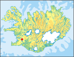 | |
| Area type | National Park |
|---|---|
| State | Iceland |
| Surface | 9,270 ha |
| Foundation year | 1928 |
| Institutional website | |
Þingvellir National Park (sometimes Thingvellir) is located in theSouthern Iceland.
To know


Þingvellir is a national park located in the southwestern part of the island, near the Reykjanes peninsula and the Hengill volcanic area. Due to its cultural value in 2004 it became part of the list of World Heritage Sites ofUNESCO.
The name Þingvellir derives from theIcelandic "Þing", parliament, and"vellir", flat land.
Geographical notes
Continental drift can be clearly recognized in the gorges and faults that cross the region; the largest of them, called Almannagjá, it is a real canyon. This also causes a large number of earthquakes in this region.
Þingvellir is located on the northern shore of Þingvallavatn, the largest lake in Iceland. The Öxará River flows through the national park and forms a waterfall at the Almannagjá, called Öxaráfoss. Together with the Gullfoss waterfall and the Haukadalur geysers, Þingvellir is one of the most famous places in Iceland, known as the Golden Circle.
Flora and fauna
There are many bird species that can be seen in this area. About fifty sedentary and thirty migratory. The greater loon is one of the most famous.
When to go
This park tends to enjoy the best climate on the island. However, as in the rest of the island, it has a rapid variability and the temperature range between night and day is considerable. During the winter it can snow a lot, so be aware of this before embarking on road trips.
Background
In 930 one of the first parliaments in the world was founded here (Alþing), which continued to play its role until 1798. It was founded by settlers who from 870 began to arrive from Norway, Ireland is Scotland.
In 1262 theIceland became part of the Norwegian kingdom. While in 1662 he swore allegiance to the king of Denmark. In both cases, the functions of the parliament underwent substantial changes.
In 1930, the whole area became a national park and in 2004 a heritage of theUNESCO.
How to get
By car
The national park is easily accessible from the capital Reykjavík. If you drive from there you have to take the road 1 passing through Mosfellsbaer. From here it is possible to take the road 36 leading to the park.
By bus
In summer, the park can be reached by buses that leave from the BSÍ terminal in the center of Reykjavik. The fare is (2008) 1,700 kr and the bus leaves in the morning for the park and in the late afternoon it goes back to Reykjavík.
Permits / Rates
Entrance to the park is free. Fishing permits are sold to Service Center and cost 1,500 kr per day.
How to get around
What see

- Area of the old parliament. The most famous place in the park is certainly the site where the old parliament resided (from which the park itself takes its name). There are no visible signs of this structure, just a placeholder indicating it. In the visitor center you will have a clearer idea of this area. With its over a thousand years, it is considered together with that of the Sicily Norman and to that of Faroe Islands, the oldest parliament in the world.
- Tectonic fault. The expanses of lava along the valley around the fault are home to several farms. These farms can be reached via non-binding excursions and give the opportunity to see other areas of this highly visited park. This fault is tangible evidence of continental plate drift (that European/asian and the American one).
- Þingvallavatn. The largest lake inIceland.
What to do

- Diving. Diving is permitted in the underwater faults of Silfra and Davíðsgjá. The first, located 50 km north of the lake Þingvallavatn, is considered to be one of the most fascinating dive sites in the world.
Shopping
- Fishing license.
 1,500 kr per day. Necessary to be able to fish in the lake. You can fish arctic char or brown trout, both of which are great for dinner!
 - Camping permit. 1000 kr per person per night. Groups (from 10 upwards): 15% discount by paying in a single payment at the time of booking. If you stay for more than three nights, the fourth night is free and every other night thereafter. Children under 13: free.. Must be purchased at the information center upon arrival.
Where to eat
A small bar is present in the service center that sells hot dogs, soft drinks, sandwiches, cookies, ice cream and candies.
Where stay
.jpeg/220px-Landscape_of_Thingvellir_(Iceland).jpeg)
There are no lodgings in the park, but the information center rangers will be able to direct you to the area.
Camping is only allowed in two areas of the national park. In Leirar, which is a 5-minute walk from the information center, and in Vatnskot, on the Þingvallavatn lake. There are four campsites in Leirar: Fagrabrekka, Syðri-Leirar, Hvannabrekka and Nyrðri-Leirar. Vatnskot is located in the area left behind by an old abandoned farm by the lake.
Permits for camping and fishing must be obtained at the information center upon arrival.
Safety
The faults are as spectacular as they are dangerous. The surrounding rock is crumbly so it is best not to lean out and if you are in the company of children, they must always be accompanied and kept at a safe distance.
How to keep in touch
Around
Itineraries
Other projects
 Wikipedia contains an entry concerning Þingvellir National Park
 Commons contains images or other files on Þingvellir National Park