 | ||
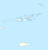
| Saint John | ||
| Outdoor area | American Virgin Islands | |
|---|---|---|
| Residents | 4.170 (2010) | |
| no tourist info on Wikidata: | ||
| location | ||
| ||
Saint John is an island in the group of American Virgin Islands.
places
Other goals
Caneel Bay
The second largest hotel on the island is located on Caneel Bay. So it is not surprising that the main beach is reserved for hotel guests. However, visitors can have a day pass issued.
- Caneel Bay Beach, Hawksnest Beach, Little Caneel Beach, Paradise Beach, Scott Beach, and Turtle Bay Beach. Fine, white sandy beaches with shady trees and palm trees, some very small, hotel beach with boat rental and hotel's own pier in Caneel Bay.
- Honeymoon Beach, behind Solomon Beach. Somewhat larger, fine, white sandy beach without infrastructure, is often visited by motor and sailing boats. Access is only possible via a dirt road.
- Solomon Beach, north of Cruz Bay. Narrow, fine, white sandy beach with shady palm trees and some rocks, unofficial nudist beach.
- Caneel Bay Resort *****, North Shore Road. Tel.: 776-6111, Fax: 693-8280. 166 rooms. Rosewood Hotel, 4 restaurants, bar, beach bar, pool, boutique, fitness center, car rental, 11 tennis courts, 6 beaches, sailing, surfing, diving, water skiing, own ferry connection to the island of St. Thomas, no children under 5 years, no TV, no room phone! Location: 1.3 km lengthways, 68 hectare facility. The whole complex was renovated in 2006.
- Caneel Beach Bar & Grill, Caneel Bay, Caneel Bay Resort. Open: Opening times: daily 11 a.m. - 9 p.m.
- Sunset Terrace, next to Beach Bar & Grill, Caneel Bay Resort. Open: Opening times: daily, Sun brunch buffet.
- Equator restaurant, next to the ruins of the sugar mill, Caneel Bay Resort. Caribbean, reservations recommended.Open: Only open in the evening.
- Turtle Bay Estate House, Turtle Bay Beach, Caneel Bay Resort. Steakhouse, reservation is recommended.
Cinnamon Bay
The gently curved Cinnamon Bay has a 1.5 km long, fine, white sandy beach with shady trees and palm trees, restaurant, mini market and campsite, showers, public telephone, beach shop, surf station, toilets. A hiking trail leads to a former plantation. The 1.5 km long beach is popular with many locals, especially on weekends. It is the longest stretch of beach in the national park.
Estate Zootenvaal - East End
In the far east of the island there are two deeply carved bays, Hurricane Hole and Round Bay. The Hurricane Hole is a safe haven. The winding bay is divided into Borck Creek, Otter Creek, Papilleau Bay and Water Creek. Estate Zootenvaal is located on the headland between Borck Creek and Otter Creek. Round Bay begins behind Turner Point. It is divided into Elk Bay, Hansen Bay and Long Bay. This is the East End, the eastern end of the island, it is outside the national park.
- shop: Sloop Jones, Batiken, East End (signposted), Tel. 779-4001
- Yacht charter: Cloud 9 Sailing Adventures, Captain Jason Beasley, Tel. 998-1940. http://cloud9villas.com
Maho Bay
Maho Bay is a sheltered bay for sailors, especially in the winter months. The northeast winds and heavy swell are then kept away from Mary Point and Whistling Cay Island. The bay is popular with locals with their children because of the calm water. There you can dive well in the offshore reefs.
- Francis Bay. Long sandy beach, clear water, there are toilets, washrooms and picnic tables on the beach.
- Maho Bay. This fine, white sandy beach has only a few parking spaces and, apart from a barbecue pavilion for groups, no infrastructure. However, the water is shallow and clean, and sea turtles can be seen there.
background
The easternmost island of the American Virgin Islands is of volcanic origin, around 15 km long and a maximum of 7 km wide. The highest point is 387 m in the Bordeaux Mountains. About two thirds of it consists of a national park, is largely covered by secondary, dense rainforest and offers fine sandy beaches. The sugar cane plantations originally scattered across the island were more or less all given up 100 years ago. There are only two continuous road connections on the north coast and in the center of the island. The south coast can only be reached on the beaten track. The highest point is Bordeaux Mountain with a height of 387 m. The Bay Tree grows on its slopes. Its leaves are the basis for the Bay Rum that is exported. The only bigger place is Cruz Bay on the western tip. From there there are regular ferry connections to St. Thomas.
history
After Columbus discovered this island on his second voyage in 1493, it changed hands several times in the following centuries: Spaniards, French, English, Dutch and Danes.
The islands of St. John and St. Thomas were uninhabited until 1660. Then the United Kingdom of Denmark and Norway began to take an interest in the islands. A Danish West India Society was founded in Copenhagen in 1665. In 1666 the first settlers came to St. Thomas, but they gave up again after two years. In 1672 a second group came under the leadership of Jorgen Iversen. These settlers also came to St. John for lumber. In 1717 the plantation land on St. Thomas was no longer sufficient. The Danish West India Society therefore took possession of the island of St. John. First a small gun emplacement was built on Cruz Bay and a fortification with 10 cannons on Fortsberg Hill on Coral Bay. As early as 1722 the whole island had been divided into parcels of land.
- In 1733, 1295 people lived on St. John, 208 Europeans and 1,087 "Negro slaves".
In the same year there was a first slave revolt. First they succeeded in taking the fort on Coral Bay and killing the crew, then the plantations were raided. Some of the white plantation owners were warned in good time and gathered on Peter Durloo's plantation in the northeast of the island. Only after six months could the uprising be completely put down. 220 mongrels from the French island helped Martinique. Of the 92 plantations that existed at the time, 48 were affected. As a result of these disputes, several plantation owners left the island to make a fresh start on St. Croix. The number of managed plantations decreased to 62 by 1735.
As a result of the uprisings, Frederik's Fort was built on Fortsberg Hill in 1736. The walls were between four and six meters high and the guns were directed both to the sea and to the land side. A few years later a second gun emplacement was built a little deeper on the mountain.
On the small, mountainous island, the end of the sugar plantations began at the end of the 18th century. Many plantations were sold and fell into disrepair. In the 1920s, the Reef Bay Estate was the last plantation to stop growing sugar cane after years of reducing it to its own needs.
In order to improve the economic situation of the island, the island was declared a free port in 1815, so that all goods could be imported and exported without customs duties.
It is thanks to the American millionaire Laurence Rockefeller that part of the island's past has been preserved to this day. In 1956 he made large sums of money and land available that made up what is now the Virgin Islands National Park.
getting there
By boat
From Cruz Bay to Charlotte Amalie on St. Thomas, the journey time is approximately 45 minutes. One-way fare is $ 7 and children are charged $ 3. There are several departures every day.
Caneel Bay Hotel Private Ferry, Tel. 776-6111. This private ferry service transports hotel guests from Charlotte Amalie Harbor and the National Park Service Dock directly to the hotel. Departure times on request.
Several ferries operate between Cruz Bay and Tortola, British Virgin Islands. These ferries can only be entered with a valid passport. The travel time from Cruz Bay to the West End is 30 minutes. The return ticket is $ 35.
Inter-Island Ferry, tel. 776-6597, runs three times a day between Cruz Bay and the West End, connecting to Road Town.
A ferry operates between Red Hook, Cruz Bay and Jost Van Dyke, British Virgin Islands. This ferry can only be entered with a valid passport. The travel time from Cruz Bay to Jost Van Dyke is 45 minutes. The return ticket is $ 40. Inter Island Ferry, Tel. 776-6597. Departures from Cruz Bay to Jost Van Dyke: Fridays, Saturdays and Sundays at 8.30am and 2.20pm. Return trips from Jost Van Dyke: Fridays, Saturdays and Sundays at 9.15am and 3.00pm.
mobility
The maximum speed on all roads is 30 mph or 30 miles an hour. Rental cars cost between $ 40 and $ 100 per day or from $ 250 for a week. A refundable security deposit of $ 500 is required. This does not apply when paying with credit cards.
- Petrol stations: There are two petrol stations on the island. One in Cruz Bay and one in Coral Bay. They are generally open until 7 p.m. Regular gasoline costs about $ 1.60 for 1 gallon or 4 liters.
Tourist Attractions
- Emmaus Moravian Church, Coral Bay. Tel.: 776-6291. Church of the Moravian Brethren Congregation. It was built in 1783 as the second mission station on the island. It is listed in the national register as "of historical importance". The Herrenhut brothers came to the island in the 1750s. They came to teach the slaves to read so that they could read the Bible and find righteous faith.
- Ruins of the fort mountain fortification, east of Coral Bay. This was created in 1717 after the Danish governor Erick Bridel was able to take the island from the English. During the slave revolt on the nearby Estate Caroline, the fortification was destroyed in 1733. When the island was once again in English possession between 1807 and 1815, they built a new gun emplacement. Since the structures are privately owned, visitors to the Skinny Legs Restaurant should ask if a tour is possible.
- Annaberg Plantation. The remains of this plantation are a kind of open-air museum. There is no manor house on the formerly 208 hectare property; the land was probably co-administered from a neighboring plantation. The Annaberg, Leinster Bay, Mary Point and Jossie Gut plantations were all owned by Hans Hendrik Berg, who in 1830 acquired the Cathrineberg plantation on Denmark Hill on the island of St. Thomas. Annaberg was named after the little daughter of the plantation owner William Gottschalk. The ruins of this complex are in relatively good condition. The current building remains from the founding time around 1718. The rum distillery extended over two floors. The sugar mill, the largest in the Danish colonies, was probably built between 1810 and 1830. At the base the diameter is over 10 meters, at the dome it is 6 meters. The height was 11.5 meters. It was operated with wind power. For times when there was no wind there was a smaller mill that could be powered by horses. After the end of slavery, the plantation was divided into small plots.
- Cinnamon Bay Plantation, on the 52 m high America Hill. One of the first plantations on the island. It was cultivated until this century. Today the ruins of the rum distillery and the servants' apartments threaten to collapse and should only be viewed with great caution.
- Estate Cathrineberg, on Centerline Road. Listed as Hammer Farm on newer maps. A few meters north of the manor house is the sugar factory with the mill. All buildings are in poor condition.
- Lameshur Plantation. This was a cotton plantation in 1780, but it also had facilities for processing sugar cane. The buildings stand in a semicircle directly on the banks of the bay of the same name. There is a National Park Ranger station there today.
- Reef Bay Plantation. There were originally four sugar plantations and two cotton plantations on Reef Bay. The Reef Bay sugar factory dates back to the early 19th century and was intended to replace the 18th century Parforce factory in the center of the valley after both plantations were bought by John Vetter. In 1869 a new steam engine and new grinders were installed there. The Reef Bay Greathouse from the early 19th century stands on the foundations of the Parforce House, the remains of which can be seen in the basement. In addition to the manor house, other buildings have been preserved, the kitchen, servants' apartments, the stables and another outbuilding.
National park
St. John Virgin Island National Park, Postal Address: Virgin Islands National Park, 1300 Cruz Bay Creek, Cruz Bay, Tel. 776-6201, Fax 775-9592, Visitor Information, Tel. 776-6201. The visitor information is open every day except Christmas from 8 a.m. to 4.30 p.m. In 2003 it was rebuilt for 3.5 million US dollars. The national park surrounds about 2/3 of the island and is open 24 hours a day, admission is free.
There are handicapped-accessible picnic areas at Trunk Bay and Hawks Nest Beach. Access to Trunk Bay and Annaberg Station facilities is $ 4, and children under 16 are free. Trunk Bay has a kiosk, restaurant, souvenir shop, showers, and water sports center.
There is a campsite at Cinnamon Bay, tel. 776-6330. There is also a mini market and a water sports center. There you can rent kayaks, sailing boats and diving equipment.
Most of the park is accessible from Cruz Bay via Centerline Road, but some secluded bays are only accessible by boat.
In the national park there are 22 different hiking trails on the north and south coast.
activities
hike
In the national park there are 22 signposted hiking trails with a total length of 33 km.
- The Lind Point Trail, 1,750 m long, takes about 1 hour, leads from the National Park Visitor Center over the 50 m high Lind Point through dry forest and areas with cacti to Honeymoon Beach.
- Caneel Hill Trail, 3.8 km long, takes about 2 hours, leads from Cruz Bay over the 218 m high Caneel Hill and over the 257 m high Margaret Hill to Caneel Bay. Parts of the trail run along Northshore Road.
- Caneel Hill Spur Trail, 1,300 m, approx. 40 minutes, starts at Lind Point Trail, crosses Northshore Road and later connects to Caneel Hill Trail.
- Water Catchment Trail, 1,600 m, approx. 30 minutes, flat hiking trail through the forest between Centerline Road and Northshore Road. Part of the trail is on the Caneel Hill Trail.
- Turtle Point Trail, 960 m, approx. 30 minutes, this hiking trail starts at the north end of Caneel Bay Plantation.
- Peace Hill Trail 160 m, 10 minute time, this short trail is 4.5 km from Cruz Bay. It leads from the grassland leading from Northshore Road to an old sugar mill and an overturned Christ figure.
- Cinnamon Bay Trail, 1,760 m, approx. 1 hour, starts 100 meters east of the access road to the Cinnamon Bay campsite. He follows an old plantation path through the forest until it meets Centerline Road. The Reef Bay Trail begins about 1,400 m east of this junction.
- Francis Bay Trail, half a mile, approx. 30 minutes, leads from the west end of the paved Mary Creek Road to the ruins of the Francis Bay House and on to the beach. You can swim there, but watch out for underwater currents and ship traffic.
- Annaberg trails. A 300 m long path leads to the ruins of the old school house. The remains of the building were restored in 1987 by the Historical Society. From there you have a beautiful view of Mary's Point, Leinster Bay and the island of Tortola.
- Another short path leads up the hill to the ruins of the sugar mill. From there you have a wide panoramic view of the islands.
- A third path leads over the paved Leinster Bay Road to the flat, reef-protected mangrove coast with abundant wildlife.
- Leinster Bay Trail, 1,300 m, approx. 30 minutes, this trail follows an old Danish road from the Annaberg picnic area east to Waterlemon Bay. You can swim and dive there.
- Johnny Horn Trail, 2.9 km, 2 hours, historical route from Waterlemon Bay over the hill country to the paved road at the Emmaus Maravian Church in Coral Bay.
- Brown Bay Trail, 2,560 m, 2 hours, this trail is not maintained and should therefore be used carefully, it leads from Watermelon Bay over a flat hill in an easterly direction through a dry valley full of thorn bushes along Brown Bay for a while East End Road. It ends there 1.9 km east of the Emmaus Moravian Church.
- Reef Bay Trail, 3.5 km in length, 2 hours, 285 m difference in altitude. The popular and marked trail leads from Centerline Road, 7.9 km from Cruz Bay, through forest past the ruins of four sugar plantations to Genti Bay or Reef Bay.
- Petroglyphs Trail, 300 m long side path from the Reef Bay Trail to petroglyphs of the former Indian population and to a natural freshwater pool.
- Lameshur Bay Trail, 2.4 km in length, 75 minutes, the path leads from the Reef Bay Trail through sparse forest to Lameshur Bay. A 500 m long side path leads past the salt lake to Europa Bay.
- Yawzi Point Trail, 500 m long, 20 minutes time, this trail leads from Little Lameshur Bay Road through thorn bushes to the tip of the narrow peninsula.
- Bordeaux Mountain Trail, 1,900 m long, 90 minutes' time, this steep path connects the Bordeaux Mountain Road with Lameshur Bay.
- Salt Pond Bay Trail, 350 m in length, 15 minutes, the trail starts at the parking lot and leads to Salt Pond Bay. You can swim there, but it is hot and without shade.
- Drunk Bay Trail, 500 m long, takes 20 minutes, the path leads from the south end of Salt Pond Bay along the north bank of the salt lake to Drunk Bay. In the months of May and June, some salt is still extracted from the salt lake. You shouldn't swim at Drunk Bay because of dangerous currents.
- Ram Head Trail, 1.6 km long, 1 hour time investment, this rocky path leads from the south end of Salt Pond Bay Beach over the coastal edge to the 60 m high Ram Hill with beautiful views over the sea.
shop
Most of the shopping opportunities can be found in Cruz Bay, where the shops are concentrated in the small harbor area.
kitchen
- Asolare, 6-B Estate Caneel Bay, Northshore Road, just outside of Cruz Bay. Tel.: 779-4747. International, very expensive.Open: Opening times: daily 5.30 p.m. - 9 p.m.
accommodation
There are several large campsites on this island.
- Cinnamon Bay, Cinnamon Bay Beach. Tel.: 776-6330, Fax: 776-6458. 40 cottages, 50 tents, T´ree Lizards restaurant, American cuisine, mini market, beach.
- Maho Bay Camps. Tel.: 776-6226, 1 (800) 392-9004, Fax: 776-6504. The Pavilion Restaurant & Bar, gift shop, beach, water sports. Location: 11 km from Cruz Bay.
health
- Myrah Keating Smith Community Health Center. The Myrah Keating Smith Community Health Center is 2 miles outside of Cruz Bay.
trips
Hikes in the National Park Take the ferry to the neighboring island of Saint Thomas or the British Virgin Islands.