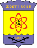
| Yellow Waters Жовті Води | |
 Palace of Culture Palace of Culture | |
| Arms | |
 | |
| Map | |
 | |
| Information | |
| Country | Ukraine |
| Region | Dnipropetrovsk region |
| Surface | 33.25 km² |
| Population | 46 200 (2016) |
| Area code | 380-5652 |
| Postal Code | 52201 |
| website | |
Yellow Waters (ukr. Жовті Води) - a town in Dnipropetrovsk regionUkraine, on the Yellow River.
Characteristic
The city is located in the southern part of Ukraine, several dozen kilometers from the Dnieper Reservoir. It is an important industrial center (mining industry) of the region. It has been an iron mining center since 1895, and uranium ore since 1950.
Drive
By plane
The nearest airports are in Dnieper (code: DNK) i Crooked Corner (code: WGK).
By rail
Traveling from Poland takes 15-25 hours.
By car
Yellow Waters is an important road junction in the region. The city is situated between two main routes in the area: the M04 main road (Zamianka Druha - Donetsk - Luhansk - Sorokyne) and the H23 road (Zaporizhia - Nikopol - Kryvyi Rih - Kirovhrad).
By ship
Communication
Public transport involves several bus lines that can travel around the city and its immediate vicinity. Buses to other parts of the country (including Kryvyi Rih and Dnipropetrovsk) also depart daily from the central public transport facility (Zhovkva bus station - ukr. Автовокзал Жовті Води). The timetable of departures from the station can be found on the website https://zabytki.in.ua/service/timetable/bus_station/53?lang=uk.
Worth seeing
- Park of Glory (парк Слави)
- Palace of Culture (Палац культури)
- Cinema-theater "Mir" (Кінотеатр «Мир»)
- Historical Museum of the City (музей історії міста Жовті Води)
Nearest neighborhood
- Kryvyi Rih
- AlexandriaMine
- Dniprodzerzhinsk
- Kirovhrad
- Kremenchuk
- Svitlovodsk
- Dnipro
- Nikopol


