![]() Click here to see the map of the area in full screen.
Click here to see the map of the area in full screen.
| Location | |
.svg/250px-Tanzania_on_the_globe_(Africa_centered).svg.png) | |
| Flag | |
 | |
| Fast Data | |
| Capital city | Dodoma (official) Dar es Salaam (administrative) |
| State | Semi-presidential system |
| Coin | Tanzanian Shilling (TZS) |
| Area | 945,087 km2 |
| Population | 47,421,786 (2014 estimate) |
| Language | Swahili, English |
| Calling Code | 255 |
| Internet TLD | .tz |
| Time zone | UTC 3 |
THE Tanzania is her country EasternAfrica.
At a glance
Appropriate visit period
Languages
Areas

Areas of Tanzania
| Central Tanzania plateau |
| Northeast Tanzania Mountain area |
| Northwest Tanzania |
| Eastern Tanzania The swampy coastal strip where the capital is located Dar es Salaam |
| Southern Highlands of Tanzania National parks and game shelters. |
| Zanzibar (Islands Zanzibar, Mafia, Pemba and Τουμπάτου) Flat, coral archipelago named after the largest island. |
Important cities
- Donut. Official capital of Tanzania
- Arousa. City at the foot of Mount Mero, near the border with Kenya.
- Dar es Salaam. Administrative capital and largest city of the country.
- Kigoma. Lakeside town.
- Βέυα (English Mbeya). City near the border with Malawi and Zambia.
- Mosi. Tourist town at the foot of Mount Kilimanjaro.
- Morogoro. City in the southern highlands about a straight distance from Dar es Salaam and Donut.
- Μουάνζα. Resort on the south shores of Lake Victoria.
- Μουάρα. City on the Tanzanian border - Mozambique
Additional tourist destinations
- Kilimanjaro. Africa's highest mountain at 5,895 meters is Tanzania's most important tourist destination.
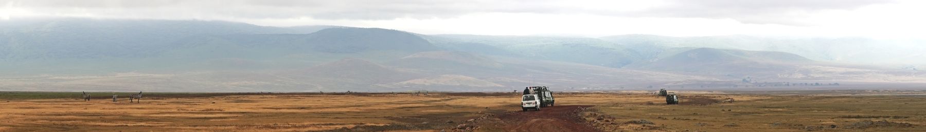
- Ngorongoro Conservation Area (Ngorongoro Conservation Area). Ngorongoro Crater Habitat is a UNESCO World Heritage Site
- Arusha National Park.
- Mikumi National Park.
- Rouhaca National Park. The second largest park in Tanzania.
- Serengeti National Park.
- Masai Mara National Shelter (east of the Serengeti). The park owes its name to the Masai tribe and the Mara River that crosses it. The fauna includes zebras, gazelles, elephants, leopards and lions.
- Tarangire National Park.
- Zanzibar Stone Town (Stone Town of Zanzibar).

Mount Kilimanjaro

Mount Meros

Rouhaca National Park
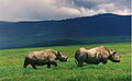
Rhinos in Ngorongoro Crater]]


How to get there
 By air
 By train
 By road
 By boat
How to move

Train.
What to see
Entertainment
Transactions and purchases
Cost
Local cuisine
Local drinks
Tourist infrastructure
Studies
Job opportunities
Stay safe
Health and precautions
Respect local customs
Communications
![]()