 | |
| population | 0(2018) |
| Time zone | UTC−12:00 |
| Edit on Wikidata | |
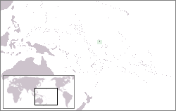
Baker Island (Baker Island) is an atoll located slightly north of the equator in the Central Pacific, approximately atHonolulu3100 kilometers southwest (1675 nautical miles),HawaiitoAustraliaHalfway, the area is 1.18 square kilometers. Baker Island isAmericaThe unincorporated territory is uninhabited, and the United States is responsible for defense.
history
Baker Island was discovered in 1818. It was discovered by the whaling ship Equator from Nantucket, and the captain Elisha Folger called it "New Nantucket." Baker Island was observed again in August 1825. It was also a whaling ship from Nantucket, the Loper, whose captain was Obed Starbuck. The name Baker Island probably comes from Michelle Baker, who came to the island in 1834. However, other references indicate that the actual time is 1832, and the whaling ship Gideon Howland once again landed on the island on August 14, 1839, to bury an American sailor.
The United States occupied the island in 1857, claiming that it applied the Guano Island Act of 1856. From 1859 to 1878, the American Guano Company collected guano here. From 1886 to 1891, John T. Arundel and his company in the United Kingdom used a statement made by the United Kingdom to excavate bird droppings in the Pacific with Baker Island as its headquarters. In order to declare sovereignty, the United States issued Executive Order No. 7358 on May 13, 1936.
In 1935, the Americans began to try a colonial effort to live briefly on the island. On April 3, 1935, American colonists arrived on the island by the US Coast Guard speedboat Itasca, which also carried colonists to the neighboring island Howland. They built a lighthouse, residence, and tried to grow various plants. In 1938, two famous Hawaii residents visited the island, and a cluster of coconut trees with a pessimistic outlook was dubbed King-Doyle Park. This coconut grove is in the best condition on the island, with water seeping close to it. But the dry climate and the seabirds eager to inhabit here did not give trees and shrubs a chance to survive. King-Doyle Park was later adopted as a geographical name by the U.S. Geological Survey.
The colony was named Meyerton in memory of the US Army Commander H.A. Meyer who helped establish the camp here in 1935. Four American civilians live here. In 1942JapanAfter the air and sea attacks, they all evacuated. During World War II, American troops occupied the island.
Ruins and cultural relics
Traces of past human occupation are scattered throughout the islands and offshore waters. Mainly from the US military occupation of the island from 1942 to 1946. The most striking relic is a wide and long airstrip. It is now completely overgrown with plants and cannot be used. In the northeastern part of the island, there are some remaining buildings and heavy equipment, which is obviously the main camp area. Five wooden antenna poles are still standing in the camp. Some crashed aircraft and large equipment such as bulldozers were scattered throughout the island. The north-central part and the northern edge of the island are scattered with large amounts of bulldozer debris, including remnants of metal, fuel and lower drums. The US Navy reported that 11 landing craft were lost here during World War II.