![]() Click here to see the map of the area in full screen.
Click here to see the map of the area in full screen.

 | |
| Location | |
 | |
| Fast Data | |
| Capital city | Belmopan |
| State | Reigning Parliamentary Democracy |
| Coin | Belizean Dollar (BZD) |
| Area | 22,966 km |
| Population | 370,300 (2015 estimate) |
| Language | English (official), Spanish (widely spoken), Maya, Garifuna (Black Carib), Creole |
| Religion | Catholics 50%, Protestants 27% (Pentecost 7%, Anglicans 5%, Seventh-Day Adventist 5%, Mennonite 4%, Methodists 3.5%, Yahovadas 1.5%), atheists 9.4%, another 14% |
| Electricity | 120 / 60Hz (North American plug) |
| Calling Code | 501 |
| Internet TLD | .bz |
| Time zone | UTC-6 |
THE Belize is her country Central America on its northwest coast Caribbean. Its area is only 22,966 sq.km. and a population of 307,300 inhabitants made up of various tribes, based on 2015 estimates. It is a land coastal strip extending from southwest to northeast with a total length of 278 km and borders southwest Guatemala and northeast with the Mexico, whose border is the Odo River, while to the east it is bathed by the Caribbean. The capital today is Belmopan, built after 1961 when a major hurricane destroyed the old capital City of Belize, 80 km from today, and which continues to be the most important commercial and populous center of the country.
At a glance
Appropriate visit period
Languages
Belize is the only English-speaking country in Central America.
Areas

| Northern Belize Corozal area (coastal) and Orange Walk (inland). |
| Belize city area Area of the largest city, airport, and various islands. |
| Cayo (Cayo) The central area consists of jungle, caves, rivers, and ancient Mayan monuments. |
| Stan Creek (Stann Creek) Seaside area south of Belize, access to coral islands and ferries to Honduras. |
| Toledo Southern region with more Mayan monuments and ships to Guatemala. |
Important cities
- Dangriga (Dangriga) —
Additional tourist destinations
Archaeological sites
Habitats
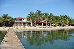
Islands
- Ambergris Kay (Ambergris Caye) —
- (Lighthouse Reef) —
- (Glover's Reef) —
Beaches
Pictures
- Main destinations in Belize

The Temple of the Mask in Lamanay

Altun Ha
_-_Belize-1059.jpg/220px-Flickr_-_archer10_(Dennis)_-_Belize-1059.jpg)
Caracol

Xunantunich


Caye Caulker

Like Pedro

The Big Blue Hole

Almond Beach in Hopkins
Placesia


_-_Belize-1059.jpg/220px-Flickr_-_archer10_(Dennis)_-_Belize-1059.jpg)


How to get there
By air
By train
By road
By boat
How to move

What to see

Entertainment

Transactions and purchases
Cost
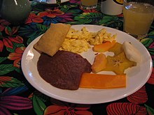
Local cuisine