 | ||
| Alpenrod | ||
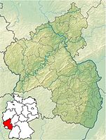
| federal state | Rhineland-Palatinate | |
|---|---|---|
| Residents | 1.549 (2019) | |
| height | 450 m | |
| no tourist info on Wikidata: | ||
| location | ||
| ||
The little place in the Westerwald belongs to the whole community Hachenburg. Dehlingen and Hirtscheid still belong to the municipality of Alpenrod.
background
It is believed that the Poststrasse runs above Alpenrode (it used to be called Albrechtsrode) on a path that was already used by the Celts. In any case, the muddy lowlands were avoided in the Middle Ages.
getting there
see article Hachenburg
mobility

Map of Alpenrod
Tourist Attractions
Gräbersberg with observation tower
On the 513 m high mountain there is a cell phone tower with a viewing platform. From the platform at a height of 33 m you have a beautiful panoramic view. On a clear day you can see as far as the Eifel.
- History: As early as 1932, the first 24 m high wooden observation tower was built on the mountain. This tower was used as an aerial observation post during World War II. A storm in November 1945 destroyed the tower. In 1998, the mobile operator E-Plus erected the current 73 m high tower in just 6 weeks.
- Opening times of the viewing platform: Mon - Sun: 8 a.m. - 8 p.m.
- Refreshments directly at the tower:
- Restaurant "Alpenroder Hütte", At the Gräbersberg. Tel.: 49 2662 943754, Fax: 49 (0)2662 943748, Email: [email protected].
- further information with picture: see description on www.alpenrod.de
activities
shop
kitchen
nightlife
accommodation
health
Practical advice
trips
literature
Web links
- http://www.alpenrod.de/ - Official website of Alpenrod