This regional dive guide is intended to provide the already qualified scuba diver with information which will help to plan dives in the waters of the Cape Peninsula and False Bay, whether as a local resident or a visitor. Information is provided without prejudice, and is not guaranteed accurate or complete. Use it at your own risk. Expand or correct it when you can.
The region described is within a day trip by road from any part of greater Cape Town, in the Western Cape province of South Africa and includes over 280 named dive sites for which positions are recorded, which is a lot for any single destination.
Detailed information on individual dive sites is provided in the sub-articles linked from the Dive sites section. The information in the site descriptions ranges from superficial to highly detailed, depending on what is known about the site. There may be a map. The bathymetric charts by SURGMAP are updated as and when new survey data is collected, and are mapped by swimming the contours towing a GPS buoy. They are reasonably accurate – within a couple of metres usually – and reliable for what is shown, but seldom complete. It is quite possible that some tall pinnacles have been missed. There is no guarantee that you will not discover one by hitting it with your boat. If you do, please let us know.
In some instances a dive site sub-article will include several sites which are in close proximity, as much of the information will be common to them all. In other cases, usually involving wreck sites, two adjacent sites will each have its own sub-article, but if two or more wrecks lie in the same position, or with substantial overlap, they will be described in the same sub-article.
Understand


General topography
The City of Cape Town was founded at the northern end of the Cape Peninsula, a narrow mountainous strip of land at the most 11 km wide and just over 50 km long. The northern border is the coast of Table Bay, a large open bay with a single island, Robben Island, in its mouth.
A ragged coastline marks the western border along the Atlantic ocean. A number of small bays are found along the coast with a single large one, Hout Bay, about half way along. Further south the peninsula narrows until it comes to an end at Cape Point. A range of mountains with Table Mountain at 1,085 m at the northern end forms the backbone of the peninsula. The highest point of the southern peninsula is Swartkop, at 678 m, near Simon’s Town. The peninsula has fairly steep slopes along most of the coast, with very narrow areas of relatively flat land except for the west side of the southern tip.
The steep eastern side is bordered by False Bay, and this stretch of coastline includes the smaller Smitswinkel Bay, Simon’s Bay and Fish Hoek Bay, where a strip of low ground extends between the coasts on both sides. At Muizenberg the coastline becomes relatively low and sandy and curves east across the southern boundary of the Cape Flats to Gordon’s Bay to form the northern boundary of False Bay. From Gordon's Bay the coastline swings roughly south, and zig-zags its way along the foot of the Hottentot’s Holland mountain range to Cape Hangklip which is at nearly the same latitude as Cape Point. The highest peak on this side is Kogelberg at 1,269 m.
In plan the bay is approximately square with rather wobbly edges, being roughly the same extent from north to south as east to west (30 km), with the entire southern side open to the ocean. The area of False Bay has been measured at about 1,090 km², and the volume is approximately 45 km³ (average depth about 40 m). The land perimeter has been measured at 116 km, from a 1:50,000 scale map.
The bottom morphology of False Bay is generally smooth and fairly shallow, sloping gently downwards from north to south, so that the depth at the centre of the mouth is about 80 m. The bottom is covered with sediment which ranges from very coarse to very fine, with most of the fine sediment and mud in the centre of the bay. The main exception is a long ridge of sedimentary rock that extends in a southward direction from off the Strand, to approximately level with the mouth of the Steenbras River. The southern tip of this ridge is known as Steenbras Deep.
There is one true island in the bay, Seal Island, a barren and stony outcrop of granite about 200 m long and with an area of about 2 ha. It is about 6 km south of Strandfontein and is less than 10 m above sea level at its highest point. There are also a number of small rocky islets which extend above the high water mark, and other rocks and shoals which approach the surface. Most of these are granite of the Peninsula pluton, but east of Seal Island they are generally sandstone, probably of the Tygerberg formation within the bay, though it is possible that some may be of the Table Mountain series. The largest of these reef areas is Whittle Rock, an underwater hill of granite rising from the sandy bottom at about 40 m to within 5 m of the surface, and about 1 km diameter.
Outside the bay, but influencing the wave patterns in it, is Rocky Bank, an extensive reef of Table Mountain sandstone reef between 20 and 30 m depth on top, and sloping down to deeper than 100 m to the south.
Strictly speaking, False Bay is part of the Atlantic Ocean, which extends as far as Cape Agulhas, but when in Cape Town, Atlantic generally refers to the western seaboard of the Cape Peninsula, and the east side is referred to as False Bay, or the Simon's Town side. This convention will be used throughout this guide.
Local topography
The strongest influence on local topography is the local geology. Unconsolidated deposits of silt, sand or gravel tend to be fairly flat. Shingle and small boulders may slope more steeply, and bedrock and large boulders may be anything from raised slightly above the surrounding unconsolidated bottom, to overhanging cliff faces and tors. The rock type, and for sedimentary strata, the dip and strike, have a major influence on the range of possible reef forms.
The present reef structures developed as landforms during the ice ages, when they were above sea level, and the granite reefs were largely shaped by underground weathering process over even longer periods. The granites are fairly old, and much jointed by tectonic forces, and the edges of the cracks have had a long time to be chemically eroded by ground-water to round off the corners and form deep crevices and gullies, which were later exposed by erosion of the saprolith and further modified by weathering and erosion of the exposed surfaces to the structures known as corestones and tors. Similarly, the exposed sedimentary rock eroded while exposed above ground. When the sea level rose during the glacial melting, these landforms simply flooded, and retain much of their previous form and character. Coastal erosion has since modified reefs in areas exposed to high enough energy wave action, and some movement of sediment occurs due to waves and currents.
Climate, weather and sea conditions

Climate of the Western Cape
The climate of the South-western Cape is markedly different from the rest of South Africa, which is a summer rainfall region, receiving most of its rainfall during the summer months of December to February. The South-western Cape has a Mediterranean type climate, with most of its rainfall during the winter months from June to September.
During the summer the dominant factor determining the weather in the region is a high pressure zone, known as the Atlantic High, located over the South Atlantic Ocean to the west of the Cape coast. Winds circulating in an anticlockwise direction from such a system reach the Cape from the south-east, producing periods of up to several days of high winds and clear skies. These south easterly winds are locally known as the Cape Doctor. They keep the region relatively cool and help to blow polluted air from the industrial areas and Cape Flats out to sea. Because of its south facing aspect False Bay is exposed to these winds, particularly on the west side, while Table Bay and the west coast of the peninsula experience an offshore wind. This wind pattern is locally influenced by the topography to the extent that gale force winds may be blowing in Gordon’s Bay , while about 10 km away parts of Somerset West may have a sweltering and windless day.
Winter in the South-western Cape is characterised by disturbances in the circumpolar westerly winds, resulting in a series of eastward moving frontal depressions. These bring cool cloudy weather, wind, and rain from the north-west, followed by a drop in temperature and a shift to south-westerly wind as the front passes. The south westerly winds over the South Atlantic produce the prevailing south-westerly swell typical of the winter months, which beat on the exposed Atlantic coastline and the east side of False Bay. The mountains of the Cape Peninsula provide protection within the west side of False Bay from this wind and from the south westerly waves – a fact which influenced Governor Simon van der Stel in his choice of Simon’s Bay as a winter anchorage for the Dutch East India Company’s ships for Cape Town. The north-westerly winter storms have wrecked many ships anchored in Table Bay over the centuries. Even today, in spite of technical advances and improved weather forecasting this still happens, though less frequently than in the past, and these days the salvage operations are more often successful.
Weather
The general trend is for the weather to come in from the west and move eastwards with the frontal systems, but there can also be more local weather phenomena such as thunderstorms (rare) and 'berg' winds, which are warm winds coming down over the mountains from inland. There can be considerable variation in weather conditions between different sites in the area covered by this guide on any day, though the general tendency may be similar. For example rain may fall on the Cape Peninsula in the morning, and by afternoon these conditions may have moved over to the east side of False Bay and the peninsula may be clearing with a significant wind directional shift from north-westerly to south-westerly. Local variation in wind strength may be extreme, and sometimes hard to believe, as there may be a dead calm in one place and a howling wind a few kilometres away. There are places known for exposure to both south easterly and north westerly winds, and some which are sheltered from one or the other, while the south-westerlies blow most places, but not usually to quite the same extremes. What this amounts to in practice, is that the weather conditions where you are at a particular time may differ significantly from those at a dive site a bit later in the day.
A berg wind is caused by a high altitude inland high pressure, usually in winter, on the cold, dry central plateau areas above the great escarpment, coupled with lower pressures at the coast. The wind flows down the escarpment and is heated by compression. The temperature rise can be considerable and over a short period. This hot, dry wind is offshore and does not greatly affect diving conditions, but it is usually followed by cool onshore winds with low cloud, fog and drizzle, and is often associated with the approach of a cold front from the west in winter, which may bring strong westerly winds and substantial frontal rain.
Sea conditions
Waves and swell
The waves reaching the shores of False Bay and the Cape Peninsula can be considered as a combination of local wind waves and swell from distant sources. The swell is produced by weather systems generally south of the continent, sometimes considerably distant, the most important of which are the frontal systems in the South Atlantic, which generate wind waves which then disperse away from their source and separate over time into zones of varying period. The long period waves are faster and have more energy, and move ahead of the shorter period components, so they tend to reach the coast first. This is known to surfers as a pulse, and is generally followed by gradually shortening period swell of less power.
Local winds will also produce waves which will combine their effects with the swell. Offshore winds as a general rule will flatten the sea as the fetch (distance that the wind has blown over the water) is usually too small to develop waves of great height or length. Onshore winds on the other hand, if strong enough will produce a short and nasty chop which can make entry and exit uncomfortable, and surface swims or boat rides unpleasant.
The combination of swell and wind waves must be considered when planning a dive. This requires knowledge of these conditions, which are forecast with variable accuracy by a number of organisations, in some cases for seven or more days ahead. Accuracy is generally inversely proportional to the interval of the forecast. It is usually quite reliable looking two or three days ahead, but can be a little shaky over more than a week. Weather is like that.
Upwellings
South-easterly winds which blow offshore and along the coast on the west side of the Cape Peninsula and the east side of False Bay cause a movement of surface water offshore to the west of the coast due to Ekman transport. This movement of water away from the coast is compensated by the upwelling of deeper water.
These upwellings are of considerable interest to the diver, as the upwelled water on the west coast is cold and relatively clear. However, as the upwelled water has a high nutrient content, the upwellings are often forerunners of a plankton bloom known as a "red tide", which will drastically reduce visibility. Water temperature tends to drop to below 12°C during a west coast upwelling, and can reach a chilly 7°C on occasion.
On the east side of False Bay the upwellings often cause poor visibility as they can disturb the very fine and low density sediment which is common on that side of the bay, particularly in the shallower part near Gordon's Bay. The water is also relatively cold, but not usually as cold as on the west side of the peninsula and temperatures may drop from around 19°C to 12°C over a day or two.
Tides
The local tides are lunar dominated, semi-diurnal, and relatively weak, and there are no strong tidal currents on the Atlantic coast or in False Bay. The resulting tidal flows are of little consequence to the diver, the main effect being slight changes in the depth at the dive site and variations on the obstacle presented by kelp fronds near the surface, which can affect the effort required to get through the kelp at the surface. In this regard it is generally easier at high tide.
Boat launches at some slipways can be difficult at low tide, which can occasionally affect boat dive schedules, and spring low is at roughly the time of first launch (roughly 09:00 to 09:30).
Maximum tidal range at Cape Town is approximately 1.86 m (spring tides), and at Simon’s Town 1.91 m, with minimum ranges at both places of about 0.26 m (neap tides).
Water temperature
Average summer surface temperature of the Atlantic off the Cape Peninsula is in the range 10° to 13°C. The bottom temperature may be a few degrees colder. Minimum temperature is about 8°C, though claims have been made for as low as 6°, and maximum about 17°C.
Average winter surface temperature of the Atlantic off the Cape Peninsula is in the range 13° to 15°C. The bottom temperature inshore is much the same.
Average winter surface temperature of False Bay is approximately 15°C, and the bottom temperature much the same or a bit lower.Average summer surface temperature of False Bay is approximately 19°C. The bottom temperature is generally 1° to 3°C lower than it is in winter, but 10° to 12°C is not unknown.
Currents
Currents are not usually considered an issue at most dive sites in this region. A shallow surface current may be produced by strong winds, over a short period, which can be an inconvenience if it sets offshore. The depth of the current depends on how long the wind has been blowing, and when a sudden wind picks up while one is diving, the current is shallow and a diver may return to shore at 3 to 6 m depth below most of the current. Tidal currents are negligible, and are only experienced at a few isolated dive sites, such as Windmill Beach, during spring tides when there is some swell running. Bear in mind that a surface current driven by wind will flow to the left of the wind direction due to Coriolis effects, and the angle will increase and strength will decrease with the depth.
Two places which may experience significant currents are at the mouth of False Bay, at Rocky Bank and Bellows Rock, where eddies from the Agulhas current frequently produce a light- to medium-strength current, which may be strong enough to inconvenience divers in the shallows around Bellows Rock.Occasionally currents of up to about a knot have been experienced at offshore dive sites in False Bay south of Simon's Town, and on the Atlantic seaboard near Duiker Point and Robben Island. These currents are usually considerably weaker at the bottom, and do not usually present much difficulty to divers, though they make the use of a DSMB for surfacing more important, as one can drift quite a long way even on a normal ascent with a safety stop. These surface currents can be more of an inconvenience at the start of the dive, as they will carry you past the shotline if you are not prompt about descending, which should be done as soon as the line is in view. Also depending on the slack in the shotline, the buoy will be downwind and downcurrent of the mark by several metres. A competent skipper will make some allowance and drop the divers in upstream of the buoy.
Weather data
Real time weather data is available for False Bay from a weather buoy operated by the Centre for Observational Oceanography. Current and 7-day historical data is displayed for air and sea surface temperature, wind strength and direction, and barometric pressure. The position of the buoy may vary, but at October 2012 it was at 34°11'19"S, 18°27'03"E. (about 700 m east of Simon's Town harbour)
Predicting the weather and sea conditions
Predicting diving conditions in this region is fairly complex. There are websites such as Buoyweather, Surf-Forecast and Windguru which provide reasonably reliable forecasts for wind and swell. This combined with information on recent conditions of water temperature and visibility will allow a fairly reliable prediction of conditions a few days in advance. The local Wavescape website and surf report is also a valuable reference with a distinctive South African ambience, though like the others, it is primarily intended for surfers, and divers must interpolate a bit.
Visibility can clear up quite quickly (overnight) on the Atlantic coast due to currents and relatively coarse sediments. On the west side of False Bay it is a little slower, and it can take several days, even weeks, on the east side of the bay, where the sediments are fine and light.
Satellite sea surface temperature and chlorophyll data are also available off the internet, and may help predict surface conditions, but how much they predict bottom conditions is not known.
Until you have developed a feel for this procedure, it is useful to get second opinions from people or organisations with experience.
Some of the local dive charter operators have better reputations for weather prediction than others, and there are some who will almost always claim that conditions are or were good. The Blue Flash weekly newsletter is as good as any other and better than many. This will refer to the preferred areas off the Cape Peninsula, including the west side of False Bay. For information on the east side of False Bay you can try phoning Indigo Divers.
The marine ecology

The bioregions
Cape Point at the tip of the Cape Peninsula is considered the boundary between two of the five inshore marine bioregions of South Africa. To the west of Cape Point is the cool to cold temperate South-western Cape inshore bioregion, and to the east is the warmer temperate Agulhas inshore bioregion. The Cape Point break is considered to be a relatively distinct change in the bioregions and this can be clearly seen from the difference in marine life between the Atlantic seaboard of the peninsula and False Bay.
The habitats
Four major habitats exist in the sea in this region, distinguished by the nature of the substrate. The substrate, or base material, is important in that it provides a base to which an organism can anchor itself, which is vitally important for those organisms which need to stay in one particular kind of place.Rocky shores and reefs provide a firm fixed substrate for the attachment of plants and animals. Some of these may have Kelp forests, which reduce the effect of waves and provide food and shelter for an extended range of organisms. Sandy beaches and bottoms are a relatively unstable substrate and cannot anchor kelp or many of the other benthic organisms. Finally there is open water, above the substrate and clear of the kelp forest, where the organisms must drift or swim. Mixed habitats are also frequently found, which are a combination of those mentioned above. The habitats are described in more detail in the following sections.
Rocky shores and reefs

The great majority of popular dive sites in the local waters are on rocky reefs or mixed rocky and sandy bottoms, with a significant number of wrecks, which are equivalent to rocky reefs for classification of habitat, as in general, marine organisms are not particular about the material of the substrate if the texture and strength is suitable and it is not toxic. For many marine organisms the substrate is another type of marine organism, and it is common for several layers to co-exist. Examples of this are red bait pods, which are usually encrusted with sponges, ascidians, bryozoans, anemones, and gastropods, and abalone, which are usually covered by similar seaweeds to those found on the surrounding rocks, usually with a variety of other organisms living on the seaweeds.
The type of rock of the reef is of some importance, as it influences the range of possibilities for the local topography, which in turn influences the range of habitats provided, and therefore the diversity of inhabitants.
Granite reefs generally have a relatively smooth surface in the centimetre to decimetre scale, but are often high profile in the metre scale, so they provide macro-variations in habitat from relatively horizontal upper surface, near vertical sides, to overhangs, holes and tunnels, on a similar scale to the boulders and outcrops themselves. There are relatively few small crevices compared to the overall surface area.
Sandstone and other sedimentary rocks erode and weather very differently, and depending on the direction of dip and strike, and steepness of the dip, may produce reefs which are relatively flat to very high profile and full of small crevices. These features may be at varying angles to the shoreline and wave fronts. There are far fewer small caverns and swimthroughs in sandstone reefs, but often many deep but low near-horizontal crevices. In some areas the reef is predominantly wave-rounded medium to small boulders. In this case the type of rock is of little importance.
The coastline in this region was considerably lower during the most recent ice-ages, and the detail topography of the dive sites was largely formed during the period of exposure above sea level. As a result, the dive sites are mostly very similar in character to the nearest landscape above sea level.
There are notable exceptions where the rock above and below the water is of a different type. These are mostly in False Bay south of Smitswinkel Bay, where there is a sandstone shore with granite reefs.
Kelp forests

Kelp forests are a variation of rocky reefs, as the kelp requires a fairly strong and stable substrate which can withstand the loads of repeated waves dragging on the kelp plants. The Sea bamboo Ecklonia maxima grows in water which is shallow enough to allow it to reach to the surface with its gas-filled stipes, so that the fronds form a dense layer just below the surface. The shorter Split-fan kelp Laminaria pallida grows mostly on deeper reefs, where there is not so much competition from the sea bamboo. Both these kelp species provide food and shelter for a variety of other organisms, particularly the Sea bamboo, which is a base for a wide range of epiphytes, which in turn provide food and shelter for more organisms.
The Bladder kelp Macrocysta angustifolia can also be found at a few sites, mostly near Robben Island. This is one of the few places in the world where three genera of kelp may be found at the same place.
Sandy beaches and bottoms (including shelly, pebble and gravel bottoms)
Sandy bottoms at first glance appear to be fairly barren areas, as they lack the stability to support many of the spectacular reef based species, and the variety of large organisms is relatively low. The sand is continually being moved around by wave action, to a greater or lesser degree depending on weather conditions and exposure of the area. This means that sessile organisms must be specifically adapted to areas of relatively loose substrate to thrive in them, and the variety of species found on a sandy or gravel bottom will depend on all these factors.
For these reasons sandy and gravel bottoms are not usually popular with novices and visitors, who are usually attracted to the more spectacular sites, but to the diver who is interested in the full variety of the marine environment they can provide a refreshing and fascinating variation, as there are a lot of organisms which will only be found on these bottom types. Mostly they can be found adjacent to reef areas, but there are a few sites which are predominantly sandy.
Sandy bottoms have one important compensation for their instability, animals can burrow into the sand and move up and down within its layers, which can provide feeding opportunities and protection from predation. Other species can dig themselves holes in which to shelter, or may feed by filtering water drawn through the tunnel, or by extending body parts adapted to this function into the water above the sand.
Red tides
On the west coast of the peninsula and to a lesser extent the east side of False Bay, the south easterly winds can cause upwelling of deep, cold, nutrient rich waters. This generally happens in summer when these winds are strongest, and this in combination with the intense summer sunlight provides conditions conducive to rapid growth of phytoplankton. If the upwelling is then followed by a period of light wind or onshore winds, some species of phytoplankton can bloom so densely that they colour the water, most noticeably a reddish or brownish colour, which is known as a red tide.
Depending on the species involved, these red tides may cause mass mortalities to marine animals for various reasons. In some cases the organisms may consume all the available nutrients and then die, leaving decaying remains which deplete the water of oxygen, asphyxiating the animal life, while others may simply become so dense that they clog the gills of marine animals, with similar effect. A third group are inherently toxic, and these may be particularly problematic as some filter feeding species are immune to the toxins but accumulate them in their tissues and will then be toxic to humans who may eat them.
Red tides also have the more direct effect on diving conditions of reducing visibility. The reduction in visibility can range from a mild effect in the surface layers, to seriously reduced visibility to considerable depth.
Red tides may be small and localised and usually last for a few days, but in extreme cases have been known to extend from Doringbaai to Cape Agulhas, several hundred kilometres to both sides of Cape Town, and take weeks to disperse (March 2005).
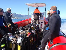
Equipment
Standard equipment
Most of the dive sites in this region are relatively shallow and can be done on air with ordinary recreational diving equipment, which would include:
- A full wet-suit of at least 5mm thickness, hood, boots and gloves.
- A cylinder with harness, regulator and submersible pressure gauge.
- A buoyancy compensator device (BCD).
- Mask and snorkel.
- Fins.
- A ditchable weight system correctly calibrated for the rest of the equipment.
- A dive computer or a depth gauge and timer with decompression tables and dive plan.
To this you can add:
- Any further equipment you or your certifying agency may consider obligatory, such as a secondary regulator, low pressure BCD inflator, knife, etc.
- Any equipment you carry or use as a matter of personal preference, such as camera, signalling device, wrist slate, dry suit, reel and surface marker buoy, alternative gas supply, compass, etc.
Recommendations
- If your fins have full foot pockets (closed heel), and your wet suit boots have soft soles, it may be necessary to wear shoes to get to the entry point on shore dives. Open heel fins and hard soled boots are recommended for most shore dives in this region because the ground tends to be rough and shoes may not still be where you left them when you return from the dive.
- A standard surface marker buoy is not recommended where there is heavy kelp growth, as it will snag frequently and provide endless annoyance. A deployable or “delayed” surface marker is better at such sites and is always a good thing to carry on a boat dive.
- Leaving out any of the above items is at your own risk. There are divers who will not wear hoods, or gloves, or boots, or feel that a snorkel or BC is not necessary, or that they can dive in a 3 mm suit. Try this on an easy dive first, where you can get out quickly. It may work for you – there are divers who manage in each of these cases, but you have been warned.
Additional equipment

For each dive site there may be additional or alternative equipment required or recommended, which may improve the dive experience or improve safety at that site. The most commonly recommended items are:
- Compass
- Dry suit
- Light
- Nitrox
- Reel with DSMB
Use of a compass is recommended wherever it may be desirable to swim back to shore below the surface to avoid wind or boat traffic, or to keep below the kelp fronds. It is required for the compass navigation routes.
A dry suit is recommended for most dives on the Atlantic seaboard, or in general if the dive is deeper than about 20 m and the water is colder than 13°C. An appropriate undergarment is required for the dry suit, at this is what provides the insulation. With a suitable combination it is possible to enjoy an hour's dive in comfort at a water temperature of 8°C, when most of the divers in 7-mm wetsuits are cold after 30 minutes. If your face and head are particularly sensitive to cold, a full-face mask will keep your face warm.
Recommendations for a light are for daytime dives, as lights are considered standard equipment on night dives. Backup lights should be carried on night dives from a boat. Underwater flashers may not be well received by the other divers as they are extremely annoying. If you feel you must use one, warn the others and stay away from those divers who do not wish to have a light continually flashing in their peripheral vision and distracting them. A strobe which may be switched on in an emergency is another matter entirely, and is accepted as a valuable safety aid.
The equipment recommendations are for divers who are competent to use those items, and if you are not, you should consider whether your competence is sufficient to dive the site without this equipment.
No recommendations are made regarding equipment for wreck penetration dives and deep dives. If you do not know exactly what equipment is required and have it with you, or are not competent in its use, you should not do the penetration. Depth, wrecks and caves are nature’s tools for culling reckless divers.
Recommendations for gas mixtures are generic. You must choose the appropriate mixture based on your qualifications, competence and the dive plan. Nitrox mixtures are generally recommended to increase dive time without obligatory decompression stops, and Trimix to reduce narcotic effects. Nitrox is available from many of the dive shops, and charter operators will usually provide cylinders filled with the blend of your choice if given sufficient notice. Trimix is more difficult to arrange, as not many filling stations keep Helium in stock, so it may require a bit of shopping around.
Decompression dives should generally only be planned by divers who are familiar with the site, and are competent and properly equipped for the planned dive. Recommendations in this regard are outside the scope of this article, and it will be necessary to discuss any planned decompression dives well in advance with the dive operator, as only a few of them are competent and willing to support planned decompression dives, and those will usually require strong evidence of your competence to do the dive, and advance notice of your dive plan.
Exotic equipment
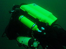

Diving equipment other than open circuit back mounted scuba with half mask and mouth-grip demand valve is considered to be exotic for this section.This would include surface supplied breathing apparatus and full face masks, used as standard equipment by commercial divers, and rebreathers, seldom used by commercial divers, but frequently used by military divers and gaining popularity with Technical recreational divers.
Also considered as exotic equipment is side-mount scuba and diver propulsion vehicles (scooters), as they are not used by many recreational divers.
Generally speaking, any use of surface supplied diving equipment will require special preparation and logistics, which are not available from the listed service providers, but are perfectly legal for use and technical support is available from the suppliers to the commercial diving industry in Cape Town.
Rebreathers are relatively uncommon, but are used by a few local aficionados, and sorb is available over the counter at a few suppliers. There is even one charter boat which regularly runs dives for mainly rebreather divers. Expect to be checked out for skills and certification before being allowed to join these dives, so it would be advisable to make prior arrangements. Technical support is available for a limited range and parts will usually only be available from overseas agencies. Most of the local dive sites do not really justify the expense and relative risk of rebreathers, and they are mostly used by divers who also use them in other places where they are more of an advantage, and by those who just enjoy the technology. They are not available for rental, except in some cases as part of a training package.
Full-face masks will not be a problem, provided you can show your ability to provide buddy support if diving with a partner (some charters will insist that you dive with a buddy). Technical support and parts are available from local agencies for most of the more popular models used for commercial and technical diving, but you may have to wait some time if parts are not in stock. The use of a full-face mask can be a particular advantage when the water is cold, and if you have one and prefer to use it, by all means bring it to Cape Town.
Side mount scuba is relatively uncommon in Cape Town, but there should be no problems if you chose to use it. Do not expect boat crews to know how to help you kit up, but they will probably respond well to explanations. There is a growing number of local side-mount aficionados, including several instructors for side-mount.
Diver propulsion vehicles (scooters) are rare but not unknown. Check with the charter boat whether will be space on board for your unit, and don't expect to find one for rental.
Decompression and bailout sets are not considered exotic, but are not easily available for rental. Bring your own, or ask around. Some of the service providers carry a small range of cylinders suitable for sling mount, but may not have the gas mixture you want in stock. Almost all the local divers that carry decompression or bailout cylinders routinely have their own equipment
Dive sites


The dive sites described in these articles include some which are well known favourites and have been dived frequently and by many divers for decades, and also newly described sites, which may only have been dived a few times, and by a few divers. There are also sites which have been known for years, but seldom dived due to their relative inaccessibility, and a few which are basically not particularly interesting, but have been included in the interests of completeness, as the information is available, and occasionally people want to know what they are like. With a few exceptions, the information provided is based on personal observation at the sites by Wikivoyagers. All photos of marine life and features of interest were taken at the listed site.
Geographical information is provided in as much detail as is available. Sites are geolinked, which allows them to be identified on various internet map systems. Positional accuracy is usually good. The maps provided should be usable, to scale, and accurate, but are not guaranteed either to be correct in all details or complete. Clicking on the thumbnail will open a link to a higher resolution image.
Atlantic coast of the Cape Peninsula

Introduction and some tips on diving the Atlantic coast.
This coastline from Table Bay to Cape Point is exposed to the south westerly swells generated by the cold fronts of the Southern Ocean. The continental shelf is narrow in this part of the coast and swells are not greatly influenced by the narrow band of shallow water, so they retain most of their deep-water energy. These swells pound this coast most of the winter, and to a lesser extent in summer, so diving in this region is mostly a summer activity, and the frontal weather patterns far to the south are more important than local weather for swell prediction.
North westerly winds are a feature of the approach of a cold front, and in winter they can be very strong for a few days before swinging to southwesterly as the front passes. These north westerly winter storms were responsible for many shipwrecks in Table Bay and other parts of the west coast, and the associated wind waves can be severe. However the fetch is short and these onshore wind waves do not last long after the storm. They do mess up the visibility though, and this effect lasts for some time after the waves have dissipated.
The south easterly winds are longshore to offshore in this area and tend to knock the swell down a bit. They also cause an offshore displacement of the surface water, which results in deeper water rising to take its place. This upwelling brings colder, initially cleaner water to the inshore areas, and can produce conditions of 20 m visibility and temperatures down to 8°C, though more usually 10° to 12°C. The diving is wonderful if you are sufficiently insulated. Out of the water, however, it is commonly fine and hot, with blazing sunshine high ultraviolet levels and air temperatures in the high 20 and 30° Celsius. This means you will be overheating until you get in the water, hence the comment that summer diving in Cape Town is one easy step from hyperthermia to hypothermia.
There is no escaping the need for a well-fitting, thick (preferably 7 mm), wet suit or a dry suit with an adequate undergarment for these conditions if you intend to stay for more than a few minutes. Carrying a bottle of water with your equipment to wet the outside of your suit before or after putting it on will help keep the temperature down due to evaporative cooling, specially on a windy day. Overheating after leaving the water is seldom a problem. The alternative option of kitting up at the water’s edge requires a shore party to look after your clothes, etc., while you dive, so it has become less common. Do not leave equipment unattended if you wish to see it again.
An upwelling is frequently followed by a plankton bloom, often called a red tide. This will reduce visibility considerably, particularly near the surface. Often the water will be much clearer below the surface layer, though the light levels may be a bit dim and the colour relatively green, or even brownish. The phytoplankton will bloom while the sun shines, so it is much more developed in summer.
The south-easter is an offshore wind at some sites, and besides its influence on temperature and visibility, it also affects the swim back to shore after the dive. The south-easter can appear seemingly out of nowhere on a previously cloudless and windless day, and build up to near gale force in the time you are underwater on a dive, though it is usually predictable, so take note of weather forecasts, and in any case, allow sufficient reserve air to swim back a few metres below the surface. A compass is extremely useful if you do this as it allows you to swim shallower, which is good for air consumption, decompression and warmth. A depth of 3 to 5 m is recommended for a long swim home. The strong south-easter in these cases produces a short, steep wind chop with white-caps which does not penetrate to any significant depth, but the constant slapping of waves and the spray in the air can make snorkelling unpleasant and difficult. There may also be a shallow offshore wind drift (surface current), but this takes some time to develop and gets rapidly weaker with depth and is not usually a problem below about a metre depth inshore. Further offshore the wind induced current can take you several hundred metres during a decompression stop, at a rate of about 0.5 to 1 kph.
When boat diving a deployable surface marker buoy (DSMB) is useful to both facilitate controlled ascent and accurate decompression or safety stop depth, and as a signal to the boat that you are on your way up. In strong wind conditions it will also improve your visibility on the surface, specially if your equipment is all black, so it is worth carrying even if only as a signalling device. Bright yellow has been shown to be best for all round visibility at sea, but orange and red are fairly good too.
Robben Island

These sites are all boat dives. There is no other practical way to get to them, as they are all several kilometres from the mainland across major shipping lanes.The waters around Robben Island were proclaimed a Marine Protected Area in 2019, so a permit is required to dive there. The boat operator will have to have a permit for the restricted area. Details of how this will be done are not yet known.
Local geography:Robben Island is a low, rocky shored island in the mouth of Table Bay. The island and surrounding reefs are rock of the Tygerberg series of the late Precambrian Malmesbury group. These are folded sedimentary rocks, frequently with very steep dip, which often weather to form rather jagged outcrops.
The sites include:
- 1 MV Treasure: S33°40.45' E018°19.95' (approximate)
- Wreck dive. Boat access only. Depth: 30 to 50 m
- On 23 June 2000 the damaged Panamanian registered bulk ore carrier sank off the coast of South Africa approximately 7 nautical miles north of Robben Island.
- The vessel lies upright on a fairly level bottom at about 50 m depth. The superstructure was removed shortly after the sinking by sawing it off at about 30 m depth with a cable towed by tugs as it was a hazard to shipping.
- 2 Robben Island steamer wreck: S33°49.886', E018°21.524' (approximate centre of wreckage)
- Wreck dive. Boat access only. Depth: 30 to 36 m
- Unidentified wreck of a steel steamship about 48 m long in reasonable structural condition.
- 3 MV Afrikaner: S33°50.012' E018°20.686'
- Boat access only. Deep wreck dive. Depth 43 to 50 m
- The 61 m fishing vessel struck Whale Rock in 1993 and sank while being towed away from the rock.
- 4 Whale Rock: S33°50.112' E018°22.858'
- Reef dive. Boat access only. Depth: Mostly less than 10 m
- A large shoal area of rocky reef, usually with a break over the pinnacle, which is the last resting place of a few ships.
- 5 SS Hypatia: S33°50.10’ E018°22.90’ (Turner 1988)
- Wreck and reef dive. Boat access only. Depth: Shallow, maximum probably about 15 m
- British Houston Line steamer of 5 728 tons, built in 1902. Wrecked on Whale Rock in Table Bay on 29 October 1929 in fog while on a voyage from Beira to New York with a cargo of blister copper and chrome ore.
- 6 MV Daeyang Family: S33°50.388' E18°23.133
- Wreck and reef dive. Boat access only. Maximum depth about 15 m
- A large Korean ore carrier which was wrecked on Whale Rock on 1 March 1986 when anchors dragged in heavy weather. The wreckage lies at a depth of about 15:nbsp;m
Table Bay

- 7 MV Winton: S33°52.1514' E18°29.1828 (Engine block)
- Wreck dive. Boat access, though shore access is feasible. Close to surf line. Maximum depth about 6 m.
- Wreck of a small steel freighter on a flat sand bottom.
- 8 MV Gemsbok: S33°53.0' E018°20.5'
- Boat access only. Deep wreck dive. Depth about 57 m on the sand.
- The 50 m 313 tonne buoy tender MV Gemsbok capsized and sank about 4 km from Green Point Lighthouse on 2 Seprember 1975 while transferring an anchor chain of a cargo vessel. The chain snagged and the weight of the chain caused the vessel to capsize and sink within minutes. The wreck lies on its starboard side.
- 9 Highfields: S33°53.13’ E018°25.83’ (Bow)
- Wreck dive. Boat access only. Close to major shipping lane at harbour mouth. Maximum depth 24 m.
- Wreck of a steel barque which sank after a collision in 1902.
- 10 SS Cape Matapan: S33°53.233' E018°24.533' About a kilometer north of Granger Bay harbour
- Wreck and reef dive. Boat access only. Maximum depth 25 m. The wreck is close to the shipping lane and there are no landmarks nearby.
- Wreck of a steel fishing boat which was sunk in a collision in 1960 in heavy fog.
- 11 RMS Athens: S33°53.85’ E018°24.57’
- Wreck and reef dive. Shore or boat access. Maximum depth about 7 m
- Union Company iron steam screw barque of 739 tons, built in 1856. Wrecked between Mouille Point and Green Point on 17 May 1865 during a north-west gale while trying to steam out of Table Bay. The site can be identified by the remains of the engine-block, which is visible above the water.
- 12 SS SA Seafarer: S33°53.80’ E018°23.80’
- Wreck and reef dive. Boat access recommended. Depth: Fairly shallow. Mostly between 5 and 9 m.
- The 8000-ton Safmarine freighter SS South African Seafarer was wrecked in a north westerly gale on 1 July 1966, and lies in front of the Green Point lighthouse.
- 13 Two Oceans Aquarium: S33°54.476’ E018°25.074’
- Shore access only. Confined water. Maximum depth 6 m
- Visitors may dive in the Predator tank, which is a large oval tank, or the Kelp Forest tank, which is roughly square. There are large windows, almost full height on one side, through which you can observe the other visitors watching you if you get bored with the fish.
Sea Point

Local Geography:There is a narrow coastal plain at the base of Signal Hill and Lion’s Head. The contact zone between the intrusive granites of the Peninsula pluton and the sedimentary greywackes and shales of the Tygerberg formation of the Malmesbury series is in this area.The northern sites are on the Tygerberg rocks, which are steeply dipped and form parallel ridges and gullies, while Bantry Bay is on the granite, and has the characteristic corestone topography of rounded boulders and outcrops with sand bottom in deeper areas.
The sites include:
- 14 Three Anchor Bay: S33°54.36’ E018°23.85’
- Reef dive. Shore access. Depth: Shallow
- A small sand bottomed bay with reef to both sides. Easy access.
- 15 Sea Point Ridge Pinnacles: S33°54.905' E018°21.421'
- Reef dive. Boat access. Depth: 17 to 27 m
- An isolated pair of corestone pinnacles on a low granite ridge.
- 16 Bantry Bay: S33°55.56’ E018°22.65’
- Reef dive. Shore or boat access Depth: Less than 10 m
- This little bay is at the southern end of Sea Point, towards Clifton.
Clifton

Clifton Rocks is generally considered a shore dive, but the Paws are quite a distance offshore and are only dived from boats. Parking in Clifton is often a problem, particularly in the kind of weather in which you may wish to go diving. Weekdays will be better and early morning will help. The offshore dives avoid this problem by using boats from Oceana Power Boat Club slipway, which has its own parking problems, though not quite as serious.
Local geography:The suburb of Clifton is built on the rather steep slopes of the base of Lion’s Head above Clifton Bay. There are four beaches in the bay which are famous for white sand, shelter from the south easter and cold water. North Paw is offshore of the headland to the north, and South Paw is offshore from Clifton Rocks, on the south headland. Access to the area by road is from Sea Point to the north and Camps Bay to the south.
The reefs of Clifton are granite corestones of the Peninsula pluton. In this area the granite base of the mountain extends to approximately the height of Signal Hill, and is capped by sandstones of the Graafwater and Table Mountain formations. Occasional rounded granite outcrops can be seen on the mountainside, which is mostly deeply weathered granitic saprolite, with some sandstone scree.
The sites include:
- North Lion’s Paw: S33°55.854’ E018°21.849’ (Exposed Rock)
- Reef dive. Boat access only. Depth: 15 to 23 m.
- A spectacular site in good conditions. A popular part of the site is the cave rock, which is slightly offshore from the exposed rocks.
- 17 North Lion’s Paw Northern Pinnacles
- 18 North Lion’s Paw Monty's Pinnacles
- 19 North Lion’s Paw Eastern Pinnacle
- 20 North Lion’s Paw Barry's Pinnacles
- 21 North Lion’s Paw Cave Rock
- 22 North Lion’s Paw Main Reef
- 23 South Lion’s Paw: S33°56.308’ E018°21.890’
- Reef dive. Boat access only. Maximum depth about 20 m.
- An extensive reef of granite corestones marked by the large outcrop which extends above the water.
- 24 Clifton Rocks: S33°56.346’ E018°22.222’
- Reef dive. Shore or boat access. Maximum depth about 14 m.
- A large area of granite corestones, bounded to the north by sand bottom. The reef extends to seaward from the shoreline at the point.
- 25 Cleeve's Tunnel: S33°56.540' E018°21.894'
- Reef dive. Boat access. Maximum depth about 20 m.
- A large corestone pinnacle with a long low tunnel
Camps Bay
Local geography:Camps Bay is in the corner made by Lion’s Head and Table Mountain. Access is over Kloof Nek from the city bowl, and round the coast from Sea Point via Clifton to the north, and from Hout Bay via Oudekraal to the south
The reefs of this area are like those of Clifton.
The sites include:
- 26 Bakoven Rock: S33°57.555’ E018°22.204’
- Reef dive. Shore or boat access. Maximum depth 17 m.
- This site is generally considered a shore dive. Parking is limited so it is most conveniently dived during the working week when there is less competition for space, otherwise get there early.
Oudekraal

This area includes some of the best and most popular shore dive sites on the Atlantic seaboard. Most can also be dived from a boat, and this is of particular importance to divers with restricted mobility on shore, as there is generally a rugged bit of coast to negotiate and in some cases a long climb. There is also a moderate to long swim at some of the sites, and at some states of the tide, heavy kelp inshore.
Local geography:The coastline at the base of the Twelve Apostles range just south of Table Mountain is steep, and south of Camps Bay, virtually undeveloped. Fortunately for divers, the coastal road is not far above sea level in the north of this area, and though there are not many off-road parking areas, the road is wide enough to park along the side.
This is an area of pale grey Peninsula Granite corestone outcrops and boulders with some Table Mountain Sandstone boulders which have rolled down the mountainside to the water’s edge. The mountainside below the sandstone cliffs is deeply weathered granite saprolite with occasional corestone outcrops. The cuttings at the roadside display the granular yellow-brown saprolite with a thin soil covering. The underwater topography is almost entirely corestones exposed by erosion, surrounded by samd, and is a continuation of the granite boulders and outcrops at the water’s edge.

North Oudekraal
The sites include:
- 27 Dreadlocks Reef: S33°58'22.05" S18°21'42.59"
- Reef dive. Boat access. Depth: 1.5 to 20 m.
- A relatively new site. First survey 30th January 2010. This granite ridge peaks about 1.5m from the surface at low tide, but the tip is small and seldom breaks. Bottom on low granite at about 20m. Colourful and diverse invertebrate cover, and notable for the relatively large colonies of Dreadlock hydroids.
- 28 Geldkis Blinder: S33°58.67’ E018°21.62’
- Reef dive. Boat or shore access. Maximum depth about 20 m.
- A relatively infrequently dived site. The highest rock on the reef is a blinder beyond Geldkis rock which occasionally breaks the surface at low tide. Huge boulders and outcrops, and a few swimthroughs.
- 29 Strawberry Rocks: S33°58.725’ E018°21.658’ (approximate)
- Reef dive. Shore or boat access. Maximum depth about 15 m.
- The two smaller rocks to the north of Geldkis rock. Several small caverns and swimthroughs.
- 30 Geldkis: S33°58.73’ E018°21.61’
- Reef dive. Shore or boat access. Maximum depth about 15 m.
- A large group of rocks with lots of overhangs, swimthroughs and chimneys. The Dutch East Indiaman Het huys te Craijestein was wrecked on the rocks in the bay at Oudekraal on 27 May 1698 in thick mist. Three chests of treasure disappeared and the name "Geldkis" (money-chest) appears on maps of the area and is now applied to the offshore rocks.
- 31 Boardroom: S33°58.761’ E018°21.151’
- Reef dive. Boat access, though possible from shore. Maximum depth about 21 m near the pinnacle, but deeper water nearby. about 10 m on top.
- A very large boulder with a large swimthrough cave and a large overhang in an area of high profile boulder reef.
- 32 Het Huis te Kraaiestein: S33°58.85’ E018°21.65’
- Wreck and reef dive. Shore access. Maximum depth 10 m.
- Remnants of the Dutch East Indiaman Het Huis te Kraaiestein of 1,154 tons, which was wrecked in the bay at Oudekraal on 27 May 1698 in thick mist while trying to find the way into Table Bay. Some cannon, anchors and a few baulks of timber are all that are usually visible above the sand.
- 33 Mushroom Pinnacle: S33°58.781’ E018°21.521’
- Reef dive. Shore or boat access. Maximum depth 17 m.
- A submerged granite tor (stacked group of large corestones) between Geldkis and Justin’s Caves. The pinnacle is surrounded by lower outcrops separated by sandy gullies.
- 34 Sandy Cove: S33°58.90’ E018°21.65’
- Reef dive. Confined waters. Shore access. Maximum depth 4 m
- A shallow sheltered cove at Oudekraal, suitable for open water training exercises, refresher courses and testing equipment when you don’t need depth. Entry area for several other sites.
- 35 Justin’s Caves: S33°58.85’ E018°21.50’
- Reef dive. Shore or boat access. Maximum depth about 13 m.
- A group of big granite corestone outcrops and boulders with several swimthroughs, overhangs, caves and deep narrow gaps between the rocks. Spectacular in good visibility, colourful reef life.

Central Oudekraal
The sites include:
- 36 Antipolis: S33°59.06’ E018°21.37’ (Bow section)
- Wreck and reef dive. Shore or boat access. Maximum depth about 10 m.
- The tankers "Romelia" and "Antipolis" were under tow on 28 July 1977 during a north westerly gale when the tow cable to the "Antipolis" snagged on the sea bed. In the ensuing confusion the cables broke and the two ships were driven aground by the wind. The "Antipolis" ran aground at Oudekraal and was later cut down to water level.
- 37 Klein Pannekoek: S33°58.91’ E018°21.09’
- Reef dive. Boat or shore access. Maximum depth about 15 m.
- A group of large fairly low and flat rocks visible offshore to the west of the "Antipolis" and north of Coral Gardens.

South Oudekraal
The sites include:
- 38 Groot Pannekoek: S33°59.13’ E018°20.75’
- Reef dive. Boat or shore access. Maximum depth about 15 m
- A large flattish outcrop of granite, which extends a short way above the sea level at all tides. Some overhangs, crevices and small caves.
- Coral Gardens (Oudekraal): S33°59.270' E018°20.782' (The pinnacles)
- Reef dive. Shore or boat access. Maximum depth 17 m
- A spectacular dive in good conditions. Huge granite boulders in groups with open patches between them. There are overhangs, small caverns, a few swimthroughs, and many deep gaps and crevices. Extensively covered in colourful reef life. Possibly the best shore dive on the Atlantic side of the Cape Peninsula on a good day.
- 39 Coral Gardens
- 40 Coral Gardens Offshore Pinnacle
Llandudno

These sites can be accessed from the shore or by boat. Parking is limited, but the area is reasonably secure. Some walking is required, but no serious climbing as the parking is near the sea level.
Local geography:The small residential suburb of Llandudno is built on the moderately steep slopes of the Cape Peninsula below the peak of Klein-Leeukop, where the coast road (M6 – Victoria Drive) from Camps Bay crosses over the neck to Hout Bay. There is only one way into Llandudno by road, which is from the M6 near the top of the pass.This is an area of granite corestone reefs with sand bottom.
The sites include:
- 41 13th Apostle: S33°59.486' E18°19.922'
- Reef dive. Boat access. Depth: 10 to 24 m.
- A large granite pinnacle on an area of low granite reef with occasional sand patches.
- 42 Llandudno Reef: S34°00.037' E18°19.897'
- Reef dive. Boat access. Depth: 10 to about 30 m, on sand
- An unsurveyed granite reef, with several pinnacles, outcrops and gullies.
- 43 Logies Bay: S34°00.25’ E018°20.53’
- Reef dive. Shore access. Maximum depth probably about 10 m.
- A small rocky cove to the north of Llandudno beach.
- 44 MV Romelia: S34°00.700’ E018°19.860’ approximately
- Wreck and reef dive. Shore or boat access. Maximum depth about 24 m.
- The tankers Romelia and Antipolis were under tow on 28 July 1977 during a north westerly gale when the tow cable to the Antipolis snagged on the sea bed. In the ensuing confusion the cables broke and the two ships were driven aground by the wind. The Romelia ran aground at Sunset Rocks, Llandudno, where its back was broken by the heavy surf and the ship split in two. Later the bow section sank, leaving the stern mostly above sea level on the rocks. Over the years the stern section has also broken up and is no longer visible above the water.
Oude Schip headland
Local geography:Oude Schip headland lies at the foot of the Karbonkelberg between Sandy Bay to the north and Leeugat to the south, It is a low rocky headland of Peninsula granite, with several reef dives and one known wreck. It is a fairly exposed section of coast but protected from the south easterly winds by the mountain. The sites are only accessible by boat as there is no road access to this part of the shore, and most are too far offshore to safely swim.
This is an area of granite bedrock of the Peninsula pluton, The reefs are exposed corestone outcrops and boulders, with sand patches in the deeper areas
The sites include:
- 45 Steps: S34°01.330’ E018°18.600’
- Reef dive. Boat access only. Maximum depth about 20 m.
- An area of high granite reef with deep gullies. Not actually in Leeugat, but just north of Oude Schip headland.
- 46 MV Harvest Capella: S34°01.600’ E018°18.750’
- Wreck dive. Boat access only. Maximum depth about 15 m.
- An area of mostly flattish granite reef with a few ridges and some wreckage of a steel motor fishing vessel, some of which has washed up onto the point and is visible from a distance. Not actually in Leeugat, but on the north shore of Oude Schip headland.

The Blue Flash Reefs
- 47 Rachel's Reef: S34°01.431' E018°18.151'
- Reef dive. Boat access only. Depth between about 3 and 21 m.
- Rachel's Reef is a compact granite pinnacle with surrounding high profile reef.
- 48 Humpback Ridge: S34°01.548' E018°18.142'
- Reef dive. Boat access only. Depth between about 4 and 21 m.
- A fairly massive granite pinnacle in the middle of a more extensive north-south ridge rising to about 12 m. Humpback whales have been seen near these reefs on several occasions.
- 49 Wilhelm's Wall: S34°01.502’ E018°17.931’
- Reef dive. Boat access only. Depth between about 12 and 31 m.
- A granite ridge somewhat more than 50 m long with sheer faces to the north and south, a flattish bottomed gully to the south, and another, more broken ridge south of the gully. Colourful sessile invertebrates on the sides and seaweeds on top.
The Middelmas reefs:
- Hakka Reef (Middelmas): S34°01.747’ E018°18.328’
- Reef dive. Boat access only. Maximum depth about 21 m.
- 50 Die Middelmas is a rock that projects several metres above the water at all tides, to the west of the Oude Schip peninsula.
- 51 Hakka Reef Southeast pinnacles is off this rock.
- 52 Hakka Reef Sven's Caves pinnacles is nearby at a set of pinnacles near a sand patch.
- 53 Twin Towers: S34°01.920’ E018°18.330’
- Reef dive. Boat access only. Depth about 20 m at the tops of the pinnacles to 34 m on the sand.
- A small but tall double-peaked granite pinnacle on a narrow base reef and surrounded by sand.
Leeugat (Maori Bay)

.jpg/220px-Gelderland_(1).jpg)
Although several of the sites are quite close inshore, this area is in practice only accessible by boat, as the distance to the nearest parking is too far to carry dive gear (about 3 km as the crow flies, more on foot).
Local geography:Leeugat, also known to divers as Maori Bay, lies at the foot of the Karbonkelberg, between the northern headland of Oude Schip, and Duikerpunt to the south. It is a small bay, but fairly deep close inshore, which in combination with the partial barrier afforded by the reefs at the headlands, has provided the wrecks in Leeugat bay with better protection from wave action than those on more exposed parts of the coastline. This means that not only have they lasted well for their ages, but conditions are suitable for diving more often than for many other wrecks on the Atlantic seaboard of the Cape Peninsula.
This is an area of granite bedrock of the Peninsula pluton, The reefs are exposed corestone outcrops and boulders, with sand patches in the deeper areas
The sites include:
- 54 MV Keryavor and the Jo May: S34°02.037’ E018°18.636’
- Wreck and reef dive. Boat access only. Depth: Not available, probably between 25 and 30 m.
- These two wrecks lie next to each other approximately between the Maori and the Gelderland. The Jo May sank first and not much of her wooden structure remains. The Ker Yar Vor was a steel lobster fishing vessel and several chunks of hull structure and twisted sections of plating remain.
- 55 SS Maori: S34°02.062’ E018°18.793’ (Machinery)
- Wreck and reef dive. Boat access only. Depth: 6 to 21 m
- The SS Maori was a typical British steam cargo vessel of the early 1890s. The ship was wrecked in the bay between Oude Schip and Duikerpunt on 5 August 1909 in thick fog and drizzle while on a voyage from London to New Zealand.
- 56 SAS Gelderland: S34°02.070’ E018°18.180’
- Wreck and reef dive. Boat access only. Depth: 30 to 35 m
- The Ford class Seaward Defense Boat SAS Gelderland was scuttled on 21s ecember 1988, north west of Duiker Point, as demolition trials.
- The vessel was about 40 m long but the main part of the wreckage is now only about 20 m long as the bow and stern sections were blown right off.
- Plan B pinnacle is just to the south of the southernmost wreckage.
- 57 SS Oakburn / MV Bos 400: S34°02.216’ E018°18.573’
- Wreck and reef dive. Boat access only. Depth: Maximum 22 m
- The "Oakburn", a British cargo steamer of 3865 tons, was wrecked on the north side of Duikerpunt in fog on 21 May 1906, on a voyage from New York to Sydney. The Oakburn has pretty much fallen apart, and on 27 June 1994, the French pipe-laying crane barge Bos 400, broke its towline and stranded virtually on top of the older wreck. The Bos has started to break up, and two large sections have collapsed into the sea, though the main crane section is still firmly stuck on top of the rocks.
Outer Hout Bay


This area includes the dive sites between Duiker Point and Duiker Island and the extensive reefs to the south as far as Vulcan Rock and Tafelberg Reef. All of these are only accessible by boat. There are a number of sites being explored in this area: the reefs between Kanobi’s wall and Stonehenge, and a wreck of a lifeboat which was used to salvage materials from the Boss 400 and which lies between Stonehenge and Duiker Island are among these. There are several unexplored pinnacles in the region identified on the SAN charts as bakleiplaas, where the sea is often very lumpy due to the influence of the underwater topography on the swell.
Local geography:The suburb of Hout Bay lies in the valley between the Constantiaberg to the east and the peninsula formed by Karbonkelberg and its lesser peaks to the west. One of these peaks, the Sentinel, gives its name to a dive site at its foot. At the mouth of the valley is the business area of Hout Bay, with its small commercial fishing harbour and marina, and a public slipway used by dive charters and private dive boats for access to most of the southern peninsula dive sites on the Atlantic coast. The slipway is in good condition, wide and accessible, and has a large parking area, which on occasions can be crowded due to heavy use by commercial fishing skiboats.
The bedrock of this area is granite of the Peninsula pluton, and most of the sites are on corestone reefs of this rock.
The sites include:
Duiker Point sites:
- 58 Die Perd: S34°02.282’ E18°18.324’
- Reef dive. Boat access only. Depth: Not available, maximum probably about 20 m
- This rock off Duiker Point extends above the water and is surrounded by rugged reefs of high outcrops and deep gullies.
- 59 Kanobi’s Wall: S34°02.365’ E018°18.138’
- Reef dive. Boat access only. Maximum depth about 25 m.
- This blinder off Duiker Point is a good site with rugged topography, good biodiversity and large depth variation. Huge boulders are stacked, with tunnels, overhangs and caves of various sizes, and lots of vertical walls, some probably 10 m or more in height.
- 60 SURG Pinnacles: S34°02.375' E018°18.015'
- Reef dive. Boat access only. Depth 9 to over 30 m.
- A group of steep granite corestone pinnacles, probably mostly huge boulders, with walls, overhangs and a swimthrough. Deep narrow cracks divide the pinnacles. Spectacular topography, covered with lots of sea urchins and vast numbers of hairy brittlestars, a moderate variety of sponges, noble corals, gorgonians, and patches of cauliflower soft coral. Red bait and Laminaria on the tops of the pinnacles. Surge can be strong when a long swell is running.
- Star Wall: S34°02.466' E18°18.087' (pinnacle)
- Reef dive. Boat access only. Depth: 6 to 32 m.
- This site has the tallest and longest wall known in the Cape Town area and is a dive site well worth visiting. A massive and continuous granite wall of about 25m almost vertical height, extending for a length of 100 m on the south face and 50 m on the south-east face. Very diverse and colourful invertebrate cover on the wall face. The sites are:
- 61 Star Wall
- 62 Star Wall - M&M Cave
- 63 Star Wall - Lollipop Pinnacle
- 64 Sunfish Pinnacle: S34°02.475' E18°18.290' (pinnacle)
- Reef dive. Boat access only. Depth: 7 to 26 m.
- A fairly large pinnacle on a rocky bottom on the way to Duiker Point from Hout Bay harbour, which has been picked up quite frequently on the echo sounders of dive boats passing over it. It has now been dived, and to some extent mapped. The site is quite pretty and should make a pleasant alternative site. Topography is rugged, with high vertical walls on two sides of the pinnacle.
Stonehenge sites:
- 65 Canyon: S34°02.595’ E018°18.073’
- Reef dive. Boat access only. Maximum depth about 35 m.
- The area is named for a gully between rows of pinnacles. Big boulders and rock outcrops cover an extensive area.
- Stonehenge: S34°02.838’ E018°18.316’
- Reef dive. Boat access only. Maximum depth about 22 m.
- The area is named for a group of tall rocks which break the surface. Big boulders and rock outcrops cover an extensive area. High profile in the deeper areas, with swimthroughs, holes and overhangs. Heavy kelp in some areas. Included in this area, Stonehenge Blinder, a pinnacle that approaches the surface and breaks in a large swell or at low tide.
- 66 Stonehenge Dusky Pinnacles - Coral Pinnacle
- 67 Stonehenge North
- 68 A-340 Pinnacle
- 69 Stonehenge Central
- 70 Stonehenge South
- 71 Stonehenge Blinder
- 72 Stonehenge Wreck
Seal Island sites:
- 73 Seal Island (Duiker island): S34°03.458’ E018°19.562’
- Reef dive. Boat access only. Depth: Shallow, mostly less than 6 m.
- The small rocky islet marked on maps and charts as Duikereiland has become known as Seal Island due to the resident colony of seals which has become a tourist attraction. It should not be confused with Seal Island in False Bay.
Vulcan Rock sites:

- 74 Di’s Cracks: S34°03.855’ E018°18.400’ – Big 14m pinnacle - boulder on top of reef .About 300 m north west (328° magnetic) of Vulcan Rock
- Reef dive. Boat access only. Depth: 10 to 30 m.
- A spectacular dive if the visibility is good. Lots of walls and overhangs, swimthoughs and deep, wide cracks. Rich invertebrate cover. Good site for dramatic wide angle scenic photography.
- 75 Vulcan Rock: S34°03.967’ E018°18.582’
- Reef dive. Boat access only. Maximum depth is over 25 m near the rock.
- Vulcan rock is the highest point of a large granite reef and breaks the surface at some states of the tide. It is low and flat on top. A spectacular dive if the visibility is good.
Tafelberg Reef sites:
- 76 Tafelberg Reef: S34°04.22’ E018°18.93’
- Reef dive. Boat access only. Depth: 8 to 30 m.
- Extensive area of rugged granite outcrops with high relief and sand bottom at about 29 m to the west. Deep crevices and gullies. Not much overhang, but a lot of vertical faces. Very rugged and spectacular topography in good visibility.
- 77 Klein Tafelberg Reef (Salad bowl, Yacht wreck): S34°04.442’ E018°19.191’
- Reef dive. Boat access only. Depth: 14 to 36 m.
- Huge granite outcrop with big boulders. Sand bottom in deeper areas. Rugged and spectacular topography. The wreckage of a GRP yacht lies in an indentation on the side of the pinnacle. It is possible to do a 40 to 45 m dive starting on the sand to the east of the reef, and swim up the reef on a north-westerly heading, but it is likely that decompression will be required if you get all the way to the shallow pinnacle.
- Tafelberg Deep:
- Reef dive. Boat access only. Maximum depth about 40 m on the sand.
- Low to medium profile granite outcrops, sloping up towards the Tafelberg Deep Pinnacle south of the pinnacle at Klein Tafelberg Reef. It is possible to do a 50 m dive and swim up the reef, but some decompression will be required.
- 78 Tafelberg Deep
- 79 Tafelberg Deep Pinnacle
Hout Bay


This area includes the sites between the Sentinel and Chapmans Peak. Most of these are boat dives. The one exception, Sentinel, can be accessed by land without great difficulty, but has a security problem.
The Sentinel is a typical area of granite coastline, with large numbers of boulders along the shore and corestone reefs with the usual rounded profiles.The wrecks of the Aster and Katsu Maru are on a flat sand bottom, and the site at Die Josie is on relatively unweathered granite at the base of the cliffs of Lower Chapman’s Peak
The sites include:
- 80 Sentinel:
- Reef dive. Shore or boat access. Depth: Mostly less than 10 m.
- This is the place on the Atlantic coast where the 30 m depth contour is closest to the shore.
- The Sentinel is considered by some to be the area below the vertical cliffs, and is an area of flat reef with lots of kelp and box jellyfish, and some big boulders.
- The Pinnacles are a group of rocks near the shore just out of Hout Bay harbour, near the sewage works.
- 81 MV Aster: S34°03.891’ E018°20.955’
- Wreck dive. Boat access only. Maximum depth 28 m.
- The 340 ton, 27 m long Motor Fishing Vessel "Aster" was a South African registered lobster fishing vessel which was prepared as a diver-friendly artificial reef by cleaning and cutting openings into the structure and was scuttled in Hout Bay near the wreck of the "MV Katzu Maru" on 9 August 1997. It it has been used as a training site for wreck penetration. The vessel is upright on the bottom and is beginning to break up.
- 82 MV Katsu Maru: S34°03.910’ E018°20.942’ (middle of the wreck)
- Wreck dive. Boat access only. Maximum depth about 30 m.
- The Japanese trawler "Katsu Maru #25" struck an unidentified object at sea and was holed on the port side. While under tow to Hout Bay the vessel flooded and it sank in the bay on 7 August 1978. The wreck lies on its starboard side on the sand bottom.
- 83 Die Josie: S34° 04.497’ E018° 21.256’
- Reef dive. Boat access only. Depth: 7 to 17 m.
- A shallow reef below Chapman's Peak, which is close to Hout Bay harbour and is suitable for night dives. One of the few areas where the granite is not rounded by weathering, as can be seen from the cliffs above the site.
Atlantic South Peninsula

This area includes all of the peninsula coast south of Noordhoek. It is not often dived for recreational purposes as it is a long way from good launch sites and not many good dive sites are known. There are several wrecks in this area, particularly at Albatross Rocks/Olifantsbospunt. Only a few of the wrecks have been positively identified.
The sites include
- 84 SS Clan Monroe: S34°08.817' E18°18.949'
- Wreck and Reef dive. Boat access only. Depth: 4 to 8 m.
- Wrecked a little north of the Slangkop lighthouse at Kommetjie. Very seldom dived. Shallow flat sandstone reef, with wreckage encrusted with coralline algae.
- SS Thomas T. Tucker:
- Wreck and Reef dive. Boat access only. Depth: Shallow
- This ship was wrecked high on the rocks, and parts of the wreckage are visible on shore. Most of the wreckage is in fairly shallow water.
- 85 Star of Africa:
- Wreck and Reef dive. Boat access only. Depth: about 27 m maximum.
- 86 SS Bia: Bow section: S34°16.140' E018°22.812' Main section: S34°16.217' E018°22.638'
- Wreck and Reef dive. Boat access only. Depth: 3 to 8 m.
- 87 SS Umhlali: S34°16.435' E18°22.487'
- Wreck and Reef dive. Boat access only. Depth: 5 to 8 m.
- 88 Albatross Rock: S34°16.495' E18°22.197'
- Reef dive. Boat access only. Depth: Probably less than 15 m near the rock.
- South-west Reefs:
- Reef dive. Boat access only. Depth: Uncertain.
- A massive area of shallow reef and kelp beds to the west of the tip of the peninsula. It is the haunt of spearfisherman and crayfish catchers and is unexplored on scuba.
False Bay coast of the Cape Peninsula


Introduction and some tips on diving the False Bay coast of the Cape Peninsula (Simon’s Town side)
Unlike the rest of the region, the west side of False Bay is sheltered from the winter westerlies, but in return it takes the South-Easter head on. As a result of this the region is usually dived in winter, when the South-Easter seldom blows for long or with great force.
The winter frontal storms over the Southern Ocean produce swells which are slowed by the continental shelf and refracted and diffused round the Cape Peninsula, so that they propagate mostly parallel to the coastline, and have lost much of their energy by the time they curve in towards the shore. The irregular form of the coast here also protects some areas more than others. Generally speaking, those parts of the coast which run in a more north west to south east direction are better protected from the south west swell than the north to south parts, so the choice of dive site is dependent on the recent weather patterns.
During the summer months when the South-Easter blows more frequently, for longer, and generally harder, this area is not often diveable, and the visibility is generally poorer than in winter even when conditions are otherwise suitable.
The water temperature during the winter months in this area is generally warmer than the Atlantic coast in summer, which is some compensation for the shorter daylight hours and often cold and rainy weather.
Water temperature may vary with depth. There is usually a thermocline in summer, and the visibility may change significantly below the thermocline. The surface can be 18 or 19°C with 10 or 11°C at the bottom, but the difference is more likely to be 5°C or less. Conditions at depth are not easily predictable, and may be better or worse than near the surface. There can be a plankton bloom in the surface layers and a sudden improvement in visibility from 3 m or less to over 10 m in the cold bottom water. The depth of the thermocline is also not very predictable, but has been known to be between 12 and 20 m in late summer.
In winter the water may be the same temperature from top to bottom, and as there is less sunlight to power the phytoplankton blooms, the visibility and natural illumination can be better even though there is less light.
Between the cold and rainy fronts there are frequently days of little or no wind, and mild to warm sunshine, when the water is flat and clear and the diving is wonderful, and the large number of sites make it difficult to decide where to go as there is so much choice. It’s a tough life here at the end of Africa, but somebody has to do it.
Water temperature during winter is usually between 13°C and 17°C, though it has been known to drop as low as 11°C, so a good suit is also needed here. In summer the temperature may rise above 20°C, but is more likely to be around 17°C to 19°C.
Most of the shore dives are relatively shallow, in the order of 8 m to 15 m maximum depth, though it is possible to do a 30-m shore dive if you don’t mind a 700-m swim to get there. The shallow waters make a dry suit less advantageous, but getting out of a wet suit in the wind and rain at night push the dry suit up again as a desirable option. It is nice to have the choice, and many local divers interchange wet and dry suits depending on the dive planned.
Muizenberg to Kalk Bay

These sites are the northernmost sites of the west side of False Bay. They are shallow and exposed to the south easterly winds and waves, so are generally considered winter dives.
Local geography:There is a narrow strip of land between the mountainside and the sea which is occupied by the suburbs of St James and Kalk Bay, and at the southern end of this there is a small hill called Trappieskop. At this point the coastline curves out into False Bay before turning back to form Fish Hoek Bay. The small commercial fishing harbour at Kalk Bay is built in this cove.
This is an area where the shoreline is sandstone of the Table Mountain series, and the dip is nearly horizontal at about 7° to the south. The resulting shoreline is generally rocky, with some sandy areas, and is surprisingly shallow considering the steepness of the mountainside. Sand bottom starts at about 5 m depth at Dale Brook and nearer 9 m at the harbour.
The sites include:
- 1 Muizenberg trawler wrecks
- Wreck dive, boat access. Maximum depth about 18 m.
- Two steel trawlers that were scuttled for bombing practice in the 1970s or thereabout. They are fairly wasted, but the hull structures are moderately intact and heavily overgrown by invertebrates.
- 2 Dale Brook: S34°07.436’ E018°27.154’
- Reef dive. Shore access. Maximum depth about 6 m.
- This site is well known in the scientific literature for a large diversity of marine life, and it has been a sanctuary zone for a long time, but is seldom dived by sport divers. It is ideal as a snorkel site due to the shallow depth and large variety of reef life, and is a very pleasant scuba dive in calm conditions. It is the nearest site for road access from most of the city on the east side of the peninsula.
- 3 Kalk Bay Harbour Wall: S34:07.787’ E018:26.967'
- Reef dive. Shore access. Maximum depth about 10 m.
- Concrete harbour wall with sand and low rock reef at base. Bottom relief not very high. Low reef of sandstone, patches of pebble and sand at about 8 to 9 m.
Fish Hoek and Glencairn
These relatively shallow sites are exposed to south easterly wind and swell and are generally considered winter dives. All can be done as shore dives, though Fish Hoek Reef and Quarry Barge are usually done as boat dives as there is a long swim from shore. Great White sharks have been seen cruising in this area.
Local geography:The low lying and relatively flat valley of Fish Hoek is bounded on the south side by the steep slopes of Brakkloofrant and Else Peak, which also slopes steeply to the sea on the east.
Fish Hoek Reef is some distance off the beach, and the other dive sites of this area are along this short stretch of rocky coastline. The main road to Simon’s Town, the M4, and the railway line share the narrow coastal strip. There is space for a few houses at Sunny Cove, and just past Quarry the Else river has cut a smaller valley with Glencairn beach. The quarry referred to is a disused sandstone quarry on the mountainside above the road just to the north of the dive site of that name.
This is an area where faulting has caused the Table Mountain Sandstones to extend below sea level, The strike is generally east-west and the dip is shallow, from about 7° (south) at Sunny cove to about 10° (south) at Quarry. Jointing however is approximately north west/south east.
The sites include:
- 4 Fish Hoek Reef:
- Reef dive. Boat or shore access. Maximum depth about 15 m.
- 5 Sunny Cove: S34°08.68’ E018°26.30’
- Reef dive. Shore access. Maximum depth about 11 m.
- Named after the railway station at the site. Moderate relief sandstone rocks, ridges and gullies shelving down to sand at about 10 m.
- 6 Quarry: S34°09.390’ E018°26.157’ (Entry/exit ledge)
- Reef dive. Shore access. Maximum depth about 10 m.
- Named after the old sandstone quarry in the hillside above the road slightly to the north. Sloping ramp-like ridges of Table Mountain sandstone, approximately perpendicular to the shoreline, with occasional sandy pockets. Profile not very high.
- 7 Quarry Barge: S34°09.395’ E018°26.474’ (approximate)
- Wreck and Reef dive. Boat or shore access. Depth 12 to 14 m.
- Small wreck of a steel barge. The hull is fairly intact and lies upright on a sandy patch between the reefs. Two holds are open to access from above and the overhead around the sides is trivial.
- 8 Glencairn Fan Garden: S34°09.418' E018°26.412' (approximate)
- Reef dive. Boat access. Depth 12 to 14 m.
- Fairly extensive area of low to medium profile sandstone reef with sandy patches, and large numbers of gorgonian sea fans, mostly the Palmate sea fan, but also a moderate number of Sinuous sea fans and a few Whip fans.
- 9 P87 wreck: S34°09.570’ E018°26.420’
- Wreck dive, boat access. Depth: About 15 m.
- Wreckage of a small wooden naval patrol boat. Its position is indicated on SAN1017 as ¼ nm south-south-west of the Quarry Barge in 15 m.
Simon's Town


The small bay on the eastern side of the Cape Peninsula known as Simon’s Bay is the most sheltered part of the False Bay coastline from the south westerly swells, and is also better protected from south easterly swells than any other place on this part of the coast.
As the main anchorage of the Cape at Table Bay is badly exposed to the north westerly storms of winter, and Hout Bay is open to the south westerly swells, Simon’s Bay was the only reasonably safe alternative anchorage within a reasonable distance from Cape Town, and for these reasons was chosen by the first Dutch Governor at the Cape, Simon van der Stel, as the winter anchorage for the Dutch East India Company at the Cape.
The town that developed at this anchorage became known as Simon’s Town, and the anchorage developed into the headquarters and dockyard for the Southern hemisphere of the Royal Navy and later for the South African Navy, which it remains to this day.
The overland access to the town is relatively poor, comprising the winding and narrow main road along the False Bay coast, with the parallel Boyes Drive and railway line, the even more winding Chapman’s Peak drive on the Atlantic coast, and the Old Cape Road (Ou Kaapseweg), a fairly steep and winding pass over the mountains in the middle of the peninsula. All are scenic routes, but none are really suited to high volume traffic, and can be annoyingly congested during rush hour. All converge on the False Bay coastal road just before reaching Simon’s Town.
The dive sites are fairly sheltered from south east wind and swell, more so further south at Long Beach, and are diveable most of the winter and some of the time in summer.
Local geography:The town is at the base of the coastal mountains, which are quite steep and have very little reasonably flat ground at the foot of the slopes, however the bay is shallow and mostly sandy bottomed, with a long sandy beach on the western side. To the east of the Naval dockyard the coastline becomes rocky again, with exposed granite corestones at Seaforth.
This area has a sandstone coastline, probably Graafwater series, but not much reef is exposed at the dive sites which are mostly on sand bottom.
The sites include:
- 10 SS Clan Stuart: S34°10.303’ E018°25.842’
- Wreck dive. Shore access. Maximum depth 9 m.
- The “Clan Stuart”, a 3500 ton British turret steamer, ran aground after dragging its anchor in a south east gale on 21 November 1914. The ship’s engine block still breaks the surface.
- 11 Brunswick: S34°10.880’ E018°25.607’
- Wreck dive. Shore or boat access. Depth: 4 to 6 m.
- English East Indiaman of 1,200 tons, captured by the French Admiral Linois in the Indian Ocean and brought to Simon's Town. Ran aground at Simon's Town on 19 September 1805 after losing three anchors during a south east gale. Not much is left of the wreckage.
- 12 HNMS Bato: S34°10.998’ E018°25.560’
- Wreck dive. Shore access. Depth: 3 to 4 m
- Dutch warship of 800 tons and 74 guns. The ship had been used as a floating battery in Simon’s Bay for several years. Set on fire and sunk off Long Beach, Simon's Town, on 8 January 1806, the same day that the Battle of Blaauwberg began. Not much of the wreck remains.
- 13 Long Beach: S34°11.239' E18°25.559'
- Wreck dive. Underwater navigation route. Shore access. Maximum depth about 9 m.
- Named for the long stretch of sandy beach. At first glance bland, but careful investigation will reveal interesting and varied life. This is the place to go when conditions are bad elsewhere. Very popular training site, and great for getting new equipment configurations sorted out.
- There are a few small wrecks which may be visited on a compass navigation route.
- 14 Simon's Town Jetty
- Artificial reef dive. Shore access. Depth about 2 m.
- Small jetty on concrete pilings. Very easy access and very sheltered.
- 15 False Bay Yacht Club moorings
- Artificial reef dive. Shore access. Maximum depth about 8 m.
- Yacht club marina with a little reef and some wreckage. Extends as far as the Simon's Town harbour wall where some of the wrecks are still floating.
Roman Rock area reefs

The offshore dives in the vicinity of Roman Rock are relatively exposed to the south east swells, but are deeper, so the effect is less severe once you are at depth. Strong south east wind and chop can make the boat trip uncomfortable, so these sites are not often dived in summer, when the visibility is frequently poor.
Local geography:The sea bed is mostly very gradually sloping sand in this area, with massive granite outcrops, which are the dive sites. The sand tends to be fairly fine away from the reefs, with coarser shelly sand near the base of the rocks.
The offshore sites at Roman Rock, Rambler Rock and Castor Rock are huge granite corestones of the Peninsula pluton.
The sites include:
- 16 Target Reef S34°10.619’ E018°27.226’
- Reef dive. Boat access only. Depth 6 to 22 m
- Small granite and rubble reef with disused concrete naval gunnery target base.
- 17 Livingstone Reef: S34°10.605' E018°27.571'
- Reef dive. Boat access only. Depth 14 to 23 m
- Granite corestone reef of moderate size with good relief and diverse invertebrates.
- Castor Rock reefs: S34°10.74’ E018°27.61’
- Reef dive. Boat access only. Depth: 4 to 20 m
- Extensive reef of granite. Basically a very large outcrop with occasional high areas, small gullies, boulders, small crevices and overhangs. The reef top is of moderate relief, with relatively shallow sandy gullies, small overhangs and boulders, and has some steep areas at the edges.
- 18 Castor Rock - Northern Pinnacle is across a narrow sand bottomed gap to the north of the main reef.
- 19 Castor Rock - Central Pinnacle is on the main reef.
- 20 Wonders Pinnacle is on the west side of the south lobe of Castor Rock.
- 21 Roman's Rest is at the east end of the south lobe of Castor Reef
- Roman Rock reefs: S34°10.87’ E018°27.60’
- Reef dives. Boat access only. Maximum depth 21 m.
- This area comprises a cluster of granite outcrops separated by sand bottom, on the largest of which the lighthouse stands.
- 22 Roman Rock North: A fairly large but relatively low expanse of reef roughly northwest of the lighthouse, of no known special interest. Shallowest point at about 11 m, and about 18 m on the sand to the north-west.
- 23 Roman Rock: An easy dive site to find as it is marked by the lighthouse of the same name off Simon’s Town Harbour. A large granite reef with a depth range from 20 m at the east end to the surface around the lighthouse rocks.
- 24 Spider Crab Reefs: Two small parallel reefs to the west of Roman Rock, rising from sand at about 21 m to 16 m at the shallowest point. They are separated by a narrow sand gap and can be seen from each other in reasonable visibility.
- 25 Roman Rock South: A small section of reef parallel to the main reef about 100 m southwest of the lighthouse rising from sand at about 21 m to probably about 18 m on top.
- 26 Tivoli Pinnacles. S34°10.892’ E018°27.765’: About 250 m bearing 301° magnetic to Roman Rock Lighthouse.
- Reef dive. Boat access only. Depth 10 to 22 m.
- A compact, high profile reef a short distance to the east of Roman Rock.
- Friskies Pinnacles
- Reef dive. Boat access only. Depth 12 to 22 m
- Two small reefs with high pinnacle a short distance to the east of the Castor Rock reefs.
- 27 Friskies Pinnacle: S34°10.778’ E018°27.822’, the larger and shallower, to the south, and
- 28 North Friskies Pinnacle the smaller and deeper, to the north.
- Rambler Rock reefs
- Reef dive. Boat access only. Depth 10 to 22 m.
- A high granite reef east of the Roman Rock lighthouse off Simon’s Town Harbour. There are four major groups of rocks at this site.
- 29 Rambler Rock North-west pinnacle: S34°10.924’ E018°27.899’
- 30 Rambler Rock North-east reefs: S34°10.916' E018°27.996'
- 31 Rambler Rock Southern pinnacles: S34°11.011’ E018°27.918’
- 32 Hotlips Pinnacle: S34°11.145' E018°28.091' (Hotlips Pinnacle)
- 33 Dome Rock: S34°11.119' E018°27.776' (Dome Rock pinnacle)
- Reef dive. Boat access only. Depth 16 to 25 m.
- A compact granite reef south of the Roman Rock lighthouse, and west of the southern part of the Rambler Rock reefs.
- Random Rocks Reefs
- Reef dive. Boat access only. A small group of reefs south of Rambler Rocks.
- 34 Rudy's Random Rocks: S34°11.329' E018°28.037' (Pinnacle at south end) Depth 21 to 26 m. A compact granite reef.
- 35 Reef With No Name (little pinnacles): S34°11.365' E018°28.055' (Pinnacle) A partially surveyed reef of unknown extent, probably quite small.
Seaforth to Froggy Pond


These sites are to the east and south of the Naval dockyard at Simon's Town. They are moderately shallow and exposed to the south east wind and swells, so are generally considered winter dives.
Local geography:These sites are all areas of granite corestone reef, though there may be occasional sandstone boulders.
The Seaforth sites include:
- 36 Ammunition Barges: S34°11.408’ E018°26.985’
- Wreck dive. Boat or shore access. Depth: 8 to 10 m.
- Two small steel barges to the west of Phoenix shoal. They are heavily overgrown and quite broken up.
- 37 Phoenix shoal: S34°11.388' E018°26.898'
- Reef and wreck dive. Boat or shore access. Maximum depth 10 m.
- The "Phoenix" was a British ship of 500 tons, built in 1810. It was wrecked a little to seaward of Phoenix Shoal in Simon's Bay on 19 July 1829. Some of the iron ballast can be seen on the reef, and the stem lies buried in sand.
- Noah’s Ark and the Ark Rock Wrecks: S34°11.533’ E018°27.232’
- Wreck and reef dive. Boat or shore access. Maximum depth 14 m.
- Named for the large rock of the same name on the SAN charts. There is a wreck of a barge just south of the rock, the wreck of a small steam-powered vessel to the west and a larger iron or steel vessel, probably the "Parana", wrecked in 1862, to the north west. Wreckage in the form of isolated boilers of an unknown steamboat or steamboats can be found south and east of the barge wreck. There are also arrays of concrete pillars remaining from a disused naval degaussing range to the south, and another small steel wreck to the east of the rock.
- 38 Noah’s Ark Rock
- 39 Ark Rock Barge wreck
- 40 Ark Rock Boiler wreck #1
- 41 Ark Rock Boiler wreck #2
- Ark Rock Boiler wreck #3a
- 42 Ark Rock Boiler wreck#3b
- 43 Parana wreck, main section
- 44 Parana wreck, small section
- 45 Noah’s Ark - Double row of concrete pillars
- 46 Noah’s Ark - Single row of concrete pillars
- 47 Noah’s Ark - Eastern wreck
- 48 Noah’s Ark - Heat exchanger
- 49 Noah’s Ark - Twin barges
- 50 Penguin Point (Boulders): S34°11.889’ E018°27.254’
- Reef dive. Shore access. Maximum depth 8 m.
- Named for the penguin sanctuary. This is the point and inshore reef at the south east end of Boulders Beach at Seaforth.
- Maidstone Rock reefs: S34°11.581' E018°27.466'
- Reef dive. Boat access Depth: 8 to 27 m.
- Named for the reef shown on the SA Navy charts. The sites are Maidstone Rock, Anchor Reef and Ammo Reef
- 51 Maidstone Rock
- 52 Anchor Reef
- 53 Ammo Reef
- 54 Photographer’s Reef (JJM Reef): S34°11.839’ E18°27.434’
- Reef dive. Boat or shore access. Depth 3 to 14 m.
- This reef is marked as Photographer’s reef on the SAN charts. It is also known to divers who dived it in the 1980s as JJM Reef. The lower reef to the south is JJM junior. There are several other isolated reefs in the area, mostly small, fairly low and not named.
- 55 Torch Reef: S34° 11.700’ E018°27.960’
- Reef dive. Boat access only. Depth: 20 to 30 m.
- This is a small reef east of Photographer’s reef. On one of the first recorded dives at this site a diver lost his torch, and the name stuck.
- 56 Outer Photographer's Reef: S34°11.778' E018°27.898'
- Reef dive. Boat access only Depth range 20 to 30 m.
- An large isolated granite outcrop east of Photographer's Reef about 140 m south west from Torch reef. Flat topped and sheer walled.

- Windmill Offshore Reefs
- Reef dives. Boat access only Depth range 12 to 30 m.
- A large number of scattered groups of granite outcrops. Seldom dived, little known. Mostly not yet surveyed. Those which have been partly surveyed are:
- 57 Dangerous Doug Reef
- 58 Lace Reef
- 59 Windmill Offshore
- 60 Outer Windmill
The Windmill Beach and Froggy Pond sites include:
- 61 Windmill Beach: S34°12.06’ E018°27.40’
- Reef dive. Shore access. Maximum depth about 8 m.
- Shore dive with very sheltered beach entry and exit areas. Sand bottom with large granite outcrops and boulders, some with very high relief, extending from flat sand to near or above the surface. Slowly shelving beaches. Popular training site.
- 62 Froggy pond: S34°12.22’ E018°27.40’
- Reef dive. Shore access Depth: Shallower than 10 m.
- This little bay is actually called Froggy Pond on the official maps and charts of the area. In spite of its name this is a sea dive, and there will be no frogs. Sandy beach with boulders in the shallows. Quite steeply shelving at the shoreline. Rocky reefs to both sides.
- 63 Fisherman's Beach: S34°12.357’ E018°27.497’
- Reef dive. Shore access. Depth: Shallower than 10 m.
- The next cove south of Froggy Pond. It has a much longer beach.
Oatlands Point

Oatlands Point is the first point south of the Froggy Pond area. There is a small group of houses on the seaward side of the main road, and more houses up the mountainside. It is easily recognised by the large flattish topped granite boulder just offshore.
Local geography:Oatlands Point is at the foot of Swartkop peak, at 678 m, the highest point of the southern peninsula. The mountainside is fairly steep, and the houses are in a fairly narrow band along the coast. This is the part of False Bay where the 30 m isobath is at its closest point to the shore and where access is good for a shore dive.
These sites are all areas of granite corestone reef, though there may be occasional sandstone boulders. The smaller boulders along the shore are often sandstone which have moved down the mountainside over the years and have been rounded in the surf.
The sites include:
- 64 A-Frame (Oatlands Point): S34°12.484’ E018°27.662’
- Reef dive. Shore access. Maximum depth about 10 m
- Named for a tripod beacon which has now been replaced by a simple post. The beacon is one of the boundary markers for a marine sanctuary. The site is also marked by a huge granite outcrop which extends several metres above the water. To the north is sand bottom with low reef and big boulders, some breaking the surface, and a couple of swimthroughs. Ridges of medium height extend beyond the big rock with a pinnacle at the seaward end. To the south there are more outcrops, and an extensive area of scattered small boulders and outcrops with sand bottom between, getting rockier towards the shore.
- 65 D-Frame (Oatlands Reef, Wave Rock): S34°12.378’ E018°27.996’
- Reef dive. Shore access. Depth: 15 to 30 m.
- This is the point on the west side of False Bay where the 30 m contour is closest to the shore. Divers wishing to do a 30 m shore dive can do it here.
- The reef comprises several large outcrops of granite with sand bottom between. There is one point that rises to about 4 m from the surface with an almost vertical drop to 14 m on both sides. Most parts are not nearly this high. The south reef has an overhanging rock outcrop known as the “Wave Rock”.
Rocklands Point

South of Oatlands Point, the shore gets steeper, and there are not many houses. The road winds along the shoreline, gaining altitude slightly towards Miller’s Point. Rocklands Point is recognisable from the road by Spaniard Rock. a moderately large sized granite rock about 100 m offshore, and the largest visible rock in the area.
The shore is rather steep at Rocklands Point, and there are no houses in the immediate vicinity. There is an extensive area of shallow rocky reef inshore of Rocklands blinder and Spaniard Rock. South of Spaniard Rock, and extending to a blinder to the south known as Stern Reef, is an area of scattered granite reef, mostly low, but with a few fairly high outcrops. This area is complex and has not yet been mapped.
Like the sites to the north and south, this is an area of granite corestones on a sand bottom, though sandstone boulders are frequently found at the water’s edge.
The sites include:
- 66 Insanity Reef: S34°12.817’ E018°28.044’
- Reef dive. Boat access. Depth: 2 to 14 m.
- Large granite corestone outcrops and boulders on a fairly level sand bottom. The reef is fairly small and broken up, but compact, and all the rocks are close together. There is a huge boulder at the north end which is supported on outcrops to form a small sand bottomed swimthrough with about 4 entrances.
- 67 Rocklands Blinder (Seal Colony): S34°12.9’ E018°28.0’
- Reef dive. Shore or boat access. Depth: 3 to 13 m.
- The main reef is large outcrops of granite rising from about 13 m on the sand to the north east, to about 3 to 4 m depth on top. The inshore side slopes down more gradually to lots of small boulders and low outcrops. The smaller second reef is high and on a sand bottom.
- 68 Spaniard Rock: S34°13.03’ E018°28.03’
- Reef dive. Shore or boat access. Maximum depth 13 m.
- Spaniard rock is a high pinnacle on a sand bottom which extends a couple of metres above the water. Contiguous low reef lies to the north. To the west is another pinnacle comprising a group of big corestone outcrops and boulders, one of which breaks surface occasionally.
- 69 Alpha Reef (Outer Spaniard): S34°12.987’ E018°28.184’
- Reef dive. Boat access. Depth 2 to 15 m.
- The site was previously known as Outer Spaniard, but Alpha reef now seems to be more common usage. The reef is an outcrop of granite corestones in two main sections divided by an east-west gulley.
- 70 Omega Reef: S34.21426 E018.47412
- Reef dive, Boat access. Depth 15 to 25 m.
- A granite corestone reef about 220 m long from NW to SE, and about 80 m wide. Not often dived.
- 71 Stern Reef: S34°13.164’ E018°28.032’
- Reef dive. Shore or boat access. Maximum depth about 14 m.
- An extensive area of high to low relief granite corestone outcrops on a sand bottom, marked by a rock which breaks the surface at some states of the tide.

Miller's Point

Local geography:This part of the peninsula coastline is a steep mountainside below the Swartkopberge. The mountainside is quite steep close to the shore, but on reaching the sea, the slope flattens out dramatically. The small rocky peninsula of Miller’s Point juts out rather abruptly into the bay and provides a sheltered site for the slipway from which most of the boat launches in this area are made. There is sufficient reasonably level ground for extensive parking areas off the main road, including boat trailer parking.
This area is characterised by large areas of granite corestone reef interspersed with sandy patches, and relatively flat sand bottom further out. There are also sandstone boulders along the shoreline. Many of the reefs are fairly large areas of massive outcrops with ridges, gullies and boulders on top, some of which are very large.
The sites include:
- 1 SAS Pietermaritzburg: S34°13.303’ E018°28.465’
- Wreck dive. Boat access only. Maximum depth 22 m.
- This 1330 tonne minesweeper was launched in 1943 as HMS Pelorus, and was sold in 1947 to the South African Navy and renamed HMSAS Pietermaritzburg. It was scuttled by explosive charges on 12 November 1994 to form an artificial reef. The wreck lies upright on the sand and is slowly collapsing.
- Caravan Reef including PMB Pinnacles, North Caravan, Central Caravan, South Caavan, Inner Caravan.
- Reef dive. Boat access only. Depth: 3 to 22 m
- This site is offshore of the caravan park at Miller’s Point, which may be the origin of its name. Extensive granite reefs on sand bottom. The reef may extend continuously to Miller's Point.
- 2 Caravan Reef - PMB Pinnacles
- 3 Caravan Reef - North Caravan
- Caravan Reef - Caravan Central
- 4 Caravan Reef - South Caravan
- 5 Caravan Reef - Inner Caravan
- Miller's Point: S34°13.822’ E018°28.411’ (Slipway)
- Reef dive. Shore access. Depth: Shallow inshore.
- Fairly shallow rocky reef of granite outcrops and boulders, some smallish swimthroughs and quite a few overhangs and holes under boulders.
- 6 Miller's Point slipway
- 7 Miller's Point tidal pool
- 8 Miller's Point - Rumbly Bay
- 9 Murphy's: S34°13.958' E018°28.988'
- Reef dive. Boat access. Depth: 14 to about 20 m.
- Small pinnacle with medium profile adjacent reef of boulders and outcrops over a fairly large area.
- 10 Boat Rock (Bakoven Rock): S34°14.05’ E18°29.05’
- Reef dive. Boat access only. Maximum depth 22 m.
- Coarse shelly sand bottom at about 14 m with big granite boulders and reef. The rock that gives the site its name extends a few metres above sea level. High relief and a lot of small holes under rocks, mostly too small to swim through.
Castle Rocks

This has been a marine sanctuary area for many years and as a result is one of the best sites for fish. There are several excellent dive sites accessible from a very limited amount of roadside parking, or by a short boat ride from Miller's Point.
Local geography:This part of the peninsula coastline is a steep mountainside below the Swartkopberge. There is very little ground along this strip which is not steep, but on reaching the sea, the slope flattens out and the small rocky peninsula of Castle Rocks juts out into the bay. There is sufficient reasonably sloped ground for a few houses above and below the main road.
This area is characterised by granite corestone reefs with sandy patches between them, and almost flat sand bottom further out. There will occasionally be the odd sandstone boulder which has made its way a short distance offshore with the assistance of wave action and gravity, and a lot of the smaller shoreline boulders are sandstone. Many of the reefs are fairly large areas of massive ridges, gullies with occasional loose boulders on top, and some of these boulders are huge.
The sites include:
- 11 Fan Reef: S34°14.165 E18°29.260
- Reef dive. Boat access only. Depth: 25 to 30 m.
- A low granite outcrop at about 30 m maximum depth, with a large number of sea fans.
- 12 Shark Alley: S34°14.21’ E018°28.60’ Estimated
- Reef dive. Shore or boat access. Maximum depth about 12 m.
- Named for the Cowsharks often seen at the site. Big granite boulders and outcrops with sand patches. Shark Alley is between the kelp forests on near-shore reef and the reef surrounding Pyramid rock.
- Pyramid reef
- Reef dive. Shore or boat access. Maximum depth about 12 m.
- Named for the pointed rock that marks the site. It projects above the water at all tides and is easily identified. Large granite boulders and outcrops with sand around them in deep areas and at the bottom of some gullies. Several small tunnels, caves and overhangs. Lots of fish.
- 13 Pyramid Rock: S34°14.225’ E018°28.698’
- 14 Castle Pinnacles: S34°14.356’ E018°28.826’ — A group of fairly tall pinnacles along the edge of the sand. One of them has a large swimthrough under it.
- Sansui Reef An area of picturesque small ridges and boulders on a rippled white sand bottom near the Castle Pinnacles.
- Castle Rocks and Parson’s Nose:
- Reef dive. Shore access. Maximum depth about 18 m.
- Castle Rocks applies to the point as a whole and the offshore rocks to the south east. The point is a small rocky peninsula that can be an island at high tide.
- The small headland just to the south of Castle Rocks is known as Parson’s Nose. Castle Pinnacles is actually part of the Pyramid Rock reef, though if dived from the shore, the Castle Rocks north entry is likely to be used,
- 15 Castle Rocks North SideS34°14.322’ E018°28.65’
- 16 Castle Rocks Point Reefs (Outside Castle) S34°14.4’ E018°28.8’
- 17 Inner Castle (South Castle) S34°14.46’ E018°28.674’
- 18 Phone reef: S34°14.225’ E018°29.202’
- Reef dive. Boat access. Depth 15 to about 24 m.
- A small patch of granite reef east of Outer Castle and north of Giant's Castle. There is a compact group of tall outcrops to the east of the reef, with the top of the pinnacle at about 15 m depth, The reef is surrounded by sand bottom. There is some unsurveyed reef to the south.
- 19 Giant's Castle: S34°14.362’ E018°29.225’
- Reef dive. Boat access. Depth 17 to about 30 m.
- A small patch of granite reef east of Outer Castle. The main feature is a compact group of tall outcrops with the top of the pinnacle at about 17 m depth, Below 24 m and the reef extends mainly to the east, and it is surrounded by sand bottom. There is a small low outlier to the north and Zigzag Reef reef is a short distance to the east.
- 20 Zigzag Reef: S34°14.362’ E018°29.275’
- Reef dive. Boat access. Depth 20 to about 33 m.
- A small patch of granite reef east of Giant's Castle. The main feature is a tall and massive but compact outcrop with the top of the pinnacle at about 20 m depth, Below 24 m the low reef extends mainly to the north-east, and it is surrounded by sand bottom.
- Pie Rock reefs:
- Reef dive. Boat access only. Depth: 5 to 25 m.
- Large granite corestone outcrops and boulders. There is a pinnacle to the east of the site, where it is generally deepest. Spectacular site in good visibility, and there are usually lots of fish.
- 21 Outer Castle (Blindevals): S34°14.320’ E018°29.002’ — Depth: about 3 to 33 m. A blinder off Castle Rocks, which breaks if there is much swell. It is marked on the SAN charts as “blindevals”. The main feature of the site is a huge granite boulder on a rock base standing on four points with a swimthrough gap underneath and a small air trap overhang. Part of the Pie Reef area.
- 22 North Pie Rock Reef: S34°14.375' E018°29.090' — Two adjacent groups of pointy pinnacles rising to about 9 m
- 23 South Pie Rock Pinnacles: S34°14.445' E018°28.985' — A group of pinnacles on a lobe of reef extending southwards between two sand tongues.
- 24 West Pie Rock Reef: S34°14.396' E018°28.943' — A lobe of reef extending in a southwesterly direction.
Finlay's Point to Partridge Point
The stretch of coastline south of Castle Rocks to Smitswinkel Bay is not really accessible from the road, partly due to the higher altitude of the road in this area and partly due to the rather steep mountainside, so these dive sites, though mostly close to the shore, are almost always dived from a boat.
The stretch of coastline south of Castle Rocks to Smitswinkel Bay is not really accessible from the road, partly due to the higher altitude of the road in this area and partly due to the rather steep mountainside, so these dive sites, though mostly close to the shore, are almost always dived from a boat.
Local geography:There are two small points along this relatively straight coastline at Finlay’s Point and Partridge Point, where some very large granite corestones form reefs which extend some distance into the bay. A few of these project quite high above the water and are easy landmarks for the dive sites.
The shoreline is consistently rocky in this section, and is made up of granite corestones with sandstone boulders which have found their way down the mountainside over the years. Above the waterline, the lower mountainside is granitic saprolith with dense vegetation cover.

The Finlay's Point area sites include:
- 25 Finlay’s Point (Jenga Reef): S34°14.959' E018°28.611'
- Reef dive. Boat access. Shore access is possible but rather athletic. Maximum depth about 15 m.
- The last big boulders north of Partridge Point. Bottom is mostly low to moderate rocky reef of outcrops and boulders of assorted sizes, some pretty big, in chaotic arrangement. Directly off the big corestones of the point is an area of big boulders and rugged reef, with small patches of sand.
- Graeme's Spot and The Jambles
- Reef dive. Boat access only. Depth 9 to 24 m.
- Large granite outcrop and huge boulders on an extensive area of granite corestone reef bordered by sandy areas to the west, north and east, and Carnaby Street Pinnacle tom the south. Good biodiversity and reef cover and spectacular topography.
- 26 The Jambles: S34°14.885' E018°28.890' —
- 27 Graeme's Spot: S34°14.9029' E018°28.9170' —
- 28 Finlay's Pinnacle: S34°14.970' E018°28.780'
- Reef dive. Boat access only. Depth 9 to 18 m.
- Large granite outcrop and boulders on an extensive area of granite corestone reef bordered by a sandy strip to the south. Contiguous reef extends to The Jambles to the north and Carnaby Street Pinnacle to the east.
- 29 Carnaby Street Pinnacle: S34°14.980' E018°28.920'
- Reef dive. Boat access only. Depth 9 to 24 m.
- Large granite outcrop and large boulders on an extensive area of granite corestone reef bordered by sandy areas to the south and east, Graeme's Spot to the north, and Finlay's Pinnacle to the west.
- 30 Finlay's Deep (Mont Blanc): S34°15.005' E018°29.194'
- Reef dive. Boat access only. Depth: 20 to 30 m.
- This is a small granite outcrop reef on a sand bottom directly offshore from Finlay's Point on the 30 m depth contour. Rich in Gorgonian sea fans.
- 31 Atlantis Reef: S34°15' E018°29'
- Reef dive. Boat access only Depth 4 to 27 m.
- A pair of huge granite pinnacles (The Pillars of Hercules), on an extensive area of high and low profile reef. Excellent diversity of reef cover, shoals of fish and some exceptionally dense groups of gorgonian sea fans.
The Partridge Point area sites include


- 32 Sherwood Forest: S34°15.190' E18°29.010' (Pinnacle) between Atlantis and Partridge Point.
- Reef dive. Boat access only. Maximum depth about 30 m.
- Reported on Underwater Cape Town as newly discovered site on 3 May 2012. Lots of sea fans.
- 33 Fish Tank: S34°15.229’ E018°28.930’ (Pinnacle)
- Reef dive. Boat access only. Maximum depth about 21 m.
- Compact granite reef, Lots of sea fans.
- Partridge Point
- Reef dive. Boat access only. Maximum depth 26 m.
- The site known as Partridge Point includes the Big Rock group of rocks to the south, while Seal Rock (or Deep Partridge) is the reef offshore of the low rock to the east of the point. Peter's Pinnacle is the reef inshore and slightly south of the Big Rock. Very large granite boulders and outcrops, some extending above the surface by several metres.
- 34 Seal Rock: S34°15.3370' E018°28.8920' — A fairly large flattish rock used as a haulout rock by seals with fairly shallow reef around it.
- 35 Deep Partridge: S34°15.3500' E018°29.0000' — A lobe of high profile reef sloping down to a sandy bottom at about 27 m.
- 36 Dave's Caves: S34°15.3780' E018°28.7040' — An exposed rock with a little cave under it in a kelp forest
- 37 Partridge Point - Big Rock: S34°15.4650' E018°28.7880' — A large exposed rock marking a moderate depth area of high profile reef with a large swimthrough and a small air-trap overhang. Maximum depth about 21 m on the sand to the south and east.
- 38 Peter's Pinnacles: S34°15.5150' E018°28.6870' — A group of shallow pinnacles with a swimthrough cave. Sand depth about 15 m
Smitswinkel Bay

The wrecks of Smitswinkel bay are among the best known and most popular boat dives of the Cape Town area. The water is deep enough to reduce surge significantly and shallow enough for recreational divers. The wrecks are easy to find, large and sufficiently intact to be recognisable, and have also developed a thriving ecology which includes a few relatively rare organisms.
Local geography:Smitswinkel Bay is a moderately large bay on the east side of the Cape Peninsula. The coast road gains altitude as it winds along the mountainside south of Simon’s Town and turns inland at Smitswinkel Bay.
To the north of the bay, the exposed rock at sea level is Peninsula granite, but on the south side the Graafwater sandstone extends below sea level. The bottom of the bay is flat sand.
The sites include:
- 39 SAS Transvaal: S34°15.956’ E018°28.778’ (Bow)
- Wreck dive. Boat access only. Depth 27 to 34 m.
- Loch class frigate "HMSAS Transvaal" F602 was launched at Belfast on 2 August 1944. The ship was sold for scrap and scuttled by explosive charges in Smitswinkel Bay to form an artificial reef on 3 August 1978. The wreck lies upright on a sand bottom and has partly collapsed.
- 40 MFV Orotava: S34°16.023’ E018°28.796’ (bow)
- Wreck dive. Boat access only. Depth 23 to 34 m.
- The "MFV Orotava" was built in 1958. The trawler was donated to the False Bay Conservation Society along with the Princess Elizabeth by Irvin and Johnson. In August 1983 the vessels were towed out to Smitswinkel Bay and scuttled. The Orotava is the larger of the two trawlers and lies on the sand heeled to port about 20°.
- 41 Good Hope Reef: S34°16.049’ E018°28.899’
- Reef dive. Boat access only. Depth 30 to 35 m.
- A small granite reef with lots of gorgonian sea fans.
- 42 MFV Princess Elizabeth:S34°16.060’ E018°28.816’(bow) S34°16.068’ E018°28.839’ (stern)
- Wreck dive. Boat access only. Depth 22 to 36 m. The Princess Elizabeth was built in 1961. The trawler was badly damaged by a fire and was donated to the False Bay Conservation Society along with the Orotava by Irvin and Johnson. In August 1983 the vessels were towed out to Smitswinkel Bay and scuttled. The Princess Elizabeth is the smaller of the two trawlers and lies on the sand with a slight list to starboard.
- 43 SAS Good Hope: S34°16.80’ E018°28.851’ (midships)
- Wreck dive. Boat access only. Depth 27 to 36 m.
- The Loch class frigate "HMSAS Good Hope" was launched in 1944. The vessel saw service as a convoy escort during the closing stages of World War II and was for many years the flagship of the SA Navy. The ship was sold for scrap and scuttled by explosive charges in Smitswinkel Bay to form an artificial reef on 18 June 1978.
- 44 MV Rockeater: S34°16.135’ E018°28.855’ (Bow)
- Wreck dive. Boat access only. Maximum depth 34 m
- The 65 m "MV Rockeater" was built in New Orleans in 1945 as a coastal freighter for the United States Navy. The ship was bought by Ocean Science and Engineering (South Africa) in 1964 to be used for marine prospecting. The Rockeater was towed to Smitswinkel Bay on 15 December 1972 and scuttled.
- Smits Swim
- Wreck dive. Boat access only. Depth 22 m to maximum of 36 m
- It is possible to visit all five wrecks on a single no-decompression dive. This is occasionally organised for people who want to have been there and done that.
Batsata area

A small group of dive sites just to the south of Smitswinkel Bay. They are inaccessible by land due to the steep cliffs along the shore and lack of nearby roads.
Local geography:These sites are at the foot of Judas Peak, the mountain peak on the south headland of Smitswinkel Bay. Their position at the base of the steep cliffs gives them protection from south westerly winds and swell, but they will catch some of the north westerly wind which comes through the gap above Smitswinkel Bay. They are exposed to south easterly winds and waves.
The shoreline and shallow reef at Smits Cliff is Table Mountain Sandstone, probably Graafwater series, while the offshore reefs at Smits Reef and Batsata Rock are Peninsula Granite. The unconformity is near sea level in this area.
The sites include:
- Smits Reef
- Reef dive. Boat access only. Depth 6 to 27 m.
- This is a very large area of granite reef extending north from near the Batsata Rock into the mouth of Smitswinkel Bay. It is a huge outcrop rising from coarse shelly sand bottom at about 27 m at the east side to 5 m on top. The reef has gradually sloping low areas and vertical walls, narrow deep gullies and ledges along jointing lines. Kreef Reef is a fairly large, relatively low profile outlying reef to the north.
- 45 Kreef Reef: S34°16.360’ E018°28.780’ — A fairly large, relatively low profile outlying reef to the north.
- 46 Horseshoe Reef: S34°16.410’ E018°28.940’ — The pinnacle on the northeastern ridge.
- 47 Smits Reef: S34°16.4860’ E018°28.9290’ — The top of the main reef at about 5 m depth.
- 48 Smits Reef - Batsata Maze: S34°16.5170’ E018°29.0170’ — A group of huge boulders clustered together on the bedrock forming several small caves, gullies and swimthroughs.
- 49 Smits Reef - West Pinnacle: S34°16.495’ E018°28.863’ — A group of pinnacles rising to about 6 m at the south end of a large but relatively low outcrop to the west of the main reefs.
- 50 Smits Cliff (Hell’s Gate): S34°16.48’ E018°28.41’
- Reef dive. Boat access only. Maximum depth about 16 m.
- The cliffs at the south side of Smitswinkel Bay are marked on the charts as Hell’s Gate. The site is not dived very often as there are more popular sites which are more accessible. As a result it is mostly unexplored and has not been mapped. The reef appears to be mostly sandstone.
- Batsata Rock Reefs
- Reef dives. Boat access only. A large area of mostly granite reef.
- 51 Batsata Blinder: S34°16.553' E018°28.840' — The half-tide rock north of the exposed rock.
- 52 Batsata Rock: S34°16.602’ E018°28.830’ — Sandstone reef with granite substrate at greater depth. Fairly shallow around the exposed rocks, maximum depth not known.
- 53 Banging Rocks Reef: S34°16.775’ E018°28.830’ — Granite corestone reef, depth 6 m on top of the pinnacle, 19 m on sand patch a few metres to the east. Maximum depth about 24 m.
Buffels Bay
This site is inside the Cape Point National Park area. Access is controlled by the Parks Board and various fees are charged. A slipway at Buffels Bay is also controlled by Parks Board, and the facilities are usually in good condition, It would probably be more popular if access was allowed after 6 pm.
Local geography:Buffels Bay is the closest place to Cape Point where there is road access to a place sufficiently sheltered for a slipway to be viable.
The shoreline is sandstone in this area.
The sites include:
- 54 Bordjiesrif: S34°18.99’ E018°27.83’
- Reef dive. Shore access. Depth: Fairly shallow.
- Shallow sandstone reef in the Cape Point National Park area.
- 55 Buffels Bay: S34°19.217' E018°27.73'
- Reef dive. Shore access. Depth: Fairly shallow, less than 10 m.
- Shallow sandstone reef in the Cape Point National Park area.
False Bay Offshore


Introduction and some tips on diving the Central False Bay sites.
All the sites in this area are fairly far offshore, and can only be done as boat dives. They are also relatively deep and because of the long boat trip and exposed positions, generally only dived when conditions are expected to be good.
This area is exposed to the same south westerly swells as the Atlantic coast, but they must travel over a much wider continental shelf, much of which is less than 100 m deep, so there is a significant dissipation of wave energy before it reaches the shoreline.
During summer the strong south easterly winds have sufficient fetch to produce sea states which are unpleasant and though the wave action may not produce a great deal of surge at the bottom, the surface conditions may be unsuitable for diving, and in winter the north-wester can have a similar effect.
As the area is affected by the winds and wave systems of both winter and summer, there is less seasonal correlation to suitable conditions, and it is simply dived when conditions are good, which is not very often, but may be more often than previously thought, and at some reefs the visibility may be better than inshore.
It is quite common for the surface visibility offshore to be poor, with better visibility at depth, but the reverse effect can also occur. These effects are often associated with a thermocline, which is associated with midsummer to autumn.
Water temperature can differ with depth in summer from 20°C on the surface to 9°C at the bottom at 28 m, sometimes with a distinct thermocline, though usually there is less of a change, and in winter the temperature may be nearly constant at all depths. A dry suit is recommended for any of these dives, but they are also often done in wetsuits.
There is often a surface current associated with wind at the offshore sites, which generally sets to the right of the wind direction.
Reefs


These sites are not dived as frequently as the inshore reefs, as they are further from the launch sites and therefore take considerably longer to get to. They are also more exposed to the weather from all directions, so the trip is often bumpy. However, as they are relatively deep, and far offshore, the visibility can be very good, and may well be better than inshore areas at any given time, particularly with an onshore wind and swell. Unfortunately this is not reliably predictable.
Local geography:The topography of the reefs differs according to the geology of the area. As a result the character varies enormously.
Seal Island, Whittle Rock, Anvil Rock and Bellows Rock are granite outcrops, probably all part of the Cape Peninsula pluton. Steenbras Reef is sedimentary rock, thought to be Tygerberg formation of the Malmesbury series, but looks more like sandstone than shale, and Rocky Bank is sandstone, probably of the Table Mountain group.
The sites include:
- 1 Choirboys Reef: S34°08.005' E18°45.270'
- Reef dive. Boat access only. Depth 20 to about 26 m
- Hard sedimentary rock reef, in moderate to low profile ridges and gullies.
- 2 Seal Island: S34°08.25’ E018°34.95’
- Cage dive. Boat access only. Depth shallow — the cages are only about 2 m deep.
- These dives are for one purpose only: to see sharks. Other fish may be attracted to the bait, but that is not what you do this dive to see. Cage dives must be done through a licensed Shark Cage Diving charter.
- 3 East Shoal: S34°08'54" E18°38'47"
- Reef dive. Boat access only. Depth probably about 2 to 25 m.
- The reef is said to be Table Mountain sandstone. A seldom dived site due to distance from launch sites, with an astonishing density of echinoderms.
- 4 Drop Zone: S34°08.561' E18°45.829'
- Reef dive. Boat access only. Depth probably from about 12 to 25 m.
- The moderate profile but extensive reef is sedimentary rock, either Malmesbury series or Table Mountain sandstone. It was only dived by charter boats beginning in 2014. Colourful invertebrates, including large numbers of gorgonian sea fans.
- 5 Moddergat: S34°09.150' E18°49.650'
- Reef dive. Boat access only. Depth probably from about 13 to 16 m.
- The moderate to low profile but extensive reef is sedimentary rock, either Malmesbury series or Table Mountain sandstone. It was only dived by charter boats beginning in 2014. Colourful invertebrates, including quite large numbers of nudibranchs. Also known as a fishing spot, but not many fish seen of a size worth catching.
- 6 Sterretjies Reef: S34°09.364' E18°45.039'
- Reef dive. Boat access only. Depth 16 to about 30 m
- Hard sedimentary rock reef, in moderate to low profile ridges and gullies.
- 7 York Shoal: S34°09.367', E018°35.583'
- Reef dive. Boat access only. Depth is between 4 and about 28 m.
- The reef is a hard sedimentary rock. It is near Seal Island where Great White sharks are a tourist attraction.
- Steenbras Deep Reef
- Reef dive. Boat access only. Depth 17 to 30 m.
- This site is at the southern end of a long ridge towards the east side of False Bay. The southern pinnacle is irregular in shape, with a large number of cracks, grooves and indentations, mostly not very deep. Sand is coarse and shelly with lots of bryozoan detritus at the edge of the reef. There is also a northern pinnacle, though both are relatively flat.
- 8 Steenbras Deep - North Pinnacles: S34°12.15’ E018°45.57’
- 9 Steenbras Deep - South Pinnacles: S34°12.642’ E018°45.498’
- 10 Off-Whittle Ridge: S34°14.364' E18°34.847'
- Reef dive. Boat access only. Depth 19 m to more than 30 m.
- An area of granite corestone reef nearly 2 km to the west-northwest of Whittle Rock. The pinnacle is in the form of a ridge running roughly north-south with a cluster of large boulders to the northeast, and is quite small. The topography is rugged in the ridge area, with a wall down to about 25 m on the west side.
- Whittle Rock
- Reef dive. Boat access only. Depth 4 m to more than 36 m.
- This is a large area of granite corestone reefs surrounded by sand. The topography varies considerably as it is such a large area. The top of the shallowest pinnacle is at about 4 m depth, and the surrounding sand is around 30 to 40 m.
- 11 Kelly's Anchor: S34°14.668' E18°33.646'
- 12 Riaan and Sven's anchor: S34°14.735' E18°33.590'
- 13 North-west corner pinnacles: S34°14.750' E18°33.482'
- 14 JJ's anchor: S34°14.756' E18°33.720'
- 15 September anchor: S34°14.762' E18°33.575'
- 16 Whittle Rock North-west Pinnacle: S34°14.765’ E018°33.622’
- 17 Euphrates anchors: S34°14.776' E18°33.801' and S34°14.783' E18°33.795'
- 18 Little anchor: S34°14.785' E18°33.666'
- 19 Whittle Rock West Pinnacle: S34°14.844’ E018°33.682’
- 20 Whittle Rock: S34°14.846’ E018°33.714’ — (Shallowest pinnacle)
- 21 Whaleback Pinnacles: S34°14.850' E18°33.508'
- 22 Whittle Rock Western Reef Pinnacle: S34°14.856' E18°33.269' (inside the MPA)
- 23 Whittle Rock South-east Pinnacle: S34°14.887’ E018°33.775’
- 24 Whaleback Rock: S34°14.900' E18°33.635'
- 25 South-east pinnacle chain (Neptune's bath plug): S34°14.917’ E018°33.753’
- 26 Flash pinnacle: S34°14.931' E18°33.718'
- 27 Georgina's anchor: S34°14.935' E18°33.784'
- 28 M&M Tower (the Spark plug): S34°14.043’ E018°33.549’
- 29 Whittle Cave Complex: S34°14.943’ E018°33.616’
- 30 Bus Stop (the Gnarly wall): S34°14.945' E18°33.573'
- 31 Wreckless Rock and the Little Labyrinth: S34°14.949' E18°33.707'
- 32 Table Top pinnacle: S34°14.968' E18°33.668'
- 33 Grant's Spike: S34°14.991' E18°33.450' (South-western pinnacles)
- 34 Labyrinth: S34°15.004’ E018°33.580’
- Anvil Rock
- 35 Anvil Rock 3 m pinnacle: S34°22.218' E18°31.090'
- 36 Anvil Rock caves: S36°22.244' E18°31.068' — Approx 20 m deep, area of nice caves/swim-throughs:
- Reef dive. Boat access only. Depth 3 m to more than 20 m.
- The reef is Peninsula granite corestone.
- Rocky Bank
- 37 36 m Pablo's steps drop: S34°25.160’ E018°35.571’
- 38 32 m drop: S34°24.994’ E018°35.463’
- 39 30 m drop: S34°24.957’ E018°35.473’
- 40 25 m drop: S34°24.906’ E018°35.478’
- 41 22 m drop: S34°24.820’ E018°35.473’
- Reef dive. Boat access only. Depth 22 m to more than 50 m on the south side.
- The reef is said to be Table Mountain sandstone. It is a beautiful site with bright colourful reef invertebrates, but is seldom dived due to the distance from the nearest launch site. Visibility is often better than inside the bay.
Wrecks

There are a number of wrecks in central False Bay. Only the ones that are identified and dived are listed here. Exploration of previously undived wrecks occurs sporadically and the list is sure to increase over time. Most of these wrecks are relatively deep, and are all too far offshore to dive from the shore. Some of them are considered among the best dive sites of the Cape Town area, at least partly because of the difficult access and rarity value.
Local geography:The "Lusitania" is on a site where the granite reef is ruggedly spectacular and the boat trip provides a magnificent view of Cape Point. The General Botha, Bloemfontein and Fleur are on the flat sand bottom of the bay and in these cases, only the wreck is of much interest. The Godetia is relatively shallow and on a mixed sand and sedimentary rock reef bottom.
The sites include:
- 42 ST Godetia: S34°6’ E018°44’
- Wreck dive. Boat access only. Depth: 15 to 17 m.
- The SS Godetia was a steam trawler operated by Irvin and Johnson that was sunk for target practice by the SA Air Force. The wreck is very broken up and lies on a bottom of small patches of rocky reef and sand at a maximum depth of about 17 to 18 m. The single scotch boiler and engine block are the most prominent artifacts, and stand on top of a small section of reef, surrounded by fragments of various sizes. The propeller shaft and propeller extend slightly to the west.
- 43 SAS Fleur: S34°10.832’ E018°33.895’
- Wreck dive. Deep dive. Boat access only. Depth: 35 to 41 m.
- The SAS Fleur was a 'Bar' class boom defence vessel, formerly HMS Barbrake. The wreck lies almost level embedded in the bottom as if floating in sand with the weather deck at about 35 m. Hull structure is collapsing.
- 44 SATS General Botha: S34°13.679’ E018°38.290’
- Wreck dive. Deep dive. Boat access only. Depth: 47 to 54 m.
- The River-Class cruiser HMS Thames was built in 1886 and later purchased from the Royal Navy and donated to the South African Government as a training ship for seafarers. The vessel was renamed the "South African Training Ship (SATS)General Botha".
- The General Botha was scuttled by gunfire from the Scala Battery in Simon’s Town on 13th May 1947. The hull is substantially intact from the ram bow to some metres abaft amidships, approximately level with the aft gun sponsons.
- 45 SAS Bloemfontein: near S34°14.655’ E018°39.952’
- Wreck dive. Deep dive. Boat access only. Depth: 47 to 55 m.
- The SAS Bloemfontein M439 was a sister ship to the SAS Pietermaritzburg and has similar dimensions and layout. This Algerine class Minesweeper was built as HMS Rosamund, and was scuttled on 5 June 1967.
- The ship lies upright on a flat sand bottom and is substantially intact.
- 46 SS Lusitania: S34°23.40’ E018°29.65’
- Wreck dive. Deep dive. Boat access only. Depth: 35 to 40 m.
- Portuguese twin-screw liner of 5557 tons, built in 1906. Wrecked on Bellows Rock off Cape Point on 18 April 1911 in fog while on a voyage from Lourenco Marques (Maputo). The granite reef slopes down from Bellows Rock to the east, and drops off almost vertically from about 15 m to about 33 m, where the broken wreckage lies between the wall and some boulders further east. The wreck is very easy to find, and spread over a fairly large area down to 40 m.
- 47 Bellows Rock
Eastern False Bay coast


Introduction and some tips on diving the Eastern False Bay coast from Gordon’s Bay to Hangklip.
This coast is exposed to the same south westerly swells as the Atlantic coast, but they must travel over a much wider continental shelf, much of which is less than 100 m deep, so there is a significant dissipation of wave energy before it reaches the shoreline. There are other influences, as some of the swells must pass over the shoal area known as Rocky Bank in the mouth of False Bay, and this tends to refract and focus the wave fronts on certain parts of the shore, depending on the exact direction of the wave fronts. As a result there is a tendency for some parts of the coast to be subjected to a type of “freak wave” which appears to be a combination of focused wave front, superposition sets and the effects of the local coastal topography. There are a number of memorial crosses along the coast to attest to the danger of these waves, though the victims are generally anglers, as divers would not attempt to dive in the conditions that produce these waves.
This area, like the Atlantic coast, is a summer diving area, though there will occasionally be conditions suitable for a winter dive.Even in milder conditions there tend to be more noticeable sets than on the Atlantic coast, and it is prudent to study the conditions for several minutes when deciding on an entry or exit point, as the cycle can change significantly over that time. Timing is important at most of these sites, and often when returning to the shore it may seem that the conditions have deteriorated dangerously during the dive. If this happens, do not be in a rush to exit, hang back for at least one cycle of sets, and time your exit to coincide with the low energy part of the cycle, when the waves are lowest and the surge least. When you exit in these conditions, do not linger in the surge zone, get out fast, even if it requires crawling up the rocks on hands and knees, and generally avoid narrow tapering gullies, as they concentrate the wave energy.
The local geology has produced a coastline with much fewer sheltered exit points on this side of the bay, adding to the difficulty, but there are a few deep gullies sufficiently angled to the wave fronts to provide good entry and exit points in moderate conditions. The most notable of these is at Percy’s Hole, where an unusual combination of very sudden decrease in depth from about 14 m to about 4 m, a long, narrow gully with a rocky beach at the end, and a side gully near to the mouth which is shallow, wide, parallel to the shoreline, and full of kelp, results in one of the best protected exits on the local coastline. As a contrast, Coral Garden at Rooi-els, which is about 1.7 km away, has a gully that shelves moderately, with a wide mouth and very small side gullies, which are very tricky unless the swell is quite low.
There is no significant current in False Bay, and this results in relatively warmer water than the Atlantic coast, but also there is less removal of dirty water, so the visibility tends to be poorer. The South-Easter is an offshore wind here too, and will cause upwelling in the same way as on the Atlantic coast, but the bottom water is usually not as clean or as cold, and the upwelled water may carry the fine light silt which tends to deposit in this area when conditions are quiet, so the effects are usually less noticeable. These upwellings are more prevalent in the Rooi-els area, which is deeper than Gordon’s Bay.
As in the Atlantic, a plankton bloom frequently follows an upwelling. This will reduce the visibility, particularly near the surface. It is quite common for the surface visibility offshore to be poor, with better visibility at depth, but the reverse effect can also occur, particularly inshore. These effects are often associated with a thermocline.
Surface water temperature on this side of the bay can range from as high as 22°C to as low as 10°C, and the temperature can differ with depth, sometimes with a distinct thermocline.
Gordon's Bay

This area includes some of the best and most popular shore dive sites in the east side of False Bay. All can also be dived from a boat, and this is of particular importance to divers with restricted mobility on shore, as there is generally a rugged bit of coast to negotiate and in some cases a long climb. There are also sites which are only dived from boats as the shore access is too difficult or dangerous. The dive sites are all close inshore, as sand bottom is quite close to the shore in most cases, There is little or no kelp at these sites.
Local geography:The coastline from Gordon’s Bay to just north of Steenbras River mouth lies approximately north east to south west along the foot of the Hottentot’s Holland mountain range. This is a steeply sloping area with low cliffs along the shoreline and no level ground. The southern part of the Gordon’s Bay urban area is perched along the northern end of this strip above the Faure Marine Drive (R44), which is the access road for all shore dives in this area except Bikini Beach.
The dive sites from Bikini Beach to Lorry Bay are along this part of the coast, and are more sheltered from south westerly swell than sites further to the south as a result of the orientation of the coastline approximately parallel to the swell direction.
Further south the coastline curves to the south east, so the sites are more exposed to the swell. By Rocky Bay the swell approaches the coastline almost perpendicularly, which makes it relatively rough in any south westerly swell.
The shoreline topography of this area is generally low rocky cliffs with occasional wave-cut caves, gullies and overhangs. The underwater profile is usually quite steep with the flat sand bottom quite close to the shoreline. Maximum depth increases from north to south, reaching just over 20 m at Rocky Bay, where the rocky bottom extends much further out than at the more northerly sites.
The coastal formation in this area is mostly light grey to yellow brown quartzitic sandstones of the Graafwater formation. This directly overlays the greywackes of the Malmesbury group which form the coastline further north from Gordon’s Bay to the Strand. Higher up the mountainside are the rocks of the Peninsula formation, which are light grey quartzitic sandstone, with thin siltstone, shale and conglomerate beds. The strike is roughly parallel to the coastline, approximately ENE, and the dip is steep SSW, nearly vertical in places.
The sites include:
- 1 Bikini Beach: S34°09.923 E18°51.492
- Reef dive. Shore access. Maximum depth about 3 m.
- A popular swimming beach at Gordon’s Bay, not generally considered a dive site, but suitable for training exercises if the waves are not too big. The beach slopes fairly steeply in the surf zone, then flat sand bottom with reef of small scattered rounded boulders.
- 2 Ledges: S34°10.193’ E018°50.726’
- Reef dive. Boat access. Maximum depth about 9 m.
- Named for the ledge on the shore just above high water, which is the landmark from the seaward side. There is also a high rock outcrop at the north east end of the ledge where enthusiasts jump into the water from several meters up. Fairly flat bottom with smallish boulders and occasionally sand between them.
- 3 Vogelsteen: S34°10.302’ E018°50.355’
- Reef dive. Shore or boat access. Maximum depth about 12 m.
- Named for the large rock favoured by seabirds and lightly coated in guano. Moderate relief close to shore, but fairly flat with only small boulders and outcrops. Notable for the beds of pebbles, silt, and shells between the rocky inshore zone and the flat sand bottom further offshore, where large numbers of the False Bay Burrowing Anemone (Cerianthid) can be found.
- 4 Cow and Calf: S34°10.310’ E018°50.263’
- Reef dive. Shore or boat access. Maximum depth about 13 m.
- Named for the twin reefs just offshore which approach and sometimes break the surface, and which are reminiscent of a whale cow and calf. Rugged reefs of sandstone with quartzite veins. The ridges are roughly parallel to the shoreline. Bottom is rock and medium to small boulders with pebbles, sand and shell in crevices. Also:
- 5 Stone Dog
- 6 Pinnacle: S34°10.468’ E018°49.981’
- Reef dive. Shore or boat access. Maximum depth about 14 m.
- Named for the rock pinnacle that breaks the surface just offshore at most states of the tide.
- An area of sandstone reef including a tall pinnacle, a small cavern, numerous gullies and ridges and a lot of boulders. Great diversity of invertebrates for a small area.
- 7 Tony's Reef: S34°10.565’ E018°49.745’
- Reef dive. Boat access. Maximum depth about 14 m.
- Fairly rugged reef with medium to large ridges and outcrops sloping down fairly steeply to a shelly pebble zone and finally sand bottom.
- 8 Troglodyte's Cove (Cave Gully): S34°10.828’ E018°49.509’
- Reef dive. Shore or boat access. Maximum depth about 14 m.
- The site is named for the cave at the head of the inlet which shows signs of recent habitation in the form of garbage and discarded utensils. Sandstone reef ridges are roughly parallel to the shore formations, and get to 9 m very close to outer edge of shoreline, then shelves down gradually to 14 m, by which time it is fine sand. There are some fairly big outcrops and boulders up to about 3 m high, and some overhangs near the shoreline, especially in the inlet.
- 9 Lorry Bay: S34°10.955’ E018°49.312’
- Reef dive. Boat access. Maximum depth about 10 m.
- Named for the bits of motor vehicle still to be found in the cove. Several vehicles have gone off the road above the bay over the years and ended in the water. Flattish bottom, sand at about 10 m. Bottom of wave rounded boulders in the bay. More rugged and steep near sides.
- 10 Phil's Bay: S34°11.199’ E018°49.133’
- Reef dive. Boat access. Maximum depth about 14 m.
- Sand bottom at about 14 m, then moderate relief reef of sandstone rocks and ridges with sandy gaps running more or less parallel to shoreline. Gets more rugged closer to shore, and is deep quite close inshore.
- Rocky Bay and Noble Reef: S34°11.585’ E018°49.035’
- Reef dive. Shore or boat access. Maximum depth more than 20 m.
- This is not actually a bay at all. The coastline has a convex curve along this dive site. The resort on the shore is called Rocky Bay, and the site name follows from that. Noble Reef is a ridge to the northwest of the Rocky Bay area.
- The shoreline is very steep and reflects rather than breaks waves, so the anchorage is very bumpy in a swell. Further out the bottom is gradually sloped, with moderate size ridges and outcrops. Further offshore it gets generally flatter with low rocky reef and pebbles and small boulders and the occasional higher ridge.
- 11 Rocky Bay: S34°11.585’ E018°49.035’
- 12 Rocky Bay Noble Reef: S34°11.332’ E018°49.123’

Rooi-els
This area includes some of the best and most popular shore dive sites in the east side of False Bay. All can also be dived from a boat, though there is limited access for launching in the area, and it is a long ride from Gordon’s Bay. At many of these sites there is a rugged bit of coast to negotiate and in some cases a long climb. The dive sites are mostly close inshore, but in some cases extend out a considerable distance. There is usually kelp in the shallower areas at these sites. Baboons can be a nuisance at Rooi-els, though here they are not quite as problematic as south of Simon’s Town. Do not leave unattended food open, and do not feed the baboons as this encourages then to become even more of a nuisance.
Local geography:The sites to the north of Rooi-els Bay are at the foot of Rooielsberg (636m), which slopes rather steeply on the north west side, but has a more gradual slope just to the north of the Rooi-els river mouth, where there is a sandy beach well sheltered from the south west swells. However, the underwater topography is in apparent contradiction to this, as the site at Bloukrans is shallower and more gradually shelving than at Percy’s Hole, where the depth drops off to about 12 m within a very short distance of the shoreline.
Outcrops of dark rock of the Tygerberg formation at Bloukrans, with sandstones of the Table Mountain series further south. Strike is about north east at Rooi-els, with dip around 25° south east.
The sites include:
- 13 Blouklip (Bloukrans): S34°16.439’ E018°50.163’
- Reef dive. Shore or boat access. Maximum depth 17 m.
- Named for the dark rock ridge of the Tygerberg formation at the entry point. The mountain range behind the site is known as the Blousteenberge, and the peak directly above it is Rooielsberg.
- Inshore reef is moderate size boulders and outcrops. Further out they get lower until at 10 m there are fairly flat gravel beds. Further out are more outcrops, some flat shale reef, more gravel beds and yet more outcrops.There are also some little patches of sand among the rocks and gravel.
- 14 Blousteen Ridge: S34°16.497' E018°49.924'
- Reef dive. Boat access only. Maximum depth not recorded, probably about 18 m.
- This site is a few hundred metres south west of Blouklip. It extends to the shoreline, but access from the road is steep and difficult and no parking is available nearby.
- 15 Whirlpool Cove: S34°16.97’ E018°49.55’ (approximate)
- Reef dive. Shore or boat access. Maximum depth about 24 m.
- Named for the turbulent gap between the group of rocks and the south end of the cove which produces some awesome vortices in a strong surge. Bottom trends down gradually in series of parallel sandstone ridges and gullies, of varying size but consistent dip and strike.
- 16 Percy’s Hole: S34° 17.350’ E018°49.377’E.
- Reef dive. Shore or boat access. Maximum depth about 23 m.
- This is one of the best known and most interesting sites in the Rooi-els area. The entry gully drops down to 14 m between the heads, there is a stepped wall to the south, and extensive high profile rocky reefs to the north with a swimthrough inshore of the exposed rock pinnacle (Seal Rocks). To seaward of these high reefs the bottom slopes down to 23 m with sand bottom, and to the north is a small cavern. This is a site of varied topographical features and a rich ecological diversity.
- 17 Kruis (Crosses): S34°17.431’ E018°49.304
- Reef dive. Shore or boat access. Maximum depth about 22 m.
- Named for the cross erected in memory of J.F. Marais, Rector of the Stellenbosch Gymnasium, who drowned in the vicinity. The inlet slopes down gradually to the north west over an extensive area of deeper low profile reef with some sand patches until it reaches the sand bottom. To seaward of the entry gully there is a fairly large, quite shallow reef which drops steeply to the low deep reef.
- 18 Rooi-els Point: S34°17.8’ E018°48.8’
- Reef dive. Shore or boat access. Maximum depth about 20 m.
- The point at Rooi-els seems an obvious place for a dive site. There is a break that extends north of the point indicating an extended reef. These reefs are a continuation of the reefs at Coral Gardens to the north and are very similar in many ways. Rugged sandstone ridges and gullies, mostly fairly broken, and of variable height on a reasonably consistent bottom depth.
- 19 Coral Gardens (Rooi-els): S34°18.144’ E018°48.795’
- Reef dive. Shore or boat access. Maximum depth more than 25 m.
- Named for the abundant gorgonians, sea fans and soft corals found in the area. Rocky ridges run approximately north east to south west. Large outcrops and boulders make rugged relief and provide a habitat for a large variety of invertebrates. There are three large pinnacles along the farthest offshore of the high ridges. The southernmost of these ridges has an arch feature just south of the high point. The northern ridge has a cave/swimthrough under a big boulder.
- 20 Andre se Gat: S34°18.25’ E018°48.76’ (estimated)
- Reef dive. Shore or boat access. Maximum depth reported as 25 m.
- This site was used for training and as a general recreational dive site some years ago.
- 21 Balcony: S34°18.454’ E018°48.911’
- Reef dive. Shore access. Maximum depth about 10 m.
- This site is mostly used as a training site or when conditions are marginal. It is not very deep and the reef is not very spectacular, but it is better protected from the swells than most sites in the area. Low to moderate sandstone reef sloping down quite steeply to sand bottom.
- 22 Ankers: S34°17.350’ E018°49.377’
- Reef dive. Shore access. Maximum depth about 20 m.
- Named for the original house which stood on the rise above the cove, which was demolished and rebuilt in 2003. This is a site with a relatively sheltered entry and exit area.
- 23 Mike's Point: S34°18.75’ E018°48.72’ (estimated)
- Reef dive. Shore or boat access. Maximum depth about 20 m.
- This is the continuation of the reefs which run south from Ankers, at the north headland of Container Bay. The site is seldom dived and has not been mapped.
- 24 Container Bay (Mike’s Bay) : S34°18.75’ E018°49.05’ (approximate)
- Reef dive. Shore or boat access. Maximum depth about 14 m.
- This site is named after a container that was washed ashore several years ago, and which has almost completely rusted away. It is not often dived on scuba. The access is relatively good.
Pringle Bay and Hangklip
These areas are mostly dived by spearfishers, but are known to have been dived on scuba. Unfortunately no information is available at this stage.
The sites include:
- Reef dive. Shore access.
- Reef dive. Shore or boat access.
- Hangklip Ridge:
- Reef dive. Boat access.
Fresh water dive sites


There is only one fresh water site of note in the region which is open to the public. This is the Blue Rock Quarry at the bottom of Sir Lowry’s Pass, near Gordon’s Bay,
The sites include:
- Blue Rock Quarry: S34°07.536’ E18°54.066’
- Quarry dive. Shore access only. Maximum depth at least 47 m, possibly more. Mostly shallower than 30 m.
- Named for the building aggregate which was quarried here in the past, which was a dark blue-grey colour. The quarry was closed and is now flooded and used for water sports including diving and water skiing using an overhead cable system.
- 1 Blue Rock Quarry Deep End
- 2 Blue Rock Quarry Floating Jetty
- 3 Blue Rock Quarry West End
- 4 Blue Rock Quarry Dive and Adventure Corner
Respect
Diving on rocky reefs
As a general rule avoid contact with living organisms. This is obviously impossible in Kelp forests, so it is fortunate that sea bamboo and the split-fan kelp are both fast growing and tough. In fact it is recommended that if you need to steady yourself in a surge, you use the lower part of the kelp stipes as handholds in preference to other organisms if there is no clear substrate to grip. They are generally strongly attached to the substrate as they must withstand a severe battering in storms, so the occasional diver holding on seems a light burden. In some cases small kelp plants may be ripped off in strong surge. You will learn to recognise when this is likely to happen and must then make another plan.
The damage done by divers in our local marine ecology appears to be mostly to slow-growing relatively fragile organisms below the surf zone. The false corals (Bryozoa) appear to be among the more fragile, and all contact with the scrolled, pore-plated and staghorn false corals should be avoided. Hard corals, soft corals, anemones and sea fans should also be treated as very sensitive. Sponges are probably less sensitive to being touched, but are not generally very strong and can tear fairly easily, and are unsuitable for holding on.
Red bait (the very common and prolific large sea squirt Pyura stolonifera) seems to be tough and resilient, and can be used as handholds, as it seems to take no noticeable harm, This does not apply to all ascidians, most are much more delicate. Red bait is also frequently the substrate for other, more delicate organisms, in which case, treat with the care appropriate to the more delicate species.
Kicking the reef and stirring up the sand bottom with your fins is considered bad form and the mark of an unskilled diver. Avoid this by maintaining neutral buoyancy and being aware of your position relative to your surroundings, keep leg and arm movements moderate, trim yourself to allow appropriate body orientation, and avoid dangling equipment, which may bang into the reef or get hooked up on things and cause direct or indirect damage. As a general rule, a horizontal orientation with fins raised above the torso is appropriate and allows maneuvering by using the fins without kicking the reef or stirring up a cloud of sand.
Some photographers seem to have developed a nasty habit of shifting things around to suit the desired composition of the picture. This is extremely irresponsible and should not be done, as the handling may be fatal to some organisms. It is also illegal in Marine Protected Areas, though in practice, virtually impossible to enforce.
Collection of marine organisms is illegal without the appropriate permit. If you need the organisms for some legitimate purpose, get the permit. Otherwise leave them undisturbed, and do not unnecessarily disturb other neighbouring organisms if you do collect.
There are concerns regarding the impact of sport diving on the reef ecology. Some of these may be legitimate, and more study is necessary to test whether this is a real problem. The number of dives in the region has increased significantly over the years, but there is no numerical data available. The number of sites has also increased, so the frequency of dives at most sites will not have increased proportionately. Unfortunately the government department previously known as Marine and Coastal Management, now part of the Department of Agriculture, Forestry and Fisheries, has seen an opportunity to interfere with sporting activity and has made use of surveys on tropical coral reefs to support an effort to take control of sport diving on the temperate reefs around the Cape Peninsula. No surveys of temperate reefs can be produced to justify their claims and it seems unlikely that their interference will benefit either the ecology or the diving industry.
Marine Protected Areas


Most of the dive sites of Cape Town are in the Table Mountain National Park Marine Protected Area or the Robben Island Marine Protected Area.
A permit is required to scuba dive in any MPA. The permits are valid for a year and are available at some branches of the Post Office. Temporary permits, valid for a month, may be available at dive shops or from dive boat operators. The permits are valid for all South African MPAs.
Boundaries of the table Mountain National Park Marine Protected Area are shown in the image, which also shows the Restricted zones, where in theory, no fishing or harvesting activities are allowed. This does not stop the poachers, and if you have political pull it appears that you can get commercial fishing permits for some of the restricted zones.
The Robben Island Marine Protected Area also has a few moderately popular wreck dives, and the Helderberg Marine Protected Area is in False Bay, but no recreational dive sites are known from that area.
Wreck diving around the Cape Peninsula and False Bay
Diving on wrecks in South Africa is a popular activity, and historical wrecks are legally protected against vandalism and unauthorised salvage and extractive archaeology. An interesting, though not particularly logical consequence of the legislation, is that any wreck automatically becomes a historical wreck 60 years after the date of wrecking, with the effect that a pile of rusty rubbish, which anyone can remove at will, can overnight become a valuable and irreplaceable historical artifact and part of the National Heritage. There seems to be a similar effect on divers, who will assiduously scrabble around in a wreck, in the hope of finding an artifact that they wouldn't bend over to pick up if it lay in the street.
Nevertheless, wreck diving has its attractions, and the waters of the Cape Peninsula and False Bay have a large number of wrecks. The reasons for this are firstly that one of the world's major shipping routes passes round Cape Point, and secondly that the weather and sea conditions in this region can be very rough. The anchorage in Table Bay provides little shelter if the wind is from the north west, which is common in winter, and many ships have been driven ashore in and near Table Bay during winter storms when anchors have dragged or cables failed, and the ship was unable to beat off the lee shore. This happens less frequently since ships were motorised, but every few years another ship is blown ashore in Table Bay due to breakdowns or incompetence.
The list of wrecks is long, but the list of wrecks in areas convenient for diving is much shorter, and a significant number of the wrecks that are probably in convenient areas, have not been found. — Recording an exact position as the vessel went down was not often a high priority to the crews, even when it would have been possible. As a result, there is continued exploration and searches made by the wreck diving enthusiasts for wrecks for which approximate positions are known, and there are a few operators who jealously guard their knowledge of wreck locations so that they can have exclusive access.
Many ships sank a significant distance beyond the point at which they were damaged, and many in water either too deep to dive or right up on the shore, where they were subsequently battered to bits by wave action. Others have deteriorated to the point where the average recreational diver would hardly recognise them as the remains of a ship. As a result of these factors, the number of wrecks which are popular dive sites is a small subset of the total number known, and many of these were originally scuttled, either as naval target practice, or as artificial reefs. These wrecks are dived fairly frequently, as conditions allow.
Get help
In case of emergency
| Note: National Hyperbarics has closed indefinitely from January 2011. There is no decompression chamber available for recreational diving accidents in the Cape Town area. Until further notice, contact DAN or Metro Rescue. |
In cases where there is a need for life support during evacuation, contact one of the paramedic services such as Netcare 911.If the diver is a DAN member, at least try to contact DAN (Diver Alert Network) during the evacuation, as they will make further arrangements. For non-DAN members contact the paramedic service or Metro Rescue direct.
If you need to transport the casualty yourself, go to the Claremont Hospital Emergency Medical Unit first, where the personnel know about diving accidents and can provide life support and appropriate treatment.
It is strongly recommended that someone from the dive group should accompany the casualty in the ambulance, preferably with a cell phone so that they can answer questions about the incident. The casualty's dive computer should be transported with the casualty, and it is helpful if the person accompanying the casualty knows how to extract the dive history from the computer.
- DAN Southern Africa 24-hour hotline, ☏ 27 82 810-6010, 27 10 209-8112, toll-free: 0800 020 111.
- Netcare 911, ☏082 911 (domestic). Sea rescue, helicopter, ambulance, hyperbaric chamber, poisons and medical emergency advice line.
- Metro Rescue, ☏10177 (domestic).
- 1 Claremont Hospital Emergency Unit (access from Main Road), ☏ 27 21 670-4333.
- National Sea Rescue Institute, ☏ 27 21 449-3500.
- Mountain Rescue, ☏ 27 21 937-1211.
- Fire, ☏107 (domestic).
- S. A. Police Service, ☏10111 (domestic).
- In case of difficulties with an emergency call, ☏1022 (domestic).
Find out
- Southern Underwater Research Group (SURG), ✉[email protected]. For identification of marine life and field guidebooks. Send a photo to SURG and they will try to identify the organism.
- iNaturalist southern Africa. For identification of plants and animals. Upload an observation photo and location to iNaturalist and one of the contributors may identify the organism. You can also share your knowledge by identifying the subject of your own and others' photos.
- Underwater Africa. “The CPR of diving”: Conservation, promotion and representation. Underwater Africa attempts to serve its members by identifying key issues that affect the growth and success of recreational diving. It is the united voice that speaks on behalf of the sport and its operational function is to create focused programs that positively affect both recreational diving and the underwater environment. Specifically, if you have difficulty getting a diving permit from a Post Office on a foreign passport, or for persons under the age of 16, Underwater Africa will try to sort out your problem, as some Post Office staff are not adequately aware of the rules.
- The Maritime Archaeologist at SAHRA, P O Box 4637, Cape Town, ☏ 27 21 462-4502, fax: 27 21 462-4509, ✉[email protected].
Get service
Learn
See Services directory for contact details.
Dive schools:
- Alpha Dive Centre
- Cape Town Dive Centre
- Dive Action
- Dive and Adventure
- Dive Inn Cape Town
- The Dive Tribe
- Indigo Scuba Diving Centre
- Into the Blue
- Just Africa Scuba
- Learn to Dive Today
- Maties Underwater Club
- Ocean Experiences
- Oceanus Scuba
- Orca Industries
- Pisces Divers
- The Scuba School
- Underwater Explorers (Tech only)
Buy
See Services directory for contact details.
Dive shops:
The retail dealers specialising in diving equipment are listed. Other sporting goods stores may also supply a limited range of diving equipment.
- Cape Town Dive Centre
- Dive Action
- Indigo Scuba Diving Centre
- Into the Blue
- Orca Industries
- Pisces Divers
Scuba cylinder fills:
The listed dealers will fill cylinders for the general public. Some other service providers will fill for members only or for their own students or charter customers. See directory for more details.
- Alpha Dive Centre: Air.
- Cape Town Dive Centre: Air, Nitrox
- Dive Action: Air, Oxygen
- Executive Safety Supplies (ESS): Air.
- Orca Industries: Air, Oxygen compatible air, Nitrox (continuous and partial pressure all percentages), Oxygen.
- Indigo Scuba Diving Centre: Air.
- Into the Blue: Air.
- Pisces Divers: Air, Oxygen compatible air, Nitrox (partial pressure all percentages), Oxygen
- Research Diving Unit: Air, Oxygen compatible air, Nitrox (continuous and partial pressure).
- The Scuba School: Air up to 300 bar, Nitrox
Rent
See Services directory for contact details.
Some dive operators will rent you equipment when you dive with them. Check when making a booking. The listed operators rent full scuba equipment. Most charter boats will provide full cylinders on request.
- Cape Town Dive Centre
- Dive Action
- Dive and Adventure
- Dive Inn Cape Town
- Into the Blue
- Pisces Diving
- The Scuba School
Do
See Services directory for contact details.
Boat dive charters:
Boat dives from a specialist dive boat. Usually one dive per trip, sometimes two. Booking essential. Some operators provide a divemaster, some will rent equipment, others only provide transport. Dives may be cancelled up to the last minute if conditions turn bad. If the trip is cancelled, you can expect a refund. Some operators will cancel if they think the dive will not be good, others will launch unless it looks too dangerous. Check terms before booking.
This listing is of operators who own and run a boat. Most dive shops and schools which do not run their own boat will book boat dives for clients on these boats. This is usually the way to go if you neet to rent equipment or need transport. Direct booking is appropriate if you have your own equipment. Most dive charters will rent cylinders.
- Animal Ocean
- Blue Flash (tech friendly)
- Dive Action (tech and rebreather friendly)
- Dive and Adventure
- Indigo Scuba Diving Centre
- Learn to Dive Today
- Ocean Experiences
- Pisces Divers
- Underwater Explorers (tech friendly)
Guided shore dives:
Shore dives led by a Divemaster. Usually one dive per trip. Booking usually required. Most operators rent equipment, some provide transport to the site from a specific assembly area, usually a dive shop. Check terms before booking
- Alpha Dive Centre
- Cape RADD
- Cape Town Dive Centre
- Dive Action
- Dive Inn Cape Town
- Indigo Scuba Diving Centre
- Into the Blue
- Just Africa Scuba
- Learn to Dive Today
- Ocean Experiences
- Pisces Divers
- The Scuba School
Dive clubs:
Places where divers gather to fill cylinders, have a drink and discuss diving. Clubs also generally offer training and equipment rental to members, and air and occasionally Nitrox and Trimix fills. Only dive clubs not exclusively affiliated to a dive school or dive shop are listed here. Some clubs welcome visitors to club dive outings, but non-members will usually have to provide their own equipment.
- Aquaholics Club
- Bellville Underwater Club
- Cape Scuba Club
- False Bay Underwater Club
- Maties Underwater Club (Stellenbosch Underwater Club)
- Old Mutual Sub Aqua Club
- University of Cape Town Underwater Club
Cage Diving (sharks)
A small number of licensed operators offer open water cage diving to get up close to the great whites in their own environment.April to September is the peak time to see Great Whites in South Africa. There are morning and afternoon trips to Seal Island, where you can see the famous breaching Great White sharks of False Bay as well as cage diving, sometimes all in one trip. Not all cage diving is on scuba — in fact most is done on breathhold. Check when booking.
- African Shark Eco-Charters
- Apex Shark Expeditions
- Shark Adventures
- Shark Explorers
Fix
See Services directory for contact details.
Scuba equipment servicing and repair:
- Alpha Dive Centre
- Cape Town Dive Centre
- Dive Action
- Indigo Scuba Diving Centre
- Orca Industries.
- Pisces Divers.
Scuba cylinder inspection and testing:Most dive shops will take cylinders in for servicing by a testing facility, those listed here do the actual testing.
- Executive Safety Systems. Hydrostatic testing and visual inspections
- Orca Industries. "Visual plus" eddy current testing of Aluminium cylinders and Oxygen service cleaning on request.
Dry suit servicing and repair:
- Blue Flash.
- Stingray.
Wet suit repairs and custom fitting:
- Coral Wetsuits.
- Reef Wetsuits.
Services directory

- 2 African Shark Eco-Charters, Shop WC13, Simon's Town Boardwalk Centre, St Georges St, Simon's Town, ☏ 27 21 785-1941, 27 82 674 9454 (mobile), ✉[email protected]. Office: 9AM-6PM. White shark cage dives. Great White shark cage dives R1450-1750.
- Animal Ocean Marine Adventures, Mobile operation - no offices, ☏ 27 79 488-5053, ✉[email protected]. Available any time on email or cell phone. Seal snorkelling, ocean safaris, boat charters, sardine run and specialist photographic expeditions. Local boat dive R200 excluding equipment, 2 pax minimum.
- 3 Alpha Dive Centre, 96 Main Rd, Strand (opposite the railway station), ☏ 27 21 854-3150, fax: 27 86 551 0702, ✉[email protected]. M-F 7:30AM-6PM, Sa Su 7:30AM-2PM. NAUI, PADI and DAN training; equipment sales and rental; air fills; regulator and BC servicing; boat and shore dives (Gordon's Bay).
- 4 Apex Shark Expeditions, Quayside Building, Shop no 3, Main Rd, Simon’s Town, ☏ 27 21 786-5717, 27 79 051-8558 (mobile), ✉[email protected]. White shark cage diving.
- 5 Bellville Underwater Club, Jack Muller Park, Frans Conradie Drive, opposite DF Malan High School, ✉[email protected]. Club night Wednesday, 7PM to 11PM. CMAS-ISA, and IANTD training; club dives most Sundays; air and nitrox fills for members; social club for recreational and technical divers.
- 6 Blue Flash, 5 Glenbrae Ave, Tokai, ☏ 27 73 167-6677, ✉[email protected]. Dry suit service, repairs and adjustments; new (Cape Gear) and used dry suit sales; recreational and technical dive charters; high-speed boat trips and marine touring; exploration of new wrecks and reefs (Cape Peninsula). Weekly e-mail newsletter can be subscribed to on the website. Local boat dive R400 excluding equipment.
- 7 Cape Town Dive Centre, 122 Main Road, Glencairn Simon’s Town, 7975 Western Cape, ☏ 27 84 290 1157, ✉[email protected]. 9AM-4:30PM (somedays longer). PADI training and discover scuba diving experiences. For those already certified, boat launches and shore dives. Scuba equipment sales and rental, as well as equipment servicing and repairing.
- Cape Scuba Club, ✉[email protected]. Weekly social gatherings. Cape Scuba Club is a fun, family-based scuba diving club. Members get: Discounted air fills, discounted boat charters, support from experienced scuba divers, weekend scuba diving in Cape Town led by experienced divers, including night dives, wreck dives, boat dives and shore entries, and weekend scuba diving trips.
- 8 Coral Wetsuits, 60 Hopkins Street, Salt River, ☏ 27 21 447-1985, fax: 27 21 448-8249, ✉[email protected]. Stock and custom wetsuits. Wetsuit tailoring and repairs.
- 9 Dive Action, 22 Carlisle St, Paarden Eiland., ☏ 27 21 511-0800, ✉[email protected]. M-F 8:30AM-5.30PM, Sa 8:30AM-1PM. PADI and IANTD training (NAUI on request); recreational and technical dive charters (Cape Peninsula); equipment sales and rentals; air, nitrox, oxygen and trimix fills; regulator and BC servicing; re-breather fills and sorb. High-speed boat trips and tours. Local boat dive R350 excluding equipment.
- Dive and Adventure, Gordon's Bay, ☏ 27 83 962-8276, ✉[email protected]. CMAS-ISA training; equipment rental; boat dive charters (Gordon's Bay); air fills; small boat skipper training.
- 10 DiveInn Cape Town (Carel van der Colff), ☏ 27 84 448-1601, ✉[email protected]. Private PADI & RAID scuba dive training, Nudibranch hunter specialist, Department of Labour approved first aid course through DAN, equipment rental, private tours to Cape Winelands, Cape Town city, Cape Peninsula, boat dives, private scuba dive via shore, Shore dive including weights and air R380.
- 11 Executive Safety Services (E.S.S.), 4 Dorsetshire St, Paarden Eiland, ☏ 27 21 510-4726, fax: 27 21 510-8758, ✉[email protected]. M-Th 8AM-4PM, F 8AM-3PM. Scuba cylinder visual inspection and hydrostatic testing; Service of pillar valves; Air fills up to 300bar.
- 12 False Bay Underwater Club, Under Wetton road bridge, Wynberg (Entrance is in Belper road, off Kildare road), ✉[email protected]. Club night Wednesday, 7PM to 11PM. CMAS-ISA, SSI and IANTD training; club dives most Sundays; air, nitrox and trimix fills for members; social club for recreational, technical and scientific divers, Spearos and Underwater hockey.
- 13 Indigo Scuba Diving Centre, 16 Bluegum Avenue, Gordon's Bay, ☏ 27 83 268-1851 (Mobile), ✉[email protected]. M-F 9AM-5PM, Sa Sun 8:30AM-2PM. SSI training ; equipment sales and rental; air fills, equipment servicing. boat and shore dives. Dive charters & sea safaris
- 14 Into the Blue, 88b Main Road, Sea Point (Right across from the Pick 'n Pay in Sea Point Main Road), ☏ 27 21 434-3358, 27 71 875-9284 (mobile), ✉[email protected]. M-Sa 9AM-6PM. PADI training. Equipment rental. Shore dives 7 day per week conditions permitting. Boat dives W, Sa and Su. Shark dive bookings and transport. Transportation provided from city centre. Boat dives R280, full equipment rental R360/day.
- 15 Just Africa Scuba, Unit 17, The Old Cape Mall, 33 Beach Rd, Gordon's Bay (Corner of Sir Lowry Road. Shop is at the back of the mall.), ☏ 27 82 598 1884, ✉[email protected]. M-F 8AM-6PM, Sa-Su 8AM-1PM. PADI training, shore and boat dives, Seal island boat trips Shore dives from R300 including cylinder, boat dives from R450 excluding cylinder.
- 16 Learn to Dive Today, 5 Corsair Way, Sun Valley, Cape Town, ☏ 27 76 817-1099, ✉[email protected]. SDI and PADI scuba training, boat charters and guided boat and shore dives. Equipment rental for students. DAN Business member.
- 17 Maties Underwater Club (Stellenbosch Underwater Club), University of Stellenbosch sports grounds, Coetzenburg, Stellenbosch. Open membership recreational diving club. Scuba, Spearfishing, Underwater Hockey; Equipment rental and air fills for members.
- 18 Ocean Experiences (OceanX), V&A Waterfront, Shop 8, Quay 5, Cape Town, ☏ 27 21-418-2870, ✉[email protected]. Daily 9:30AM-6PM. PADI 5* scuba and freedive centre: Scuba diving courses from try dives and beginner courses to professional levels, freediving courses from beginner to advanced levels. Boat and shore entry dives. Boat dive charter trips out of the Cape Town V&A Waterfront on 8.5-m RIB or 40-ft catamaran. Snorkeling and scuba diving with Cape fur seals, scuba diving on shipwrecks, reefs and kelp forests. Adventure boat rides, Adventure combo packages with partner Cape Town Helicopters. Stand up paddle boarding lessons and trips in the V&A Waterfront Canals, Granger Bay & Windmill Beach. Surfing and Kitesurfing lessons.
- Oceanus Scuba, Mobile Operation (based in Tokai), ☏ 27795225903, ✉[email protected]. PADI training, guided dives (shore and boat), equipment rental & sales.
- Old Mutual Sub Aqua Club (OMSAC), Old Mutual head office in Pinelands. Thursday nights from 7PM. Air fills and equipment hire for members. Open membership recreational diving club.
- 19 Ollava, 122 Main Road, Glencairn, Simon's Town, 7975, ☏ 27 217861261, ✉[email protected]. PADI recreational and technical diver training, PADI emergency first response training, equipment sales and rental, Air and nitrox fills, equipment service See website.
- 20 Orca Industries, 3 Bowwood Road, Claremont, ☏ 27 21 671-9673, ✉[email protected]. M-F 8:30AM-5:30PM, Sa 8:30AM-1PM. Naui & CMAS-ISA training; equipment sales; air, nitrox and oxygen fills; regulator and BC servicing; scuba cylinder inspection and testing (Visual Plus); oxygen cleaning.
- 21 Pisces Divers, Goods Shed, Main Road Simon's Town, Cape Town, ☏ 27 21 7863799, 27 83 231-0240 (Mobile), fax: 27 21 7862765, ✉[email protected]. Tu-F 8AM-4:30PM, Sa Su 8AM-4PM, M closed. PADI training; dive charters (Cape Peninsula); equipment sales and rental; air and nitrox fills, regulator and BC servicing. Local boat dive R400 excluding equipment.
- 22 Reef Wetsuits, Royal Park, Percy Road, Ottery, ☏ 27 21 703-6662, fax: 27 21 703-6678, ✉[email protected]. M-Th 8AM-4:30PM, F 8AM-2:30PM. Stock and custom wetsuits, Wetsuit tailoring and repairs
- Shark Adventures, 11 Faure Street, Gordons Bay, 7150, ☏ 27 21 856-4055, 27 83 225-7227 (mobile), fax: 27 86 627-0374, ✉[email protected]. White shark cage dives.
- Shark Explorers, ☏ 27 82 564-1904, ✉[email protected]. Shark, seal and kelp forest diving packages. Cage dives with Great Whites R1300 per person.
- The Scuba School, Western Cape, Independant, fax: 27 86 662-3989, ✉[email protected]. PADI recreational & technical diver training, EFR & DAN First Aid training, Sharklife training, air and nitrox fills, equipment rental, boat and shore dives.
- Underwater Explorers, PO Box 60604, Flamingo Square, 7439, Cape Town, ☏ 27 82 648-7261, ✉[email protected]. Rebreather diving and rebreather courses; Technical diver training; recreational and technical dive charters. DAN Diving Safety Partner. Local boat dive from R330 excluding equipment.
- 23 University of Cape Town Underwater Club (UCTUC), Lower Campus Sports Complex, off Woolsack Road, Rondebosch. Training, equipment rental and air fills to members.
Get around

Transportation to shore dive sites or boat launching sites is best done by road. In most cases there is no other option. The public transport in the region is not diver-friendly. Trains do not stop near most of the sites, Buses are infrequent, and also usually do not pass near the sites, and Mini-bus taxis are geared to maximising the number of passengers. If you are visiting for a short period and do not wish to rent a vehicle, it may be possible to arrange transport through a local divemaster or charter organisation. Ask if they have facilities for fetching you from your accommodation when you arrange a dive. Not all will offer this service, but it can be a great convenience if available. Some will even fetch you from the airport.
If travelling in your own or a rented vehicle, bear in mind that many dive sites, particularly on the Cape Peninsula, are notorious for theft from parked vehicles. Do not leave any items that may attract unwanted interest in the front of the vehicle, and ensure that the luggage compartment is secure. Dive clubs will sometimes arrange for an attendant to watch over parked vehicles during club dives.
The Street Guide to Cape Town, published by MapStudio and available at most book shops in Cape Town, is recommended for finding your way around to any of the sites north of Miller’s Point on the peninsula, and north of Steenbras river mouth on the east side of False Bay. This is adequate for most divers.
The map shows the most useful main road routes for getting around the dive sites. Road signs for these routes are as good as any in the region. The National roads are indicated with white numbers on blue signs and the prefix N. Regional routes are white on green signs prefixed with R. Main routes in the greater metropolitan area are prefixed with an M and are usually black on white signs.
Map links to Geocoded sites — Most of the dive sites, harbours and slipways featured in this guide are Geocoded . Look in the left hand sidebar 'toolbox' for a "Map" link. If you click on this a choice of on-line zoomable street maps will become available. The Google maps have the advantage that a photo-overlay is available as an option.
Boat dives
Day trips

Most of the dive charter boats of Cape Town are large rigid hulled inflatable boats powered by twin outboard engines. These boats are usually launched from a slipway for the day’s dives and are transported to the slipway on trailers. The boats are usually from 6 to 7.5 m in length and are licenced to carry from 8 to 12 divers.
Bookings are made by phone, e-mail or in the shop. If you are not known to the operator you will be asked to present certification, and usually to sign a disclaimer.
Many of the dive charter boats in this area are purely transport facilities, leaving the responsibility for safety during the dive to the divers. If you want a guided tour, or need a buddy, check whether this is provided before booking.
Equipment is usually loaded onto the boats before launching or at a jetty near the slip. Diving suits are generally put on before boarding and worn during the ride, though occasionally jackets may be carried and put on at the site if the weather and sea conditions are suitable. Ask your skipper.
If you dive with unusual or specialised equipment such as large twin cylinders, side mounts, rebreather or bulky video equipment it is recommended that you clear this with the operator before booking. Similarly if you wish to dive solo or do scheduled decompression this should be cleared before booking, as some charter boats do not cater for these procedures.
Liveaboards
There are no liveaboard dive boats based in Cape Town. However there are a number of large motor and sailing yachts that may be chartered, and there is no fundamental reason why they could not be chartered for a dive trip. Enquire about diving equipment and compressor rental when booking, as these will generally not be included.
Harbours and slipways


Atlantic seaboard:
There is a beach launching area behind the point reefs at Melkbosstrand which is sometimes used for dives to the Treasure. Adequate parking, Restaurants nearby, Security dubious but probably better than on the southern Peninsula.
- 1 Melkbosstrand launch site: S33°43.705' E018°26.330'
Most launches for the Table Bay and north Peninsula sites are from the Oceana Power Boat Club slipway at Granger Bay, just west of the V&A Waterfront.
- 2 Oceana Power Boat Club slipway: S33° 54.074' E018° 24.926'
The V&A Marina slipway near the Cape Grace hotel in the V&A Waterfront has also been used, but access is limited and parking can be a problem.
- 3 V&A Marina slipway: S33°54.570' E18°25.244'
The southern part of the Atlantic seaboard is served by the Hout Bay harbour and slipway
- 4 Hout Bay harbour slipway: S34°03'01.76" E018°20'42.97"
The launching area at Kommetjie is only for vessels less than 5.8 m long. This is a beach launch into a protected gully. Parking is usually adequate except in Rock lobster season. Security unknown. There is a public toilet about 200 m back along the road you come in on.
- 5 Kommetjie launch gully: S34°8.406' E018°19.314'
- 6 Kommetjie parking: S34°8.496' E018°19.455'
The Peninsula south of Noordhoek is also served by the Witsand slipway at the Crayfish factory near Scarborough.
- 7 Witsand slipway: S34°10.692' E018°20.684'
False Bay coast of the Cape Peninsula:
Western False Bay launches are from the slipway at Miller's Point or the slipway at the False Bay Yacht Club in Simon's Town.
- 8 False Bay Yacht Club slipway: S34°11'32.54" E018°26'0.22"
- 9 Miller's Point slipway: S34°13'49.63" E018°28'25.12"
The municipal jetty of Simon's Town is also used for diver pickups, but it has no launching facilities and parking is limited. Long Beach is also sometimes used for diver pickup and drop-off, as it has fairly extensive parking, but no slipway. Boats can be launched at the False Bay Yacht Club by members or prior arrangement, or at Miller's Point slipway.
- 10 Municipal jetty parking: S34°11'33.56" E018°25'56.49"
- 11 Municipal jetty: S34°11'31.49" E018°25'58.06"
There is a slipway at Buffels Bay, but that is seldom used by divers.
- 12 Buffels Bay slipway S34°19'15.24" E018°27'40.29"
Gordon's Bay:
On the east side of False Bay, there are two good slipways in Gordon's Bay: at the Old Harbour and at Harbour Island.
- 13 Old Harbour slipway: S34°09'53.48" E018°51'33.90"
- 14 Harbour Island slipway: S34°09.132' E018°51.470'
Rooi-els:
There is a small and very shallow slipway at Rooi-els which can only be used by local residents who have permits, and is too small for the charter boats.
- 15 Rooi-els slipway: S34°17'56.27" E18°49'2.67"
Hangklip:
Lastly there is a slipway at Masbaai just east of Hangklip, which is open to the public, but is very shallow at low tide.
- 16 Masbaai slipway: S34°22'49.62" E18°49'51.70"
Stay safe
The regional and local hazards are of the following main types:
Topographical features
Many of the local dive sites require some level of fitness and agility to access as shore dives. Research the site, ask the locals, but the final responsibility is with the diver to assess each site personally. Beware of loose rocks and slippery slopes.
Sea and weather conditions
These are variable, and even the experts get them wrong occasionally from forecasts and reports. You just have to estimate which area looks most promising, and go there to take a look. Be aware that a strong offshore wind can develop in a relatively short time, and plan accordingly. This is particularly prevalent in summer, when a strong South-easter can spring up from a quiet morning, and make a long surface return swim hard work.
Many of the shore dive sites have limited access areas, which may vary in suitability with changes in tide or weather conditions.
The air and water temperatures can also be considered as hazards, particularly in summer on the Atlantic coast, where on an extreme day it is possible for the air temperature to be over 30°C and the water below 10°C. Both hyperthermia and hypothermia are possible on the same dive outing.
Boats and shipping
Some areas are more heavily used by seaborne traffic than others. In this respect, shore dives are not generally a problem, except for a few of the deeper shore dives on the west side of False Bay, in the vicinity of Miller’s Point. It is recommended to tow a brightly coloured SMB with an Alpha flag if you dive Boat Rock, Outer Castle, Oatlands outer reefs, or Photographer’s Reef as a shore dive.
Bakoven is a launching site for the National Sea Rescue Institute, and divers are required to tow a SMB when diving there.
The Law requires all powerboats to be in the charge of a licensed skipper who is theoretically aware of the international regulations regarding divers in the water and keeping clear, but in reality there are a number of skippers who are either ignorant or don’t care. Look out for yourself and do not fasten the SMB to your equipment in an area of boat traffic, in case it gets hooked up on a boat and you get dragged up. Report incidences of dangerous boat-handling to Table Mountain National Park offices if in their jurisdiction, or to the nearest harbour master.
Incidences of dangerous or illegal boat handling can be reported to the SA Police Services Water Wing in Simon's Town, but it appears that they only work alternating weekends, so there is a 50% chance there will be no-one there, and the regular police charge office does not know how to deal with this class of offense. More action is likely if you report the problem to SAMSA, (South African Marine Safety Authority). Try to provide as much information as possible to identify the offenders. Ideally the registration number of the vessel should be included, and a photograph can be helpful.
Marine life forms


The Great White Shark is found in False Bay and is considered by some to be a danger to divers. This may be true, and it would be prudent to avoid them when possible. There are areas and seasons when they are more common. The west side of False Bay from Muizenberg to Simon’s Town seems to be the most popular inshore cruising ground, particularly in spring and summer, and Whittle Rock has also been reported to be a popular site for the sharks. Seal island is known as their main feeding area, and there are known cases of attacks on divers and close encounters of the terrifying kind from that area. If you want to see the sharks, do a cage dive with a licensed operator. If you do encounter one during a dive, try to avoid looking like a seal. Some divers suggest keeping close to the bottom, most recommend getting out quickly. Hanging around in mid-water or on the surface is not recommended by anyone. If there are Great Whites around, a safety stop may not be safe. On the other hand, if you do a cage dive, some cage operators will tell you that the noise of open circuit scuba keeps the sharks away, but this may be to save them money by not providing air and space on the boat for scuba equipment. Cow sharks are not kept away by scuba noise.
An analysis of sightings by shark spotter personnel has shown that some conditions are correlated to shark sightings:
- More sharks are seen in summer than in winter. This trend has been known for a long time, and is confirmed by the data.
- Sea surface temperatures of 16-20 °C increase the probability of a sighting — the probability of a shark sighting at Muizenberg is significantly higher when the water is warmer. This is thought to relate to the preferred temperature range of many of the shark’s prey species.
- There is a greater probability of shark sightings from 3 quarter (waning) to new moon than at full moon.
Bluebottles or Portuguese Man o’ War are often seen in the bay, and can give an unpleasant sting, which may be dangerous to sensitive people. A wet suit is good protection. Avoid contact with your face; hands can be used to cover the exposed parts, or dive below the trailing tentacles, which can be quite long. Box jellyfish are also reputed to sting. The stinging cells of bluebottles and jellyfish may become attached to your gloves or other equipment by contact during a dive, and may later sting you if they come into contact with unprotected skin. The triangular shaped leafed succulent beach groundcover creeper the 'Sour Fig' provides excellent treatment. Rub some of the leaf`s juice on the sting. Ammonia also works well as does Meat Tenderiser.
Cape Fur Seals are not considered a hazard, though they make some people nervous. If they are relaxed, there are probably no Great Whites hunting nearby. If you ignore them they will typically get bored eventually and go away. They are big, strong, fast and have large teeth with strong jaws, so don't molest them.
Stingrays are theoretically a hazard. If you walk on one it may swipe you with its tail barb. This does not happen here, as we don’t walk on them. If you don’t try to grab hold or harass them they will not sting you.
Electric or Torpedo rays may shock you if you touch them. This is unlikely to happen as they are shy and usually avoid divers, but it could happen that you might touch one inadvertently when it is buried under the sand. This is highly unlikely, and will probably not do any lasting harm. Don’t worry about it, and don’t touch any yellowish brown disc-shaped ray that your buddy suggests you handle.
Sea urchin spines are a real but minor hazard. Surge or inattention may result in you getting spiked by these. If they bother you, get medical attention, but usually they will dissolve or if large may work their way out in time. A few spines is not usually considered a reason to abort a dive. There are so many sea urchins that it is only a matter of time before you get spiked by one. It is no big deal, the local urchins have fairly short and non-venomous spines, but they will go right through most suits and gloves.
There are various polychaete worms with bristles that may be an irritant. Avoid touching them. Gloves which are recommended as thermal protection will also protect against these bristles.
Red tides have occasionally produced irritant aerosols which can affect the respiratory passages. More often they do not and merely cause poor visibility, but bear this in mind. If by some chance you find yourself diving in waters where the air on the surface seems to be an irritant, breathe off your scuba gear until clear of the water. Associated toxins in the water may also produce a skin rash in these conditions, so get out as soon as possible.
Terrestrial life forms
Most of the terrestrial life forms in the Western Cape are not ordinarily considered a hazard to divers, though theft from parked vehicles at dive sites puts people at the top of the list.
Baboons in the southern peninsula and Rooi-els areas have become an occasional nuisance as they have learned to steal food from tourists, and as they are quick and strong and are armed with large teeth, they should be taken seriously. Some have learned how to open car doors and break into houses. Do not feed them, do not let them see that you are carrying food, and do not leave food where they can get to it. If you do you may be prosecuted, and will certainly be contributing to a problem that may result in serious injury to people and the necessity to kill the offending baboons.
There are a few species of venomous snake in the area, but mostly they are shy and keep away from people.
At some sites it is necessary to walk through bush with overgrown paths. Some of the bushes may have thorns. They will not usually penetrate a wet-suit, but be careful.
Microbiological hazards
These are not generally considered a problem in the region. There are no endemic parasite-transmitted diseases. The area is free of Malaria, Bilharzia, Sleeping sickness and other tropical diseases. Aids can be avoided by the usual precautions, and municipal water supplies are safe to drink. Sewage is treated before discharge to the sea, and the greatest hazard is probably storm water runoff from the Cape Flats after heavy rains. Most of the dive sites are in areas well clear of major storm drainage, and if the water looks clear it should be fine.
Marine filter feeders should not be eaten after Red tides, but anything served in a restaurant should be safe.
Artificial hazards
Unfortunately some of our citizens and visitors are complete slobs and dispose of their garbage illegally, and broken bottles and similar hazards may be encountered. This can happen almost anywhere, but is most common at the roadside within throwing distance and along the paths where you need to walk. Some places are worse than others, and you will just have to be careful. Wet-suit boots are not always sufficient protection. Areas controlled by SAN Parks Board are usually better than those theoretically maintained by the City Council. Areas outside the municipal and Table Mountain National Park area appear not to be maintained at all.
Cope
Most divers will drive to the meeting point by car. Public transport is very limited and does not usually get you where you need to go. Uber and other taxi services will get you there, but at a price. It may be cheaper to rent a car. Minibus taxis are cheaper, but crowded, and are restricted to a route. Some dive operators will collect visitors from their accommodation by arrangement, but this should be negotiated as early as possible during the booking process. Make sure you know exactly where the meeting point is when making a booking. For shore dives, it is sometimes possible to just drive along the coast until you find a suitable parking place and find yourself a path to the shore and a suitable entry and exit point, but a lot of effort can be avoided by consulting local knowledge through a dive shop, a local diver, or a website. There are several websites provided by local dive shops, but they tend to tell you almost nothing about doing your own thing, as they would prefer you to pay them to take you diving, which is fair enough - that is their business. The sites that are more likely to provide practical information are those of dive clubs and Wikivoyage, which is particularly detailed for the sites around Cape Town.
Hazards of the parking lot

Security at parking areas in South Africa is unfortunately a big problem, and some of the worst places are harbours nominally under the control of the Department of Agriculture, Forestry and Fisheries, who pay no apparent attention to security, since the local fishermen and poachers are too much for them to handle. If they do show themselves, it is usually to be officious and harass someone unlikely to fight back, like tourists and divers. Sad, but that’s how it goes.
Parking attendants may improve security. They are a mild equivalent to a protection racket, but not organised. They are usually unemployed and what they get in way of tips is their income. However if a couple of Rand can reduce the risk of having your car broken into and the contents stolen it is a bargain. Car guards who have some form of a uniform are usually semi-official at least, and are less likely to turn a blind eye on vandals and thieves as their income depends on satisfied customers, and they could lose their spot. Don’t leave your car unlocked unless you are watching it. Some dive charters employ a person specifically to guard the customers' cars.
Parks Board controlled parking areas are usually acceptably secure, and most areas where you pay to get through the gate are not too bad (Hout Bay harbour excepted).Some south peninsula parking areas have an added hazard: Baboons are intelligent and have learned how to open unlocked car doors, and will do so on the chance there may be food inside. They will not intentionally steal anything else, but may damage and befoul anything that happens to be in the wrong place at the time. They are very strong, and have large teeth. Do not attempt to get between them and the only escape route. They will go right over you.
Shore dives
Getting to the water for shore dives

Most Cape Town shore dives are from rocky shores, or from beaches with some surf. These entries can be more physically challenging than the actual dive. In some places the parking area is about 50 m above sea level, with a scramble over boulders to get to the water, and occasionally a further scramble over boulders in the water. In other places there may be a surf line to cross.
Entry and exit
When you plan a shore dive there are a few complications that must be considered.
One is that you need to find your way back to a suitable exit point. Often this is the same place as the entry point, but not always. There are places where it is easy and convenient to get in, but not to get out. Be sure you can recognise the exit point from the sea, and find your way to it after the dive.Ideally you should be able to find the exit point while underwater, but at an unfamiliar site this is seldom possible, so make sure you know the landmarks which will be visible from where you are likely to surface. They will look different from the sea. Check them out before you descend, and take a bearing. Keep track of your movements underwater if you swim a long way, and try to keep a picture in your mind of where you are in relation to where you will need to be later.Another complication is that the conditions may change at the exit point while you are underwater, and it may not be so suitable when you get there. Have an alternative planned where this can happen.
Notification
When you do a shore dive it is a good idea to let someone on shore know your dive plan, so that they can start things happening if you are not back on schedule. This can be a hassle, but if you end up drifting out to sea in the wind at the end of a dive, you will have some idea of when the search party is likely to be notified.The other side of this is that if you don’t report in at the expected time, you may be sitting in the pub looking out to sea and wondering what all the fuss is about. This will not be appreciated by the rescue teams.
Boat dives
The joys of rubber ducks (not the bath-time version)


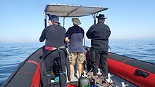
In South Africa, the standard dive boat is a large (6 to nearly 9 m) Rigid Inflatable Boat These are known as rubber ducks. Power is generally twin outboard motors, which may be two-stroke and smoky, but are increasingly often either four stroke, or the improved two-strokes which are cleaner and quieter.
These boats are generally powerful and fast, but speed is usually limited by sea state. They have a wet ride in a bumpy sea or if there is a crosswind. You travel in your dive suit, quite often with your hood on, and sometimes with your mask on to keep the spray out of your eyes. It has been known for the occasional diver to also use a snorkel to keep out heavy spray in rough conditions. If you wear a hat to protect your head from UV, make sure the hat is a tight fit, and preferably with a lanyard. The combination of cool sea air, wind, spray and high levels of UV can grill you in quite a short time, even in winter. Wear a good blockout or other method of keeping the sun from your skin. Unfortunately some blockouts wash off easily, and others sting your eyes if water gets into your mask and sloshes around a bit. A ski-mask is considered slightly eccentric, but it does the job.
Preparing for the dive.

If using all your own equipment, pack it as you find convenient, and check that everything is in good working order before leaving home. It will be wet on the way home, a waterproof bag or bin will keep the water off the upholstery. If using rental gear, get to the shop early to make sure it fits and works properly. If you are an unusual shape or size you may have difficulty finding a suit which fits well.At some places you will kit up at the side of the road or in a parking lot, and at others there will be changing rooms provided by the dive operator. If this is an issue, find out before the dive, You might want to take along a small mat or towel to stand on while putting on your suit, particularly if the ground is sandy or muddy.Some operators provide facilities at the dive shop for the customers to change into their dive suits and assemble equipment and load the boat before leaving for the launch site. In these cases the heavy equipment is usually loaded by staff, and the divers carry their light equipment to the boat. Where the boat collects divers from a jetty, the divers are expected to get their own kit to the boat. Actual loading will usually be done or supervised by the skipper.You will almost always be expected to wear your dive suit on the boat trip. There is no space to put it on during the ride, which may be wet.
What to take
- A small bag is useful to carry items like sunglasses, sunblock, hat, etc. Cell phones and car keys are usually kept in a waterproof bag or box by the skipper, and stored in the console. Large boxes for underwater cameras or video equipment should be negotiated before the dive, as there may or may not be space for them on board. In summer sunblock is advised for most skin types. UV factor is generally high and reflection from the water grills you from below. A peaked or brimmed hat may help if securely strapped on against the wind generated by boat speed.
- Kit bags for dive gear are not usually carried, but a medium sized soft bag to hold fins and mask, and other dive accessories like DSMB, reel, computer, dive light etc. is OK.
- On a long boat trip a small bottle of water or other suitable rehydration drink is nice to have, specially for after a deep or long dive. Similarly a small amount of high energy food may be welcome after a cold dive. In Cape Town, many dive boats supply a small chocolate bar or other sweet (candy) to each diver after the dive.
- A light waterproof windbreaker jacket is useful if the wind is strong, the weather or water is cold, or the trip is long. This can reduce wind-chill, particularly after the dive if you wear a wetsuit.
- A small emergency supplies (dive saver) kit of spare O-rings, fin strap, etc is acceptable.
What not to take
- Don’t take anything that you do not intend to use on the trip. (emergency equipment excepted).
- Don’t bring anything that must not get wet unless you have a watertight bag or box for it. A towel is usually a waste of time, as it will probably get wet. The same goes for dry clothing.
- Space is limited and must be shared by all. Do not annoy everyone by bringing a huge bin for your kit and fighting with the skipper at boarding time. No-one will have sympathy when you are evicted.
Loading kit and getting into the boat


The boat may loaded before launching, except where the water at the slipway is too shallow, when the boat is not taken out between dives, or when the slipway is not at the same place where the divers will be boarding.Loading of the boat is usually done by the skipper and divemaster. You are usually expected to transport your own equipment to the boat and hand it over to the person who will stow it for the trip. The standard arrangement is to stack scuba sets along a centreline rack, and tie them in place. You will usually sit at your scuba set, so if you want to do pre-dive buddy checks, ask for your gear and your buddy’s to be stowed together.Weight belts and pockets may be stacked on deck or in a box at the front or back of the rack. They are handed out when the boat gets to the site, so be sure you can identify your weights.
Fins and masks are usually stowed by the diver. There are often no special places reserved for this purpose, and fins are generally stowed either behind a handrope along the inner side of the pontoons, or between scuba sets along the rack. Be careful how you do this, as simply stacking them on top of the scuba sets can sometimes result in a fin or two being blown overboard by wind. This can ruin your dive, and is usually expensive. Masks are commonly stored in the foot pocket of a fin. The deck is not a good place for fragile items.Large cameras with strobe arms should be carried in the smallest plastic bin or crate that will hold them. There will often be several divers with camera boxes contending for the same limited storage space. Do not expect special treatment unless you have specifically organised it with the charterer.Some crews will carry your scuba set to the boat, but don’t count on it. If you need help, say so. If you are renting gear from the same organisation that runs the boat, they will usually load it for you. Make sure you can identify your rented gear and that it has all been loaded.
Slipway launches


Slipway launches are standard in the Western Cape
Where launching is from a slipway the procedure is fairly relaxed, and much depends on how far the slipway is from the parking area, and whether there is a convenient jetty.In some cases, usually at low tide, the water may be too shallow to launch the boat loaded with kit, but more often the boat is loaded with most of the dive gear, but not the divers, before launching. The boat is then launched with usually just the skipper on board, and the divers either get in from shallow water or from a jetty, as described above.Sometimes there may be commercial ski-boat fishermen launching at the same slipway. There are exceptions, but the lasting impression is of a mob of hooligans with no respect for anyone. They are generally a law unto themselves, and you will not gain brownie points by pointing out the error of their ways, and are likely to be given a brief introductory course in local invective at no charge.
Getting into the boat will depend on the launch site. In most cases the boat will be launched with only a skipper on board. Divers will board from the jetty or from the water.
Boarding from a jetty
Boarding from a jetty is usually easy, unless the step down to the boat is high. The crew will help where necessary and direct boarding. Follow their instructions. Do not leap down onto the deck, as it may not be designed to take this kind of shock load, and the sound of cracking glass fibre will not bring a smile to the skipper’s face. Also don’t leap down onto the pontoon, as this is likely to be followed by an inelegant face-plant onto the rack of scuba gear. The owners may be more concerned with damage to their equipment than your injuries.
The roll bar at the stern is a good place to hold if you can reach it. The radio antenna, plastic windscreen and engine control levers are not.Try to avoid getting parts of yourself between the boat and the jetty. The pontoons are fairly soft, but the jetty usually isn't, and may be decorated by barnacles and other abrasive material.
Boarding from shallow water
If boarding from standing in the water, try to get in where the water is not too deep, as most divers do not have the agility and upper body strength to boost themselves in without fins or a jump. Ask for help if you need it, but your fellow divers are more likely to be enthusiastic than skillful at pulling you in, Say goodbye to dignity, and hope for a reasonably comfortable landing.
The stern of the boat (blunt end) is usually lower and therefore easier to get into. This is often combined with it being in the shallowest water, so get in and out of the way of the people who have to hold the boat while the rest are getting in.
If you are a gymnast or acrobat you may safely ignore this advice.
Seating


Seating is almost exclusively on the pontoons, with your back to the water. This puts you in a position where losing your balance backwards will result in falling into the water, a manoeuvre most divers prefer to restrict to times when the boat is stationary at the dive site. To prevent unscheduled backward rolls, use the foot-straps and hand-ropes provided. As a general rule, sit opposite your scuba set, so you don’t have to move around when kitting up on site.
Occasionally there may be a seat across the stern in front of the motors. This will be the most comfortable place on the boat but may catch more spray in your face. The boat will bounce up and down as it hits waves. Bigger boats less so than small ones, and the part that bounces the least is the stern, so the most comfortable seating is as far back as you can get. This puts you close to the motors, and if they are two-stroke, closest to the exhaust smoke when the boat is not moving. You may not have much choice where you get to sit, but if you have a bad back or other disability which makes a rough ride a problem, mention this to your dive-master or the skipper as soon as possible. You will not be popular if the boat has to stop to re-arrange passengers. With practice it is possible to sit with one foot in a foot-strap (preferably the foot nearer the bow (pointy end)) and ride the bumps with very little effort. It is much like riding a horse, don’t fight the motion, absorb the bumps by relaxing a bit, and you will bounce less. A death-grip on the hand ropes will be exhausting if the ride is long.
Some boats have no footstraps. You will have to find something else to hold onto, or lean into the boat to keep more weight on your feet. Some divers may be seen comfortably sitting on the tubes, riding the waves with no obvious concern as the boat bounces along. They may not even need to hold on. They have done this before.
Moving around in the boat
If possible, don’t move around while the boat is moving, unless asked to trim the boat. You will be expected to sit where directed by the skipper, and unless there is a good reason not to, do as requested. Standing up when the boat is moving and there is nothing to hold onto can result in a fall and possible injury if the boat hits a wave or moves in an unexpected direction. If equipment comes loose under way, shout to the skipper, who will stop if it is safe, so that the equipment can be re-stowed.There may be cables and pipes in places on the deck. These are usually routed through areas where they are reasonably protected, but as a rule don’t stand on them or use them to hold on to. Batteries are often stored in plastic boxes near the transom, to keep the wires short. The lids are not usually load bearing structures, do not use them as steps.
Getting out of the boat

Getting into the water is usually done by a synchronised backward roll – falling into the water alongside your neighbour, neither on top nor underneath. Generally all the divers or a nominated group will roll off together, on a countdown from the skipper or divemaster. It is important to all roll together, as if you do not, the later divers may fall on top of the earlier ones, possibly casing injury or equipment damage. If you are not ready, or are not happy with this procedure, wait until the others are in and the boat is clear of them. The skipper will then let you roll in clear of the others, but you may have to fin a bit to get to them. This can be a problem if diving in a current. Some divers may not wish to backward roll with a large camera setup. They can ask the skipper to pass the camera to them when in the water. In this case they should stay close to the boat and preferably hold onto it until their camera is passed down.
The shotline and marker buoy

Most diving in Cape Town is at a reef or wreck. It is usual to mark the position with a shotline before the dive so that the divers can descend to the right place. If there is a slight current at the surface, the shotline will drift downwind to take up the slack. In this case it is usual to enter the water a short distance upcurrent of the buoy, and to start the descent as soon as the line is visible through the water, to minimise the work of swimming back against the current. Drifting all the way to the buoy means you will have to swim back against the current. The shotline is not an anchor. If you pull yourself down the buoy line, it may drag the shot, and you will end up down-current of the site, as will everyone else behind you. If the shotline is too short, the shot may be lifted by the buoy and drift off site, so it needs some slack. The current may not run directly downwind. Even when it is a wind-induced current, Coriolis forces will offset it anticlockwise from wind direction in the Southern Hemisphere, in an effect known as Ekman transport. The effect is about 45° at the surface, more as you go deeper, but with less speed.
You may choose to surface on the shotline or away from it. If you don't know the site it may be difficult to find your way back. This is not usually a problem, and most Cape Town divers will ascend wherever they happen to be at the end of the dive, but in this case it is strongly recommended to deploy a DSMB and surface on your own buoy, or your buddy's buoy. The DSMB will indicate the presence of a diver so that boats in the area can keep clear, and so that your dive boat skipper can keep track of where his customers are likely to surface.

If there is a significant chance of surfacing away from the shotline in an area with much boat traffic, divers are encouraged, or may be required, to carry a DSMB and deploy it before surfacing. Other sites where divers may be required to carry a DSMB are those far offshore, or at any time that the skipper thinks it may be difficult to find a diver because of sea conditions. For recreational diving, the choice of colour and size for a personal DSMB is up to the diver. Yellow, orange and red are most common, but bright pink is also occasionally seen, and unless you explicitly notify the skipper of a special meaning for a colour, it will be assumed that there is no special meaning other than marking your position. No one will care how big it is as long as it can be seen from a reasonable distance. Reflective strips, flashing lights and your name are also optional.
Divemasters
There may be one on the boat, or there may not. The boats which cater for locals are less likely to provide a divemaster than the boats connected with schools or which generally cater for the passing trade and visitors. If you are not confident about diving without someone to show you around, mention this when you book, and ask about the options.
Kelp diving
In areas where there is heavy kelp, divers generally do not tow SMBs during the dive. Fortunately these are also usually places where there are no significant currents, though the surge can be strong. Many of the Cape Town shoreline and inshore sites have heavy kelp, particularly on the Atlantic seaboard. In these areas divers are encouraged to carry DSMBs, and use them when surfacing away from the shotline, so the skipper can keep track of where everyone is surfacing, and so that passing boats can have a chance to avoid running you down if anyone is bothering to keep a lookout. DSMBs are also very effective for signalling to the boat when you are on the surface – much more so than an arm in a black wetsuit. This can be particularly valuable if the wind picks up during the dive and the surface is choppy with white water.
Getting back in the boat after a dive


Rule 1: Do not take off your fins in the water unless there is a ladder. You need them to boost you up. Most rubber ducks do not provide a boarding ladder. This is even more important if you are boarding on the upwind side of the boat, as the boat will almost always drift downwind faster than a diver.Approach the boat and get a grip on the outer hand-rope. Try to retain a grip on the boat at all times, and let go only for as long as absolutely necessary to remove kit, as the boat may drift away while you are not holding on.
A few boats may provide a short grab-line with a loop you can slip an arm through, but for some reason this is extremely rare. Even less common is a line with a clip you can attach to equipment before taking it off. Presumably there is no customer demand for these items…Your equipment will be lifted on board by the crew or other divers.
The recommended procedure is to first pass up any cameras or other loose equipment.Then take off and hand up your weights. This ensures that you will float after removing your BC. Do not let go until you are sure the other person has a good grip, weight belts sink very fast.Remove scuba set and hand this to the crew. You can help by pushing up under the set when they lift, and checking that DVs and gauges don’t hook on the hand-ropes. Mask and snorkel may be handed up at any time if convenient.Get a good grip on the handles provided, or a hand-rope as high as possible up the side of the pontoons. Dip yourself down as far as possible to get some buoyant lift, then fin strongly upwards and use your arms to pull yourself up as high as possible, then push down on the rope or handles while rolling your upper body onto the pontoon. Change grip to an inside handle or hand-line, and swing a leg over into the boat. It may be convenient to stop here while someone removes your fins, then sit up and swing the other leg into the boat. With good fins, good technique and reasonable strength it is possible to board this way in comfort and dignity. This method is a lot more difficult if on the downwind side in a strong wind.

If you don’t have the strength, the procedure is similar, but with the assistance of crew or divers already in the boat, who will drag you in by main force and whatever they can get a grip on. Before accusing anyone of indecent assault, consider if there was a reasonable alternative place for them to grab that would have worked. Elegance is inversely proportional to your size and mass. If you have thigh pockets in front of your suit, don’t board with any fragile or bulky equipment in the pockets. Side pockets are usually not a problem.

There is a new trend with some boats to provide a ladder for boarding. The "Christmas tree" style is relatively popular as it is easy to climb with fins on your feet. On rubber ducks it is usually hung over the side, and on rigid hull catamarans the transom is preferred.
Getting out of the boat after diving

Getting out onto a jetty is usually straightforward, but may be complicated by a high jetty and low tide. If it is a problem, the crew will help and give instructions. If you do your own thing, the same warnings apply as for getting in from a jetty. Particularly about not getting yourself between the boat and the jetty.
Getting out onto a beach is unusual in Cape Town, but relatively straightforward. It is usually safer and more convenient to get off on the low side if the boat tilts when running up the beach. If you are on the high side, wait until there is space and move to the low side, or in some cases the high side will become the low side as the boat flops back as the load is removed. Don’t try to unload kit over the high side, in case you are in the wrong place and the boat rolls down on top of you. This is particularly likely if the boat is not fully clear of the waves.
See

The waters of the Cape Peninsula and False Bay support a thriving ecology of cool temperate marine organisms, many of them endemic to South Africa, or even smaller regions, and although the fish are not as spectacularly coloured as those seen in tropical waters, many are quite colourful in order to camouflage themselves among the extremely vivid invertebrates that cover the reefs.
Marine animals
There are a wide range of marine animals which one may see while diving this region, and they include some of the most awesome and spectacular encounters possible for a diver.
Whales and Dolphins
False Bay is a destination noted for whale watching. Large numbers of Southern Right whales visit the bay every year, but it is unusual to see one during a dive. Other whale species occasionally seen in False Bay are Humpback whales, Bryde's whales and Orca, and these are even less likely to be seen while diving. If you do have the good luck to encounter a whale during a dive, be careful, as their huge size makes it easy for a diver to be injured unintentionally.
Dolphins are also seen in False Bay and on the Atlantic seaboard. Common dolphins occasionally visit on schools numbering in hundreds to thousands, but are not often seen by divers. Dusky dolphins tend to travel in smaller groups, but are also more likely to investigate a diver at the safety stop. Other species occasionally visit, but are more noted for stranding incidents that being seen underwater by divers.
Sharks

False Bay is one of the most reliable places to view Great White sharks, although rarely as a diver, and several other shark species are also frequently seen. The Sevengill or Cowshark can often be seen at a few sites, while Gully sharks and catsharks are more widespread. There are four common catshark species locally, from the colourful puffadder shyshark to the much larger pyjama shark. Other pelagic sharks are usually only seen on offshore "blue-water" dives off the south peninsula, and several large pelagic fish species can be seen on similar trips.
Pelagics

Large shoals of Yellowtail are occasionally seen at some dive sites, and on unpredictable occasions divers may be lucky enough to see Oceanic sunfish, Southern right whales, Humpback whales, Common, Bottlenose or Dusky dolphins.
The common Snoek, which is the cornerstone of a local linefishing industry, is very shy and hardly ever seen by divers, in spite of its habit of shoaling in large numbers.
Penguins and seals

There are colonies of African penguins in False Bay, but it is extremely unusual to see them during a dive. On the other hand, the Cape fur seals are both curious and unafraid of divers, and are very commonly seen, both in False Bay and on the Atlantic seaboard. There are several places where they can almost be guaranteed to be seen.
Reef fish

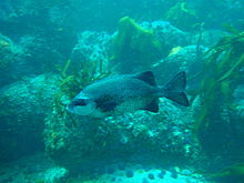


Reef fish of this region are most varied in False Bay, and most common in the restricted zones of the Marine Protected Areas, where they have been protected by law for several decades, though poaching still occurs, and enforcement is quite unreliable. Most of the reef fish are camouflaged to some extent. Many are silvery grey and countershaded, like the ubiquitous Hottentot seabream, the silvery Fransmadam and the Steentjie. Others have vertical bars or dark patches which may help break up their profile in kelp, such as White stumpnose, Zebra, and White steenbras, while many of the smaller species are cryptically coloured and blend very well into their environment. These are generally fish which spend most of their time on or very close to the reef, and their coloration is usually an indication of the typical colours of their habitat. These include various endemic klipfish, and a few blennies and gobies, the fingerfins, Cape triplefin, Smoothskin scorpionfish, two species of horsefish, a pipefish and the Rocksucker. There are also a few red fish, which are fairly visible, such as the very common Roman, and the less common Red stumpnose and Red steenbras. Most of the fish mentioned are solitary or found in small shoals, but there are also Strepies and Maasbanker which tend to shoal in fairly large numbers, and moderately large shoals of Hottentot are seen quite frequently. Galjoen are fairly rare and usually seen in small groups on top of the reef where there is a lot of wave movement, and the similar looking Cape knifejaw prefers deeper and high profile reef between the rocks. Seacatfish are shy and tend to spend the daytime in crevices and holes.
Sandy areas

The sandy areas also have their characteristic fish, which include a few species of ray, soles, gurnards, a pufferfish and the Beaked sandfish, which is rare and shy by day, but may be seen in large numbers at night at some sites, when it comes out of the sand it hides in and swims around freely. A few species of klipfish are also sand-dwelling, with the various species preferring different densities of sand, with those preferring fine sand having a more snake-like body, whereas those in coarse sand being more robust. Their body pattern tends to match the type of sand as well.
Reef invertebrates
Benthic invertebrates provide most of the bright colours on the reefs of this region, and the distribution of species is as characteristic of the different sub-regions as the depth and water temperature. The diversity is large, and there is a big variation in the predominant reef cover with both depth and geographical location. The characteristic reef life varies considerably between the east and west sides of the Cape Peninsula, and this is recognised as the border between the South Western Cape and Agulhas Inshore Bioregions. The vertical zonation is also characteristic of the different bioregions, so there can be very noticeable differences in what can be seen at the various sites.
There is a general tendency for a given area of reef to be dominated by a particular species of organism, for example, Common feather stars, Red-chested sea cucumbers, Mauve sea cucumbers, Red Bait or sea urchins, to the extent that a major part of the surface area is covered by the dominant organism. This does not mean that there is no variety, as there is a large range of habitats on most reefs depending on orientation and rugosity, and to a large extent, sessile organisms live where they can, and this is largely dependent on where the planktonic larvae find a foothold.
Midwater
Pelagic invertebrates are by their mostly planktonic nature unpredictable as to when and where they can be seen. They include several species of jellyfish, a few species of comb jelly, a few sporadic siphonophores, salps and pteropods, and lots of things too small to easily notice. There are also squid, but they are very shy and are seldom seen by day.
The sponges, cnidarians, comb jellies, flatworms, segmented worms, arthropods, molluscs, bryozoans, echinoderms, ascidians, fish, sea birds and marine mammals recorded from this region are listed in the Wikipedia:List of marine animals of the Cape Peninsula and False Bay. Many of these might be seen by a recreational diver.
Seaweeds
Kelp forests
Kelp forests are the most obvious seaweeds of Cape Town. There are three genera found locally, sometimes in close proximity. The most obvious is the Sea bamboo, which reaches the surface when fully grown, and has a thick stipe with a gas-filled cavity at the top, and which keeps the frond near the surface for maximum exposure to the light. This kelp is very common on the Atlantic seaboard, and is also found on both sides of False Bay, but more commonly towards the southern part of the bay.
The smaller Split-fan kelp grows on deeper reefs, and does not reach the surface. The stipes are shorter and there is no gas-filled cavity, so the fronds stay submerged in the darker waters. This kelp is found in deeper water than the Sea bamboo, with a similar geographic range.
The third is the Bladder kelp, which has clusters of long thin stipes, with long fronds and large numbers of small gas-filled bladders which keep the kelp upright and the fronds at the surface. This kelp is not found in False Bay, and is mostly seen near Robben Island.
Algal turfs and kelp forest understoreys.
Below the kelp fronds, the reef in shallower areas where there is enough light, may be covered by an understorey of assorted seaweeds, and the particular species will depend on a variety of factors, including the amount of light available, and the amount of water movement. As a rule, green and brown seaweeds will be found in shallower areas, and reds will be deeper, as they can survive with less light. The deepest are often the red coralline algae, which can form a dense turf on the upper surfaces of rocks.
Encrusting corallines.
Where the surf is too powerful or the light is too dim for other seaweeds, the encrusting coralline algae may still find a foothold and thrive. These red algae form a fairly hard and tightly adherent crust on the reef, and are also known as "pink paint", which is a fair description of their appearance — they don't look at all like seaweeds. Their range is almost anywhere in the region where enough light penetrates and there is no other occupant already on the reef.
There are about 57 green seaweeds, 49 brown seaweeds and 240 red seaweeds recorded from this region in the Wikipedia:List of seaweeds of the Cape Peninsula and False Bay.
Shipwrecks

The Cape of Storms and the Cape of Good Hope are both traditional appellations for this region, and for good reason. The weather can be very bad at times, and the coast is very exposed, with few sheltered harbours, but is also an important waypoint on one of the worlds great maritime trade routes. As a result, there are a daunting number of shipwrecks recorded along the local coastline.
Many of these wrecks have never been found, and many others have been broken up beyond recognition, or covered in sand, or in the case of Table Bay, been buried under land reclamation projects, but several are in diveable places and may be visited by divers if conditions are suitable.
Depths of the diveable wrecks vary from 3 or 4 metres, to more than 65 metres, and condition varies from half buried fragments of wood or steel, to ships that retain most of their original structure and appearance, and loom out of the depths as if sailing through the sand bottom.
Most are heavily encrusted with reef organisms, ranging from seaweeds in the shallow water to a large range of colourful invertebrates in deeper water. They also shelter a variety of reef fish, and may be visited by pelagic fish on unpredictable occasions. In effect, they serve as artificial reefs, and as a result are generally also of interest to divers who are not particularly interested in them as artifacts.
Topographical features
Many of the sites are characterised by interesting topographical features, including pinnacles, gullies, caverns, swim-throughs and overhangs. These features are notable not only for their contribution to the seascape, but also provide major variations in available habitats at the site, and the result is a strong correlation between high biodiversity and interesting topography. The general topographical character of a site is dependent on the geology, and the granite sites are instantly distinguishable from the sedimentary sandstone and shale sites. The granite rocks are typically rounded and stacked as corestone boulders on outcrops of the same rock, often with white quartz sand between them, or as a gradually sloping base. These stacks of variously sized rocks often form pinnacles, and gullies in fairly random directions, and the overhangs and holes between them are in some cases large enough for divers to swim through, providing a spectacular reef structure.
The sandstone strata tend to produce formations dominated by the local dip and strike, and this is more predictable. However, the detail on a smaller scale tends to produce more small holes, crevices, ledges and ridges than the granite areas, and these are less spectacular as a general rule. There are exceptions, where the sandstone reefs are very craggy, usually where the dip is quite steep, but not vertical, and the shoreline is quite steep, but in a different plane to the dip.
Fortunately the old dictum "as above, so below" applies quite well, and the character of the reefs can be predicted fairly reliably by observing the adjacent shoreline landscape. The major exception to this rule is south of Smitswinkel Bay, where there are sandstones above the water and granite below.
The geological structure and history of this region is briefly described in Wikipedia:Marine geology of the Cape Peninsula and False Bay
Read
Reference books on the ecology of Cape Town's waters:
From SURG, specifically for divers in this region: Available from selected dive shops and book shops in Cape Town, and direct from SURG.
- Jones, Georgina. 2008. A Field Guide to the Marine Animals of the Cape Peninsula, SURG, Cape Town. ISBN 9780620416399
- Zsilavecz, Guido. 2005. Coastal Fishes of the Cape Peninsula and False Bay, SURG, Cape Town. ISBN 0620342307
- Zsilavecz, Guido. 2007. Nudibranchs of the Cape Peninsula and False Bay, SURG, Cape Town. ISBN 0620380543
From other publishers, and of more general application:
- Branch, G. and Branch, M. 1981, The Living Shores of Southern Africa, Struik, Cape Town. ISBN 0869771159
- Branch, G.M. Griffiths,C.L. Branch, M.L and Beckley, L.E. 2010, Two Oceans – A guide to the marine Life of Southern Africa, David Philip, Cape Town. ISBN 9781770077720
- Gosliner, T. 1987. Nudibranchs of Southern Arica, Sea Challengers & Jeff Hamann, Monterey. ISBN 0930118138
- Heemstra, P. and Heemstra E. 2004, Coastal Fishes of Southern Africa, NISC/SAIAB, Grahamstown.
- Ed. Smith, M.M. and Heemstra, P. 2003 Smith’s Sea Fishes. Struik, Cape Town
- Stegenga, H. Bolton, J.J. and Anderson, R.J. 1997, Seaweeds of the South African West Coast. Bolus Herbarium, Cape Town. ISBN 079921793X (rather technical)
Reference books on the Geology of the Cape Peninsula:
- Compton, John S. 2004, The Rocks and Mountains of Cape Town. Double Storey, Cape Town. ISBN 1919930701

![]()