Satellite navigators, such as GPS devices, use satellites to get your position. They can often be equipped with maps and be told your intended route or calculate routes to your destination. We use the term "GPS" here, although some devices use other satellites, often in addition to the GPS ones.
Understand
A world of technology If you're shopping for a GPS device for specialized uses, it may help to be familiar with some of the acronyms and technologies.
|
Although most people are familiar with using GPS navigation while in their home area, GPS navigation can easily become your most useful tool when traveling. They can give you live directions while driving, cycling, hiking, walking or catching public transport. It can help you stay on the well beaten path. But better still, they can tell you where you are, allowing you to get hopelessly lost in the medina of Marrakesh, and then allow you to wander out when you feel like it. Or tell you the name of the small church you are cycling past on the Rallarvegen. Or for those who like every second of their day planned, you can load up your daily sightseeing route, and make sure you keep to your schedule. They can give you confidence to explore!
These days, pretty much every smartphone (and even some feature phones) offer GPS. Many newer cars also offer a trim package that includes built-in navigation. If neither of these are available, you can use standalone devices designed for a variety of specific uses such as driving, hiking, or boating.
GPS devices with cellular or internet connectivity can determine their position in as little as a few seconds of being turned on, using nearby cell towers or Wi-Fi networks to obtain a rough position and download data about the satellite network. But standalone devices must download all the required data from the satellites; if it's been more than a few hours since the device was last used, this can take up to 30 seconds (or potentially much longer if conditions are poor, such as not having good view of the sky or moving rapidly).
Smartphone apps

Using GPS navigation apps on your smartphone can be the easiest and most convenient way to navigate when out of your home country. It can save money over buying a standalone GPS device and new maps for it, or renting one from a car rental company. However, iIf you don't have a data connection for your phone, or when it is out of range, their performance can be limited or unavailable. They usually have a less suitable user interface for driving or for use in any challenging conditions.
Some apps allow download of maps before departure or while on Wi-Fi, avoiding the need to have a live data connection or to consume data on mobile telephone networks while moving. However, you need to have enough capacity in your phone. On the other hand, if you have a weak and useless Wi-Fi connection, turn it off or move further away, and start using cellular data. If your app can't give you directions, that's usually what's wrong.
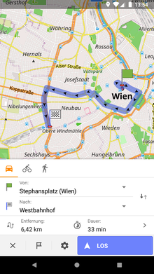
Google maps
Google maps is the global behemoth of proprietary maps applications. It has maps of just about everywhere you would like to go, provides turn-by-turn directions, and allows you to download maps for areas in advance, and continues along a planned route even when it loses data signal. When the application is offline, the search results of places and turn-by-turn navigation can be limited. The more information you give it before leaving (with a Wi-Fi connection), the better. If you have a basic smartphone, or are running out of storage, you can use Google Maps Go. This runs online on the Chrome web browser, and creates an icon. A second app is needed for navigation: Navigation for Google Maps Go, and the latter does not create an icon.
Waze
Waze is available on the Google Play and iOS App Store. It's the world's largest crowdsource navigation system, and completely free (ad-supported during stops). While it's a bit weaker in data relating to traffic congestion and accurate maps than Google, Waze is well known for giving warnings for road hazards and police activity. It also gives updated fuel prices for gasoline/petrol and diesel. Interestingly, Waze is owned by Google, but kept as a separate operation. However, Waze map editors can now use Google's satellite maps for better accuracy. Waze maps tend to emphasize the road itself, rather than the periphery. Not recommended for offline use while driving, though brief "dead spots" aren't usually a problem. Initial Wi-Fi route setup can eliminate much of cellular data usage.
MAPS.ME
Also, free on Google Play and iOS App Store, MAPS.ME allows download of all or part of the OpenStreetMap (OSM) world map (selectable per-province or per-country). Completely free (ad-supported). As the project started in Switzerland, and later was acquired by a Russian company, the multilingual support is very good. Each country consumes around 100MB on your phone to download. The complete world map can be downloaded offline in under 30GB.
MAPS.ME is open source, and a fork called Maps exists for Android that removes ads.
CoPilot GPS
One country map can be downloaded for free and used with restricted functions. Additional maps can be purchased after an upgrade to voice turn by turn navigation for US$24.99.
Brazil, Australia, New Zealand, US, Canada, UK, Ireland, Balkans, BeNeLux, Russia, Central Eastern Europe, DACH, France, Greece, Iberia, Italy, Nordics, Poland, Romania, Turkey, Ukraine, South Africa, Lesotho, Swaziland, Namibia and Botswana. Middle East Maps (Bahrain, Jordan, Kuwait, Lebanon, Oman, Qatar, Saudi Arabia, UAE).
OsmAnd
Open source program for maps from OpenStreetMap (OSM). OsmAnd is focused on car, bike, and foot navigation. There is additional support for public transit, nautical, and ski navigation. OsmAnd supports extra features like trip recording, parking position recording, street level photos via Mapillary integration, and sharing your GPS location with authorized contacts over telegram.
The easiest way to install OsmAnd is by using Google Play or the iOS App Store.
The free version is limited to 7 downloaded map files at a time. Be aware that some areas can have map files which are quite large.
OsmAnd is a US$9 paid version that eliminates the need to pay for updates. The paid version can also download articles from Wikimedia pages related to POI's for offline reading, as well as more then 7 downloaded map files. It is also possible to download an offline copy of Wikivoyage, and integrate Wikivoyage listings as an overlay on the map, though this feature is still in beta as of 2019.
OsmAnd live is a subscription service that offers hourly map updates, whereas the other versions are updated about once a month. 50% of the subscription fee is used to support mappers working on OpenStreetMap.
Technically savvy users can build the app from source, or download it as a package from an open source repository such as F-Droid. This is functionally equivalent to OsmAnd , but free.
Application with maps from OSM. For iPhone only, with limited country support. Basic maps are free (ad-supported), with in-app purchases for turn-by-turn navigation and other features.
Some still choose a standalone navigation device, rather than using a smartphone app. There are several reasons why a smartphone may not be the best navigation device: small screen size, short battery life, overheating, piecemeal map coverage, lack of water resistance, no Wi-Fi or cellular data in remote locations, and risk of theft.
A standalone device has county-wide map coverage, and can have better controls and screen brightness adjustment. Most are made by Garmin, Magellan, and TomTom. Also, hand-held units (not meant for city or highway driving) can be waterproof, and run from standard batteries. Should you lose it, you don't also lose your photos and other critical phone information. And in most cases, you can still call for help and check your location on the smartphone when the navigation device runs out of power or fails in other ways.
Get around
You will need to set the device so it works as a GPS. This will depend on the type of GPS you are using. But the basic way to use a GPS is this: once you've got it working and you've got the destination set, all you need to do is drive and GPS will work out your location as you drive. It will then use your location on the route to determine where next you will need to turn or drive on so you can continue along the GPS's route to the destination.
Check the settings for what routes the device will prefer. If you have a flight to catch or driving conditions are bad, you probably want the "fastest route" instead of "shortest route", but if you want to enjoy the landscape and come in touch with the life in regions you are driving through, the other way round is better. There may be other options or possibilities to finetune. Sometimes unpaved roads are not even shown by default, so if you want or need to use them you need to explicitly enable viewing them.
It is advisable that you use your GPS software for some time in familiar areas, so that you get used to it and any quirks it may have. Try also to get into conditions similar to those that may pose challenges at your destination.
Problems
Although a GPS navigator makes navigation and orientation very much easier in many situations, in some circumstances the information given may be misleading. For example, you're traveling from Pittsburgh to Philadelphia. You enter into the GPS system that you're going to Philadelphia, so the GPS successfully takes you to Philadelphia. But for the GPS "Philadelphia" is not the town, but some more or less arbitrary point in the town (perhaps the geographic midpoint). It will take you there, even if that means driving away from your intended destination by obscure alleys. Giving a suitable exact address avoids this problem.
Enclosed areas, narrow streets, and unusual topography can cause problems for GPS navigation, which may be less reliable than usual in these areas, as the device gets information from fewer, sometimes none of the satellites.
Lack of accuracy when off-road can apply to both smartphones and standalones. If the device is running a program for driving, it assumes you're on the road, and adjusts the "location cursor" accordingly. Google maps has a walking mode, but you risk damage to your smartphone. If you can afford it, have three devices capable of receiving GPS: a standalone device for driving, a durable standalone waterproof device for walking and hiking, and a smartphone.
When you cross time zones, the GPS will automatically update the time and ETA. However, if you're setting up the route, and the destination is in a different time zone, your ETA is still in your current time. Example: You're driving east from Chicago (Central Time) to Detroit (Eastern Time), and you must be there by 3 PM. If your ETA during setup in Chicago is anything beyond 2 PM, you will be late.
China uses its own coordinate system, which is deliberately obfuscated and different from the international standard, apparently for national security reasons. This means that various foreign GPS navigation programs have problems in China, with locations displayed about 100–700 m from where they should be. Wikivoyage's practice is to use standard (WGS84) latitude and logitude coordinates in all articles, including articles about China, which means that our coordinates should display correctly on OpenStreetMap and other mapping programs that use WGS84, but may display incorrectly on Chinese mapping apps. However, some Wikivoyage articles mistakenly use some Chinese (GCJ) coordinates, which will display incorrectly on Wikivoyage maps and other OpenStreetMap-based maps. The Special Administrative Regions of Hong Kong and Macau use WGS84 coordinates, but for some reason some mapping apps still have problems, especially near the border with mainland China. The result of all of this for travellers is you should be careful when using GPS navigation in China, including Hong Kong and Macau—be on the lookout for offsets of 100–700 m, especially when doing anything that involves interaction between Chinese and foreign data or software. For more details see the Wikipedia article Restrictions on geographic data in China.
Stay safe
If you're driving, be careful of dangerous or remote roads. River crossings, mountain passes and poor road surfaces aren't always taken into account by all navigation software. Town centres can be marked as being at the geographical centre, and can direct you to the centre of forests and lakes. Do a sanity check to make sure you're taking the main road. Try and navigate to an address or a known place. If you're carrying bikes on the roof, don't drive under a low bridge just because a car GPS says this is a fine route. Pay attention to the roads.
If you're using a GPS navigator for backcountry hiking, you just lifted the stakes in the game. You need to check the veracity of the route before you go – against a known reliable source. Open mapping data is often done by armchair mappers from aerial imagery – and mapped trails lead into fences, steep country, and cliffs that aren't visible from this imagery. Some navigation or orienteering skill and some experience with the device will be needed to identify and handle these situations. And like all electronics, the device can fail, and (you know Murphy's law, don't you!) it may fail at the worse possible moment. Especially paper maps may use coordinate systems other than WGS84 (which is used by the GPS), thus giving a mismatch in positions unless correction data are used. Check beforehand. If you're in England, France, or Spain, don't forget to double check east ( ) and west (-) longitude coordinates, as these countries have both. Satellite navigation uses quite a lot of power. Carry a spare battery. Remember that batteries are consumed quickly in the cold. For longer voyages a solar power charger may be an option, but whether its capacity suffices (also in cloudy weather) and it keeps working is an open question.
Some manufacturers (such as Garmin) market specialised devices specifically for marine use. The underlying satellite signal is the same, but a marine GPS stores nautical charts (usually purchased separately) instead of highway maps. If you take this on the autobahn, it'll display valid coordinates but tell you that you've run aground.
If you're on a boat with a non-marine device, reverse problems apply: some devices may put the marker on a nearby road on the assumption that the location in the water must be due to signal problems. In low visibility conditions, remember that boats, swimmers, birds and that half-submerged log are not on your map. If you sail in the night and the person navigating is simultaneously lookout, make sure the brightness can be adjusted to dim enough (which is much dimmer than you could imagine in the day).
The device should be usable for the intended use. A device used by the driver should allow him or her to concentrate on the driving. A device used outdoors should be rain and moisture resistant. The controls should be usable also in the field and the display bright enough in sunshine and dim enough in the night.
The device may fail. You should have some backup, usually including paper maps and paper notes about where you are, including time of and direction since last update (depending on circumstances, good mental notes may be enough). A traditional compass and a flashlight may be a good investment if you plan on traveling far away from infrastructure.
Consider using a computer or tablet with a larger screen for route planning. You can get a wider view than a screen on phone or small GPS. Then you can transfer the route to your smaller device once your planning is done. On a boat you may want to use that larger screen also for actual navigation (check that the devices can communicate: there are different connectors and protocols). It is still hardly ever as large as a paper chart, and zooming out can hide important features.
And finally, a GPS needs a good view of at least half the sky to work effectively. Your device may mislead you if your view is blocked by skyscrapers in Sydney or the canopy of the Kakamega Rainforest. If you're trying to navigate The PATH in Toronto, better grab a paper map.
Privacy
When using navigation on your mobile phone the navigation app has access to your location, and may record your location history. Most modern phones allow you to limit the which apps have access to your location information. These permissions and limits are found in the phone settings, and it is worth checking to limit apps with location access if you are concerned about privacy.
The future
L5 signal is slowly being introduced into consumer devices. As of 2019, it is available in just a handful of non-mainstream phones. GPS accuracy will be accurate to within a few centimeters, and will work much better in areas with partial sky-cover.