| Grande Terre (New Caledonia) | |
 | |
| State | France |
|---|---|
| Region | New Caledonia |
| Surface | 16,346 km² |
| Inhabitants | 208.700 (2004) |
| Tourism site | |
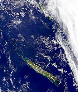
Grande Terre is the largest island of the New Caledonia.
To know
Geographical notes
The highest peak is Mont Panié with its 1,628 m.
Territories and tourist destinations
Urban centers
West Coast
- Boulouparis - Continuing along the Rt1 heading north you will find the village of Boulouparis 15 km from the Bay of San Vincenzo and 78 km from Nouméa, dotted with islets. It is possible to camp for free in an equipped camp on Bouraké beach.
- Bourail — [1] Village of 5,000 inhabitants near the bay of Gouaro and the Poé beach, the largest in Grande Terre. An internal road connects it to Houaïlou on the eastern side. It has a small but interesting museum on the history of the penal baths.
- Koné
- Koumac
- La Foa - Village between green countryside and with the possibility of excursions to Sarraméa in a pretty valley located 82 km from Nouméa.
- The Tontouta - 17 km north of Nouméa, La Tontouta is the location where the international airport is located. It is also the base for exploring the mountainous interior of Grande Terre. The excursion to Mount Humboldt (1617 m) generally takes place in two or three stages, spending the first night at the volcano refuge (Refuge du Vulcan) and the second at the Humboldt refuge at an altitude of 1380 m.
- Nouméa - Departmental capital, Nouméa puts on the airs of a "little girl." Paris".
- Voh
Oriental Coast
Keep in mind that the eastern side is wetter than the western one, receiving more rainfall. The vegetation is therefore more luxuriant.
- Hienghène - Administrative capital of the northern province of Grande Terre which is 376 km from Nouméa. Hienghène is also a seaside resort with a stretch of coastline dominated by cliffs with imaginative shapes. It is no coincidence that Hienghène has a club med.
- Houaïlou - From Houaïlou it is possible to continue on the east coast in a northerly direction up to Hienghène crossing the villages of Poindimié is Touho.
- Thio - Thio nickel mining center boasts many beaches in its surroundings. It can also be reached from Boulouparis on the other side via an internal road, the RP4.
- Yaté - Small village on the east coast, Yaté can be reached from Nouméa, from which it is 83 km away, via the RP3 panoramic road that winds through green hills. The road allows access to the lake of the same name and the Provincial Park of the Blue River (Parc Provincial de la Rivière Blue). Yaté is suitable for lovers of hiking or off-road excursions. In its surroundings are the Maddalena waterfalls (Chutes de la Madeleine) and those of Wadiana. It is possible to camp on the beach near the Touaourou mission or on the other three in the peninsula of Kwé Binyi. Unfortunately there is no coastal road to the village of Thio described below and for the return there is no other choice than to go back along the provincial road nº 3 to Nouméa.
Other destinations
- Belep Islands - Off the north coast, the tiny islands of Belep are served by flights of Air Calédonie.
How to get
How to get around
What see
What to do
At the table
Safety
Other projects
 Wikipedia contains an entry concerning Grande Terre (New Caledonia)
 Commons contains images or other files on Grande Terre (New Caledonia)