Hatay is a province in southeastern part of Mediterranean Turkey, bordering Syria.
Cities

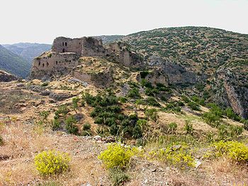
- 1 Antakya , also known as Antioch — the provincial capital; a riverside city with a great Mosaic Museum and the hub for sites of early Christianity in the surrounding countryside
- 2 Iskenderun , also known as Alexandretta — the biggest city of the province, situated on the shore of Mediterranean Sea, with a pleasant palm-lined waterfront
Other destinations
Understand
The only piece of land annexed by Turkey after its modern borders were defined in the Lausanne and Ankara Treaties of 1923 and 1926, respectively, this province, which was then known as Sandjak (county) of Alexandretta, was under French control as a part of the French Mandate of Syria between 1920 and 1938. In 1938, it appeared on the maps as the independent State of Hatay. Following a plebiscite a year later, it joined Turkey as the Hatay Province in 1939.
It's easy to point out Hatay on maps, even on those showing full continents, as it is where the southern border of Turkey, which follows roughly a straight line in a west-east fashion extends significantly southwards. Situated on the very northeastern corner of the Mediterranean Sea, where northern shores lying on a west-east direction curves into the Middle Eastern shore stretching north to south (traditionally known as the coasts of the Levant), it's possible to find long and sandy beaches popular with the locals in the region, although the traditional centre of the region, Antakya/Antioch, is an inland city.
Talk
Almost all people in the province can speak Turkish, although with a heavy accent in most cases. Also, the Syrian dialect of Arabic is the native tongue for many people in many parts of the province, especially in the south.
Get in
By air
Domestic flights are available to Hatay Airport which is located about 25 km away from Antakya. However, nearest airport with international connections is located in Adana to the north.
By train
The only significant settlement in the province with a railline is Iskenderun, which has several daily train connections with Adana and Mersin. Since 2008, trains have been suspended for railtrack improvements between Adana and Iskenderun. For updates, visit Turkish State Railways (TCDD) website [1].
By car
The main highway connecting the province to the rest of Turkey to the north is the motorway O-53 (toll-road). There are also secondary highways as well, some of which eventually reaches one of many border posts located on the Turkish-Syrian border.
Get around
See
Do
Eat
Drink
Sleep
Stay safe
Connect
The telephone code of the province is 326, which should be prefixed with 0 when calling from elsewhere in Turkey, or with 90 when calling from outside of Turkey.
Go next
With two border posts (one leading to Aleppo, and the other to Latakia), Hatay is usually a jumping off point for trips into Syria to south. The neighbouring regions of Cilician Plains to northwest and Southeastern Anatolia to northeast also have many cultural similarities with Hatay.