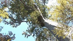
Tall kauri in Omahuta Kauri Sanctuary
Mangamuka Bridge is a small town in Hokianga.
Get in
Get around

Map of Mangamuka Bridge
See
- 1 Omahuta Kauri Sanctuary (2 km south of Mangamuka Bridge, turn east into Omahuta Road, then after 7 km, turn right onto Sanctuary Road and go to the end). See five of the twelve biggest kauri trees in an undisturbed healthy forest in a reserve established by Dept of Conservation in 1952.
Do
Buy
- 1 Mangamuka Dairy, SH1. Dairy selling hot burgers.