The Dominican Republic has thirteen National parks expelled. There are also other nature reserves.
List of national parks

Map of national parks in the Dominican Republic
- 1 Parque Nacional Armando Bermúdez (Parque nacional José Armando Bermúdez).


 in the Wikidata database") on the north side of the Pico Duarte, 766 km², furnished in 1956 and Parque Nacional José del Carmen Ramirez, on the south side of the Pico Duarte, 764 km², established in 1958; are the two highest nature parks in the Caribbean. The formation of the mountains is volcanic, about 60 million years old. The amount of precipitation is between 1,000-4,000 mm per year, the vegetation is subtropical to subtropical cloud forest. The Caribbean pine grows up to 35 m high at higher altitudes. There are wild boars in this national park. In these two national parks, together with the nature reserve of Valle Nuevo, there are 249 plant species, 97 of which are only native to the Dominican Republic. There are also 64 species of birds there.
on the north side of the Pico Duarte, 766 km², furnished in 1956 and Parque Nacional José del Carmen Ramirez, on the south side of the Pico Duarte, 764 km², established in 1958; are the two highest nature parks in the Caribbean. The formation of the mountains is volcanic, about 60 million years old. The amount of precipitation is between 1,000-4,000 mm per year, the vegetation is subtropical to subtropical cloud forest. The Caribbean pine grows up to 35 m high at higher altitudes. There are wild boars in this national park. In these two national parks, together with the nature reserve of Valle Nuevo, there are 249 plant species, 97 of which are only native to the Dominican Republic. There are also 64 species of birds there.

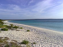
View of the coast
- 2 Parque Nacional del Este.547 km², established in 1975; the inhabited island of Isla Saona, 110 km² and the surrounding sea area belong to the national park. On the mainland side near Guaraguao there are caves with rock carvings of the Taino Indians. Boat tours to the island are available from Boca de Yuma and La Romana.

- 3 Parque Nacional El Choco (Monumento Natural Lagunas Cabarete y Goleta)
- 4 Monte Isabela de Torres Nature Reserve. Puerto Plata, 22 km². An artificial park was created on the mountain top, in which one encounters diverse fauna and flora.
- Parque Nacional Las Cuevas de Cabarete
- 5 Parque Nacional Isla Cabritos.24 km², established in 1974. The 12 km long and 2-2.5 km wide island of Isla Cabritos in Lake Enriquillo is a breeding ground for red flamingos, iguanas and around 300 crocodiles. The Lake Enriquillo, 30 km long, 12 km wide, 256 km² in size, is the largest inland lake in the Dominican Republic, its water is slightly salty. It is also the lowest point in the Caribbean, the water level is 40 m below sea level. Millions of years ago there was a continuous connection to the open sea all the way to the Republic of Haiti. The strait has silted up due to the uplifting of the sea floor and flooding by rivers. From Jimani fishermen drive their boats to the national park. The fare is around US $ 5.

Bahia de las Aguilas; "Eagle Bay"
- 6 Parque Nacional Jaragua.1,400 km², established in 1983. This park surrounds the small treeless island of Alto Velo, the large island of Beata, which is closer to the mainland, and the surrounding sea area. In this sanctuary you can find 60% of all bird species that live in the Dominican Republic, including red flamingos, rose spoonbills, silver and blue herons. Some of the indigenous caves can be visited in Cueva, Mongó and El Guanal.
- 7 Parque Nacional José Del Carmen Ramírez


Bird island
- 8 Parque Nacional Los Haitises.Sanchez, 208 km², established in 1976, Tel. 552-7593, Fax 552-7334. The park consists mainly of subtropical wet forest and extensive mangrove forests on the shore region. The age of this region is estimated to be 40 million years. At that time it was the seabed on which coral deposits developed into rocks. By shifting the tectonic plates, the sea floor was lifted 200-300 m out of the water. The kilometer-long cave systems La Arena, San Gabriel and La Linea, which contain over 2,000 Indian drawings from the 5th to the 16th century, have now become accessible. Trips from Samana cost US $ 120 per boat with 6 people (US $ 20 per person). Departures from Sanchez from the Los Haitises restaurant, Tel. / Fax 552-7593, fare: US $ 50 per person.

- 9 Parque Nacional Monte Cristi.Monte Cristi, 530 km². This national park, founded in 1983, encloses parts of the sea area on the border with Haiti with the island group Site Hermanos. In the park is "El Dromedario que Duerme", the sleeping dromedary, a natural rock formation that rests on the seabed.
- Parque Nacional Pérez Rancier
- 10 Parque Nacional Sierra De Baoruco. 800 km², founded in 1986. A total of 166 orchid species grow in the protected area, 32 of which are exclusively found in this region.
- 11 Parque Nacional Submarino La Caleta.The La Caleta underwater park was established in 1986. This national park is located west of Boca Chica. Originally it was only 10 km² in size. In the meantime it has been extended to the entire sea area in front of the capital Santo Domingo. The marine park has an average water depth of 10-50 m, but the reef that runs parallel to the coast drops to a depth of 180 m. In 1984 the ship "hickory"deliberately sunk in about 20 m water depth in order to better observe fish in this" artificial reef ".

Other protected areas
- 12 Reserva Cientifica Laguna Rincon (Laguna del Rincon)..was founded in 1983 on the northern edge of the town of Cabral, 15 km west of Barahona, between Barahona and Lake Enriquillo, 47 km² in size. This is the largest freshwater lagoon in the country, with a water depth of 3-5 m.
- 13 Valle Nuevo National Park..south of Constanza, 409 km². This protected area lies exactly in the geographic center of the Dominican Republic. Large parts of the forest were destroyed by forest fires in 1983 and are only slowly recovering.