 | ||
| Queenstown | ||
| province | Eastern Cape | |
|---|---|---|
| Residents | unknown | |
| no value for residents on Wikidata: | ||
| height | 1,081 m | |
| no tourist info on Wikidata: | ||
| location | ||
| ||
Queenstown is a city in the Midlands of the province Eastern Cape.
&groups=Maske,Track,Aktivitaet,Anderes,Anreise,Ausgehen,Aussicht,Besiedelt,Fehler,Gebiet,Kaufen,Kueche,Sehenswert,Unterkunft,aquamarinblau,cosmos,gold,hellgruen,orange,pflaumenblau,rot,silber,violett)
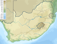
Map of Queenstown (South Africa)
background
The city of Queenstown was founded in the mid-19th century, then on the border between the British, Xhosa and Boers. The town planning at the time was extraordinary: six streets start from a central square, on which at that time a cannon was ready to fire.
At the time of apartheid, Queensland was between the Ciskei and the Transkei. After its end, mainly Xhosa moved into the city, the proportion of the white population has decreased. The area is relatively little industrialized, the high unemployment and other social problems make the city only partially attractive for tourism.
getting there
By plane
By train
In the street
- Queenstown is on the N6 between East London and Bloemfontein
mobility
Tourist Attractions
- Queenstown is considered the rose capital of South Africa, due to the climate and altitude, roses thrive here particularly well
- Walter Everitt Sunken Gardens
activities
Queenstown is the starting point for several tourist routes:
- the Friendly N6 route leads from Cathcart to Sterkstroom and Dordrecht
- the Various R61 Sisulu route goes to Cradock in the west past game reserves, to the east it goes to Tsomo and Engcobo, past rock carvings of Bushmen