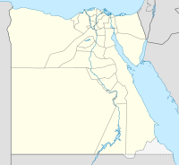
 View of Umm Kābū | ||
| Umm kaboo · أم كابو | ||
| Governorate | Red Sea | |
|---|---|---|
| no tourist info on Wikidata: | ||
| location | ||
| ||
Umm Kabu, also Umm / Um Kabo, Umm Harba (h), Umm Dobaa, Umm Diba, Arabic:أم كابو, Umm kaboo, is an archaeological site north of the Wādī el-Gimāl valley, belonging to the emerald mining area Mons Smaragdus belongs. This site includes administrative buildings and an emerald mining area 1.2 kilometers further north of it.
background
Umm Kābū is the easternmost of the Egyptian emerald mines and was mainly used in Greek times (after 300 BC) and in the early Roman times (around the turn of the times). The small settlement was probably used for processing and loading the mining products that were brought in from the nearby mines.
Umm Kābū is a modern name. The ancient name of this site is unknown.
The emeralds in the mining area of Umm Kābū, which extends over 4 square kilometers, crystallized similarly to in Sikait and at the Gebel Zabāra on the edge and within quartz-feldspar-biotite lenses and ducts that are embedded in serpentine edge rocks such as biotite or talc schist. Lenses and ducts are a few inches thick and up to several meters long. The higher chromium concentration in the rock can also be seen in the occurrence of fuchsite, a chromium-containing one Muscovite, read (Grundmann 1993).
The emeralds of Umm Kābū, which can be anywhere from about 1 millimeter to 10 centimeters long, are not evenly colored. In the core, which makes up about a third of the crystal, they are colorless, cloudy white or cloudy green. The green color increases towards the edge. Inclusions exist e.g. B. off Biotics, Quartz, chlorite and Plagioclase (Soda lime feldspar) (Grundmann 1993).
getting there

In addition to the authorization from the military and the national park administration, several all-wheel-drive all-terrain vehicles are required for the journey.
The arrival takes place from Marsā ʿAlam on trunk road 24 until after 52 kilometers you get to the 1 Access to Wādī el-Gimāl(24 ° 39 '44 "N.35 ° 5 '28 "E) reached. Shortly before you pass the building of the 1 National Park Administration(24 ° 41 ′ 12 ″ N.35 ° 5 ′ 1 ″ E).
Now follow the wadi to the west and after 33.5 kilometers you reach the access to the northern side valley 1 Wādī Umm Kābū(24 ° 34 '6 "N.34 ° 52 '54 "E). After 300 meters you reach the ancient production facilities of Umm Kābū, about 100 meters south of it there is one 2 Information booth(24 ° 34 '14 "N.34 ° 52 '48 "E.) with an information board. After about 1.2 kilometers along the side valley you will reach the area of the 2 Emerald mines(24 ° 34 '47 "N.34 ° 52 '36 "E).
mobility
The slope to the settlement and the mine area can be covered with an all-terrain all-wheel drive vehicle. The rest must be done on foot.
Tourist Attractions
First you pass one on the left on the southwest side of the wadi Information booth. It is probably the only one in the whole of Wādī el-Gimāl.
About 100 meters further north you get to the former production facilities, which are located on a natural 3 platform(24 ° 34 '17 "N.34 ° 52 '48 "E.) are located. Even today there are several windowless buildings at a considerable height of over a meter, which were built with dry stone walls from sandstone blocks without mortar. Lintels and ceilings are no longer available. In these buildings, among other things, The emeralds are separated from the rock, so that quartz and other rock remains can still be found here today.
To the northwest of the building there is also a buried one in the immediate vicinity 4 Fountain(24 ° 34 '18 "N.34 ° 52 '48 "E.) next to an acacia.


Immediately to the south in front of the platform, the runway runs in a north-westerly direction to the Emerald mines, which can be reached after about 1.2 kilometers.
Back in Wādī el-Gimāl, after a kilometer to the west, one reaches another wadi, probably the one mentioned on the information board in Umm Kābū 5 Wādī Umm Ḥīrān(24 ° 34 '15 "N.34 ° 52 ′ 7 ″ E). After about 800 meters to the north and then back to the west you will find the 6 ruins(24 ° 34 '36 "N.34 ° 51 '52 "E) of simple residential buildings. It is conceivable that the huts of the workers of Umm Kābū were located here or that it was a Christian hermitage used in late Roman times.
Kitchen, shelter and security
see article Mons Smaragdus.
trips
The trip to Umm Kābū can be made with a visit to Sikait and Wādī Nugruṣ connect. After about 4 kilometers west of Umm Kābū one sees again 7 ruins(24 ° 34 '6 "N.34 ° 48 ′ 59 ″ E) of simple residential buildings in the emerald mining area of Wādī el-Gimāl B, both on the northern edge of the Wādī el-Gimāl and in the Wādī itself, which branches off to the north.
literature
- : “Emerald mines of Cleopatra”: Zabara, Sikait and Umm Kabo in Egypt. In:Lapis: the current monthly magazine for lovers and collectors of minerals and precious stones, ISSN0176-1285, Vol.18,7–8 (1993), Pp. 27-39, in particular pp. 36 f.
- : Multi-stage emerald formation during Pan-African regional metamorphism: The Zabara, Sikait, Umm Kabo deposits, South Eastern desert of Egypt. In:Journal of African earth sciences, ISSN1879-1956, Vol.50 (2008), Pp. 168-187, especially pp. 171-173, doi:10.1016 / j.jafrearsci.2007.09.009.

