| location | ||

Waterfall on the Whanganui River
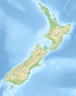
The Whanganui National Park is a 724 km² protected area on the North Island of New Zealand. The park is located on the Whanganui River of the same name.
background
history
landscape
Flora and fauna
climate
getting there
Fees / permits
mobility
Tourist Attractions
"Bridge to Nowhere"

Bridge to Nowhere
The "Bridge to Nowhere" was built in the jungle in the mid-1930s. The aim was to open up the region for settlers. However, the project failed, among other things. at the outbreak of World War II. So there was no longer any road construction. Therefore, even today, the bridge can only be reached on foot.
- Access:
- With the speedboat off Pipiriki: With the "jet boat" you can go from Pipiriki drive until shortly before the bridge. The boats cover the 50 km long route in about 30 minutes (?). From the landing point ("Mangapurua Landing") it is about 30 minutes on foot to the bridge.
- On foot from the next street: approx. 3 hour hike, starting point?
- By canoe or kayak over the Whanganui River - popular paddling route. By the way, the river is New Zealand's longest navigable river.
- Further information please refer Wikipedia - Bridge to Nowhere

