 | |
| capital | Antananarivo |
| currency | Madagascar Ariari (MGA) 1 MGA = 0.0002 EUR |
| population | 25,570,895(2017) |
| Power Systems | 127 volts / 50 Hz, 220 volts / 50 Hz (European plugs, AC power plugs and sockets: British and related types, Type E, SEV 1011, Type K) |
| country code | 261 |
| Time zone | UTC 03:00 |
| Language | Malagasy, French |
| Emergency call | 117 (police agency), 118 (fire department), 124 (emergency medical service) |
| Driving direction | right |
| Edit on Wikidata | |
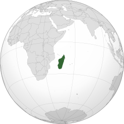
Republic of Madagascar, FormerlyWestern Republic of Malaga,AfricaThe Indian Ocean island country on the east coast. Madagascar is the largest island in Africa and the fourth largest in the world. It covers an area of 587,041 square kilometers, including 581,540 square kilometers of land and 5,501 square kilometers of water. As of July 2010, the population is 21,281,844; the capital and largest city areAntananarivo。
learn
area

Madagascar map
| Antananarivo(Antananarivo、Antsirabe) The capital of the region is the arrival point of many tourists and a hub for domestic airlines and land transportation routes. The town outside the capital is named after the craft workshop, and the local nature reserve with lemurs. |
| Antsiranana(Anziranana、Masoala National Park、Bay Island) Beautiful tropical islandBay IslandAs well as the surrounding small islands, this area is where most tourists go to high-end resorts and pristine beaches. It is also one of the most popular attractions in the country. |
| Fianarantsoa(Fianarantsoa、Ambsitra、Ambalava、Andringitra National Park、Ranomafana National Park) The area south of the capital is rainforest and mountains, which can be passed by the RN7 highway. |
| Mahajanga(Mahajanga、Tsingy de Bemaraha Nature Reserve) Mahajanga is an impressive wetland and some hidden resorts that can only be reached by private jet or boat. |
| Toamasina(Tuamasina、Vatu Mandri、Natus Island、Andasibe-Mantadia National Park) This province is the seat of Andasibe-Mantadia National Park, where there are many lemurs, and the eastern coast is a destination that is less known to tourists. |
| Toliara(Tuliara、Anaco、Isalo National Park) The southern part of the country is also the main area of thorny forests. Hot and dry conditions result in a harsh vegetation environment, but there are still many lemurs, lizards, birds and insects. |
city
- Antananarivo -The capital, usually called "Tana" by the locals.
- Ambalava
- Ambsitra
- Antsirabe
- Fianarantsoa
- Ihusi
- Morondava
- Tauranaru(Also known as Fort Dofan)
- Tuliara(Also known as Turia)
Other destinations
- Anaco
- Andasibe-Mantadia National Park
- Andringitra National Park
- Natus Island
- Isalo National Park
- Masoala National Park
- Bay Island
- Ranomafana National Park
- Tsingy de Bemaraha Nature Reserve