| Dumfries and Galloway | |
 | |
Location 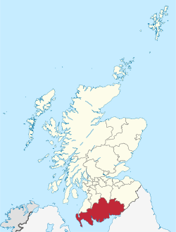 | |
| State | UK |
|---|---|
| Region | Scotland |
| Capital | Dumfries |
| Surface | 6,426 km² |
| Inhabitants | 148.200 (2005 estimate) |
| Institutional website | |
Dumfries and Galloway (Dùn Phris agus an Gall-Ghaidhealaibh) is a traditional region of the Scotland.
To know
Background
It was created in the 1975 year of the merger of three historic counties: Dumfriesshire, Kirkcudbrightshire and Wigtownshire.
Territories and tourist destinations

Urban centers
- Dumfries - Capital of Dumfries and Galloway 35 km from the border withEngland.
- Annan - It rises on the river of the same name.
- Castle Douglas - The city is commonly used by tourists as a base for exploring the rest of the area.
- Drummore - Small mainly agricultural village.
- Gatehouse of Fleet - River city.
- Gretna - On the border withEngland.
- Kirkcudbright - Located near the mouth of the River Dee approximately 10 km from the Atlantic Ocean.
- Lockerbie - Lockerbie was and still is a market for the trade of cattle and sheep, due to its proximity to the English border.
- Newton Stewart - Named after its founder William Stewart.
- Portpatrick - Near the ruins of Dunskey Castle.
- Stranraer - It lies on the banks of Loch Ryan on the north side of the isthmus which connects the Rhins of Galloway to the mainland.
- Wanlockhead - Nestled in the Lowther Hills.
- Whithorn - It boasts being home to the first Christian church in Scotland.
- Wigtown - The access point and main center of the Machars.
How to get
How to get around
What see
What to do
At the table
Safety
Other projects
 Wikipedia contains an entry concerning Dumfries and Galloway
 Commons contains images or other files on Dumfries and Galloway