
| South Holland | |
.jpg/250px-Tulip_fields_Lisse_(13983881641).jpg) | |
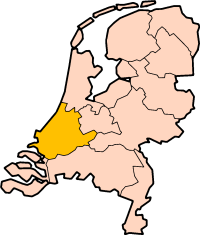
| location | |
 | |
| Flag | |
 | |
| Main information | |
| Capital city | the Hague |
| Currency | euro |
| Surface | 3403 |
| Population | 3 452 323 |
| Tongue | Dutch |
| Time zone | 1 |
| Time zone | 1 |
South Holland - province The Netherlands along the North Sea coast. The provincial capital is the Hagueand the largest city Rotterdam. The southern part of the province is Westland and has numerous greenhouse areas. The most important water bodies in South Holland are Nieuwe Maas, Nieuwe Waterweg, Oude Maas, Haringvliet and Hollands Diep
Characteristic
Geography
South Holland is one of the most densely populated and industrialized areas in the world. The population of the province in 1514 was about 200,000. inhabitants and this number grew over the centuries, reaching the value of 3 560 205 (as of September 30, 2012). With 3.5 million inhabitants, the area covers only 3,403 km², which is the largest population density in the whole of the Netherlands. The adjacent provinces are: Zealand on the south, North Brabant in the southeast and Gelderland together with Utrecht on the east.
Climate
History
Policy
Economy
Drive
By car
By plane
By ship
Cities
Interesting places
Transport
Shopping
Gastronomy
Accommodation
Security
Health
contact
| This is outline article. For now, it includes the article schema and not much else. You can help by supplementing the article with at least basic information, making it useful. |