 View over Jerash | ||
| Jerash | ||
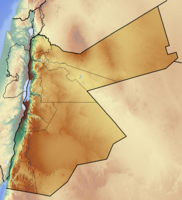
| Governorate | Jarash | |
|---|---|---|
| Residents | unknown | |
| no value for residents on Wikidata: | ||
| height | unknown | |
| no value for height on Wikidata: | ||
| no tourist info on Wikidata: | ||
| location | ||
| ||
Jerash is a historical site in northern Jordan. To the city that is part of the League of Cities Decapolis was, and one of the best preserved archaeological sites from Roman times, has developed into a modern city since the foundation of Jordan.
background
.jpg/300px-Jerash,_Jordan_-_panoramio_(31).jpg)

The ancient Gerasa, today Jerash, is a city in northern Jordan, about 40 km from the capital Amman away. The ruins of the Roman city remained uninhabited for centuries until they were rediscovered in 1806 by the German traveler Ulrich Jasper Seetzen.
After 1878, Circassians displaced by the Ottomans settled here and found a new home here. After Jordan's independence in 1946 and again after the Six Day War, refugees mainly from Syria and Palestine settled outside the historical ruins. The modern one Jerash, the capital of the newly founded governorate (or governorate) of the same name since 1994, has exceeded 50,000 inhabitants in 2015.
history

The fertile area has been inhabited for over 6000 years, traces of settlement from the Bronze Age have been proven in Jerash.
Alexander the Great left here in 332 BC. create a military post, under the Diadochus ruler Antiochus IV. from the Seleucids dynasty, a Hellinist city was founded on the river in honor of the founder Antioch on Chrysorhoas (Antioch on the Gold River) was called.
The city came in 84 BC. under the rule of the Jewish Hasmonean king Alexander Jannäus and became through the conquests of the Roman general Pompey in 63 BC. to the Roman province Syria integrated and subsequently became part of the city union of Decapolis. During this time the city developed into a strong trade and transport hub and experienced brisk construction activity. With the annexation of the Kingdom of Nabataeans by Emperor Trajan in 106 AD. Gerasa became a Roman province Arabia Petra beaten. In the year 129/130 AD the city was visited by Emperor Hadrian, for whom a triumphal arch was built in front of the city gates; in the year 217 Gerasa was raised to a Roman provincial town by Emperor Caracalla.
With the declaration of Christianity under Emperor Constantine as the state religion changed from 324 AD. the image of the city. The temples dedicated to the Roman deities fell into disrepair or were given a new use as Christian churches; In the 5th and 6th centuries the city experienced a brisk building activity with the construction of Byzantine churches with the typical mosaic floors.
After a brief period of Persian rule Sassanids In 613/30 the city came under Muslim rule in 636. Under the rule of Umayyads The city lost its size and importance until it was severely destroyed by a strong earthquake in 749.
The crusaders marched into the deserted, deserted city where the governor of Damascus had built a fortress in the Temple of Artemis. With the end of the Crusader Kingdom, the historical records of the city, which had sunk into insignificance until its rediscovery in 1806, are lost.
getting there
By plane
The next international Airport is the Queen Alia International Airport, which is about 25 km south of Amman opened in 1983 and replaced the Amman-Marka City Airport.
By train / bus
There is no rail link to Jerash. The city can be reached from Amann by bus, for example by bus from JETT or RUMTT.
In the street
Jerash is on the highway 35 of Amman to Irbid. The course of the route roughly corresponds to that King's Highway.
mobility
You usually come from the bus parking lot 100 m west of Hadrian's Arch to the south of the archaeological site. The archaeological park of Gerasa can practically only be explored on foot, you should plan at least half a day, the complex is spacious, it often gets hot, and there is seldom shade.
Tourist Attractions


_(representation);_DSCN0771.jpg/210px-Jordan,_Jerash._South_Theater_(Jerash)_(representation);_DSCN0771.jpg)

Modern Jerash is a fast-growing provincial city with no particular structure or highlights. Only the Roman East Baths are in the middle of the modern city of Jerash.
Jerash Archeological Park
- 1 Jerash Archeological Park. Price: 10 JOD (locals 0.5 JOD).
Almost all tourists only visit the fenced archaeological site in Jerash, which is known as Pompeii of the East applies.
The city developed on both sides around the river that cut through the urban area in a north-westerly direction. In ancient times, a 2 - 3 m thick and 4 - 5 m high stone wall surrounded the entire city area, which is only preserved in sections. Of the Roman city complex are the Cardo maximus, the north-south axis and two east-west cross streets that Decumani well preserved.
- the 2 Hadrian's Arch. The triumphal arch was built on the occasion of the visit of the Roman emperor Hadrian in 129 AD. erected outside the ancient city. A dedication inscription on the north side commemorates the historical event. In old pictures, Hadrian's Arch can still be seen without a gable, in the meantime the structure has been largely restored. The ancient road leads from Hadrian's Arch along the racecourse to the south gate of the city, on the right are the ruins of the Church of Mariano.
- the 3 hippodrome is right next to the ancient access road leading from Hadrian's Arch to the city. It was used to host horse races than Roman Circus around 220 AD built. In the middle of the 260 x 80 m hippodrome are the turning marks around which the teams of horses turned their laps. Later it was converted into an oval amphitheater in the northern part, which could be used for gladiator games; the southern part was used for the extraction of building material until the earthquake in 749 put an end to the flourishing life in the city.
- One then enters through that 4 South gate the ancient city, it is architecturally very similar to the Arch of Hadrian. At the south gate is the visitor center with information about the archaeological site.
- past the market halls one arrives at the 5 oval forum . Due to the topography, the access to the Temple of Zeus is angled to the axis of the Cardo, the square is oval, and the architectural trick gives the impression of a round square. The square, which measures 80 x 90 m and is paved with stone slabs, is surrounded by more than 60 columns. To the left a path leads to the Temple of Zeus and the South Theater.
- From the forum, the Cardo North. The former main street was once lined with over 1000 columns and extends over 800 m to the north gate. In the southern part, the south decumanus crosses and east-west direction, which is also bordered by rows of columns. The travel guides are happy to demonstrate how one of the 16 m high columns can be caused to vibrate slightly by simply pushing it; the movements are made visible with the help of a lever (e.g. with a teaspoon).
- Originally, the cardo was simply paved and had a curve that allowed the water to drain off on the sides, in the middle of the 2nd century. a central sewer was installed and the side areas were later paved. The wheels of the carts have left their mark on the antique floor slabs.
- It is well preserved 6 South Tetrapylon. At the right-angled street crossing there were four square pillar platforms, each with four pillars made of Egyptian rose granite, which probably supported a beam and a roof.
- the Cardo is lined with representative buildings:
- The 7 Macellum, the slaughterhouse in which meat was also sold, stands out with its octagonal rotunda with a central fountain. The stone slaughterhouses for calves and poultry can still be seen in one of the slaughterhouses.
- The 8 Cathedral was originally a pagan building, possibly a sanctuary dedicated to Dionysus. After converting to Christianity and the abolition of the Temple of Zeus, parts of the temple were turned over here, around 450 AD. to equip the oldest still existing church in Gerasa under Bishop Placcus. The apse of the three-aisled building faces east, to reach the entrance to the west from the Cardo, you go around the church building. The main entrance was probably used from the west via the St. Theodor Church and the Brunnenhof.
- it follows that 9 Nymphaeum: The gigantic, over 20 m wide fountain system was built in 190/191 to supply the city population with water. Statues stood in seven niches on each of the two floors; the water was led to the fountain basin via an aduct and the overflow from six water spouts designed as lions' heads into six pouring bowls. In front of the pool there is a huge, monolithic, round water basin, also made of rose granite.
On the Cardo, the pillared vestibule of the Temple of Artemis, the Propylaea, follows on the left. If you like, you can visit the relics of the north city:
- opposite the Propylaea there is a Byzantine church building, the 10 Propylaean Church.
- a little further to the northwest are at the intersection with the North Dekumanus am North Tetrapylon the 11 West thermal baths.
- the 12 North Theater probably originated around 164 AD. initially as a meeting hall for the city council and was later expanded into an odeion or theater with 14 rows of seats. As a unique detail, the names of the town's patrician families were found engraved in certain rows of seats. In the 3rd century the theater was extended with a second tier to 1,600 seats, this extension collapsed in an earthquake in the 6th century. a.
- Behind the theater are the remains of the small Byzantine church of Bishop Isaiah.
- the cardo ends a little further on 13 North gate
Back to the Temple of Artemis:
- The area of the Temple of Artemis was reached from the Cardo through a gate system with three gates adorned by four huge columns, the main gate was 5 m wide and 8 m high. The pilgrims reached the stairs with seven by seven steps 14 Temple Propylaea to the enclosed forecourt of the temple.
- The 15 Artemis Temple long in a huge forecourt, which was surrounded by columns decorated with Corinthian capitals. The actual temple, the pedestal measures 42 x 22 m, was surrounded by 36 columns with Corinthian capitals. The cella, the sanctuary, is still well preserved. The niche with the cult image of the goddess Artemir faced west.
- between the Temple of Artemis and the Church of St. Theodor was an ancient water-powered one Stone saw discovered, with which the stones could be cut to size for the construction of the monuments.
The tour now leads in a south-westerly direction:
- on the left is the 16 St. Theodor Church from Byzantine times, which from the west to the Wunderbrunnen-Hof and the access to the cathedral borders. The legend tells of the miracle fountain that every year to celebrate the anniversary of the miracle at the wedding at Cana, the water was turned into wine, usually it was fed from a reservoir 3 km outside the city, which also supplied the fountain of the nymphaeum.
- The St. Theodorkirche is a huge three-aisled building that was built in 495 and restored in 1965/6. The church was built largely from recycled ancient building materials and was adorned with magnificent mosaics. The baptistery is worth seeing.
- to the north is the 17 Complex of the three churches: From the south the church of St. George (530 AD), the round church of St. John the Baptist and the small three-aisled church of St. Cosmas and Damian are built together. Behind it lies the 18 Church of Bishop Genesius (530 AD) and a little further north the also around 530 AD. erected 19 Synagogue Church.
- the 20 Church of Saints Peter and Paul lies to the north behind the complex of the Temple of Zeus.
The path now leads to the complex with the South Theater.
- The 21 South Theater was built in the area above the Temple of Zeus. The auditorium with 14 15 rows of seats offered around 3,000 spectators. With the well-preserved stage house with the three portals typical of the ancient theater buildings for the actors to perform, the South Theater is one of the most beautiful and best-preserved ancient theater buildings in the Middle East. Sometimes you are lucky enough to experience the acoustics at a performance by a drum and bagpipe player from the Royal Jordanian Music Corps.
- The Sanctuary of Zeus extended over two terraces. an enclosure which the temple precinct, the Naos surrounded, was around 69/70 AD. built. Older building elements were also used for this, on a frieze depicting birds and pomegranates there was a Greek inscription from around 135 BC. Around 135/140 AD. the area was renewed and Hellenistic elements cleared, around 450/455 AD. a monastery was established by Byzantine monks.
- The 22 Temple of Zeus was on a hill, the pedestal and the six pillars of the front can still be seen. In Byzantine times, the area was looted and the building elements were reused in the numerous churches and other public buildings in the city. Some damage was also caused when the local population searched for hidden treasures here ...
activities
- Visit to the archaeological site (at least 2 - 6 hours)
- in the hippodrome sometimes find demonstrations of horse races and gladiator fights in the roman style instead of.
shop
- Countless souvenirs are on sale at the handcraft market at the entrance to the archaeological site, and there are occasionally local art objects (including toilets).
kitchen
- Inside the facility there is a restaurant, which has seats in the shade, is often overlaid and offers a simple buffet or salads.
There are a number of excursion restaurants just a little to the south:
- 1 Artemis restaurant. Tel.: 962 79554 6682.
- 2 Lebanese restaurant at Khalil. Tel.: 962 2635 1301.
- 3 Green Valley Restaurants. Tel.: 962 79610 0700.
trips
- About 10 km west near the town Ajlun the castle is located at an altitude of 1250 m Qalat-ar-Rabad. It was built around 1185, destroyed by the Mongols in 1260, but then restored and enlarged. It offers a good view over the Jordan Valley.
- Jerash is on the edge of the Jordan Rifts. From here it is only about 50 km to Pella, also a city of Decapolis.
literature
- leader Jerash, German edition, Prof. Dr. Safwan Kh. Tell, Bonechi Verlag, Florence, approx. 5 JOD