| Miranda (state) | |
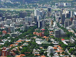 | |
Location  | |
Coat of arms and flag  | |
| State | Venezuela |
|---|---|
| Capital | Los Teques |
| Surface | 7,950 km² |
| Inhabitants | 3.222.374 (2015 census) |
| Institutional website | |
Miranda is one of the federated states Venezuelans of the Central Venezuela.
To know
The state also encompasses much of the metropolitan area of Caracas, which, since the second half of the twentieth century, had been developing outside the district territory of relevance (Distrito federal).
Geographical notes
It borders to the north with the state of Vargas, to the north-east with the Caribbean Sea, to the south-east with the state of Anzoátegui, south with the states of Guárico is Aragua and to the west with the Capital District and Aragua himself.
The territory of the state is very varied, the northern part is crossed by the Cordillera della Costa, to the west are the Los Teques mountains separated by the Serranìa del Interior mountain range by the Tuy river valley. To the east, however, there is a flat area with sandy beaches.
Territories and tourist destinations
Urban centers
- Los Teques - Capital of the State of Miranda.
- Petare - One of the most populous cities in Miranda.
Other destinations
- Guatopo National Park
- Laguna de Tacarigua National Park
- Macarao National Park
- Waraira Repano National Park (former El Ávila National Park)
How to get
By car
Road links are poor and congested.
By bus
The recent subway of Los Teques connects the satellite cities of Miranda with Caracas in a few minutes.
How to get around
What see
What to do
At the table
Safety
Other projects
 Wikipedia contains an entry concerning Miranda (state)
 Commons contains images or other files on Miranda (state)