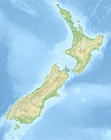
| location | ||
The Ninety Mile Beach is a 55 miles or 88 km long beach on the east side of the Aupouri Peninsula in the far north of New Zealand.
background
The sandy beach of Ninety Mile Beach begins at Ahipara in the south and extends to Cape Maria van Diemen near Cape Reinga. As part of the official highway network, it can be used outside of the flood. Organized bus rides across the beach to the Cape Reinga drive, start in all places in the vicinity.
Most of the Ninety Mile Beach runs in a straight line, only rarely do a few rocky spots or offshore islands interrupt the straight line of the sandy beach.
In the southern part only a narrow coastal strip is accessible, behind it are forests that cannot deny the character of the intensive forestry. Further north it turns into pastureland, which is mainly used by herds of sheep and cattle.
Behind the beach there are mostly lightly overgrown dunes. The beach is popular with tourists and locals alike. In summer it can get busy, especially in the area of the driveways. Due to the length of the beach, however, the hustle and bustle dissipates quickly.
 The beach forms an almost endless straight line ... |  ... interrupted by a picturesque islet |  ... and The Bluff peninsula |
By car across the beach

In principle, rental car companies prohibit driving on the beach with rental cars. If you have your own car you can drive on the beach at your own risk. However, information about the time of the flood should be obtained beforehand. This can be done at any tourist office in the area. There you can also get information brochures about the four entrances to the beach, some of which require four-wheel drive and can run through quicksand. You should never drive your car into the water and the car can sink into the dry sand in the upper part of the beach. There is no cell phone reception on the route.
activities
In the far north there are high sand dunes, the slopes of which can be used for sand snowboarding. In the vicinity of Te Paki, however, there are places whose quicksand has been the fate of many vehicles.
trips
north
- Cape Reinga. Not the northernmost point of New Zealand, but the place where the Tasman Sea and the Pacific meet. The lighthouse is picturesque over a cliff. Several walks are also possible around the Cape.
west
south
- Hokianga. On the way to the Kauri forests of the east coast.
- Waipoua Forest. A primeval forest that houses, among other things, huge kauri trees.

