 | ||
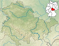
| Oberweißbach / Thuringian Forest | ||
| federal state | Thuringia | |
|---|---|---|
| Residents | 1.678 (2017) | |
| height | 670 m | |
| no tourist info on Wikidata: | ||
| location | ||
| ||
The small town Oberweißbach is a state-approved resort and is located in Schwarzatal-Area on the eastern edge of the Thuringian Forest. Oberweißbach is well known for the mountain railway of the same name, although the place is not on the funicular itself, but "only" on the electric flatland railway.

getting there
By train
You first have to reach Rottenbach by train. This happens from Erfurt or Saalfeld - both are ICE train stations - off. From Rottenbach it goes on over the Schwarzatalbahn According to the fruit field smithy. The valley station of the Oberweißbacher Bergbahn is located there. The funicular takes you 1.4 km up the slope to the Lichtenhain mountain station. Right next to the roofed building is the electrically operated friction track, which you can use to continue your journey to the Oberweißbach-Deesbach train station.
In the street
From Saalfeld you drive on the B 281 direction Neuhaus and turn right just before the winter sports resort. The route from Ilmenau (A 71) leads via Langewiesen and Gehren. The German toy route leads through the place.
mobility
Tourist Attractions
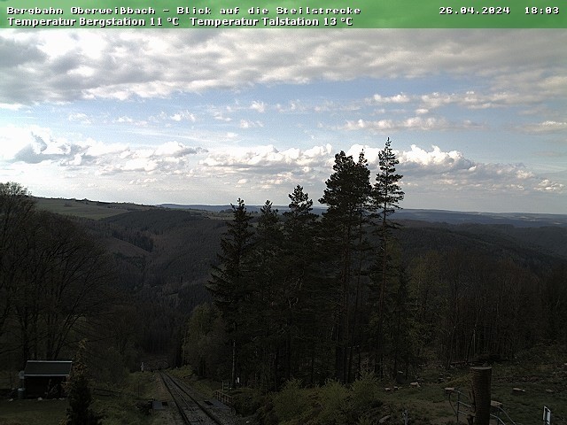
- Oberweißbacher Bergbahn - The mountain railway, built between 1919 and 1923, consists of a funicular railway and an electric flat railway. As a special feature, combined transport is possible on the system. The railcar of the flat railway can be loaded onto a wagon platform and thus also use the inclined mountain route. Deutsche Bahn has been operating the mountain railway since 1994.
- further information:
- - the official website of the Deutsche Bahn to the mountain railway
- - good, private side Oberweißbacher Bergbahn
- - webcam with View of the funicular
- Froebel Tower - The observation tower with restaurant on the summit of the Kirchberg (785 m) can be climbed against admission.
- Birthplace of Friedrich Froebel with Froebel exhibition and city library (info).
- Hope Church ("Südthüringer Dom") from 1779 - largest village church in Thuringia with 2000 seats.
activities
- Walk along the herbal nature trail from Froebelhaus to Froebel tower, which is south of the city.
- hike - In combination with the mountain railway, comfortable hikes are possible: uphill by train, downhill on foot.
shop
There is a on the ground floor of the Froebelhaus Olities trade, this is a kind of pharmacy in which traditional herbal mixtures from the Thuringian Forest are sold.
kitchen
- 1 Mountain inn Fröbelturm, On the Kirchberg, 98744 Oberweißbach. Tel.: (0)36705 62074, Fax: (0)36705 63134, Email: [email protected]. Restaurant and café with a lookout tower.
- 2 Steakhouse "Zum Ochsen", Lichtenhainer Str. 8/9, 98744 Oberweißbach. Tel.: (0)36705 209866, (0)36705 63807, Fax: (0)36705 63808, Email: [email protected]. With in-house bowling alley.
nightlife
accommodation
- 1 Hotel Burghof, Sonneberger Strasse 67, 98744 Oberweißbach. Tel.: 49 (0)36705 6870, Email: [email protected]. Price: Prices (including breakfast): single room € 43, double room € 36..
- 2 Gasthof & Pension zur Schenke, Markt 8, 98744 Oberweißbach. Tel.: (0)36705 62048, Fax: (0)36705 62048, Email: [email protected]. Mainly Thuringian cuisine at reasonable prices.Feature: pension.Price: Single from € 28, double from € 44.
health
Practical advice
- 1 Tourism information center of Fröbelstadt Marketing GmbH, Market 10. Tel.: 49 (0)36705 62123, Email: [email protected].
trips
- Neuhaus am Rennweg (10 km south) - winter sports resort directly on the ridge of the Thuringian Forest; End point of a railway connection from Sonneberg.
- Katzhütte (11 km southwest) - end point of the Schwarzatalbahn from Rottenbach.
- Schwarzburg (11 km northeast) - Schwarzburg castle ruins.
- Lauscha (15 km south, via Neuhaus) - small glassblowing town with a terminus.
- Großbreitenbach (18 km to the west) - Thuringian Dumpling Press Museum; largest timber frame church in Thuringia.
literature
- "Bergbahnregion" bike and hiking map - M 1:25 000. The map shows the entire Schwarzatal including Oberweissbach. Neuhaus am Rennweg is still shown on the southern edge of the map; ISBN 978-3-937929-61-3 (March 2006), published for € 3.50 in the Kartographischen Kommunalen Verlagsgesellschaft Nordhausen
Web links
- Official website of the city of Oberweißbach with tourist information