| Peneda-Gerês National Park ((pt)Parque Nacional da Peneda-Gerês) | |
 | |
| The sanctuary of Nossa Senhora da Peneda | |
| Information | |
| Country | |
|---|---|
| Region | Northern Portugal Minho / Trás os Montes |
| IUCN Category | II (National Park) |
| Administration | ICNF |
| Watercourse | Lima, Homem, Cávado |
| Maximum altitude | 1 548 m (Nevosa peak) |
| Area | 702,9 km² |
| Location | |
 41 ° 53 ′ 32 ″ N 8 ° 7 ′ 22 ″ W | |
| Official site | |
| Touristic site | |
the Penada-Gerês park is a national park straddling the regions of Minho and of Trás os Montes to Portugal.
Understand
Founded in 1971, as a mitigation measure for the many dams built nearby, this park is the only national park in the country. Located in the border area with Spain, it has been training since 1997, with the Baixa Limia-Serra do Xuré Spanish Natural Park, the Gerês-Xuré cross-border park, classified since 2009 as UNESCO biosphere reserve. It is one of the last sanctuaries, with the park of the Monastery of Tibães, of indigenous flora, with three endemic species: yellow-bearded iris (Iris boissieri)trumpet narcissus (Narcissus pseudonarcissus subsp. nobilis) and lemon balm (Melittis melissophyllum)In terms of fauna, the park has 235 species of vertebrates (the deer is the emblem of the park), 204 are protected, and 71 are endangered like the Iberian wolf (Canis lupus signatus)otter, etc. But you will have little probability of seeing these wild animals, on the other hand with a little luck you will be able to see a raptor, eagle or kite, a semi-wild animal like the many garranos (small endemic horses, and pre-historic which are the ancestor of the American mustang), or of course ... a domestic animal like goats and cows, all in all very photogenic with their large horns.
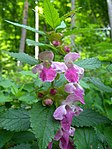
Melittis melissophyllum

Iris boissieri
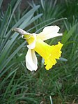
Trumpet narcissus
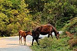
Garrano mare and her foal

Iberian wolf
.jpg/150px-Portugal-Parque_do_Gerês-P1240550_(25867579876).jpg)
Barrosã breed cow


.jpg/150px-Portugal-Parque_do_Gerês-P1240550_(25867579876).jpg)
To go
- The easiest, by your own means of transport (car, motorbike, bicycle).
- Bus connection from Braga bus station to the small spa town of Gerês (Terras de Bouro) by: Empresa Hoteleira do Gerês, or to the village of Campo do Gerês (Terras de Bouro) by: Transdev (pt).
Circulate
By car, or by motorbike, but to be closer to nature, a visit on horseback, by bike (MTB) or simply on foot is recommended. There are many trails, from short walks to long hikes. However, do Warning, the mountain is not high, but the climatic conditions change there quickly, the fog, the rain or the snow can occur in a short time without warning signs. The terrain is rugged, the GSM (telephone) coverage, although not 100% important, some gray areas remain. Also, the Emergency Protection Intervention Group (GIPS) of the gendarmes, must intervene many times throughout the year (34 interventions in 2018) in search of groups lost in the middle of the fog, to transport people suffering from hypothermia. in winter, or injured as a result of fall in the waterfalls in summer. Access to Portela do Homem by car by road and the forest path (very dusty), are paid in summer, moreover it is forbidden to stop. These measures aim to limit road traffic, in fact it is the reverse, the Portela do Homem site is saturated. To see the Mata de Albergaria follow the route described below, for swimming, come early.

To see


.jpg/220px-Lindoso_-_panoramio_(3).jpg)
.jpg/220px-Santuário_de_Nossa_Senhora_da_Peneda_(48710293957).jpg)
.jpg/220px-Monasterio_de_Santa_Maria_de_Pitões_das_Júnias_(2891510779).jpg)
From the city of Gerês
- 1 City of Gerês (Vila do Gerês)
 free. – Small spa (the most fluoridated water in Europe), tucked away at the bottom of a tectonic fault, but which is a good starting point for visiting the south of the park. In particular, at 6 km, the 2 viewpoint of Pedra Bela (Viewpoint of Pedra Bela) on the Cávado valley, the 3 Arado river waterfall , the 4 Fecha de Barjas waterfall (Cascata de Fecha de Barjas, or Tahiti.) or the 5 Leonte waterfall (towards Portela do Homem.) .

Arado river waterfall

Panorama da Pedra Bela
The viewpoint of Pedra Bela

Fecha de Barjas or Tahiti waterfall


- 6 Portela do Homem waterfall (Cascate da Portela do homem) free. – Pretty waterfall, the water is pure, but the place is saturated in summer, little place to park, and a lot of people. To the right of the waterfall a small path leads to the old da Carris gold mine, but you will not find any nuggets and the path is difficult to see very difficult depending on the weather, moreover it is not marked. However the first kilometers are on easy and flat terrain so you can go up the Homem river and see its glacial valley.
From Campo do Gerês
- 7 Roman route da Geira or Via Nova or finally route XVIII (Geira or Via Nova (Latin name preserved especially in Spain)) free. – Roman road built in 80, starting from Braga in the direction of Astorga (330 km) then to Rome, by the way known as, way of the French, in pilgrimage towards Saint Jacques de Compostelle. This line was built to ensure the telegraphic link between Braga and Rome. It is visible in Portugal for 30 km, by sections of the village of Souto, Lugar de Santa Cruz, Terras de Bouro to Portela do Homem (border post). This track is the one that retains the largest number of milestones in all of Europe. The most famous section is the one that runs along the artificial lake of Vilarinho das Furnas, to discover it follow the route PR 5 (3h), Trilho da águia e do Sarilhão, Pdf with plan (pt and en) or follow the route on the website of Wikiloc from the 8 da Geira museum at the entrance to the village of Campo do Gerês . Note more particularly, at the starting point, a milestone transformed into a Calvary (national monument), 9 the village of Campo do Gerês , 10 the lake and the submerged village, of Vilarinho das Furnas , the mata de Albergaria (wood of native species, oak, strawberry tree, holly and holly), the rock of the eagles (a nest is often visible there), and just before the Cerdeira campsite, a ruin of " silha "(peripheral wall built around an apiary to protect it from bears). If you have a little time you can visit the da Geira museum (starting and ending point) Museu da Geira, which shows the layout, Roman construction techniques, infrastructure, and finally the evolution of the landscape.

Calvary of Campo do Gerês
Vilarinho das Furnas artificial lake


From Ponte da Barca (or Arcos de valdevez)
- 11 Portela do Mezio – Portela do Mezio is one of the 5 gates of the national park. This site has a picnic area, a swimming pool, a restaurant, and an "adventure" park (see below). A 2km PR course (duration 1 hour) allows you to see some dolmens of the eleven that exist in the perimeter PDF of the Course. Two permanent exhibitions, one on the agricultural world, the other on local archeology.
- 12 Village of Soajo, Arcos de Valdevez (Aldeia de Soajo,) free. – Small village famous for its large number of espigueiros (drying cobs, on stilts, to protect them from rats). See also its pillory.
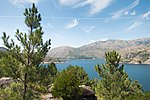
- 13 Lindoso village, Ponte da Barca (Aldeia de Lindoso) free. – Another village, this border one, also known for its "espigueiros", but especially for its fortified castle which dominates a superb landscape (Spain in the distance, an artificial lake in the foreground).
- 14 Sanctuary of Our Lady of Peneda, Arcos de Valdevez (Santuário de Nossa Senhora da Peneda) free. – Sanctuary (inspired by Bom Jesus de Braga) isolated in the middle of the mountain at the foot of a huge rock, well known to mountaineers. It was in the last century a high place of pilgrimage.
Departing from Pitões das Júnias
- 15 Village of Pitões das Júnias, Montalegre (Aldeia de Pitões das Júnias, Montalegre) free. – Small mountain village located at an altitude of 1103 m, from there a small path (2 km) begins in the direction of the Cistercian monastery of Santa Maria das Júnias (XIIº S.). Another to the Chapel of Saint John da Fraga (3 km). Also see the waterfall.
- 16 Monastery of Santa Maria das Júnias – Cistercian monastery of Santa Maria das Júnias (XIIº S.) classified as a national monument.
- 17 Chapel of São João da Fraga (Capela de São João da Fraga) – Chapel of Saint John da Fraga (3 km), located on a rocky outcrop, pilgrimage on the first Sunday after June 24. Routes and photos on Wikiloc. Impressive photo of the chapel Duration of the route 1h30.
- 18 Pitões das Júnias waterfall (Cascata de Pitões das Júnias) (Pretty waterfall to see from a watchtower.)
.jpg/100px-Cascata_de_Pitões_das_Júnias_-_Portugal_(5571557518).jpg)
Cascade
.jpg/150px-Pitões_das_Júnias-3_(48448309107).jpg)
Town
.jpg/100px-Cascata_de_Pitões_das_Júnias_-_Portugal_(5571557518).jpg)
.jpg/150px-Pitões_das_Júnias-3_(48448309107).jpg)
In the near surroundings
The next two sites are located on the outskirts of the park, but the routes from these sites are mostly inside the park.
- 19 Village of Sistelo, Arcos de Valdevez (Aldeia of Sistelo) (to the northwest) – Charming little village, in the middle of a very preserved natural setting, where man still lives in harmony with nature. It is nicknamed the "little Portuguese Tibet" because the crops are grown there on terraces. Since 2017, the landscape of Sistelo has been classified as a national monument. Many hiking trails start from Sistelo, Wikiloc
.jpg/220px-Sistelo_44_(46810034315).jpg)
- 20 Branda de Santo António de Vale de Poldros, Riba de Mouro, Monção (The Hobbit Village) – The hamlet of Santo António de Vale de Poldros, in the village of Riba de Mouro, is located at an altitude of 1050 m, it was a temporary living area for transhumance (branda), now accessible by car. The shelters of the shepherds of this hamlet, are called "cardenhas", they are very particular houses, originally round, in stone with stone roofs, which some compare to the houses of the Hobbits, but which would be for some the reminiscence of the houses of the ancient Castros of the Bronze Age. Photos and routes on Wikiloc
Do
Hiking List of routes with description and respective map in PDF with other information (pt and en)

- 1 Cruise on the ... Cávado (Albufeira da Caniçada) Rio Caldo Marina
 Weather function.. Around 10 € per pers.. – Several boats / companies make hour-long rides. But also paddle 10 €/ h, water skiing 90 €, water bike 45 € for 1/4 h. 85 € for 1/2 h.
 - 2 Canyoning Center Varziela, 4960-094 Castro Laboreiro,
 351 932 480 157, e-mail : [email protected] Between 35 € and 65 €. – Climbing activities (from 12 years old) and canyoning (from 18 years old).
 - 3 Portela do Mezio Adventure Park (Aventura Park) Portela do Mezio, 351 258 510 100, e-mail : [email protected] 9:30 am / 8:00 pm (5:00 pm in winter). – Climbing wall, slide, canyoning 3 to 4 hours, the little village (a mini village for children), swimming pool 1 €, guided tour of the archaeological site and the interpretative center 1h30, horse ride 1h, 25 €, 1 day 100 €, by cart 1h, 40 € per pers.
To buy
Buy honey, produced locally, it is natural.
Eat
Note: the prices inside the park are generally higher than those in the surroundings, this is explained by the lack of activity 9 months out of 12. Also do not hesitate to broaden your field of investigation to eat or sleep.
- 1 Miradouro do Castelo Vila, 4960-061 Melgaço, 351 251 465 469 Mon.- Sun. : 8 h - 23 h. –
 Regional cuisine. Large shaded terrace. Free parking on the square. Some double rooms ( from 77 € breakfast included
 free.).
Cheap
- 2 Restaurante O Vaticano Lugar da Igreja nº 117, Souto, Terras de Bouro 4840-130, 351 253 351 492, e-mail : [email protected] from 12 p.m. to 10 p.m.. from 6 €. – Regional cuisine, hearty meals, in a small village.
- Casa do preto 3 Largo do Salgueiro, Pitões das Júnias 5470-370, 351 276 566 158, e-mail : [email protected] 8 am / 10 pm closed on Thursday.. from 6 €. – Regional cuisine (eg feijoada). With hotel: see below.
 , very inclined ramp.
Average price
- 3 Casa do Videira Eiró - Soajo. 4970-660 Arcos de Valdevez, 351 258 576 205, e-mail : [email protected] from 12 p.m. to 10 p.m.. from 12 €. – Regional cuisine, local meat, hearty meals, vegetarian dishes.
- 4 O Abocanhado Brufe village, 351 253 352 944, e-mail : [email protected] 12.30 / 3.30-7.30 / 9.30 p.m.. from 20 €. – Regional cuisine, with local products if possible. Superb point of view, on the valley of Rio Homem, the interior decoration obtained the silver medal of the competition "Architecture, Landscape Architecture, Interior Design" in the USA in 2005. From there, you can reach Campo do Gerês, going down a vertiginous road, up to the Vilarinho das Furnas dam (be careful, the dam is narrow, check that there are no vehicles in front of you before entering)
Have a drink / Go out
Events
- 1 (Queima do Pai Velho) – The carnival is celebrated in a curious way in Lindoso, we reenact ... funerals. It is a tragicomic spectacle, which dates back several millennia. The named deceased, the old father, is taken for a ride in the village on an oxcart, followed by the chariot of herbs (formerly aromatic herbs to drive off the bad odors of the corpse). At nightfall we witness the lifting of the body, the mannequin being carried on the shoulders by several men, then finally the cremation around a ... bonfire. Carnival, by its date, corresponds to a new agricultural cycle, we burn the old, turning the page of the past to look to the future of the next harvest.
- 2 The blessing of animals in Valdreu (Benção dos animais) (Near Caldelas or the Aboim da Nóbrega campsite.) – Why not attend a mass on Sunday morning? Even if you are not a believer, you will be amazed to see cows, horses, dogs, cats ... stoic, wisely at the Mass of Saint Anthony in Valdreu, at the sanctuary of Santo António de Mixões da Serra, the Sunday before June 13 around 11h. In the end, they are all blessed by the parish priest, each in turn, Saint Anthony being considered locally a protector of animals. Apart from this somewhat peculiar pilgrimage, this mountain-top sanctuary is always an appreciable place for the beauty of its landscapes.

Housing
Campsites
- 1 Parque Cerdeira Rua de Cerdeira, 400 Campo do Gerês 4840-030 Terras de Bouro, 351 253 351 005, e-mail : [email protected] 8:30 a.m. - 9:00 p.m.. from 23 € for a tent (4 € for electricity) to 75 € for a 2-person bungalow. in summer. – Campsite, cabins or bungalows with bar, restaurant, swimming pool, bikes, kayaks, etc.
- 2 Parque de campismo de Aboim da Nóbrega Lugar das Lameiras, Aboim da Nóbrega, 4730- 010 Vila Verde, 351 253 348 094, e-mail : [email protected] 8:30 a.m. - 9:00 p.m.. € 3 / pers., € 2 / child for a tent (€ 3 for electricity), caravan € 5, at € 65 for a two-bedroom house for 4 people. in summer, equipped with dishes, TV, fridge, microwave, sheets and towels.. – A little further, but more affordable in price (not updated) and availability, this campsite is located in a beautiful isolated location: Camping, caravans or small houses f2 for 4 or 6 people, marked hiking trails PR .: Fojo do lobo (stone walls forming a funnel, to trap wolves in Gondomar) and Sanctuary of Santo António de Mixões da Serra (Valdreu)
- 3 Park of Campismo de Entre Ambos-os-Rios Lugar de Igreja 4980-312 Entre Ambos-os-Rios Ponte da Barca (Center of the park), 351 258 588 361, e-mail : [email protected] 8 a.m. - 10 p.m..to be released before 3 p.m. (camping). € 6 / pers., € 4.5 / (- 12 years old) € 5 for a tent (€ 4 for electricity), caravan from € 6 to € 10, € 70 for a two-bedroom house for 5 people. in summer, equipped with crockery, fridge freezer, sheets and towels.. – Camping in a wood on a peninsula of Lima, with bar, restaurant, bungalows, house f2, with hiking along marked routes, cycling or E-Bike, horse riding, 4 × 4 ride, Stand Up Paddle or kayak .
Hotels
Average price
- 4 Casa do Preto Largo Salgueiro 3, 5470-370 Pitões das Junias, 351 276 566 158, e-mail : [email protected] restaurant: Fri.- sea. : 8 h - 22 h. room available from 15 h, to be released before 12 h. 50 € (breakfast included). – (there is a ramp at the entrance but the slope is quite steep) free.
 among the languages spoken. 5 double bedrooms. Restaurant with local and traditional cuisine. Free parking. Animals not accepted.
 - 5 Castrum Villae Lugar de Vila Castro Laboreiro, 4960-061 Melgaço, 351 251 460 030, e-mail : [email protected] room available from 15 h, to be released before 12 h. (breakfast included) double room: from 42 €, quadruple room: from 85 €. – free. among the languages spoken. 32 double, triple and quadruple rooms. Bar and restaurant. Terrace and small garden. Snooker table. Free secure parking. Animals not accepted.
Luxury
- 6 Pousada of Santa Maria do Bouro Largo do Terreiro, Santa Maria do Bouro, 4720-633 Amares, 351 253 371 970, fax : 351 253 371 976, e-mail : [email protected] room available from 15 h, to be released before 12 h. Between 80 € and 240 € (breakfast included). – free. among the languages spoken. Occupies a Cistercian monastery in XIIe century, classified as a national heritage. Double and quadruple rooms. Bar with large terrace and panorama, restaurant. Outdoor swimming pool and tennis court. Free parking. Accepted animals.
Manage the day-to-day
Cash dispensers
- 1 Banco BPI Praça Amadeu Abílio Lopes 150, 4960-531 Melgaço – 1 indoor distributor, as well as three others nearby, Novo Banco, Caixa Caixa Geral de Depósitos , and BCP
- 2 Delegação Bancária BCP Eiró - 4970-660 Soajo – outside distributor.
- 3 Credito Agricola 81 Rua Dr. Manuel Gomes de Almeida 4845-075 Gerês – outside distributor.
- 4 Caixa Caixa Geral de Depósitos Av. Dom Afonso III, 5470-235 Montalegre, 351 276 510140 – indoor distributor, as well as three others nearby.
In the surroundings, distributors and pharmacies in Caldelas, Terras de Bouro, Arcos de Valdevez, Ponte da Barca, Monção.
Health
There is no establishment with an emergency service in the park or its immediate surroundings. The closest are, to the north-west, at Monção, west, to Ponte de Lima, southwest to Braga.In the event of a serious health problem, the referral hospitals are those of Viana do Castelo and Braga.
- 5 Montalegre Health Center (Centro de Saúde) 44 R. Lama do Moinho, 5470-225 Montalegre, 351 276 510 160 8:30 am / 6:00 pm closed on weekends.
- 6 Terras de Bouro Health Center (Centro de Saúde) 180 Rua Dr. Francisco Xavier de Araújo, 4840-100 Terras de Bouro, 351 253 350 030 8:30 am / 6:00 pm closed on weekends.
- 7 Arcos de Valdevez Health Center (Centro de Saúde) 39 Rua Eng. Amaro da Costa, Arcos de Valdevez, 351 258 520 120 8:30 am / 6:00 pm closed on weekends.
Security
- 8 Gendarmerie de Montalegre (Guarda Nacional Republicana) Posto Territorial de Montalegre, 85 Rua do Avelar, 5470-235 Montalegre, 351 276 510300, e-mail : [email protected]
- 9 Gendarmerie of Gerês (Guarda Nacional Republicana) Posto Territorial de Gerês, 9/11 Avenida D. João V, 4845-067 Gerês, 351 253 900100, e-mail : [email protected] – (ramp to the right of the building).
- 10 Terras de Bouro police station (Guarda Nacional Republicana) Posto Territorial de Terras de Bouro, 55 Rua de Santo André, Moimenta 4840-100 Terras de Bouro, 351 253 351134, e-mail : [email protected]
- 11 Gendarmerie of Arcos de Valdevez (Guarda Nacional Republicana) Posto Territorial de Arcos de Valdevez, Avenida Doutor António Caldas, 4970-592 Arcos de Valdevez, 351 258 510090, e-mail : [email protected]
Around
- 1 Melgaço (North)
- 2 Monção (to the northwest)
- 3 Baixa Limia-Serra do Xuré Natural Park (to North-east) –


- 4 Montalegre (to the East) – To see, the fortified castle classified as a national monument.
- 5 Braga (at the South West)
- 6 Ponte de Lima (West)
- 7 Caldelas (West) – Small spa (radioactive water), whose main interest is its large hotel stock, from boarding houses to luxury hotels, you will find where to stay, certainly even in summer, at a reasonable price.
- From Caldelas: 8 Geira – From there, a few kilometers, you can walk a section of the Roman road, go up, towards Paranhos, continue on the same road, until Santa Cruz Souto / Serramil (Small chapel at the end of a descent), then the road turns at right angles to the right, but in front of you, take a dirt road, continue on foot, you will soon see the first milliaries, then a superb view of the valley of the Homem river
 . Leave this path to the right following the rusty plaque indicating "Geira" at a place called "Bico da Geira", from this point the Roman road is as at its origin. A few kilometers from the chapel of São Sebastião da Geira, then a deep valley, and so on to ... Rome.9 Rodas Bridge – From Caldelas towards Vila Verde, a Romanesque bridge (Ponte de Rodas), end of the 12th century, classified as a national monument.
