| Province of Ávila | |
 | |
Location .svg/250px-Avila_in_Spain_(plus_Canarias).svg.png) | |
Coat of arms and flag | |
| State | Spain |
|---|---|
| Region | Castile and León |
| Capital | Avila |
| Surface | 8,050 km² |
| Inhabitants | 158.265 (2018) |
| Tourism site | |
| Institutional website | |
Province of Ávila is an administrative division of the region Castile and León
To know
Geographical notes
It borders the provinces of Salamanca to the west, of Valladolid North of Segovia to the north-east, with the autonomous community of Madrid to the east, with the Castile-La Mancha (province of Toledo) to the south and theExtremadura (province of Cáceres) to the southwest.
The characteristic of this province is a great orographic diversity. This is why it is divided into three major regions:
- The northern area, continuation of the Meseta Norte, characterized by a flat landscape and its sedimentary materials. It is a continental climate area with long, cold winters and short but hot summers. Among the important places in this area: Piedrahíta, Barco de Ávila, La Horcajada is The Aldehuela.
- The central area, where the mountainous areas are located (Sierra de Gredos, Sierra de Béjar, Sierra de Villafranca, La Serrota, Sierra de la Paramera, Sierra de Ávila, Sierra de Malagón, etc.) with huge granitic formations. Its mountain climate is characterized by very low temperatures in winter and short and not very hot summers.
- Finally, the southern area which includes the Tiétar Valley and the lower Alberche Valley, characterized by low altitude and a milder climate. In this area there are orange groves, olive groves and palm groves.
Territories and tourist destinations
Urban centers
- 1 Arenas de San Pedro - Located in the Tietar valley, Arenas de San Pedro it is a medieval town and is a good starting point for excursions to the lakes and forests of the Sierra de Gredos.
- 2 Arévalo - Located in the north of the province, Arévalo is a traditional Castilian village with interesting military and religious architecture. It is located in the center of La Moraña, a territory of pastures and extensive fields of cereals so called because the Moors still constituted the majority after the Christian reconquest of the twelfth century. To Arévalo spent his adolescence Ignatius of Loyola, the founder of the company of Jesus.
- 3 Avila (Ávila) - Famous for being the birthplace of Saint Teresa of Jesus, Avila is one of the major tourist destinations in the Castile and Leon, thanks to its mighty walls that enclose a historic center registered in the UNESCO list of World Heritage.
- 4 El Barco de Ávila - Pretty village on the banks of the Tormes, the river that also bathes Salamanca, with a Roman bridge and a mighty castle, the castillo de Valdecorneja, rebuilt in the 14th century.
- 5 The Aldehuela - Rural village on the northern slopes of the mountains of Villafranca (sierra de Villafranca).
- 6 Madrigal de las Altas Torres - Village of 1,400 inhabitants in the territory of La Moraña, famous for its fortifications, reminiscent of the time when it was a buffer zone between the Moors in the south and the Christians in the north. On April 22, 1451 he was born there Isabella the Catholic and his birthplace is now a convent open to the public (Monasterio de Nuestra Señora de Gracia).
- 7 Mombeltrán - At 635 m. of altitude, Mombeltrán is a village of about 1,000 inhabitants, located in the pleasant valley of the Cinco Villas, defined as heavenly by the writer Miguel de Unamuno. Among its monuments, the crenellated castle of the Dukes of Alburquerque, from the 15th century, stands out.
- 8 Piedrahíta - Village of less than 2,000 inhabitants, Piedrahíta it is located in a valley of the mountains of Villafranca, at an altitude of over 1,000 m. It boasts a historic center with interesting noble palaces among which the one of the eighteenth century, which belonged to the Dukes of Alba, stands out.
Other destinations
- 1 El Burguillo lake (Embalse de El Burguillo) - An artificial lake formed by the damming of the Alberche river in 1813. Today it is a recreational area, suitable for sports such as rowing and sailing.
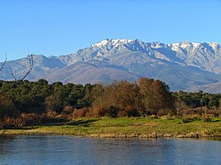
- 2 Sierra de Gredos Regional Park (Parque regional de la Sierra de Gredos) - The park extends over the granite peaks of the homonymous sierra on the border with Salamanca province and is a popular tourist destination, especially on hot summer weekends Madrid. In fact, the park offers many possibilities for excursions to pine and chestnut woods, prairies and high mountain lakes. It can also be accessed by car, with some seasonal restrictions, along the 11 km route of the AV-931 carriage road (Carretera de la Plataforma de Gredos) which starts from the Hoyos del Espino village.
- 3 Nature Reserve of the Iruelas Valley (Reserva natural del Valle de Iruelas) - Established to protect colonies of birds of prey, including the monk vulture, the reserve extends along the valleys of the Iruelas river and its tributaries, covered with elm and chestnut woods.

Castle of Arenas de San Pedro

Arevalo Castle

Castle of El Barco de Ávila

Castle of Mombeltrán

El Burguillo lake

"Hoyos del Espino" village, in the Sierra de Gredos park

Iruelas Valley


How to get
How to get around
What see
- Caves of the Eagle (Cuevas del Águila).

Events and parties
What to do
Shopping
How to have fun
Where to eat
Where stay
Safety
How to keep in touch
Around
Other projects
 Wikipedia contains an entry concerning Province of Ávila
 Commons contains images or other files on Province of Ávila