As Peninsula becomes the peninsula in the west of the San Francisco Bay Area designated. It coincides geographically with San Mateo County and borders directly on the city to the north San Francisco. The bay follows to the east and the Pacific to the west. It borders to the southeast South Bay Area (administratively Santa Clara County) and south the California central coast at. The southeastern part of the peninsula becomes the Silicon Valley counted and thus belongs to one of the economically strongest regions worldwide.
Cities


- 1 Belmont


 in the Wikidata database")
- 2 Brisbane

- 3 Burlingame
- 4 Colma
- 5 Daly City
- 6 East Palo Alto
- 7 El Granada
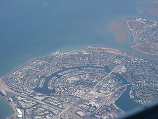
- 8 Foster City
- 9 Half Moon Bay
- 10 Hillsborough
- 11 Menlo Park
- 12 Millbrae
- 13 Moss Beach
- 14 Pacifica
- 15 Palo Alto - The renowned Stanford University is located in the suburb of Stanford; also headquarters of Hewlett-Packard, Tesla, Skype and other IT and high-tech companies
- 16 Pescadero
- 17 Portola Valley
- 18 Redwood City - The administrative headquarters of San Mateo County, as well as the headquarters of IT companies such as Oracle and Electronic Arts
- 19 San Bruno
- 20 San Carlos
- 21 San Mateo
- 22 South San Francisco
- 23 Woodside


.jpg/240px-Library_in_the_Landscape_--_The_Portola_Valley_Library_(12422097064).jpg)


The town San Francisco itself is also on the peninsula, but is usually excluded. When locals speak of “The Peninsula” they mean the area south of the city.
Other goals
background
language
getting there
mobility

One of the most convenient forms of public transport in the region is the BEARD, an S-Bahn. The yellow line runs on the Peninsula (the red line on weekdays before 9 a.m.), from Millbrae station via the airport and then the San Bruno, South San Francisco, Colma, Daly City stations to San Francisco. If you want, you can take this line - without changing - to Oakland and even up to Walnut Creek, Pleasant Hill and Concord in the East Bay Area drive.

There is also the Caltrain between San Francisco and San Jose (via San Mateo and Palo Alto through the middle of Silicon Valley). It drives at least once every hour during the day, and even more frequently during peak times. Some trains stop everywhere on the way, some only at the larger stations. From San Francisco to Palo Alto it takes between 40 minutes (“Baby Bullet”, which skips many stations) and an hour (“Local”, which stops everywhere). The Peninsula is divided into three zones in terms of tariffs: a single ticket for one zone (e.g. San Francisco – San Bruno or Millbrae – Redwood City) costs $ 3.75, two zones (e.g. San Francisco – Redwood City) 5 , $ 75 and three zones (e.g. San Francisco – Palo Alto) $ 7.75.