| Santiago de Chile | ||
 | ||
Coat of arms and flag .svg/55px-Escudo_de_Santiago_(Chile).svg.png) | ||
| State | Chile | |
|---|---|---|
| Region | Central Chile | |
| Altitude | 567 m a.s.l. | |
| Surface | 837.892 km² | |
| Inhabitants | 6.257.516 (2017 census) | |
| Name inhabitants | Santiaguino, -na | |
| Prefix tel | 56 2 | |
| POSTAL CODE | 3580000 | |
| Time zone | UTC-4 | |
| Patron | Santiago el Mayor | |
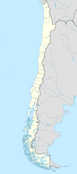
Position
| ||
| Institutional website | ||
Santiago is the capital of Chile.
To know
Despite not having the notoriety of Buenos Aires and other cities ofSouth America how Rio de Janeiro is Cusco, the capital Chilean has seen a huge increase in the number of tourists from 2010 onwards. The bulk of the visitors come from other Latin American countries but to these have been joined by others from European countries, especially from Germany. Many are transit only, heading to the Lake District or further afield Tierra del Fuego but the stay in Santiago, however short it may be, promises to be pleasant. Local authorities have invested huge sums of money in the construction of new buildings and the restoration of older ones.
Within the limits of the Greater Santiago, 174 sites of cultural interest have been reviewed as well as various areas of landscape interest. Although none of Santiago's monuments appear on the UNESCO list of World Heritage Sites, three have been proposed by the Chilean government and are awaiting approval: these are the Inca sanctuary cerro El Plomo, the church and convent of San Francisco and the La Moneda Palace. .
In June 2012, National Geographic magazine listed Santiago's central market as one of the world's top ten worth visiting, while the previous year the New York Times newspaper had mentioned Santiago as one of the best destinations of 2011.
Given its proximity to the Andes, Santiago is an important destination for winter tourism, having a number of ski resorts in its immediate surroundings. Autumn (March) is harvest time and a whole series of wineries are waiting to be visited in the Maipo river valley (Maipo Valley Wine Route).
Among the little-known surroundings of Santiago that are worth a visit, is the O'Higgins region, commonly known as "the village of Huaso" for its Creole-inspired rural culture. Pichilemu is known for having the best beaches in Chile for surfing. Other tourist sites in the O'Higgins region include the historically significant city of Rancagua, the Rio de los Cipreses nature reserve, El Teniente with the deepest copper mine in the world and the mining town of Sewell, a World Heritage Site. Humanity by UNESCO in 2006.
Geographical notes
The city is located in the center of the country.
When to go
The climate of the city of Santiago is Mediterranean with four well-defined seasons. The rains are concentrated in the winter months as well as sporadic snowfalls. The soil freezes at altitudes above 1800 m a.s.l. Any season of the year is good for a visit that depends on individual intentions:
- Santiago's summer runs from December 22nd to March 21st, when Europe is wrapped in the grip of winter frost. This simple finding alone can constitute a valid reason for a trip.
- Autumn runs from March 21st to June 21st. March is the harvest month which could be the occasion for a visit to one of the many wineries in the surrounding area.
- Winter runs from 22 June to 21 September, an ideal period for skiing and other winter sports in one of the numerous equipped centers east of the center.
- Spring is the time of flowering and for outdoor activities such as hiking in the mountains or going up rivers by canoe.
Background
The presence in the region of nomadic groups dedicated to hunting and collecting wild fruits is attested since the 10th millennium BC. while in the ninth century A.D. the first sedentary settlements along the banks of the Mapocho River date back. These tribes, known by the name of promaucaes, lived from the cultivation of corn, potatoes and beans and were subdued by the Incas at the end of the 15th century.

The first European to arrive in the Mapocho valley was Pedro de Valdivia, sent by Francisco Pizarro to explore the territories south of Cuzco. Pedro de Valdivia camped with his troops on the banks of the river, at the foot of the Tupahue hill and after establishing contacts with the local tribes he formally founded the city of "Santiago del Nuevo Extremo" on February 12, 1541. The name was given in honor of the apostle St. James, patron saint of Spain and the hill of Huelén was renamed by the conqueror "hill of Santa Lucía" (Cerro Santa Lucía). Valdivia designed the city as a chessboard in the center of which stood the Plaza Mayor and around the cathedral, the prison and the governor's house. The external lots were assigned to settlers who built temporary thatched-roof houses.
Months later, Valdivia left with his soldiers to continue the exploration of the southern lands of the new world. On 11 September 1541 Santiago was attacked by the natives who were rejected by the garrison commanded by Inés de Suárez, the companion of Valdivia left to garrison the city.
In addition to the incursions of the natives, Santiago suffered from a series of epidemics and natural disasters, earthquakes and floods above all but the settlement of Pedro de Valdivia managed to survive. In 1558, of the 126 plots planned, forty were already occupied, while large companies dedicated to livestock farming had established themselves in the surrounding area. In 1561 the construction of the cathedral began, the first stone building followed in 1572 by the church of San Francisco.
Major urban planning works date back to the 18th century, such as the Calicanto bridge and the construction of embankments to prevent the Mapocho from overflowing. In 1780, Governor Agustín de Jáuregui hired the Italian architect Joaquín Toesca, who designed the Palacio de La Moneda and the San Carlos canal. In 1798 the way was opened for Valparaíso, the main port of the country.
On 18 September 1810 the first junta of the national government was proclaimed in Santiago, an act that marked the beginning of the independence process of the Chile which ended on April 5, 1818 with the defeat of the Spanish troops in the battle of the Maipú river.
At the end of the war, Bernardo O'Higgins took over as the first dictator of the new Chilean state. Below him, the General Cemetery and the San Carlos Canal were inaugurated. The southern stretch of the Mapocho River, known as La Cañada was channeled underground and transformed into a tree-lined avenue with the name of Alameda de las Delicias.
Two new earthquakes struck the city: one on November 19, 1822 and the other on February 20, 1835. These two events, however, did not prevent the city from continuing to grow rapidly: in 1820 Santiago had 46,000 inhabitants and in the 1865 census of 115,337 inhabitants.
During the so-called Conservative Republic, various institutions were created, mainly of an educational nature such as the University of Chile and the Quinta Normal de Agricultura. In 1851 the first telegraphy system was established with Valparaíso. The date of December 8, 1863 marked the tragic fire of the Iglesia de la Compañía in which more than 2000 people died.
The first railway arrived in the city on September 14, 1857 and in 1884 Santiago Central Station was inaugurated. A thousand private vehicles circulated on the streets of Santiago in those years and 45,000 people used the tram for their daily commutes. The first telephones appeared in the 1880s, and over the next ten years, more than 1,200 telephone lines were assigned.
At the end of the 19th century, a system of sewers and rainwater collection was created to prevent flooding in the center. For the same reason, the canalization works of the Mapocho river were started with the consequent demolition of the Calicanto bridge on 10 August 1888. At that time Santiago had a population of about 256,000 inhabitants.
At the beginning of the 21st century Santiago surpassed in importance Valparaíso, until then the largest economic center in the country. Already in 1895, 75% of the national manufacturing industry was centralized in the capital. Beginning in 1910, major banks and commercial enterprises moved their headquarters to the capital.
In 1903 it was installed on the hill (Turkey oak) San Cristóbal the astronomical observatory and the following year the first stone of the statue of the Madonna, 14 meters high, was placed on the top of the hill.
The 1920 census showed that Santiago's population had risen to 507,296, marking an increase of 52.47% over the previous 1907 census. This growth was mainly due to the arrival of peasants from the south, who came to work in factories and in the opening of new railway sections.
In those years the city center lost its residential character to become a financial and administrative district. Numerous modernist buildings were erected along Via Ahumada to house ministries and other public offices. Back then still rural areas such as Providencia and Ñuñoa were transformed into residential neighborhoods for upper-middle-class families.
The Great Depression of 1929 caused the collapse of the nitrate mining industry in northern Chile and the fall of agricultural exports totaling nearly 300,000 unemployed nationwide. These, for the most part, saw the big city and its booming industry as the only chance for survival. Many migrants arrived in the city with nothing and thousands had to survive on the streets due to the impossibility of renting a room. The spread of disease and tuberculosis caused the deaths of hundreds of homeless people. Unemployment and the cost of living rose significantly while the wages of the employed were cut by half.
The situation changed only a decade later thanks to the boom of state industries due to the launch in 1939 of the CORFO project (Corporación de Fomento de la Producción). Santiago expanded like wildfire and the population went from 952,075 inhabitants in 1940 to 1,907,378 in the 1960 census. The low-income classes illegally occupied plots of land in the suburbs while the affluent classes built villas on the slopes of the Las hills. Condes. The center continued to lose inhabitants to the benefit of commercial, banking and government activities.
Widespread unauthorized use was contrasted with the promotion of social housing and the launch of regulatory plans. The 1962 World Cup football championship provided the opportunity for the opening of large avenues such as the Avenida Circunvalación Américo Vespucio and for the expansion of existing ones.
In 1966 the Parque Metropolitano was set up on the hill of San Cristóbal and in 1967 the new international airport of Pudahuel was inaugurated. Two years later, work began on the subway whose first line was opened to the public in 1975.
After the 1973 coup d'état and the establishment of the military dictatorship, urban planning adopted a neoliberal economic model, marking the definitive disengagement of the state and the end of public housing. The violent earthquake of March 3, 1985 caused the collapse of the older buildings.
By 1990 Santiago had over four million inhabitants, most of whom lived in the southern suburbs: Florida had the highest population density followed by the neighboring neighborhoods of Puente Alto and Maipú. Several high-income families moved from the Providencia area to the Barrio Alto and the municipalities of La Reina, Las Condes, Vitacura and Lo Barnechea. Despite the decline in poverty in the last decade of the twentieth century, the strong dichotomy between the upper middle class neighborhoods of the east and north and the slums scattered throughout the city remained.
As a result of the relocation of high-income families, the Providencia area suffered the same fate as the center, becoming a commercial area.
The old colonial-era center had to be reinvented to escape the degradation caused by the escape of its inhabitants. Its main avenues were transformed into pedestrian areas, many old buildings were renovated and incentives were proposed for those who wanted to move back to the center. Thanks to these policies the old barrio Brazil attracted a population of young age.
At the beginning of the second millennium Santiago was faced with a series of problems generated by disorderly growth, including record-breaking air pollution in the winter months. The metro network was significantly expanded in order to limit the circulation of private vehicles.
The strong earthquake of February 27, 2010 generated a heated debate on the effective application of the anti-seismic standards. In 2014, the Costanera center was inaugurated, a group of skyscrapers among the tallest in the southern hemisphere.
How to orient yourself

Heart of the center is the Plaza de Armas, at the metro stop of the same name. The square is surrounded by the cathedral, the central post office, once the seat of the governor and the Palacio de la Real Audiencia which now houses the Histórico Nacional museum.
Another important square in the center is Plaza de la Ciudadanía, 1 km further south and at the "La Moneda" metro stop. The square is dominated by the Palacio de La Moneda, the residence of the president of the Chilean republic.
Plaza de la Ciudadanía is crossed by the Alameda, the main avenue in the center whose official name is "Avenida Libertador Bernardo O’Higgins". It is an avenue with heavy car traffic and walking through it is not pleasant.
Districts
Santiago is made up of 32 municipalities but there are few with tourist interest. The neighborhoods where to choose the hotel are Providencia and Las Condes, both located north-east of the center and alternatively Sanhattan, the business district of Santiago. Choosing a hotel in the colonial center might not be a very good idea.
How to get
By plane

- 1 Comodoro Arturo Merino Benítez International Airport. The terminal building is spread over four levels:
- Ground floor: arrivals, duty-free shop, baggage claim, customs and border control, transport services, parking areas, access to the hotel.
- First floor: administrative offices, VIP rooms (access from the second floor).
- Second floor: departures, check-in areas, border control police, duty-free shops, restaurants, boarding halls and gates.
- Third floor: restaurants and VIP check-in areas (LATAM).
- In the terminal there are also bank branches and offices of mobile phone companies (Claro, Movistar and Entel PCS) as well as pharmacies, travel agencies, insurance offices and a police station (Carabineros de Chile).
- Air France, British Airways, Iberia, KLM fly from Paris-Charles de Gaulle, London- Heathrow, Madrid-Barajas and Amsterdam-Schipol respectively.
- Airlines LATAM Chile they handle the largest number of domestic and international flights including one to Madrid.
- Company buses Centropuerto they connect the airport with the Los Héroes metro station. Their frequency is every 10 minutes on weekdays and 15 minutes on weekends.
- Turbus offers a similar service with terminus at the Alameda terminal.
- Buses from both bus lines make an intermediate stop at Pajaritos metro station at the long-distance bus terminus.
- There are two taxi companies authorized to enter the airport: Taxi Oficial and Taxi Vip.


By bus

Buses to some nearby cities like Valparaiso or Viña del Mar they have a frequency of 15 minutes during the day. The price of the tickets varies according to the demand and the type of seat (normal seat, semi-bed or bed). The buses are generally clean and comfortable but the onboard toilets leave something to be desired. There are several bus terminals in the city, the largest of which is Terminal Santiago.
Although it lasts 8 hours, the overland trip from Santiago to is recommended Mendoza (Argentina) and vice versa as you pass through a panoramic road that crosses the Andes. The border post is located at a mountain pass at an altitude of approximately 2,800 m. Fruit, vegetables and food products are not allowed on board; all baggage will be checked at the border. One-way fares are often cheaper if you book early and in the low season.
You can also rely on other international rides for San Juan is File. Santiago has more than one long-distance bus terminus:
- 2 Santiago Terminal (Estación Central, formerly Terminal Sur), Avda. Lib. Bernardo O'Higgins 3850, Alameda 3848, (Universidad de Santiago metro station on line 1), ☎ 56-2-23761750, 56 2 23761755. The terminal can be overly crowded on the eve of national holidays such as Christmas or Easter. Inside it has dining options including a McDonald's. While not having a reputation for dangerousness, it is necessary to exercise caution by avoiding, for example, consulting your smartphone in a crowd.

- 3 Alameda Terminal, Avda. Lib. Bernardo O'Higgins 3750 (Universidad de Santiago and Estación Central metro stations on line 1), ☎ 56-2-22707425, 56 2 27762424. Company buses terminate there Turbus is Coach Bus for various domestic and international destinations. A hotel and small shops are nearby.
- 4 Terrapuerto Los Héroes, Tucapel Jiménez 21 (Los Héroes Metro Station [Line 1]), ☎ 56-2-24239530, 56 2 24200099. It serves as a terminus for bus lines Cruz del Sur covering various destinations in the Patagonia argentina and the Tierra del Fuego (Punta Arenas). Other bus lines for Mendoza (Argentina) and destinations north of Santiago
- 5 San Borja Terminal, San Borja 184 (Metro Estación Central), ☎ 56-2-27760645. Buses from coastal towns and northern Chile terminate here.
- 6 Pajaritos Terminal (Pajaritos metro station). Bus terminal from the international airport, Valparaíso and Viña del Mar.
How to get around
By public transport
There are four types of public transport in Santiago: taxis, shared taxis, metro and buses.
Underground
The metro currently has 5 lines and 2 are under construction, 103 km long and 108 stations. Lines 1, 2 and 5 pass through Santiago while lines 4 and 4A surround it to the southeast. The metro is the most used and fastest way to get around, even if at peak times it is very congested, especially in the center. To use it you need to buy a card beep! worth $ 1500 on which you can load a minimum of $ 1000.
Bus
The bus system is called Transantiago and is integrated with the metro, works with the card beep!. The buses, called "micro", cover the whole territory of Santiago.
By taxi
Taxis are black with a yellow roof, the base price is $ 250 plus $ 200 per 100 meters. "colectivos", they usually work on a predetermined route and leave when they are full. Fares vary from route to route.
What see
Civil architectures
- 1 Bolsa de Comercio (Center).
- 2 Casa Colorada (Center). Museo de Santiago
- 3 Centro Cultural Palacio de La Moneda, Plaza de la Ciudadanía (Center).
- 4 National Library (Center).
- 5 Palacio Cousiño (Center).
- 6 Costanera Center (Providencia). A real estate complex that includes the Gran Torre Santiago and three other skyscrapers inside which there are two luxury hotels and a large shopping center, as well as several offices. The tallest of the four buildings is the Torre Costanera, (or Gran Torre Santiago) designed by architect César Pelli
- At 2020 Gran Torre Santiago was with its 300 m. the tallest building in Latin America and the second tallest in the Southern Hemisphere after Q1 on the Gold Coast, Queensland (322 meters).
- On 11 August 2015, an observation deck on the 61st floor, the "Sky Costanera", was opened to the public, offering a 360 ° view of Santiago.
Religious architectures
- 7 Catedral Metropolitana (Center). Museo de Arte Sagrado
- 8 Iglesia, Convento y Museo de San Francisco (Center).
- 9 Basilica de la Merced (Center).
Museums
- 10 Museo de la Memoria y de los Derechos Humanos, Avenida Matucana 501 (Line 5 Quinta Normal metro stop).
 free. Museum that tells about the Pinochet dictatorship and the crimes committed. Really recommended for the quality of the information. It also hosts exhibitions related to human rights.
- 11 Museo Nacional de Historia Natural, Parque Quinta Normal (Quinta Normal metro line 5 stop).
- 12 [link not working]National History Museum, Plaza de Armas 951 (Center).
 Tue-Sun 10:00 - 17:30.
- 13 Museo de Arte Contemporáneo de Santiago (Metro stop: Bellas Artes).
- 14 Museo de la Solidaridad Salvador Allende, Av. República 475.
Parks and gardens
- 15 Cerro Santa Lucía (Center).
- 16 Cerro San Cristobal (Providencia).
- 17 La Chascona (Providencia).
Events and parties
- Festival Internacional Santiago at Mil. January.
- International Providencia Jazz Festival. January.
- International Film Festival. August.
- International Book Fair. October December.
What to do

- 1 Fantasy land, Avenida Beaucheff 938.
Shopping

Traditional markets
- 1 Mercado Central de Santiago (500 m north of Plaza de Armas. Metro stop: Puente Cal y Canto).
Shopping centers
- 2 Alto Las Condes, Avenida Presidente Kennedy, 9001. The largest shopping center in Santiago
- 3 [link not working]Pueblito de Los Dominicos artesanal center, Calle Apoquindo, 9085 (Los Dominicos Metro Station.). If you are looking for a souvenir to take home, you can go to the Centro Artesanales Pueblito inside the Los Dominicos park, also in the Las Condes area. The shops are housed in a reconstructed colonial-era village and display traditional clothing such as ponchos and antiques.
On the central Alameda avenue, at the height of Cerro Santa Lucía, there is an open-air market whose stalls display all kinds of trinkets. The market is known as Feria Santa Lucía.
How to have fun
Shows
- 1 Caupolicán Theater, San Diego 850, ☎ 56 2 2699 1556.
- 2 Municipal Theater of Santiago, Agustinas 794, ☎ 56 2 2463 1000. The most prestigious theater in Santiago, home to the ballet company. The repertoire also includes operas.
- 3 Cariola Theater, San Diego 246, ☎ 56 2 2696 7101.
- 4 Coliseo Theater, Nataniel Cox 59, ☎ 56 9 6877 7430.
- 6 Centro Cultural Matucana 100, Matucana 100, ☎ 56 2 2964 9240. Wed-Sun 11: 00-21: 00.
- 7 National Stadium (Estadio Nacional), Av. Greece 2001 (Ñuñoa).
Night clubs
- 8 La Batuta, Jorge Washington 52 (Ñuñoa), ☎ 56 2 2274 7096. Disco / concert hall for the exclusive use of university students.
- 9 The Jazz Corner, Isabel 0451 (Providencia / Barrio Italy), ☎ 56 2 2274 9941. Tue-Sun 11: 00–01: 30.
- 10 Blondie, Av Libertador Bernardo O'Higgins 2879 (Metro station: "Unión Latino Americana"), ☎ 56 9 4137 7529. Thu-Sat 23: 00-05: 00. As of 2020 the most renowned and largest gay / underground club in Santiago.
- 11 Fausto Discotheque, Av. Sta. María 832 (Providencia), ☎ 56 2 2777 1041. Gay club.
- Nueva Cero Discotheque, Euclides 1204, ☎ 56 2 2551 7298. Fri-Sun 00: 00-05: 00.
Where to eat
Where stay
Safety
How to keep in touch
Around
- NORTH
- 7 Colina (Chile) —
- EAST


- 8 El Colorado —
- 9 Farellones —
- 10 Valle Nevado (46 km) -
- 11 La Parva —
- SOUTH
- 12 Pirque - First stop on a wine itinerary that winds through the Maipo river valley (Maipo Valley Wine Route).
- 13 Cajón del Maipo —
- 14 Baños Morales —
- WEST
- 15 Pomaire —
Other projects
 Wikipedia contains an entry concerning Santiago de Chile
 Commons contains images or other files on Santiago de Chile
 Wikiquote contains quotes from or about Santiago de Chile