| Trujillo (state) | |
 | |
Location 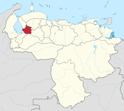 | |
Coat of arms and flag  | |
| State | Venezuela |
|---|---|
| Capital | Trujillo |
| Surface | 7,400 km² |
| Inhabitants | 807.988 (2015 census) |
| [link not working]Institutional website | |
Trujillo is one of the federated states of the Venezuelan Andes in Venezuela.
To know
Geographical notes
It is mostly occupied by the Cordillera di Mérida, which is part of the Andes chain, although it has a fairly extensive flat area in the west overlooking Lake Maracaibo. The highest peak in the state is the Teta de Niquitao, located at 4.006 m.
When to go
The climate, closely related to altitude, reaches an annual average of 30 ° C in the Santa Apolonia area, to drop below 10 ° C in the high mountain areas, located above 3,000 meters. The most densely populated areas, generally located between 500 and 1,800 m a.s.l. have average annual temperatures between 15 ° C and 25 ° C.
Background
The Spaniards began to permanently occupy the region around the middle of the sixteenth century, gradually mixing with the indigenous peoples. In 1557 the city of Trujillo was founded, a base for the creation of new urban centers and rural settlements in the area.
Territories and tourist destinations

Urban centers
- Trujillo (Trujillo de Nuestra Señora de la Paz) - Capital of the Federated State of Trujillo.
- Boconó - Second city of the state.
- La Quebrada - Located in a beautiful mountainous area.
- Mount Carmel - In the mid-1600s it was the administrative seat of the crown Spanish.
- Valera - About 33 km from Trujillo.
Other destinations
How to get
How to get around
What see
What to do
At the table
Safety
Other projects
 Wikipedia contains an entry concerning Trujillo (state)
 Commons contains images or other files on Trujillo (state)