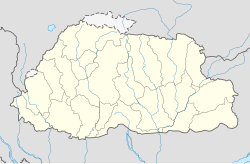
| Wamrong | ||
 | ||
| State | Bhutan | |
|---|---|---|
| Altitude | 1,439 m a.s.l. | |
| Inhabitants | 416 (2012 estimate) | |
| Prefix tel | 975 | |
| POSTAL CODE | 42004 | |
| Time zone | UTC 6 | |
Position
| ||
Wamrong is a village of the Eastern Bhutan.
To know
Geographical notes
The village is located on a ridge in the district of Trashigang overlooking Samdrup Jongkhar, and is well positioned between these two cities.
The terrain around Wamrong is mountainous and the highest point nearby is 1,935 meters above sea level, 1.3 km southeast of Wamrong.
In the surroundings of Wamrong mainly mixed forest grows.
When to go
| Climate | gen | Feb | mar | apr | mag | down | Jul | needle | set | Oct | nov | dec |
|---|---|---|---|---|---|---|---|---|---|---|---|---|
| Maximum (° C) | 10 | 12 | 15 | 17 | 17 | 18 | 16 | 14 | 15 | 16 | 14 | 11 |
| Minimum (° C) | 2 | 4 | 5 | 5 | 8 | 11 | 7 | 6 | 9 | 10 | 6 | 5 |
| Precipitation (mm) | 5 | 20 | 37 | 126 | 191 | 324 | 265 | 246 | 277 | 111 | 2 | 2 |
The climate in the area is humid and subtropical. The average annual temperature in the neighborhood is 11 ° C. The hottest month is June, when the average temperature is 14 ° C and the coldest is January at 6 ° C. Average annual rainfall is 1,606 millimeters. The wettest month is June, with an average of 324 mm of rain and the driest month is November, with rainfall of around 2 mm.
How to orient yourself
How to get
By bus
All buses that depart from Mongar is Trashigang traveling to Samdrup Jongkhar make a stop in Wamrong.
How to get around
What see
- Panoramas. Like the enchanting view down the mountains to the plain of the State of Assam.
Events and parties
What to do
Shopping
How to have fun
Where to eat
The village has developed an excellent reputation for good inexpensive food.
Average prices
- Dechen Wangdi. It is considered to be one of the best restaurants in the village.
Where stay
Safety
How to keep in touch
Around
- Pemagatshel - The closest major community located 16.5km west of Wamrong.

