| Saaremaa ((sv)Ösel) | |
 | |
| Information | |
| Country | |
|---|---|
| Region | West Estonia and islands |
| Regional capital | Kuressaare |
| Area | 2 673 km² |
| Population | 36 000 hab. |
| Density | 13,47 inhab./km² |
| Spindle | UTC 02:00 |
| Location | |
 58 ° 15 ′ 0 ″ N 22 ° 31 ′ 59 ″ E | |
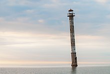
| Touristic site | |
Saaremaa Island is an island ofEstonia.
Understand
Saaremaa is the largest island inEstonia with its area of 2 673 km2.
Cities
- 1 Kuressaare – The only town on the island, there is a very well preserved castle dating from the 13th century.e century which houses a museum on the history of the island. It is also a spa town that has many spas, the downtown area is rich with many shops and restaurants.
Other destinations
To go
By car
The main access to the island is via the ferry connecting Virtsu on the mainland to Muhu Island. Since Tallinn first take route 4 (![]() ) towards Pärnu during about 20 km then take route 9 (
) towards Pärnu during about 20 km then take route 9 (![]() ) in the direction of Haapsalu and finally take route 10 (
) in the direction of Haapsalu and finally take route 10 (![]() ) to Virtsu. Since Pärnu take route 60 (
) to Virtsu. Since Pärnu take route 60 (![]() ) in a northwesterly direction and then when this road joins route 10 (
) in a northwesterly direction and then when this road joins route 10 (![]() ) go left towards Virtsu. From this village a ferry reached themuhu island. Route 10 (
) go left towards Virtsu. From this village a ferry reached themuhu island. Route 10 (![]() ) resumes, it crosses the island, then takes a bridge 2,5 km to the island of Saaremaa, following it to the end we reach Kuressaare.
) resumes, it crosses the island, then takes a bridge 2,5 km to the island of Saaremaa, following it to the end we reach Kuressaare.
On a boat
There are connections in ferries with the islands of Hiiumaa, of Ruhnu and of Vilsandi.
By plane
- Kuressaare Airport – Ensures regular connections with Tallinn. It is also the best airport to travel to Ruhnu, an Estonian island in the Gulf of Riga.
By bus
Circulate
By car
By bus
By bike
To see