| North Carolina | |
 | |
Location 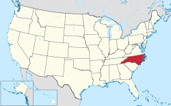 | |
Flag | |
| State | United States of America |
|---|---|
| Region | South |
| Capital | Raleigh |
| Surface | 139,390 km² |
| Inhabitants | 10.042.802 (2015 estimate), 9.535.483 (2010 census) |
| Tourism site | |
| Institutional website | |
North Carolina it is a federated state USA in the region of Southern United States of America.
To know
North Carolina is one of thirteen native states of the United States of America. In its territory there are four national forest parks (Pisgah, Croatan, Nantahala and Uwharrie) administered by the "United States Forest Service"(section of"United States Department of Agriculture").
Geographical notes
Geographically it is located between the Atlantic and the Appalachian Mountains, including part of the Blue Ridge Mountains.
North Carolina is bordered to the south by South Carolina and the Georgia, to the west with the Tennessee and to the north with the Virginia.
Background
It was explored by Giovanni da Verrazzano in 1524 and was then colonized by Walter Raleigh from whom the capital city took its name. Become a colony English (Province of Carolina), was named after King Charles II ofEngland in memory and honor of his father Charles I, beheaded on January 30, 1649 at the end of the English civil war. It was first ruled by eight landowners (1663-1729) and later became a crown colony by the king's governors (1729-1776).
In 1730 it was divided by the southern part. In the province of North Carolina there were frequent rebellions due to the taxes imposed by London and its protectionist policy. Allied with the other colonies, it fought for independence and entered the Union of United States of America as 12th State on May 29, 1789.
In 1784 with the cession of some western territories, the counties of Washington, Sullivan, Greene (now belonging to the Tennessee) formed an independent state, called the "State of Franklin" (State of Franklin). Capital of the new state and of the assembly was the town of Greenville in 1785. However, the state was never recognized by the US Congress, in 1788 it was dissolved and the counties became part of North Carolina again.
In 1861, when the Civil War began, North Carolina left the United States and became part of the Confederation, with which the war continued.
Territories and tourist destinations

Urban centers
- Raleigh - Capital of the Federated State of North Carolina.
- Asheville
- Chapel Hill
- Charlotte - The largest city in the federal state.
- Durham
- Greensboro
- New Bern
- Wilmington
- Winston-Salem
Other destinations
- Blue Ridge Parkway
- Great Smoky Mountains National Park
How to get
How to get around
What see
What to do
At the table
Safety
Other projects
 Wikipedia contains an entry concerning North Carolina
 Commons contains images or other files on North Carolina