The Julier Pass leads from Tiefencastel in the GraubündenOberhalbstein to Silvaplana in the Upper Engadine and is the most important winter-safe road connection to the Engadine.
background


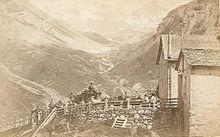
The Julier Pass, ital. Passo del Giulia resp. Romansh Pass digl Gelgia leads from the Graubünden region Oberhalbstein resp. the Albula valley into the Upper Engadine. The transalpine north-south connection was already used as an alpine crossing in Roman times due to its favorable topography. The most difficult route is not the actual Julier Pass, but the Crap Ses gorge between Tiefencastel and Savogninthat was about in Roman times Mon and Salouf was circumvented. From Roman times, fragments of columns and cart tracks were found on the Julier Pass height, which indicate that the pass was already used by carts. Ruins of a Roman horse changing station were excavated near Riom.
In the Middle Ages the importance of the Julier Pass declined, as it was still the after arrival in the Engadin Malojapass down into Bergell and in the direction of Italy. The route over the Septimer pass directly into Bergell was given preference.
The critical point in the Crap Ses Gorge, in which the path ran near the Julia River, was secured by blasting rocks in 1777. In 1820, the canton of Graubünden commissioned a new road over the Julier Pass, terrain levels are overcome by serpentines, the sections in between were structurally less demanding and less prone to avalanches. The street was renewed around 1930. A project of an electric railway launched around 1910 Lenzerheide and Tiefencastel over the Julier Pass into the Engadine was never realized.
Since 1990 the pass road has been renewed in large sections, the critical point near the gorge 1 Crap Ses was bypassed by a 700 m long tunnel. In 2016, Silvaplana was relieved of through traffic with a bypass and the flow of traffic improved.
Regions


The Julier Pass connects the Oberhalbstein region with the Upper Engadin and further over the Malojapass to Chiavenna and Lake Como; it forms the watershed between the river basins of the Rhine (the Albula flows into the Hinterrhein) and the Inn, which ultimately drains east into the Danube.
language
North of the pass, Romansh resp. Spoken Bündnerdeutsch (Surmeirisch), Putèr in the south, also a Rhaeto-Romanic dialect.
getting there
From Chur if you take the highway ![]() and at the end of the autobahn turns south in the direction of San Bernardino Pass from. From Thusis you take the street 417 to Tiefencastel and drives from there on on the Julier Pass road
and at the end of the autobahn turns south in the direction of San Bernardino Pass from. From Thusis you take the street 417 to Tiefencastel and drives from there on on the Julier Pass road![]() . The sufficiently wide road is largely built to be winter-proof; in the event of a massive onset of winter there may be short-term closures, the corresponding information on the Website of the Bündner Tiefbauamt must be taken into account.
. The sufficiently wide road is largely built to be winter-proof; in the event of a massive onset of winter there may be short-term closures, the corresponding information on the Website of the Bündner Tiefbauamt must be taken into account.
The Julier Pass ends in the south at Silvaplana, the main road runs to the south ![]() continue about the Malojapass ins Bergell and to Italy, to the northeast the main road
continue about the Malojapass ins Bergell and to Italy, to the northeast the main road ![]() to St. Moritz and through Engadine.
to St. Moritz and through Engadine.
mobility
The Julier Pass road is well developed and relatively easy to drive on; As everywhere in Graubünden, other road users appreciate it when trucks, mobile homes and caravan teams briefly turn up at passing points and let the columns that have formed behind them drive past. In winter, winter equipment, winter tires and, depending on the snow situation, snow chains are mandatory.
Public transport over the Julier Pass is made by the Postbuses of the line Chur - Tiefencastel - St. Moritz ensured for the entire route Chur A reservation is necessary, but not for short sections.
Tourist Attractions
- at the top of the mountain lake 1 Lej da las Culuonnasthat can be circled on a walking path.
activities
.jpg/220px-Julierpass_-_panoramio_(6).jpg)
In summer
- Walk around the Lej da las Culuonnas
- past the 1 Leg Grevasalvas and over the pass 2 Fuorcla Grevasalvas to Grevasalvas in the Upper Engadine (near Maloja).
- on foot from Bivio on the 3 Septimer pass to Casaccia im Bergell
In the winter
- The 4 Bivio ski area includes 3 lifts and around 30 kilometers of slopes.
| Surname | phone | Altitude | Σ | ||||||
|---|---|---|---|---|---|---|---|---|---|
| Bivio ski area | 41 (0)81 684 52 33 | 1,769 - 2,560 m | — | — | 3 | 12 | 15 | 3 | 30 km |
kitchen
- 1 Ristorante Ospizio La Veduta, Julier Pass, 7513 Surses. Tel.: 41 (0)81 828 96 77. The inn with simple guest rooms is located a little north of the Julier Pass.
climate
In the winter months, winter equipment (snow chains or all-wheel drive) is often compulsory, and if there is heavy snowfall, the pass is included Winter closure occupied, the website of the Bündner Civil engineering office informs about the road conditions.