| ||
| Santa Lucía de Tirajana | ||
| region | Canary Islands | |
|---|---|---|
| Residents | 74.602 (2020) | |
| height | 680 m | |
| no tourist info on Wikidata: | ||
| location | ||
| ||
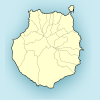
Santa Lucía de Tirajana is a municipality on the island Gran Canaria. The old town center is in the central mountainous area of the island. The districts belong to the municipality Vecindario, Cruce de Sardina and Doctoral and are located southeast of it on the motorway.
background
If you are from the Gran Canaria Airport south to the resorts around Maspalomas is on the way, you would like to turn around and fly back. Ugly-gray greenhouses, in which tomatoes are likely to ripen, apparently endlessly long warehouses, boring commercial estates, in between rows of unattractive wind turbines and power pylons, barren rocky landscape, that's not how you imagine a holiday island. And yet some tourists are drawn to this area. The reason for this lies in the trade wind, which turns the wind turbines, and which has made a world-class surfing area possible on the municipality's coast: Pozo Izquierdo. And on closer inspection you can still find one or the other attraction in this municipality, which is more shaped by trade and commerce than tourism.
getting there
By plane
From Gran Canaria Airport it is about 12 km after Doctoral, the mountain village of Santa Lucía is then 20 km inland.
In the street
The community is on the GC-65that at Cruce de Sardina from the highway GC-1 branches off into the mountains.
By boat
mobility
Tourist Attractions
- Fortaleza de Ansite or Fortaleza Grande, cave dwellings and tombs of the old Canary Islands. This is where the last battle of the Guanches against the Spaniards instead of the king Doramas would rather die with his warriors than submit.
activities
- surfing: Pozo Izquierdo beach is world famous. World Cup races are also held here.
shop
kitchen
nightlife
accommodation
health
Practical advice
Tourist information: Avda. de Canarias, Plaza de la Era, s / n. E-35110 Vecindario. Tel. 928 125 260