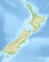
| location | ||
The Tongariro National Park is a volcanic area in the heart of the North Island New Zealand.
background
Tongariro National Park is New Zealand's oldest national park. In 1887 the Maori chief gave a gift Te hayay Tukino IVwho saw this land, sacred for Maori, threatened, the state of New Zealand around the volcanoes with the condition to protect them from settlement or destruction. Today the Tongariro National Park is a UNESCO World Heritage Site due to its cultural significance for the Maoris and the unique characteristics of the volcanic landscape. The core of the national park are the three volcanoes Mt Ruapehu (2797 meters), Mt Tongariro (1967 meters) and Mt Ngauruhoe (2287 meters). On the east side of the volcanoes the lava and rubble stretches out Rangipo desert. The last eruptions of the volcanoes are not far back in 1995 and the erupted in 1996 Mt Ruapehu and spit out a cloud of ash and dust 12 kilometers high. At that time people were not harmed (apart from a shortening of the ski season).
Incidentally, there were also some scenes in the film Lord of the rings shot in the national park. North of the Mt Tongariro originated the "Plains of Gorgoroth", the Mt Ngauruhoe was built in as a mountain of fate and around the Mt Ruapehu scenes from "Mordor" and "Emyn Muil" were created on the north side and "Ithilien" on the south side.
getting there
The national park is located south of the lake Taupo and just over 100 kilometers north of Wanganui. There are bus connections to the hiking trails from all the surrounding towns, but also from more distant towns such as Taupo. The connections are given by the New Zealand State Highways 46 and 47.
Cities
- Turangi
- Ohakune
- Whakapapa
Hiking trails
Note!

When hiking in the national park, please note that you go into the mountains and reach heights of over 2,000 meters. The weather can always change quickly here and even in summer you have to be prepared for all possible weather conditions. Good shoes and wind-repellent, warm, rainproof clothing are strongly recommended. If visibility is poor and the wind is strong, you should also think about turning back. Water is only available at individual huts. Take plenty of water with you, especially in summer. The water from the rivers and lakes in the park is not drinkable due to the high mineral content. In any case, a sufficient amount of sun protection should also be considered, especially in summer. And last but not least, you should always be aware that you are on land that is sacred to the Maori and should behave accordingly. Climbing several peaks, such as Mt. Ngauruhoe, has therefore been prohibited since 2018.
Tongariro Alpine Crossing
This is the most popular and well-known route in the national park. It is 19.4 km long, takes 6-8 hours and is no Circular hiking trail. The Tongariro Crossing is sometimes very steep and a certain level of fitness and a head for heights are essential. When crossing, depending on the direction in which you walk, you will have to climb 800 or 1200 meters in altitude.
The starting points of the trail are the Mangatepopo hat in the east or the Ketetahi Road in the north of the park. There are car parking spaces at the starting points, but unfortunately cars are broken into here more often. Under no circumstances should you leave valuables in the car or, better still, take a bus shuttle in one of the surrounding cities. This also solves another problem, because although the hiking trail is only 19.4 kilometers long, the endpoints are more than an hour's drive apart. Hitchhiking is difficult here, so you need two cars for a private solution. Many bus companies have adapted to this and offer trips to one of the starting points early in the morning and pick up the tourists at the other end in the late afternoon. If you arrive with your own car, you can also take a bus from one of the parking spaces to the other. In addition, some resourceful Maori also offer transport with their private cars and are more flexible than the organized buses. The price is a matter of negotiation.
Most of the hikers of the Tongariro Crossing prefer the route from east to north, as there is about 400 meters less to climb. The description of the stages follows this direction:
- Mangatepopo Valley to Soda Springs 1 to 1 1/2 hours, 300 meters in altitude
- Soda Springs to the South Crater 40 minutes to 1 hour, 250 meters in altitude
- South Crater to the Red Crater 1 hour, 250 meters in altitude
- Red Crater to the Emerald Lakes 10 to 20 minutes, 200 meters in altitude
- Emerald Lakes to Ketetahi Hut 1 to 1 1/2 hours, 400 meters in altitude
- Ketetahi Hut to Ketetahi Road Parking Lot 2 hours 600 meters in altitude
Tongariro Northern Circuit
Ruapehu Crater Rim Walk
Round The Mountain Track
activities
- To ski
- Rafting
- The Tongariro River can be rafted
- fishing

