 View from Durie Hill to Wanganui | ||
| Wanganui | ||
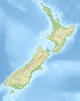
| region | Manawatu-Wanganui | |
|---|---|---|
| Residents | 39.400 (2018), 39.720 (2018), 42.200 (2020) | |
| no tourist info on Wikidata: | ||
| location | ||
| ||
Wanganui is a city in the region Manawatu-Wanganui.
background
The city is near the mouth of the river Whanganui in the Tasman Sea. The spelling of the names of the city and the river was the same until 1992, when the name of the river was changed to the native Maori tribe at the request of the local Maori tribe Iwi renamed because he considered one for her Tapu applies. In the meantime there is also a discussion about changing the name of the city. Most of the city is on the right bank of the Whanganui.
getting there
By plane
South of the city is a regional airport, IATA code WAG, he's going out Auckland and Wellington approached.
By train
The nearest train station is in Marton, about 40 km away. The "Northern Explorer", which connects Auckland with Wellington, stops in Marton. The "Northern Explorer" sails Monday, Thursday and Saturday from Auckland to Wellington, Tuesday, Friday and Sunday from Wellington to Auckland, each with a stop in Marton.
By bus
Several bus connections daily in all directions. The InterCity line has its stop at 156 Ridgeway St. at its travel center.
In the street
The city is on SH 3that of Palmerston North comes and continues after New Plymouth goes. That goes from Wanganui SH 4 in a northerly direction over Raetihi and the Tongariro National Park to Hamilton.
By boat
mobility

The city center can be explored on foot.
Tourist Attractions

- Victoria Avenue. It is the main street in the city and comes from the City Bridge. One section is traffic-calmed. There are numerous shops and restaurants in this area. Further out of town the street goes to Viktoria-Park, in this part there are supermarkets, hotels and the usual fast-food chains.
- Durie Hill. The City Bridge leads on the left side of Whanganui to Durie Hill, the summit of which can be reached by public elevator. Above is the small ocher-colored concrete tower of the elevator, a few meters next to it is the 33 m high Memorial Tower from 1919. Both towers are open to the public during the day and offer a beautiful view of Wanganui.
activities
shop
kitchen
nightlife
accommodation
security
health
Practical advice
- Wanganui i-Site Information Center, Guyton Street. Open: Mon - Fri 8:30 a.m. - 5:00 p.m., Sat Sun 9:00 a.m. - 5:00 p.m.
trips
literature
Web links
- https://www.visitwhanganui.nz - Wanganui Official Website