| Per month | ||
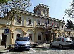 | ||
Coat of arms  | ||
| State | Italy | |
|---|---|---|
| Region | Piedmont | |
| Altitude | 365 m a.s.l. | |
| Surface | 17.88 km² | |
| Inhabitants | 6.408 (2014) | |
| Name inhabitants | Almesini | |
| Prefix tel | 39 011 | |
| POSTAL CODE | 10040 | |
| Time zone | UTC 1 | |
| Patron | Most Holy Name of Mary | |
Position
| ||
| Institutional website | ||

Per month is a municipality in the metropolitan city of Turin.
To know
The municipality of Almese located about 27 km west of Turin it was one of the places out of town of the Turinese up to the entire period of the 1960s.
Geographical notes
Located in the lower Val di Susa, in the plain where the Messa stream flows; it is one of the first municipalities to meet going up the Val di Susa from Turin, on the left of the Dora Riparia. The municipal territory extends from the plain area on the slopes of the Prealps to the watershed that unites the mountains Musinè and Mount Curt. In its territory there is the Alpine itinerary of Colle del Lis, whose attendance dates back to pre-Roman times.
Background


Although the area was already populated in the second period of the Iron Age, thanks to ceramic findings by Truc Randolera (a peak of the Musinè), a vast and organized settlement should only be sought in Roman times, when the area was enhanced thanks to the road that from Augusta Taurinorum, today's Turin, went up the Val di Susa to Colle del Monginevro and minor passes that connected the Turin plain with the Briançonnais and the French Moriana.
The Romanesque bell tower in a massive defensive tower, inside a residential area developed with the abbey hall, where the abbot stopped during his travels from Susa to Turin, and where the castellan resided with a garrison intended for the first defense of the castle. The subsequent affirmation of the castle refuge of San Mauro decreed the definitive decline of the fortified center of Castellarium at the Church of Santa Maria.
How to orient yourself
How to get
How to get around
What see


- 1 Archaeological remains of the Roman Villa (Roman Villa). Archaeological site of the 1st century Roman Villa.
- Near the hamlet of Rivera, there are the ruins of the Roman villa. In the archaeological site there are masonry works, fragments of mosaics with geometric motifs and ceramics dating back to a period between the 1st and 6th centuries AD.
The villa was discovered in 1979 during excavations for the construction of a private house. - Excavations continued for several years. The site periodically takes place environmental education courses organized by the municipality of Almese in collaboration with the Superintendency for the archaeological heritage of Piedmont.
- 2 Goja del Pis. 14 m jump of the Pis stream with a basin below.

- 3 Tower of San Mauro. Defensive tower from the 14th century.
- In 1029 a farm, curtis, was sold in Almese by the marquises to the Benedictine monks of San Giusto di Susa. It is precisely in this period that the settlement of the municipality begins to be defined in its two main settlement points: The Church of Santa Maria or Chiesa Vecchia, and the curtis of San Mauro in the current hamlet of Rivera. The Curtis di San Mauro, located in control of the plain lands, and protected by the flooding area of the Dora Riparia, is certainly the dominical nucleus of the farm sold by the Arduinici to the monks of San Giusto, who made it a provost named precisely in San Mauro.
Events and parties
What to do
Shopping
How to have fun
Where to eat
Where stay
Safety
How to keep in touch
Around
- Avigliana Lakes Natural Park
- Sacra di San Michele, an architectural complex located on Mount Pirchiriano, at the entrance to the Val di Susa
- Nature trails on the Firebreak track
- Excursion to the Pylon of the Coast
- The water route, along the Messa stream