The Arava (Arava Depression) is in the range of the Great rift valleythat between the Dead sea and the Gulf of Eilat runs and the boundary between Israel and Jordan forms.
Regions


The Arava Depression extends for 166 km between the Dead Sea and the Gulf of Eilat. From sea level on the Gulf of Eilat, the level of the plain rises gently, the maximum height of 230 m above sea level is reached 77 km to the north. Further north, the level of the Arava drops gently towards the Dead Sea, and reaches the lowest point on earth at - 417 m.
The result is that Arava Depression about 30 million years ago: the continental plates of the Syrian-Arab massif and the African massif began to shift in a north-south direction. The Syrian-Arab continental plate moved 100 km north in a first phase, then the continental plates diverged in a second phase. The Rift Valley or the big rift valley begins in the north in the territory of Lebanon, continues along the Jordan, the Sea of Galilee, the Jordan Valley and the Dead sea away. The Arava is the extension of the Jordan Valley to the south. In the Arava there was another lake similar to the Sea of Galilee, which has dried up for thousands of years. Of this Lisan lake the seemingly unreal sediment deposits of sand and clay that once formed the lake bed are still preserved. To the south, the "Rift Valley" continues into the Red Sea near Eilat.
The plain of the Arava is bordered on both sides by mountain ranges, in the east are the Jordanian mountain ranges, which reach an altitude of 1700 m, in the west the mountain ranges of the Negev. The land border between Israel and Jordan runs largely along the Wadi Araba, more to the west of the middle of the Arava plain, at some distance from the Negev heights. With the peace treaty between Israel and Jordan in 1994, the definitive course of the border and the details of the border crossing points were regulated and the region pacified.
places
On the Israeli side of the Arava described in this article (the article provides information on the Jordanian side Wadi Arabah) there are only a few comparatively small settlements with a predominantly agricultural - craft character.
In north - south direction:
- A tamar and Neot HaKikar south of the Dead Sea Evaporation Basin and the Dead Sea Mineral Works.
- Idan
- A hatzeva and Hatzeva, in the vicinity of the Hatzeva Hill and Ir Ovot with the archaeological site of the biblical Tamar
- A yahav
- Sapir
- Tsofar with the archaeological site of Moa
- Tsukim
- Paran, an agricultural settlement ("moshav") on Nahal Paran; near the Baraq Canyon and the Vardit Canyon.
- Yahel with the Yahel Dune, a sand dune area
- Lotan with the Bird Watching Area
- Ktora, Grofit
- Yotvata (Yotveta)
- Samar, Elifaz
- Beer Ora
- Egg pilot, immediately north of Eilat
Other goals

- the Timna Park is a national park with archaeological and geological sights, it is located about 25 km north of Eilat. The best known are the ancient copper mines, the geological phenomena of the "mushroom" (mushroom-shaped rock) and "Solomons Pillars" (pillars of Solomon) and the replica of the tabernacle.
background
The Arava plain lies in the area of the great African rift valley ("Rift Valley"), where the African and Arabian plates split from each other 35 million years ago. The Lebanese Bekaa Plain, the Jordan Valley with the Sea of Galilee, the Dead Sea (actually an evaporation lake) and the Arava Depression to the Gulf of Eilat form the northern part of this rift. By shifting the tectonic plate on the eastern side in a northerly direction, the same geological layers are found on the Jordanian side 107 km further north than on the Israeli side of the Arava.
The Arava was already settled in antiquity, probably under different climatic conditions; traces of settlement from the Neolithic and Bronze Ages were found here. In Roman - Nabatean times there were routes to the Red Sea and the Incense Route to Petra and to the Arabian Peninsula; On the camelbacks of the Nabatean caravans, spices and incense were transported from Arabia through the northern Negev to Gaza on the Mediterranean coast.
In modern times, the valley was first entered as El-Araba on a map by Johann Ludwig Burckhardt in 1822. During the British mandate, it was only accessible by a narrow runway over the "Scorpions-Ascent" (Ma'ale Aqrabim, here Hiking suggestions in the region) into the Arava and south to Eilat. Today's well-developed road connection 90 has only existed since 1966, the continuation along the Dead Sea into the Jordan Valley only since 1970.
Various settlements (kibbutzim and moshavim) have been built, the focus is on agriculture (including date palms), handicrafts and, increasingly, tourism is also being used.
language
Hebrew is spoken locally, but good English skills are widespread.
getting there
.jpg/220px-Directions._Boy_walking_israel_highway_desert_autoroute_beersheva_(2454582241).jpg)
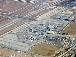
Most travelers are from abroad via the Ben Gurion Airport![]()
![]()
![]()
![]() (IATA: TLV) arrive. Excursions to the Arava are also easy from Eilat from possible, also from the new one a little north of Eilat Ramon Airport Eilat Airport
(IATA: TLV) arrive. Excursions to the Arava are also easy from Eilat from possible, also from the new one a little north of Eilat Ramon Airport Eilat Airport![]()
![]()
![]()
![]() (IATA: ETM) .
(IATA: ETM) .

All places are located at a shorter or longer distance from the street 90which aims from Eilat to the Jordan Valley.
mobility
Bus connections run along the road 90As a rule, the buses stop at the intersections at the entrances to the villages. To get to the starting points of various tours, a private vehicle is a great relief.
Tourist Attractions

activities
- hike, including on the Israel National Trail
- the Israel Bike Trail and other cycle routes for normal bikes and mountain bikes also run through the south of Israel
- a special opportunity to experience the barren beauty of the Arava is offered by the journey along the Jordanian border on the 1 Peace Route (Derech HaSchalom): the connection between A yahav - Hatzeva and Idan can be easily accessed by car; Be careful with photo stops because of the intensive agricultural traffic. Where indicated, you must not deviate from the asphalt road near the border and under no circumstances drive on the sand strip near the border (which is used by the military to record footprints as a sign of illegal border crossing). In the north of Hatzeva can at 2 Peace Road Lookout take a short circular walk in the sediment mounds that have formed at the bottom of the former Lake Lisan south of the Dead Sea; the steps start just below the lookout's canopy. Peace Road ends at the entrance of 3 Ida (Idda).
kitchen
In the Arava there are only a few places to stop for a break, in addition to restaurants in the villages, there are mainly roadside rest stops 90.
nightlife
Eilat is not only known throughout Israel for its nightlife, in the Arava there is hardly any nightlife worth mentioning in the localities.
security
Since the peace treaty with Jordan there is no longer any danger from fighting along the border in the Arava, the military presence of the Israeli and Jordanian armies is still unmistakable. A direct border crossing to Jordan is only possible at a few border crossings and usually only on foot and not with a rental car registered in Israel. For military reasons, any approach to the border installations with barbed wire and chain link fences is not permitted; the time of terrorist attacks on Israeli citizens has passed for decades.
Danger threatens from inattentiveness in road traffic and above all from the hot desert climate and water scarcity in the hot and shadowless stone desert of the Arava.
climate

The Arava has an arid desert climate, which makes the winter months the cheapest months to travel. Temperatures reach 30 - 34 ° C in the summer months, still 21 - 23 ° C during the day in winter, and temperatures below zero are rarely reached at night. Rainfalls are extremely rare, in the few rainy days in the winter months, annual rainfall levels of just over 20 mm are achieved.