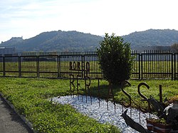
| Bertassi | ||
 | ||
| State | Italy | |
|---|---|---|
| Region | Piedmont | |
| Territory | Val di Susa | |
| Altitude | 350 m a.s.l. | |
| Inhabitants | 232 (Sant'Ambrogio), 230 (Avigliana) (2001 Census) | |
| Prefix tel | 39 011 | |
| POSTAL CODE | 10057, 10051 | |
| Time zone | UTC 1 | |
| Patron | Blessed Virgin Mary of Sorrows (September 15) | |
Position
| ||

Bertassi (Bertass in Piedmontese) is a fraction of the municipalities of Avigliana and of Sant'Ambrogio of Turin in Val di Susa in the province of Turin.
To know
The subdivision of Bertassi is not only administrative but also of the diocese to which it belongs, in fact Bertassi di Sant'Ambrogio belongs to the diocese of Susa, while Bertassi di Avigliana belongs to the diocese of Turin.
Background
Bertassi is an ancient settlement located on the border of the municipalities of Avigliana is Sant'Ambrogio of Turin. In 1630 during the siege that saw Carlo Emanuele I of Savoy and the troops of the King of France Louis XIII commanded by Duke Henry II of Montmorency, was the scene of an epic battle in the plain between Sant'Ambrogio and Avigliana between the army Piedmontese and the French army.
The locality of the Bertassi is reported as present on the medieval road that pilgrims, in transit in Val di Susa to and from Turin, they traveled along the right bank of the Dora Riparia, on a road that still remains faithful to the original and which runs through the countryside, along the one indicated as the "Ancient way of France".
There Borgata Berassi appears in the Topographic map of the Susa Valley and those of Cesana and Bardonecchia divided into 9 parts (Part 8a which includes the places of Coazze, Giaveno, Valgioie, La Chiusa, S. Ambrogio, Avigliana, Chiavrie Villar d'Almese, Almese, Rubiana and S. Moro), undated and unsigned, on the 1/9576 scale, preserved in the Turin State Archives. The Charter, not later than 1700, marks the boundary lines between the Communities, natural and artificial waterways, mills, chapels, convents, pylons and wooden crosses, "carriageways, for horses and for pedestrians”, Crops, toponyms, houses and urban agglomerations. Of particular interest is the location of the Borgata Bertassi, which does not correspond to the current one, but located further upstream, on a plateau overlooking the more recent town of Case Dino. Where today's Bertassi stands, on the other hand, just behind the border line between the two communities of Avigliana and Sant'Ambrogio (border apparently not entirely coinciding with the current demarcation), we find two distinct villages: to the northwest that of Bertus, to the southeast that of Pertus.
The toponym Bertassi, as well as the similar ones of Bertus and Pertus refer to the Lombard word "berhta”(Light, brilliant, shining), to the Germanic name Berth, but also to the apheresis of Lombard names such as Rupertus, Cunipertus, Paulipertus and the like.
The toponymic references to the Lombard period can be traced back to the occupation of the territory of the lower Val di Susa by the Lombards, attested by recent and not yet complete archaeological investigations on the territory of Clusae Langobardorum of which the plain of Sant'Ambrogio and the territory of Bertassi were part.
A Lombard necropolis was identified during an excavation campaign conducted in the 1990s on a part of the route of the ancient Via delle Gallie, discovered in La Perosa, while an older and isolated discovery of a tomb has not been documented. bounded by stone slabs, found in Bertassi, in the early years of the last century, during a widening of the road that from the village, through the woods, climbed up to the hamlet of Mortera. At the time, the tomb was generically attributed to a Lombard warrior, but no archaeological investigations were carried out in this regard and that finding is now part of only oral memory, which often borders on legend.
How to orient yourself
How to get
By car
The main access road to Bertassi is represented by the Strada Statale n.25 from Avigliana towards Sant'Ambrogio of Turin.
How to get around
What see
- Chapel of Our Lady of Sorrows.
 Chapel of Our Lady of Sorrows

Events and parties
What to do
Shopping
How to have fun
Where to eat
Where stay
Safety
How to keep in touch
Around
Itineraries
Numerous paths depart from Bertassi towards the surrounding lakes of Avigliana and the Mareschi swamp in Avigliana Lakes Natural Park.
Path 501 passes through Bertassi (one of the RPE-Piedmont), which starts in Piazza del Popolo ad Avigliana, dates back to Monte Pirchiriano and arrives near the Sacra di San Michele passing for a stretch on the Path of the Princes.