 | ||
| Lead alf | ||
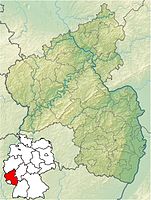
| federal state | Rhineland-Palatinate | |
|---|---|---|
| Residents | 1.197 (2019) | |
| height | 385 m | |
| no tourist info on Wikidata: | ||
| location | ||
| ||
Lead alf is a community in the Schneifel in Rhineland-Palatinate. The state-approved resort is part of the Verbandsgemeinde Prüm.
background
A place with lead in its name usually has a mining tradition. It is the same here. In the 19th century mining attracted people to the village, today tourism.
getting there
By plane
The nearest airports are Luxembourg Airport![]()
![]()
![]()
![]() (IATA: LUX), 95 km away), 1:15 hours by car or 4 hours by buses and trains via Bitburg; the Liege airport
(IATA: LUX), 95 km away), 1:15 hours by car or 4 hours by buses and trains via Bitburg; the Liege airport![]()
![]()
![]()
![]() (IATA: LGG), 105 km away), 1:15 hours by car; Cologne-Bonn Airport
(IATA: LGG), 105 km away), 1:15 hours by car; Cologne-Bonn Airport![]()
![]()
![]()
![]() (IATA: CGN) , 120 km away), 1:45 hours by car or 4 hours by buses and trains via Bitburg.
(IATA: CGN) , 120 km away), 1:45 hours by car or 4 hours by buses and trains via Bitburg.


.jpg/350px-Flughafen_Köln-Bonn_-_Terminal_1_Hauptgebäude_(9054-56).jpg)
By train
- railway station Bitburg. With the bus you drive over Prüm and Bitburg (two changes) just under 2 hours. Bus connection is only available Mon. to Fri., not on public holidays.
- railway station Gerolstein Despite the greater distance, it is easier to reach with a change in Prüm The connection also exists on Saturdays.
In the street
Bleialf has its own exit ![]() 3 Bleialf on the only one lane here
3 Bleialf on the only one lane here ![]() .
.
By bicycle
- Place is station of Eifel-Ardennes cycle path
mobility

Map of Bleialf
Tourist Attractions

Bleialfer Tunnel east portal
- 1 Church of the Assumption of the Virgin
- 2 Visitor mine (lead mine), Auwer Straße 32 (registration). Tel.: 49(0)6555 1227. Open: May-Oct Sat, Sun 2 pm-5pm.Price: Admission adults € 5.
- 3 Bleialfer tunnel Open Apr 1 to Oct 31
activities
- Running club Bleialf
- hike
- the Eifel-Ardennes cycle path leads to Vennbahn, the Belgian border is not far
shop
- Bakery & Cafe Albert Dahmen, Poststrasse 5, 54608 lead alf. Tel.: (0)6555 332.
- Café Petit, Bahnhofstrasse 2, 54608 Bleialf.
kitchen

Old Bleialf train station
- 1 Globetrotter restaurant in the former train station, Train station at Bahnhofsstraße 52.
- 2 Bakehouse
nightlife
accommodation
- 1 Camping Bleialf, Im Brühl 4, 54608 Bleialf.
Cheap
- Pension Haus Dahmen, Poststrasse 6, 54608 Bleialf. Tel.: 49(0)6555-332. Feature: pension.Price: Single from € 38.
medium
- Pince-nez, Am Markt 2, 54608 Bleialf. Tel.: 49 (0)6555-92000, Email: [email protected]. Price: single from 45.00.
health
Practical advice
trips
- 4 Saint Barbara Chapel, Buchet, main street (3 km northeast of Bleialf). Unusual, modern construction; 1999–2002 prepared by the parishioners themselves; based on a design by the Aachen architect Dieter Alexander Boeminghaus. The floor plan and the roof are in the shape of a beech leaf.
- The Ernest Hemingway hiking trail leads along the Alfbach through the nearby villages of Buchet and Halenfeld. He recalls the American writer who was a war correspondent in Buchet in September / October 1944. He ironically called his modest dwelling in the Jennenbach "Schloss Hemingstein".
- Schneifel - The "Black Man" (692 m above sea level) is located a good 6 km northeast of Bleialf
- Prüm - 14 km east
- Burg-Reuland in Belgium - 17 km on the Eifel-Ardennes cycle path and the Vennbahn
- Saint-Vith in Belgium - 18 km along the Eifel-Ardennes cycle path /Vennbahn
- Bitburg - 45 km southeast
- trier - 75 km south-east (the journey time by buses is just under 2 hours)
literature
Web links
- https://www.bleialf.de/ - Official website of Bleialf