| location | |
 | |
| flag | |
.svg/150px-Flag_of_the_Netherlands_Antilles_(1986–2010).svg.png) | |
| Short dates | |
| Capital | no |
|---|---|
| Form of government | Independent parts of the Kingdom of the Netherlands or special municipalities of the Netherlands |
| currency | Dutch Antilles Guilder (ANG) or US dollars |
| languages | Dutch, English |
| Phone code | 599 |
| Internet TLD | .at |
| Time zone | CET-5h |
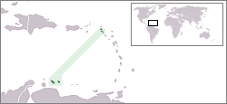
The Netherlands Antilles lie in the Caribbean. Until October 10, 2010 they formed a joint administrative unit. Today it is only a collective name for the Caribbean islands that are politically associated with the Netherlands are connected. These include, on the one hand, the islands belonging to the Leeward Islands Sint Maarten, St. Eustatius and Saba (summarized as SSS islands), on the other hand, the hundreds of kilometers further south-west ABC islands (Aruba, Bonaire and Curacao) off the coast of Venezuela. The two archipelagos differ greatly in their geographical location as well as in their culture - the only thing they have in common is their political affiliation with the Netherlands.
This article will focus on the small Leeward "SSS Islands"; to the ABC islands there is a separate article.
Regions
.png/300px-Nt-map_(de).png)
- ABC islands: The islands Aruba, Bonaire and Curacao are about 25 to 80 km off the coast Venezuela. Aruba and Curaçao are independent parts of the Kingdom of the Netherlands and within it have equal rights with the mother country. Bonaire has the status of a special parish within the mother country. The archipelago makes up 92% of the land area and 90% of the inhabitants of the Netherlands Antilles. The designation of the Netherlands Antilles is therefore often mistakenly simply equated with the ABC islands.
- SSS islands: The 950 km northeast of the ABC Islands Sint Maarten, Saba and St. Eustatius are called SSS islands. You belong to the Leeward Islands, the northern part of the Lesser Antilles. Sint Maarteen is only partly Dutch, the other part, Saint Martin, is French. Like Aruba and Curaçao, Sint Maarten has the status of an independent part of the kingdom, while Saba and Sint Eustatius are special parishes. Saba has just 1,400 inhabitants, Sint Eustatius 2,100.
- Saba
- Location: 72 km southeast. from Sint Maarten (N.A.), 35 km north of St. Eustatius (N.A.)
- Population: 1,500
- Area: only 13 km² (3 km wide and 4 km long)
- The highest point: Mount Scenery at 877 m the highest point in the Kingdom of the Netherlands
- Capital: The bottom
- Nickname: The unspoiled Queen
- St. Eustatius
- Location: 74 km southwest. from Saba
- Population: 3,100
- Area: 21 km²
- The highest point:The quill, a dormant volcano of 601 m
- Capital: Oranjestad
- Sint Maarten (N / A.) / Saint Martin (F)
- Location: approx. 300 km east of Puerto Rico, approx. 950 km north of Curaçao
- Population: 74,000, including French Page: 38,000, Dutch Page: 36,000
- Area: 75 km²
- Highest point: French page: Pic du Paradis with 424 m, Dutch page Sentry Hill with 344 m
- Capital: Philipsburg (NA) or. Marigot (FWI)
- Nickname: The friendly Island
- Saba
- BES islands: Since the dissolution of the administrative unit, the three islands become Bonaire, St. Eustatius and Saba as BES islands or Caribbean Netherlands designated. This takes account of the fact that these islands are special municipalities in the national territory of the Netherlands, in which in some cases different laws apply than in the rest of the Netherlands. On January 1, 2011, the U.S-$ the Antillean guilder as the official currency.
Cities
- Philipsburg, Capital of Sint Maarten
Other goals
With the ferry in 20 minutes to Anguilla, a British island within sight north of Sint Maarten.
background
Originally, the six islands together formed the Netherlands Antilles despite their different geographical locations (Netherlands Antilles), an autonomous country within the Kingdom of the Netherlands. Aruba left this association on January 1, 1986 and became an autonomous part of the Netherlands. The so-called "Status Aparte". On October 10, 2010, the alliance between the remaining five islands was finally dissolved. Curaçao and Sint Maarten were assimilated to Aruba, while Bonaire, Sint Eustatius and Saba (the BES islands) became special parishes within the Netherlands.
"Independent part of the kingdom" means that foreign policy, defense (army) and passport system (nationality) are still regulated by The Hague, but the rest of the school system, maximum speed, police (uniform), radio / TV and social security are regulated yourself So you can do what you want inside and leave it alone. Nevertheless, all residents have a Dutch passport and the rights of an EU member (although they do not belong to the EU) and can go to the Netherlands at any time without formality and without restrictions, which almost 1/3 of all Antillians and Arubans have done so far. So: there is no “Embassy of the Netherlands Antilles” abroad and consequently no German embassy on Curaçao, but only a consulate. And if a Curaçao resident in Australia or Hungary has problems, he or she would have to go to the respective Dutch embassy. The special municipalities are part of the mother country, their relationship to the European Union has yet to be clarified.
For Caribbean terms, one is very wealthy here thanks to the previous grants from the Netherlands, there is no illiteracy, malaria and infant deaths or the like. But it depends on how you see it: rich for a Venezuelan or a Dominican, but since the Netherlands Antilles are based on The Hague and Amsterdam, you find yourself poor and prefer to move to the motherland if you can: living at the moment, for example 50,000 Antillians in the European Netherlands, and that's not a problem (with a Dutch passport).
All six islands each have their own political parties, their own radio and TV stations, their own telecom, their own daily newspapers, their own flags, their own island anthems, etc. So the “we-feeling” has never been very big.
All information on population and area figures should be treated with caution. The Caribbean doesn't seem to be too strict about statistics. Aruba is 180 km² and 193 km². It is sometimes said that Curaçao has 152,700 inhabitants (= Landenreeks des Kon. Instituut voor de Tropen, 1999), the book "ANWB-Reisgids" from 2000 says that the island has 160,000 inhabitants, the Marco Polo travel guide writes 144,000.
getting there
By plane
Each island has an airport.
By boat
Various cruise ships operate Willemstad / Curaçao and Philipsburg / St. Maarten. Such ships cannot dock on the other three islands.
mobility
Different on every island:
Sint Maarten: There are some regular buses and minibuses that go to the French side. Just wave and stop.
Other islands: No local public transport.
A passenger ferry runs daily between St. Maarten and Saba. There is also a fast passenger ferry between Bonaire and Curaçao.
language
The official language is Dutch, but English is the everyday language of communication and communication on Sint-Maarten, Saba and St. Eustatius. The press and TV are also in English there.
to buy
kitchen
nightlife
accommodation
Learn
Work
public holidays
| meeting | Surname | importance |
| xx. yy | Xyz | Xyz |
security
health
No vaccinations, no malaria. 'Clean' like in Europe, you can eat anything without fear of Montezuma's revenge. But be careful of the strong sunlight. Drink a lot!
climate
Tropical hot, eternal summer.