
Eastern Norway is a tourist region Norwegian.
To know
Geographical notes
In the westernmost part, the Jotunheimen range marks the border with the Vestlandet region, while to the east the counties of Akershus, Østfold and Hedmark allow to reach Sweden.
Water sources include the Glomma River and Lakes Mjøsa and Randsfjorden.
When to go
The temperatures are quite bearable, in winter they can reach no more than -20 ° C on the hills and in the summer the flat areas breathe air from 20-25 ° C.
Territories and tourist destinations

Akershus - The region around Oslo which includes many of its suburbs, as well as a quarter of the entire Norwegian population.
Hedmark - The county of eastern Norway in the deep interior of the country, with degrees of valleys, rivers and forests.
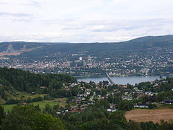
Oppland - Includes both lakes and plains and mountains and plateaus.
Oslo - The capital of Norway.
Østfold - Eastern lowlands of Oslofjord.
Telemark - From urban plains to green valleys to rugged plateaus.
Vestfold - Western lowlands of Oslofjord.
Urban centers
Other destinations
How to get
How to get around
What see
What to do
At the table
Safety
Other projects
 Wikipedia contains an entry concerning Eastern Norway